Radio navigation in Austria in the 1950s
Navaids: NDB, Range, ILS
The following list contains the aeronautical radio beacons that were active in Austria in the mid of the 1950s. All information is outdated and may not be used for navigational purposes.
It is difficult to compile a complete and consistent directory. Austria was divided into four occupation zones from 1945 to 1955 and there is hardly any information available on the radio beacons in the Soviet zone. But also in the three other zones and in the remaining areas there were many changes in the period under consideration due to the regaining of full sovereignty. These cannot be completely understood with the material available to me, so that this list mixes information from several points in time. The predominant part, however, refers to the period of occupation until 1955.
- The Soviet airfields were mainly located in Niederösterreich. Only a few pieces of information are available here.
- The US troops used the airfields of Linz, Salzburg and Tulln in the Soviet zone.
- The English troops used the airfields Klagenfurt and Wien-Schwechat, but had given them into civilian administration at an early stage.
- The French troops used the Innsbruck airfield.
In addition, there were small landing strips in Vienna, but they probably did not have radio beacons.
Radio beacons and airways in 1955
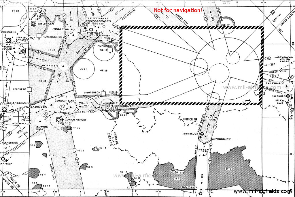
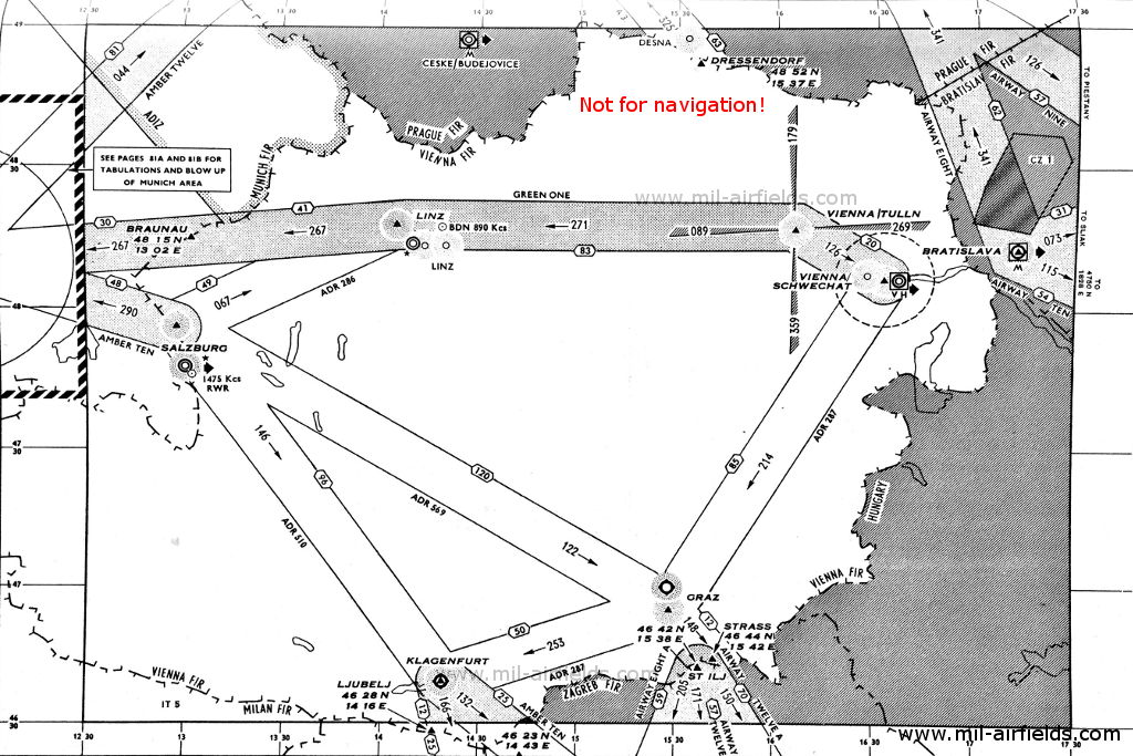
Explanations
![]()
Abbreviations
| approx. | approximately | |
| civ | civil | civil operator |
| GP | Glide path | Glide path transmitter |
| ILS | Instrument Landing System | (Approach and landing aid) |
| IM | Inner Marker | Marker beacon just in front the runway |
| kHz | Kilohertz | (Unit for frequency) |
| L | Locator | Non-directional beacon for the approach |
| LLZ | Localizer | Localizer transmitter |
| LMM | Locator Middle Marker | Combination of Middle Marker and Locator |
| LOM | Locator Outer Marker | Combination of Outer Marker and Locator |
| m | Meter | (Unit for length) |
| MHz | Megahertz | (Unit for frequency) |
| mil | military | military operator |
| MM | Middle Marker | Marker beacon |
| NDB | Non-directional beacon | Non-directional beacon on long or medium waves |
| NM | Nautical Miles | (Unit for length) |
| OM | Outer Marker | Marker beacon |
| PRMG | ПРМГ Посадочная радиомаячная группа | Soviet / russian military instrument landing system |
| RSBN | РСБН Rадиотехническая система ближней навигации | Soviet / russian military radio navigation system |
| SBA | Standard Beam Approach | Approach system, Lorenz system, predecessor of the ILS |
| THR | Threshold | Runway threshold (most often with number of runway) |
| transf. | transformed | Coordinates were converted from a different reference system, therefore there may be deviations. |
| VAR | Visual-Aural Rnange | |
| VOR | VHF Omnidirectional Radio Range | |
| W | Watt | (Unit for power) |
| WGS84 | World Geodetic System 1984 | (geospatial reference system, GPS coordinates) |
Directory
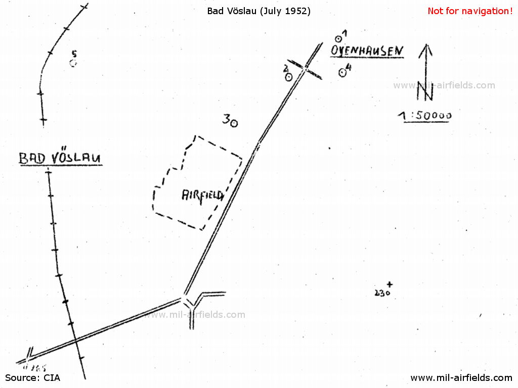
Bad Vöslau: Airfield
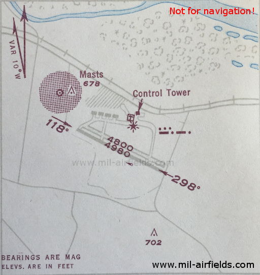
Graz: Thalerhof Airport (Nitter Air Base)
N4658 E01527 (approx.), 350°/1.0 NM to field Google Maps
GR, 329 kHz, 60 W
Innsbruck: Airport (Kranebitten)
N4714 E01125 (approx.), 127°/3.0 NM to field Google Maps
OEJ, 278 kHz, 1000 W
Klagenfurt: Airport (Annabichl, Möderndorf)
Linz: Hörsching Airport (Vogler Air Base)
272°/3.0 NM to field
OEA, 327 kHz
Salzburg: Airport
Vienna: Schwechat Airport (Wien)
OEW, 408 kHz
N4806 E01635 (approx.) Google Maps
WN, 325.3 kHz
OEW, 110.3 MHz
N4808 E01628 (approx.), 300°/3.9 NM to field Google Maps
WO, 378 kHz, 40 W
120°/0.65 NM to THR 12
Dots Dashes, 75 MHz
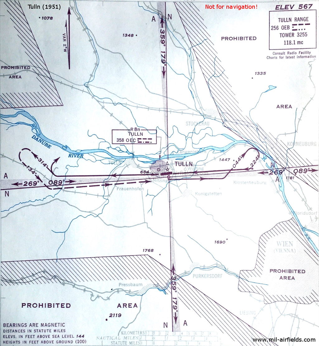
Tulln: Air Base (Langenlebarn, Brumowski)
N481850 E0160709 (WGS84, transf.) Google Maps
OEA, 256 kHz, 100 W