Radio navigation in Switzerland in the 1950s
Navaids: NDB, Range, ILS
The following list contains the aeronautical radio beacons that were active in Switzerland in the mid of the 1950s. All information is outdated and may not be used for navigational purposes.
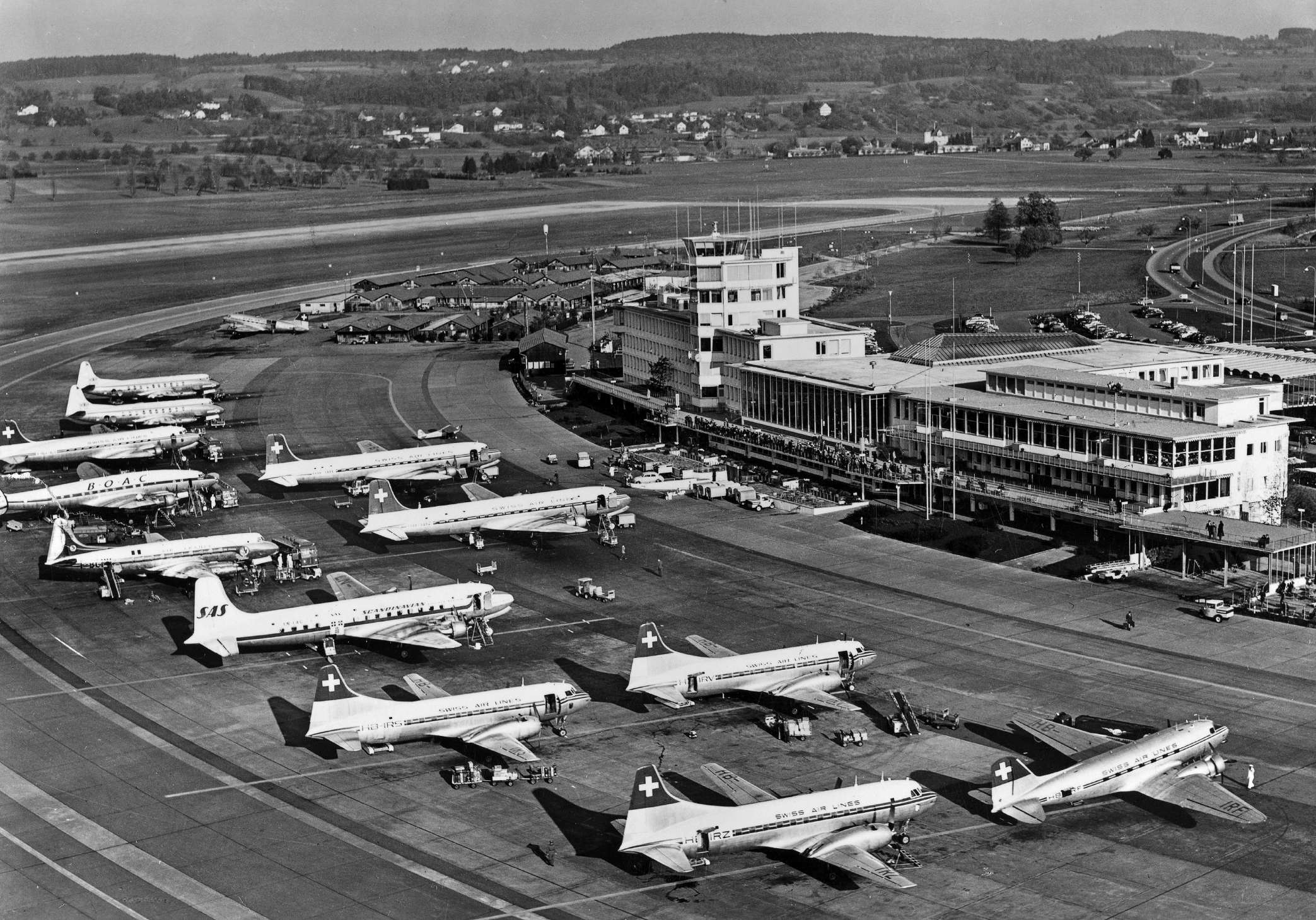
At that time only Non-Directional Beacons (NDB) were used. Ranges apparently did not exist at any time in Switzerland. VORs were not yet available. The airports of Geneva and Zurich had been equipped with instrument landing systems for several years. The Standard Beam Approach systems (SBA, Lorenz system) on these two airports were probably taken out of service in the early 1950s.
Remarkable are the Monte Ceneri and Sottens NDB. They worked on the same frequency as the radio broadcasting stations at these places. The beacons were operated only during the breaks of the radio station. This indicates that the broadcasting stations were regularly used as navigation aids. This differs from the situation decades later: Powerful transmitters can interfere with aircraft electronics due to the electromagnetic field they generate and are therefore now specially designated as "High Intensity Radio Transmission Areas" (HIRTA), to be avoided as far as possible.
The list is incomplete, as I don't have any information about military radio beacons.
Radio beacons and airways in 1955
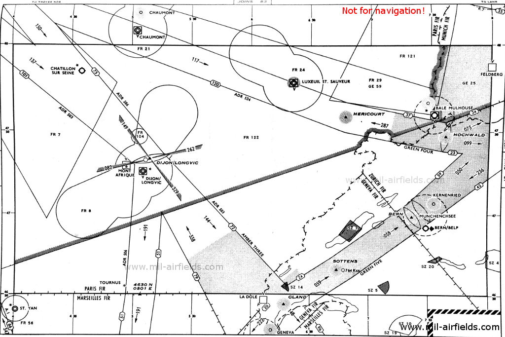
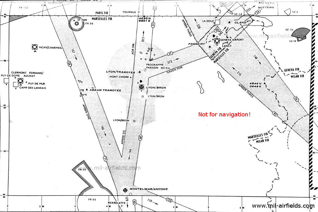
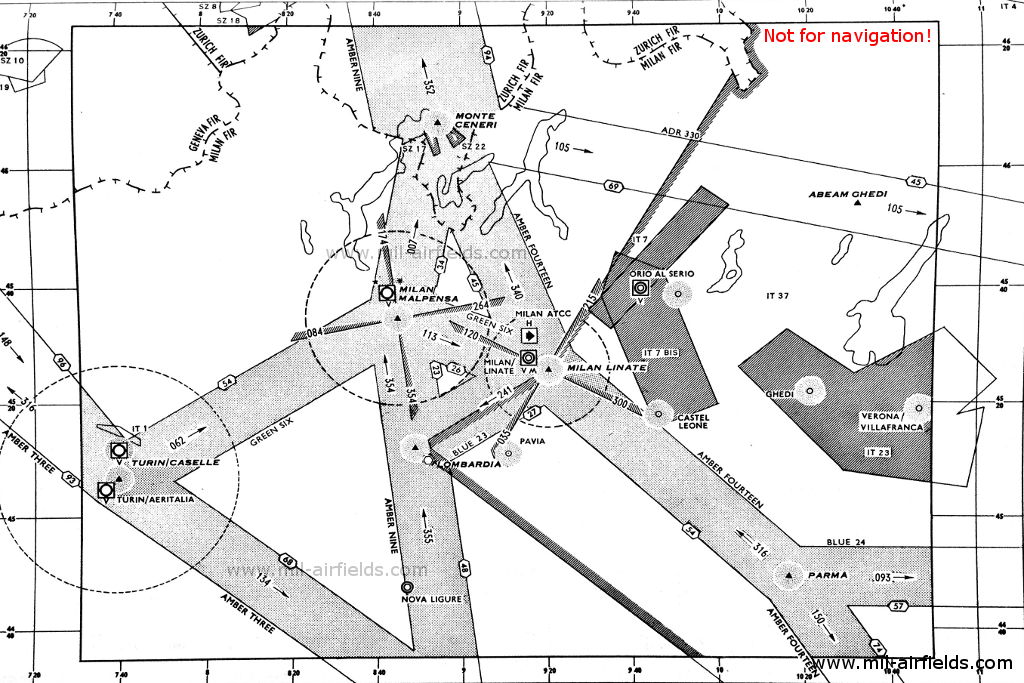
Explanations
![]()
Abbreviations
| approx. | approximately | |
| civ | civil | civil operator |
| GP | Glide path | Glide path transmitter |
| ILS | Instrument Landing System | (Approach and landing aid) |
| IM | Inner Marker | Marker beacon just in front the runway |
| kHz | Kilohertz | (Unit for frequency) |
| L | Locator | Non-directional beacon for the approach |
| LLZ | Localizer | Localizer transmitter |
| LMM | Locator Middle Marker | Combination of Middle Marker and Locator |
| LOM | Locator Outer Marker | Combination of Outer Marker and Locator |
| m | Meter | (Unit for length) |
| MHz | Megahertz | (Unit for frequency) |
| mil | military | military operator |
| MM | Middle Marker | Marker beacon |
| NDB | Non-directional beacon | Non-directional beacon on long or medium waves |
| NM | Nautical Miles | (Unit for length) |
| OM | Outer Marker | Marker beacon |
| PRMG | ПРМГ Посадочная радиомаячная группа | Soviet / russian military instrument landing system |
| RSBN | РСБН Rадиотехническая система ближней навигации | Soviet / russian military radio navigation system |
| SBA | Standard Beam Approach | Approach system, Lorenz system, predecessor of the ILS |
| THR | Threshold | Runway threshold (most often with number of runway) |
| transf. | transformed | Coordinates were converted from a different reference system, therefore there may be deviations. |
| VAR | Visual-Aural Rnange | |
| VOR | VHF Omnidirectional Radio Range | |
| W | Watt | (Unit for power) |
| WGS84 | World Geodetic System 1984 | (geospatial reference system, GPS coordinates) |
Directory
Bern: Belpmoos Airport
N4659 E00722 (approx.) Google Maps
UE, 366.5 kHz, 60 W
Geneva: Airport
N4617 E00610 (approx.), 231°/3.25 NM to THR 23 Google Maps
OG, 279 kHz
GE, 109.9 MHz
231°/3.3 NM to THR 23
Dashes, 75 MHz
231°/0.53 NM to THR 23
Dots Dashes, 75 MHz
231°/0.04 NM to THR 23
Dots, 75 MHz
231° to THR 23
Dashes, 38 MHz
231° to THR 23
Dots, 38 MHz
N4704 E00733 (approx.), 197°/9.5 NM to Bern/Belp Google Maps
BP, 312 kHz
N4608 E00855 (approx.) Google Maps
HEL, 557 kHz, 150 W

N4701 E00727 (approx.) Google Maps
75 MHz
N4639 E00644 (approx.) Google Maps
HEO, 764 kHz, 200 W
N4740 E00825 (approx.), 162°/13.0 NM to Zürich/Kloten Google Maps
HEZ, 395 kHz, 400 W
Zürich: Kloten Airport
N473401 E0082823 (WGS84, transf.), 159°/6.2 NM to THR 16 Google Maps
NDB: RN, 293 kHz
Fan Marker: 75 MHz
Z, 110.3 MHz
N4731 E00830 (approx.), 159°/3.5 NM to field Google Maps
Locator: OZ, 316 kHz
Outer Marker: Dashes, 75 MHz
159°/0.58 NM to THR 16
Dots Dashes, 75 MHz
159°/0.04 NM to THR 16
Dots, 75 MHz
159° to THR 16
Dashes, 38 MHz
159° to THR 16
Dots, 38 MHz