For historical information only, do not use for navigation or aviation purposes!
| Coordinates | N514317 E0115752 (WGS84) Google Maps |
| Elevation | 304 ft |
| Former East Germany (GDR) | District of Halle |
| Federal state | Sachsen-Anhalt (Saxony-Anhalt) |

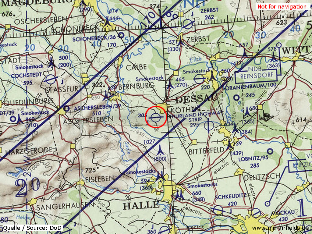
Germany during the Cold War Map
The history of the Cold War airfields: Köthen
During World War II
Use
Luftwaffe airbase.
Overview
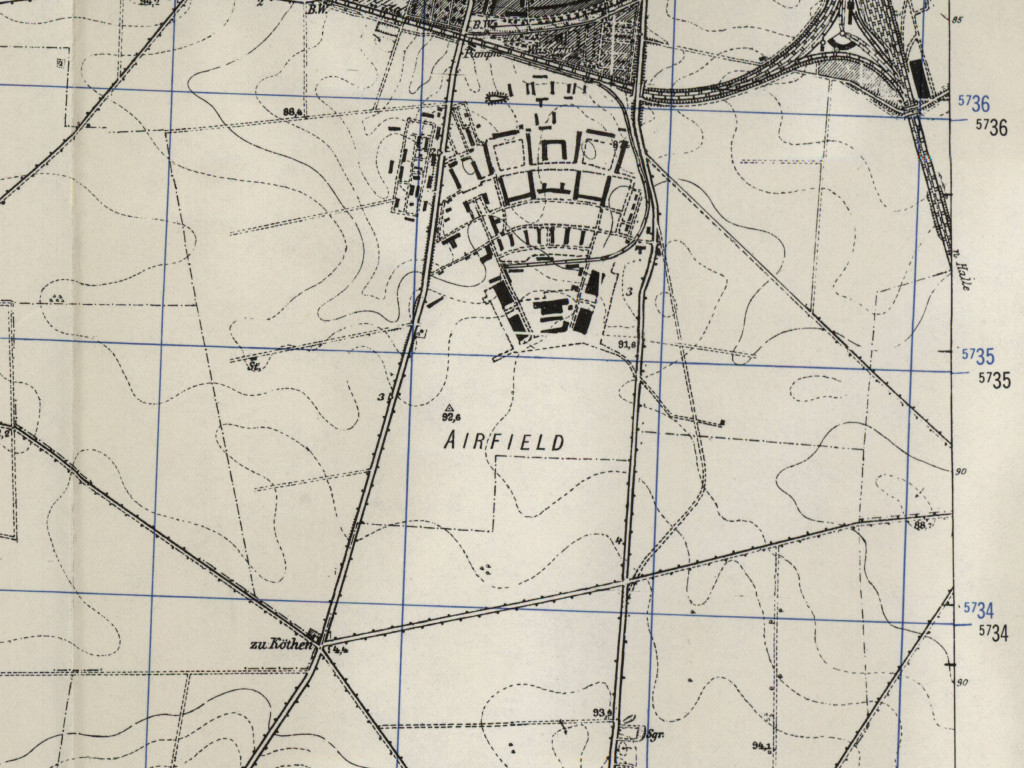
Köthen air base on a US map from 1952 - Visible are the buildings of the old air base and the connecting railway.
Source: AMS M841 GSGS 4414, Courtesy Harold B. Lee Library, Brigham Young University
During the Cold War
Use
Soviet airbase.
In the 1950s
Units
Units in 1954
- One fighter regiment (P. O. Box of the technical unit: 22 703),
- One reconaissance regiment MiG-15 (P.O. Box of the technical unit: 78 633);
- A total of 39 MiG-15/MiG-15U were counted at the airfield.
Source: BND/Bundesarchiv B 206/3033
(For the P. O. Box numbers the digits 3 and 5 may be confused, because they are difficult to distinguish in the source document)
(For the P. O. Box numbers the digits 3 and 5 may be confused, because they are difficult to distinguish in the source document)
History
- July 1954
Relocation of the Reconnaissance Regiment (MiG-15) Welzow (PFN 78 633) to Köthen Air Base.
In the 1960s
Overview
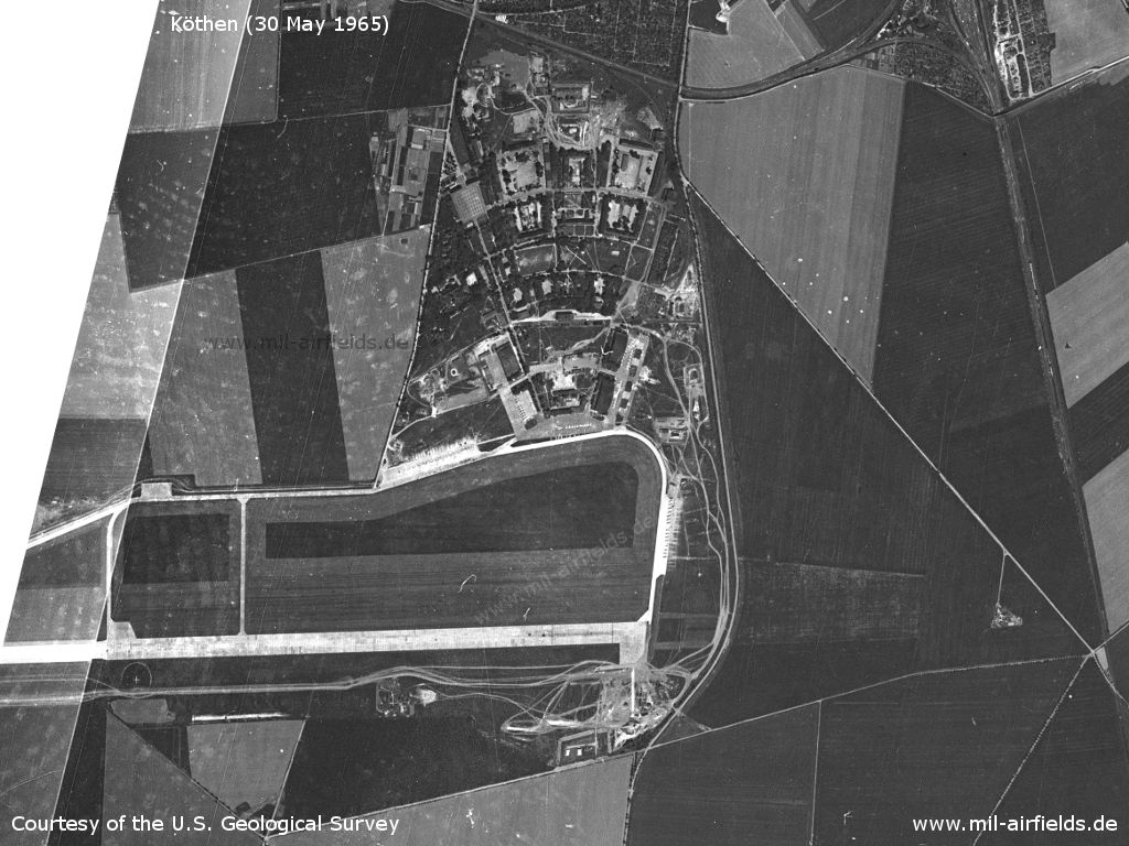
Köthen Air Base on a US satellite image from 30 May 1965
Source: U.S. Geological Survey
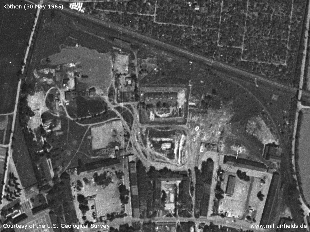
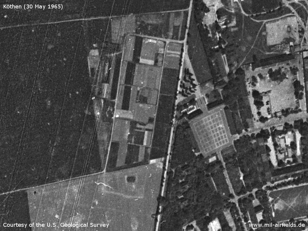
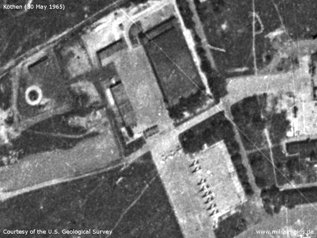
Northern part of the barracks
Source: U.S. Geological Survey
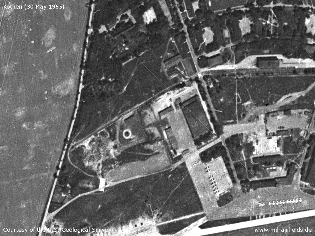
Northwestern part
Source: U.S. Geological Survey
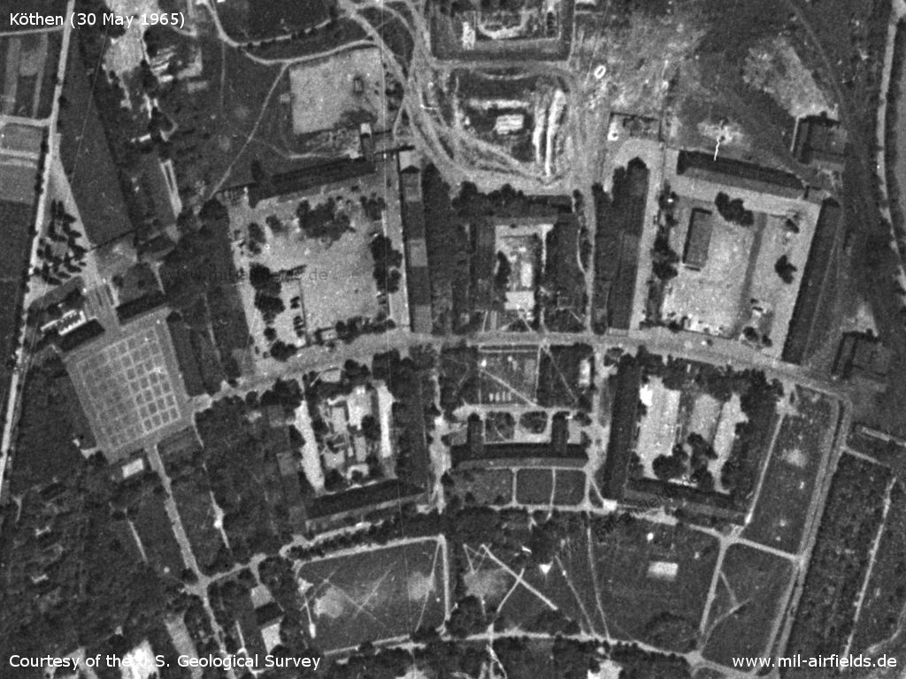
Barracks
Source: U.S. Geological Survey
Western side of the barracks
Source: U.S. Geological Survey
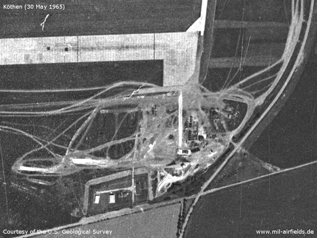
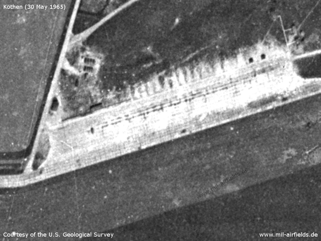
Hangars and aircraft - 52 fighter aircraft can be counted in this area.
Source: U.S. Geological Survey
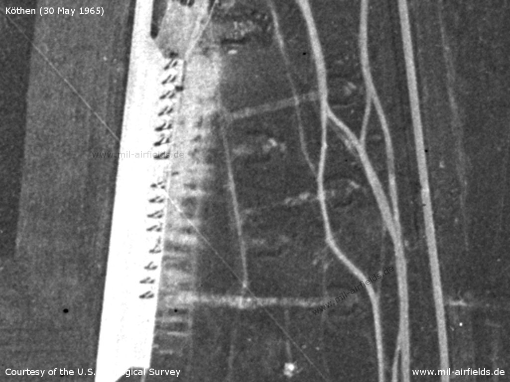
Flight line in the east - Here are additional 15 fighter aircraft. At the eastern edge, a system of aircraft revetments can be seen.
Source: U.S. Geological Survey
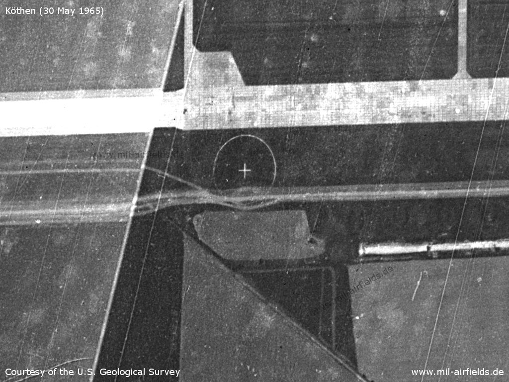
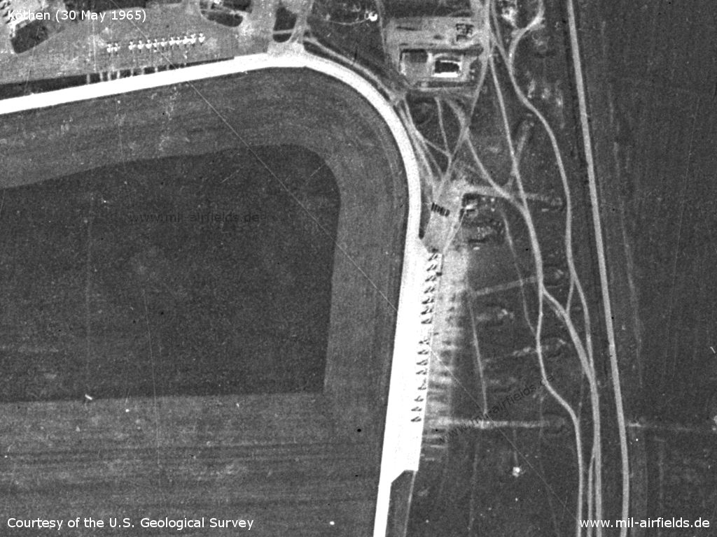
Runway and target circle - An extension of the runway to the west was made narrower
Source: U.S. Geological Survey
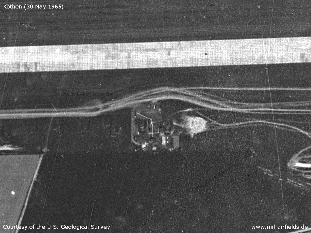
Object south of the runway
Source: U.S. Geological Survey
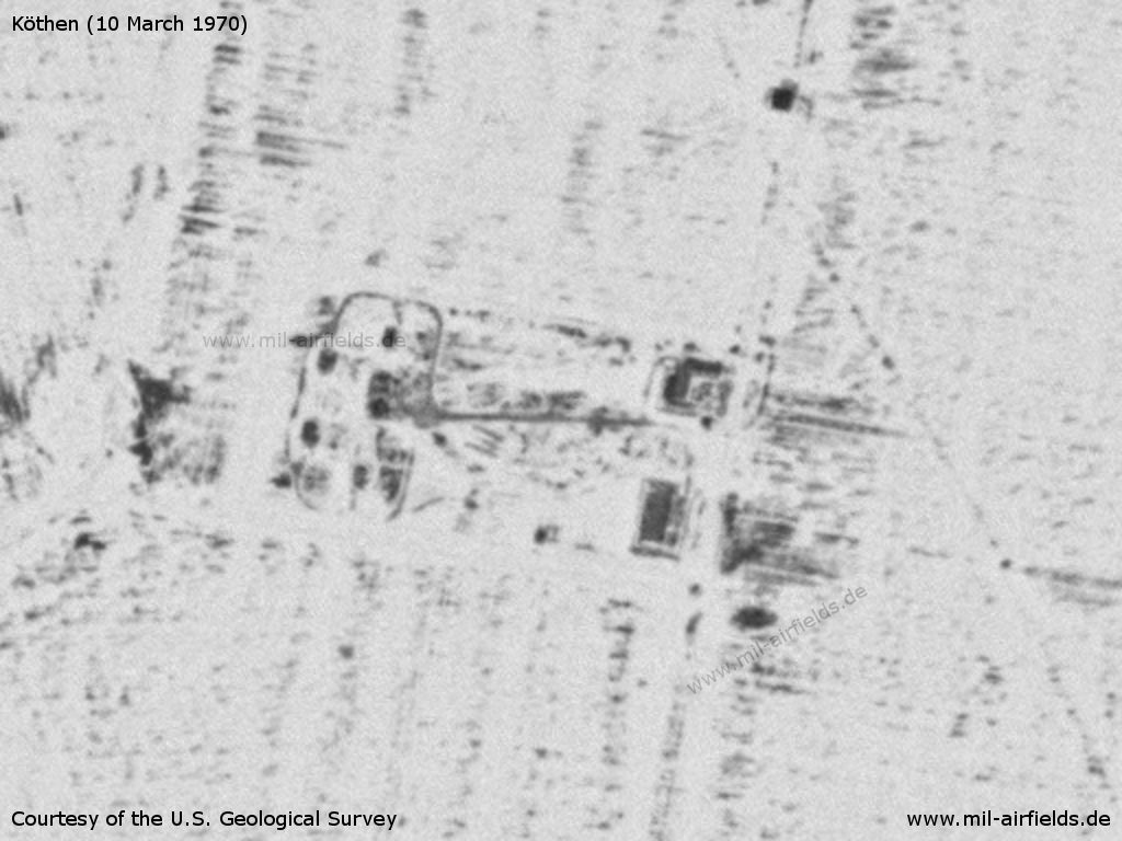
Southeastern part - There seems to be dump and a radar site here.
Source: U.S. Geological Survey
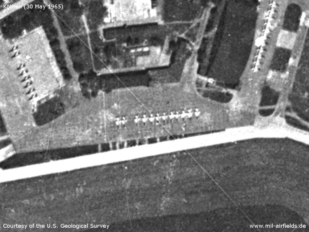
Flight line - The grass to the north seems to have been damaged by the jet exhausts.
Source: U.S. Geological Survey
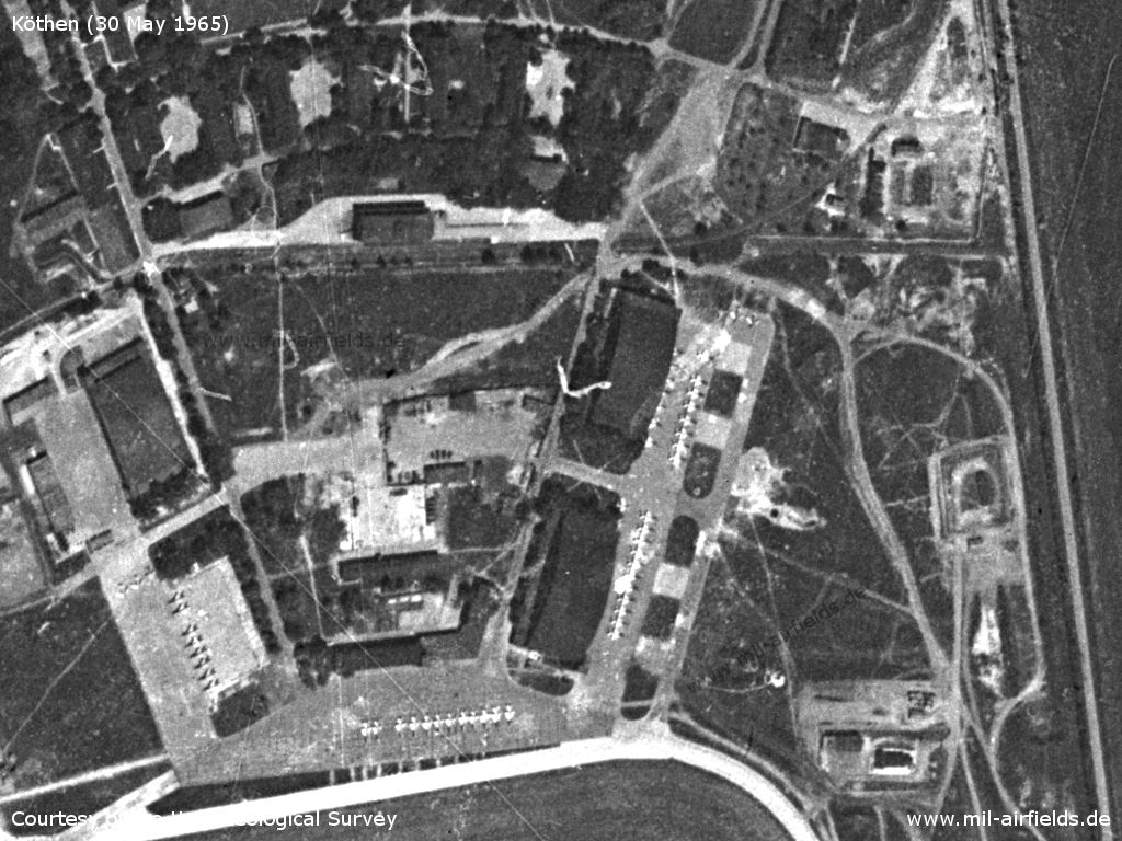
Hangar
Source: U.S. Geological Survey
Aircraft
Source: U.S. Geological Survey
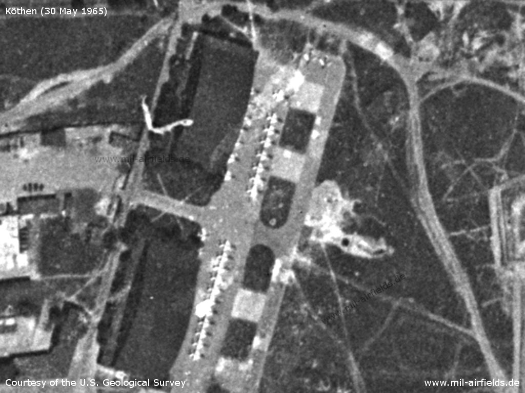
Two hangars with parked aircraft
Source: U.S. Geological Survey
Eastern flight line - Here, too, the grass is damaged by the exhaust jet.
Source: U.S. Geological Survey
Radio communication
Call sign: SIMNIK (1967)
History
- February 1966
Observation by the US Military Liaison Mission: "The deployment of an air defense regiment from Zerbst to Koethen was observed" (Source: USMLM 1966) - March 1966
Observation by the US Military Liaison Mission: "A USMLM Air Team brought in the first sightings of (Yak-28P) FIREBAR long-range fighter-interceptor in the forward area, when it observed these aircraft taking off from FINOW, on their way to KOETHEN where they were deployed." (Source: USMLM 1966)
In the 1970s
Situation
Köthen Air Base on a map of the US Department of Defense from 1972 - The blue lines mark the southern allied air corridor from and to Berlin (ONC E-2 (1972), Perry-Castañeda Library Map Collection, University of Texas at Austin /PCL MC/)
Source: ONC E-2 (1972), Perry-Castañeda Library Map Collection, University of Texas at Austin
Overview
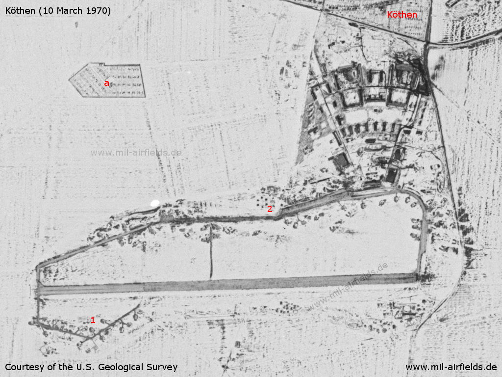
Köthen on 10 March 1970 - The landscape is snow-covered. In the meantime the airfield has got airplane shelters, including the shelter loop in the southwest (1). The six dots in the north (2) probably belong to an anti-aircraft site. In the northwest there is an allotment site (a).
Source: U.S. Geological Survey
SAM site near Dohndorf, approx. 7 km southwest of the airfield - The surface-to-air (SAM) missile site is equipped with S-125 Newa (NATO: SA-3 Goa) missiles.
Source: U.S. Geological Survey
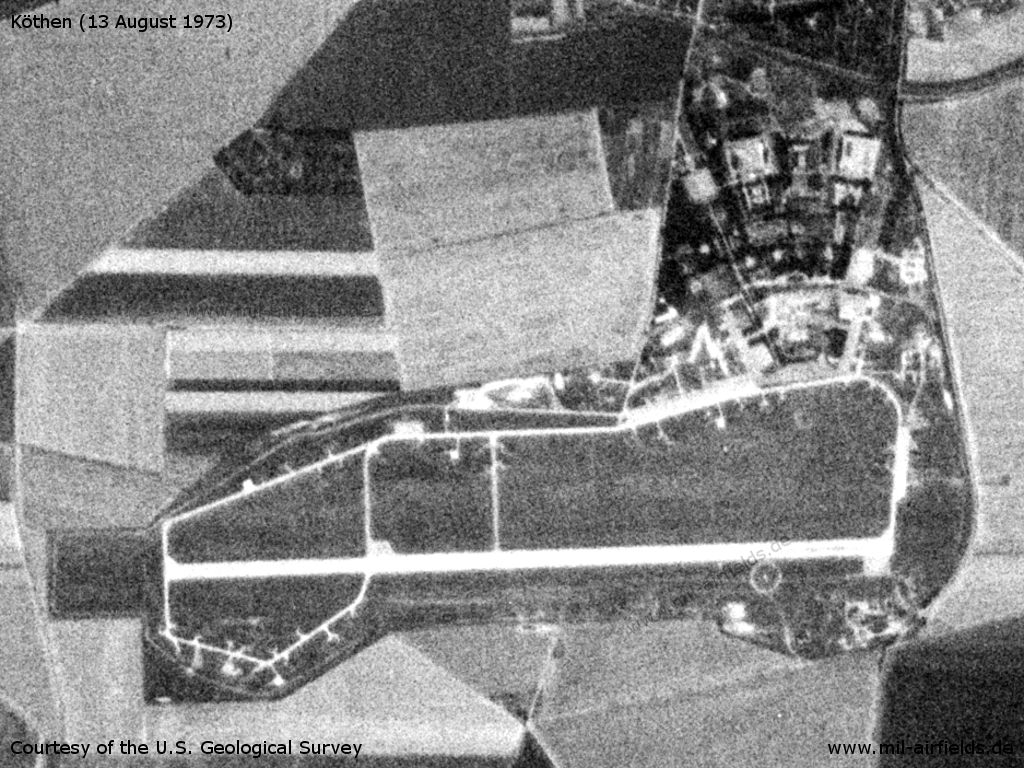
This satellite image from 13.08.1973 shows the airfield boundaries well.
Source: U.S. Geological Survey
In the 1980s and early 1990s
Overview
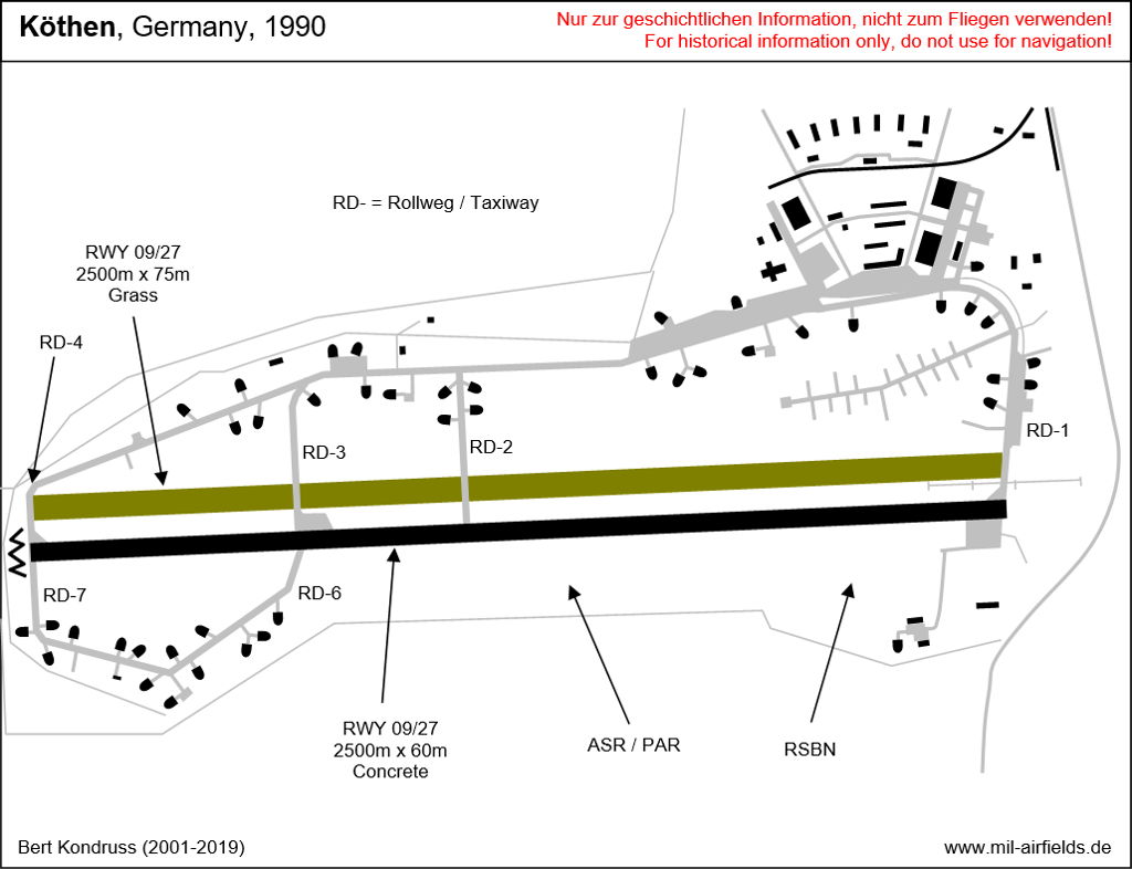
Köthen in the early 1990s. - The basic layout of the old air base is still recognizable. However, over the years the airfield had expanded far to the west. ASR/PAR: Location of the surveillance and precision approach radar; RD + number: Taxiway; RSBN: Location of the RSBN radio beacon; RWY: Runway.
Runways
- 09/27: 2500 m x 60 m Concrete
- 09/27: 2500 m x 75 m Grass
Radio beacons
- RSBN
- LOM 27: 350 "RC", 4080 m
- LMM 27: 718 "R", 1150 m
- LOM 09: 350 "GX", 4100 m
- LMM 09: 718 "G", 1000 m
Radio communication
Call sign: SEMELNI
Auf einer Karte mit Wetterstationen, die Anfang der 1990er Jahre in der Flugleitung am Flugplatz Sperenberg hing, war für Köthen der Name SENITNYI eingetragen (= Tarnname der Wetterstation Köthen?)
Standard training routes
"Flüge der LSK/LV der NVA und der LSK der GSSD im Rahmen der Gefechtsausbildung sind entsprechend der Grafik der Flugtage / -nächte auf der Grundlage der "Hauptflugregeln zum Fliegen im Luftraum der Deutschen Demokratischen Republik" auf Standardflugstrecken in den dazu festgelegten Flughöhen durchzuführen. ..." (Quelle: "Verzeichnis der Standardflugstrecken der LSK/LV der NVA und der LSK der GSSD"
As of 1989
203 Köthen, Ballenstedt, Grabow, Ziesar, Köthen
Höhe: 600 - 1850 m (unter dem zeitweiligen Luftverbindungsweg 300 m)
Abfangabschnitt: Ermsleben, Ballenstedt, Grabow, Ziesar
Höhe: 600 - 1850 m (unter dem zeitweiligen Luftverbindungsweg 300 m)
Abfangabschnitt: Ermsleben, Ballenstedt, Grabow, Ziesar
204 Köthen, Nauen, Wolmirstedt, Köthen
Höhe: 4900, 5500 m
Abfangabschnitt: Buschow, Colbitz
Höhe: 4900, 5500 m
Abfangabschnitt: Buschow, Colbitz
205 Köthen, Bitterfeld, Holzdorf, Golssen, Baruth, Schießplatz Heidehof, Markendorf, Schweinitz, Köthen
Höhe: zum Schießplatz 300 m, Rückflug 3650 m (Steigflug über dem Schießplatz)
Höhe: zum Schießplatz 300 m, Rückflug 3650 m (Steigflug über dem Schießplatz)
206 Köthen, Wolfen, Trossin, Schildau, Schießplatz Belgern, Torgau, Köthen
Höhe: zum Schießplatz 300 - 1200 m, Rückflug 4250 - 5500 m (Steigflug über dem Schießplatz)
Höhe: zum Schießplatz 300 - 1200 m, Rückflug 4250 - 5500 m (Steigflug über dem Schießplatz)
207 Köthen, Aschersleben, Erfurt, Ortrand, Köthen
Höhe: 7900, 8550, 11900 - 18000 m
Höheneinnahme: Traverse Sangerhausen minimal 7900 m
Abfangabschnitt: Sangerhausen, Großenhain
Die Linie Altenburg, Hoyerswerder ist nach Süden nicht zu überfliegen
Höhe: 7900, 8550, 11900 - 18000 m
Höheneinnahme: Traverse Sangerhausen minimal 7900 m
Abfangabschnitt: Sangerhausen, Großenhain
Die Linie Altenburg, Hoyerswerder ist nach Süden nicht zu überfliegen
Units
73 GwIAP: MiG-29, MiG-29UB, MiG-23UB (1990)
Real property
The airfield covered an area of 259,65 ha.
Today
Use
General aviation and solar energy park.
Links
- http://lib.byu.edu/collections/german-maps/ - German Maps (Topographische Karte 1:25,000)
- https://flugplatz-koethen.jimdo.com/ - Flugsportverein Köthen
Bibliography
- Ries, Karl; Dierich, Wolfgang: "Fliegerhorste und Einsatzhäfen der Luftwaffe" Motorbuch Verlag Stuttgart, 1993 - Allied map of Kothen airfield.
- /USMLM 1966/:
United States Military Liaison MissionUnited States Military Liaison Mission: "Unit History 1966Unit History 1966" - Freundt, Lutz: "Sowjetische Fliegerkräfte in Deutschland 1945-1994, Band 2" Freundt Eigenverlag, Diepholz 1999 - Description, pictures, aerial pictures from 1953 and 1991.
- Freundt, Lutz (Hrsg.), Büttner, Stefan: "Rote Plätze - Russische Militärflugplätze in Deutschland 1945 - 1994" AeroLit Verlag, 2007 - Description, pictures, aerial pictures from 1953 and 1991.
Related topics
Airfields in the vicinity
- 100°/12km Hinsdorf: Radio-Technical Company 412 (FuTK-412) (Helipad 3170)
- 108°/18km Thurland: Highway Strip (Reuden, Autobahnabschnitt ABA Dessau)
- 052°/20km Dessau: Airfield (Alten, Junkers-Flugzeugwerk)
- 186°/26km Halle (Saale): Nietleben Airfield
- 077°/27km Oranienbaum: Airfield
- 357°/30km Flötz: Agricultural Airfield (Gödnitz, Zerbst)
Categories
Military Airfields GermanyMilitary Airfields in former East GermanyAirfields of the Soviet Forces in GermanyRecommended
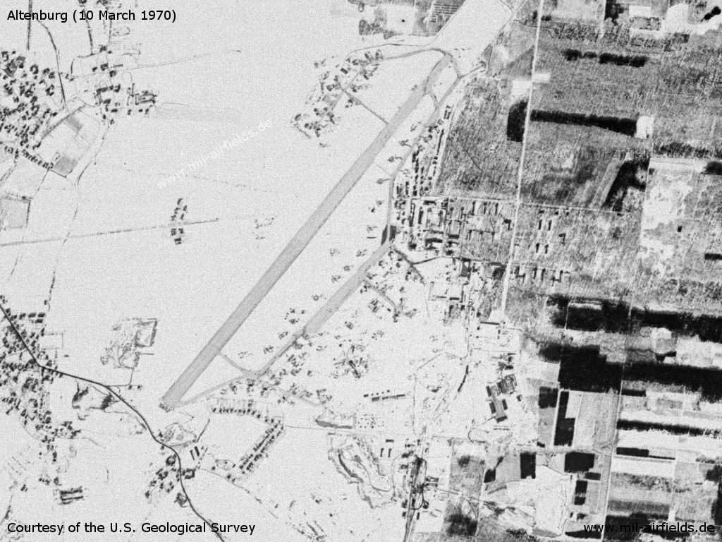
Image credits are shown on the respective target page, click on the preview to open it.
 Follow mil-airfields on Facebook