Neubiberg Air Base
Neubiberg Air Base
Historical approach charts - Federal Republic of Germany
For historical information only, do not use for navigation or aviation purposes!
| Coordinates | N480422 E0113814 (WGS84) Google Maps |
| Elevation | 1800 ft |
| Location indicator | DENU (195x), EDSN |
Airfield
Region:
Bayern (Bavaria), München (Munich)
Location Indicator:
DBNU (USAF), DENU, EDSN (GAF)
User:
US Air Force (USAF), German Air Force (GAF)
In the 1950s
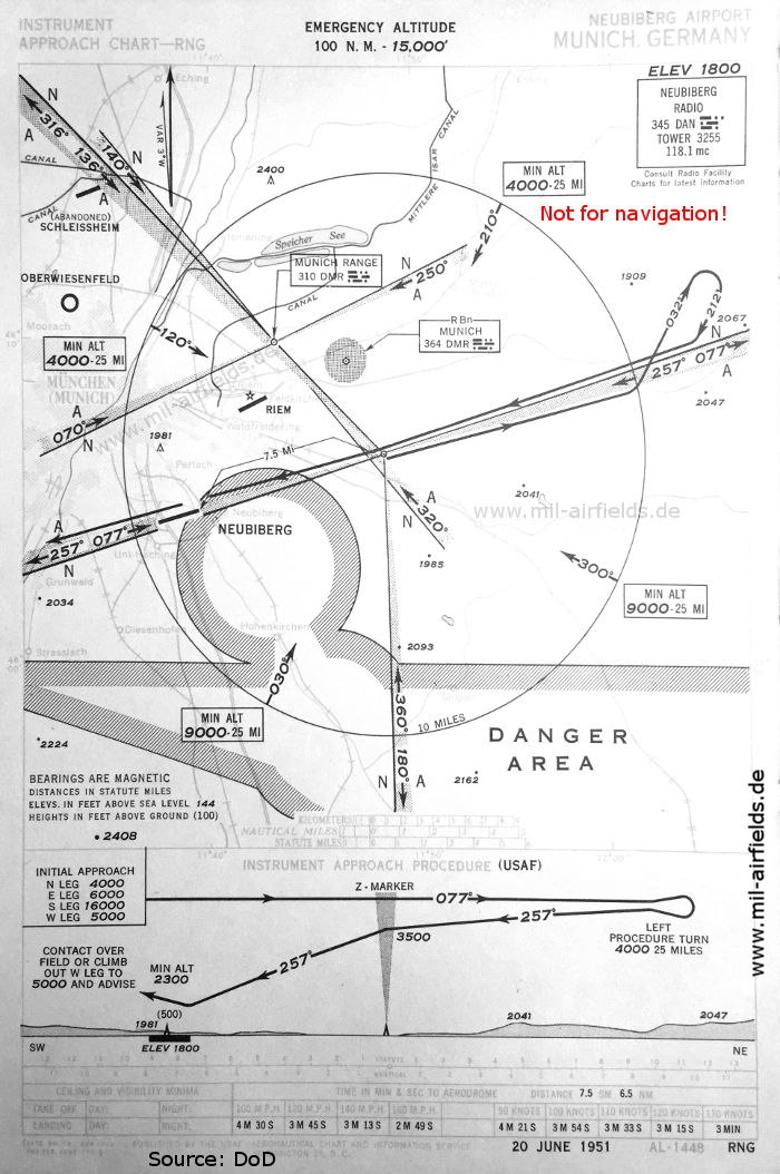
Range approach runway 26 (June 1951) - The approach uses the beam 257° from a Radio Range, which is located 13.9 km (7.5 nautical miles) northeast of Neubiberg airfield. (Source: DoD)
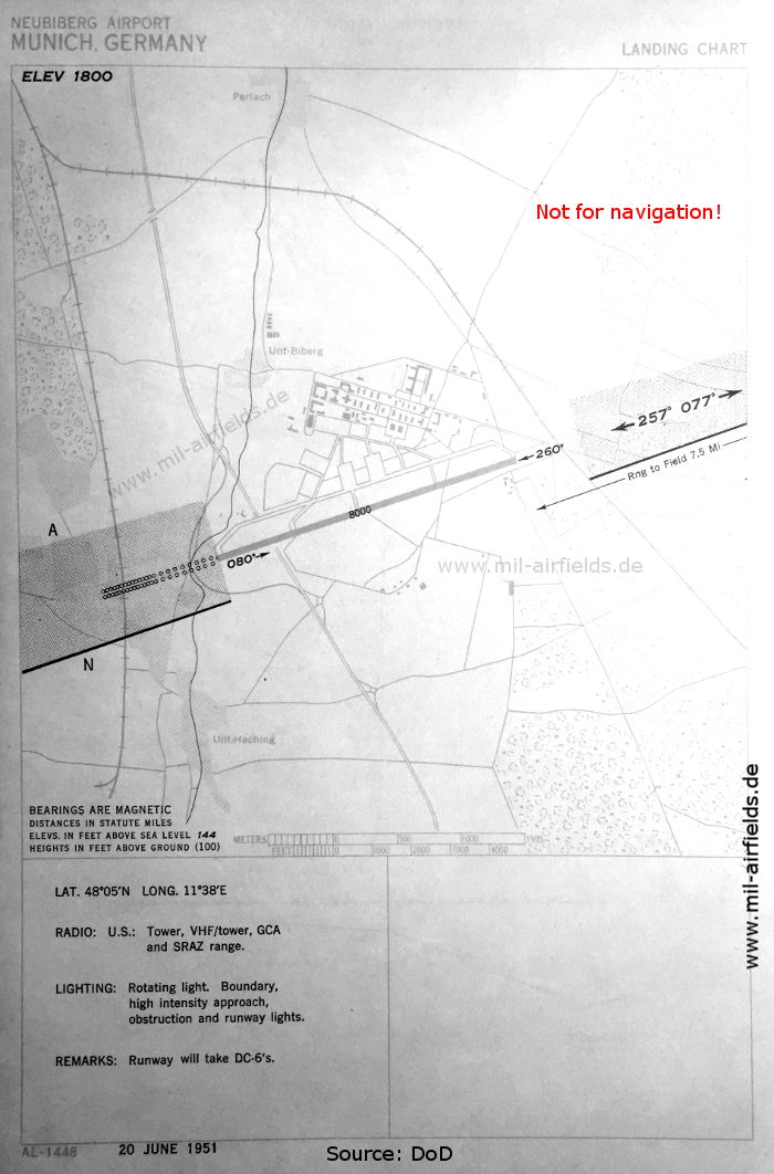
Airfield (June 1951) - The beam with zones A and N is shown here again. Approach lights are only available for approaches from the east. At this time the field is still operated by US troops. (Source: DoD)
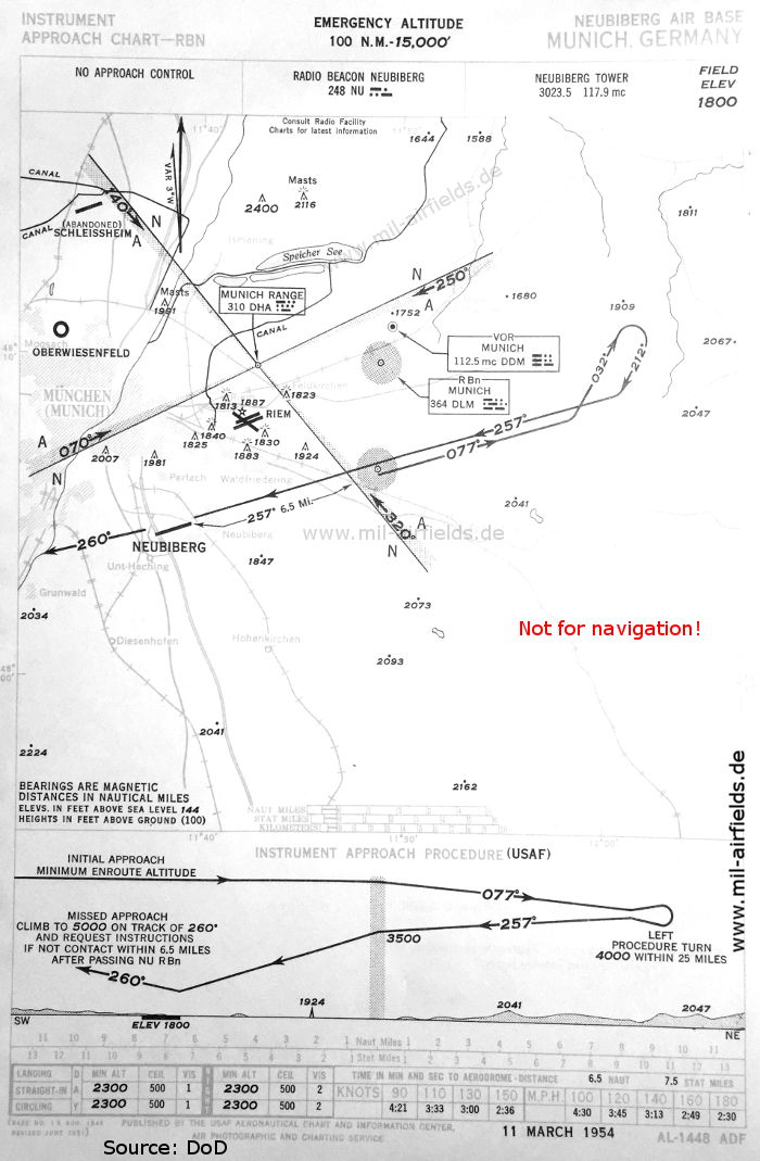
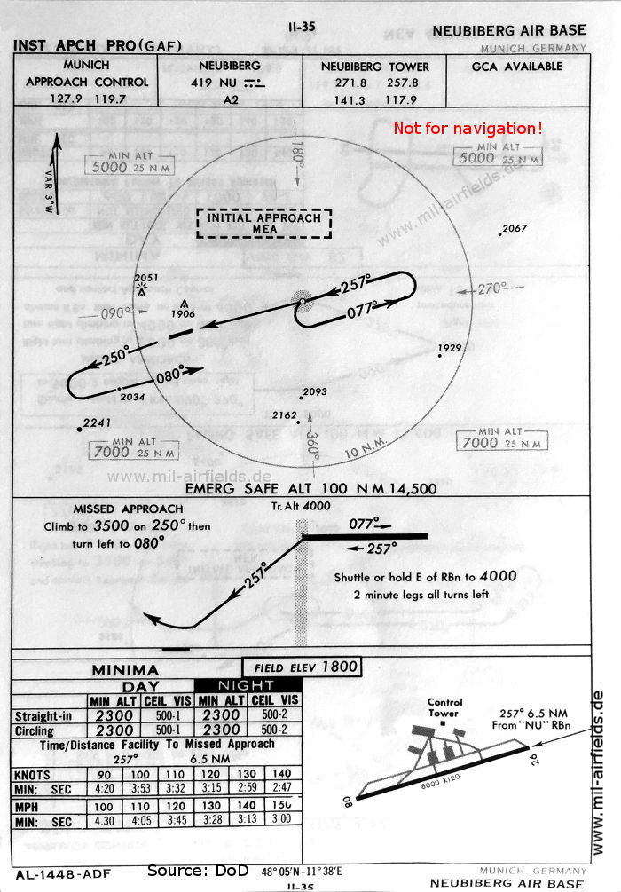
NDB approach runway 26 (March 1954) - The Neubiberg Range is no longer shown, instead there is now a non-directional radio beacon (RBN) standing 12 km (6.5 nautical miles) away. The identification of the still existing Munich Range and of the Munich Radio Beacon have changed. The danger area southeast of Neubiberg is no longer shown. (Source: DoD)
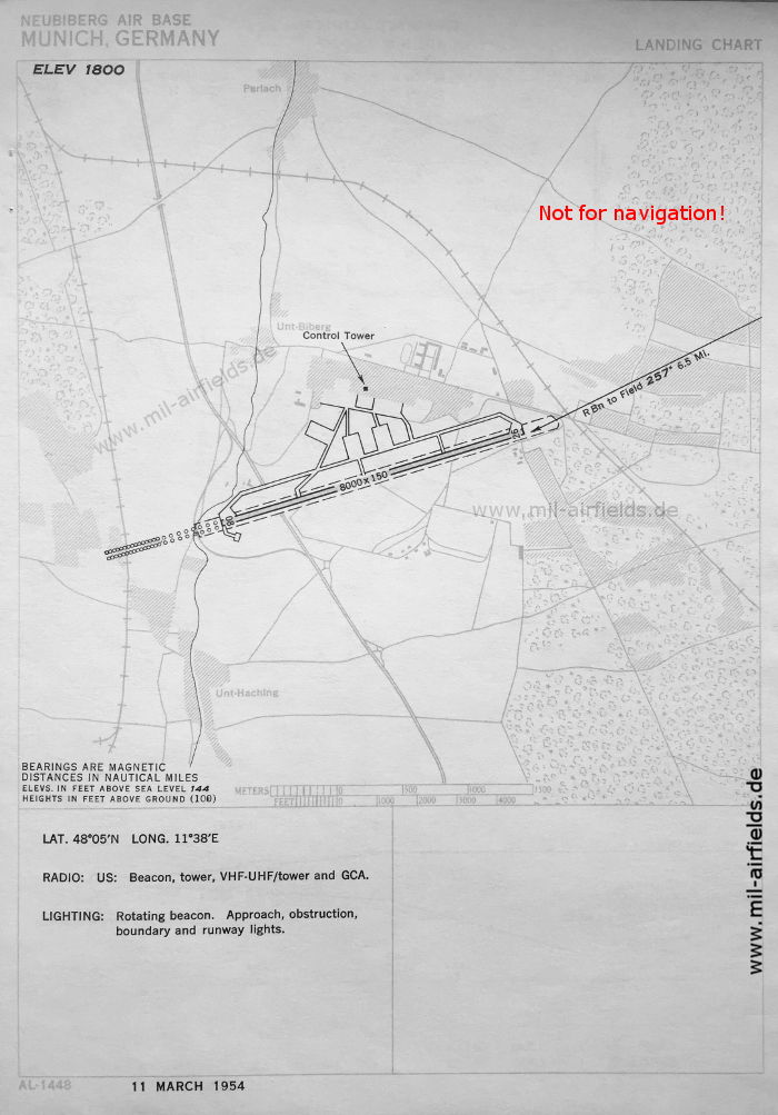
Airfield (March 1954) (Source: DoD)
In the 1960s
The field was taken over by the German Bundeswehr in 1958. This can also be seen on the maps, because the origin of the procedure is now the Luftwaffe (GAF German Air Force).
NDB approach runway 26 (October 1960) (Source: DoD)
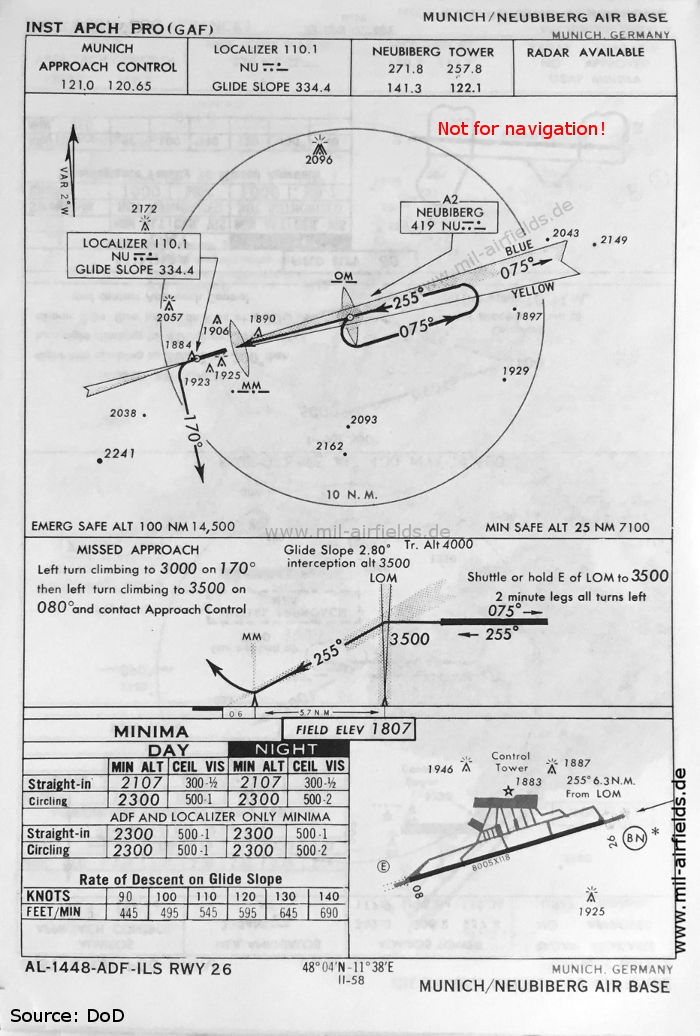
ILS approach runway 26 (May 1966) - As home base of the Lufttransportgeschwader 61 (Air Transport Wing 61), the airfield was equipped with an instrument landing system ILS. (Source: DoD)
Index to the objects shown on the maps
Aerodromes:
- München Riem, Neubiberg, Oberwiesenfeld, Schleißheim
Airspace:
- Danger Area
Radio beacons:
- Munich Radio Range "DHA", "DMR", NDB "DLM", "DMR"
- Neubiberg Radio Range "DAN", NDB "NU", ILS "NU", Outer Marker, Middle Marker
Air traffic control
- München Approach Control
- Neubiberg Tower
Source for all maps, if not marked otherwise: US Department of Defense (US DoD)
Recommended

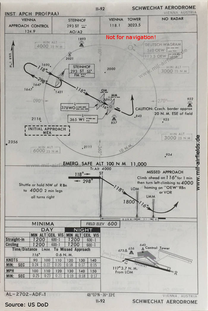
Image credits are shown on the respective target page, click on the preview to open it.
Navigation
Approach and airfield charts - Federal Republic of Germany