Hamburg Fuhlsbüttel Airport
Historical approach and aerodrome charts
For historical information only, do not use for navigation or aviation purposes!
| Coordinates | N533759 E0095937 (WGS84) Google Maps |
| Federal state | Freie und Hansestadt Hamburg (Free and Hanseatic City of Hamburg) |
| Region | Norddeutschland, Elbe, Alster, Bille |
| Location indicator | DDHF, EDDH |
| Operator | Royal Air Force, Flughafen Hamburg |

In the 1950s
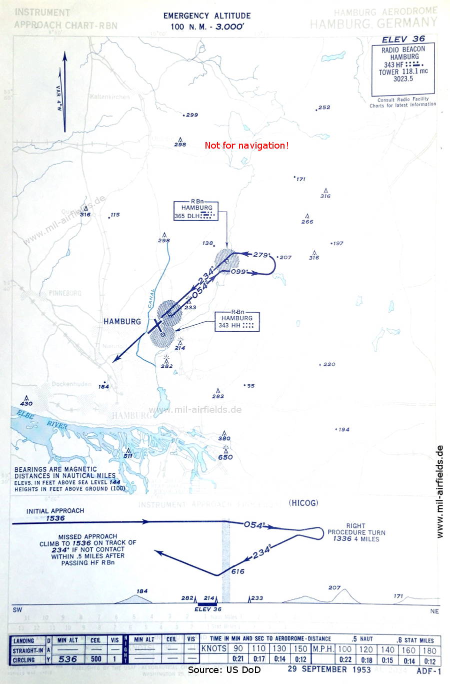
NDB approach runway 23 (September 1953) (Source: US DoD)
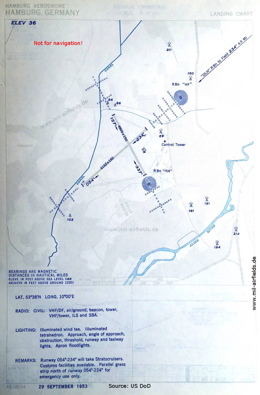
Airport chart (September 1953) - Runway 05/23: 1,878 m x 46 m (6,162 feet x 150 feet), runway 16/34: 1,463 m x 46 m (4,800 feet x 150 feet). (Source: US DoD)
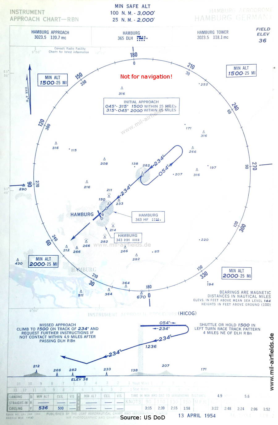
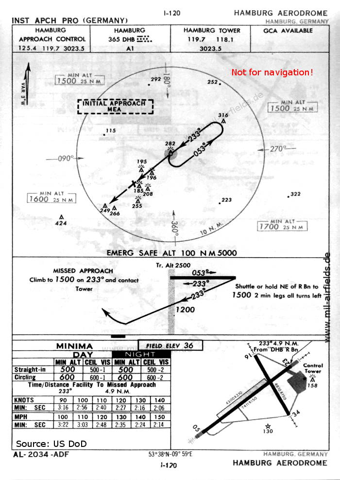
NDB approach runway 23 (April 1954) (Source: US DoD)
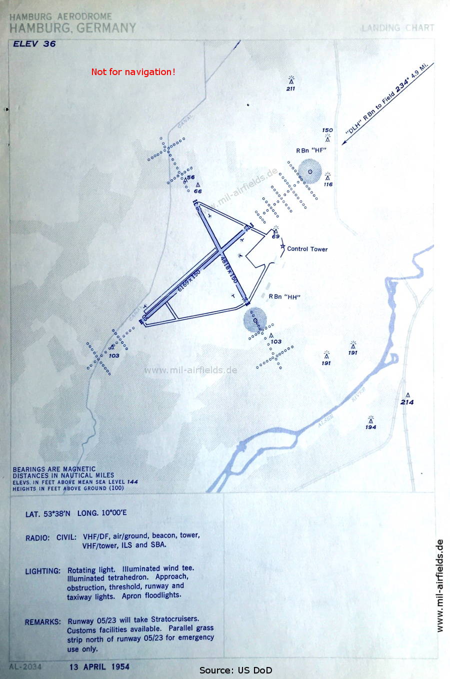
Aerodrome map (April 1954) - The airport is equipped with Instrument Landing System (ILS) and Standard Beam Approach (SBA). (Source: US DoD)
In the 1960s
NDB approach runway 23 (October 1960) - There are two runways - 05/23: length 2259 m, width 46 m (7411 feet x 150 feet), 16/34: length 1466 m, width 46 m (4810 feet x 150 feet). In addition, there is an emergency strip 05/23: length 1311 m, width 64 m (4300 feet x 210 feet). (Source: US DoD)
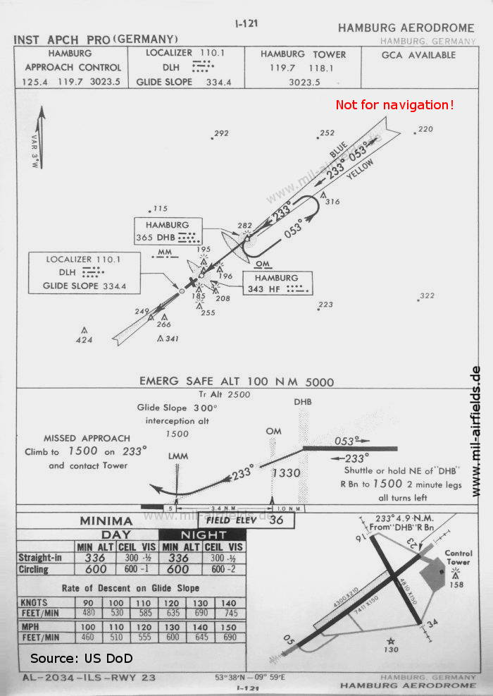
ILS approach runway 23 (October 1960) (Source: US DoD)
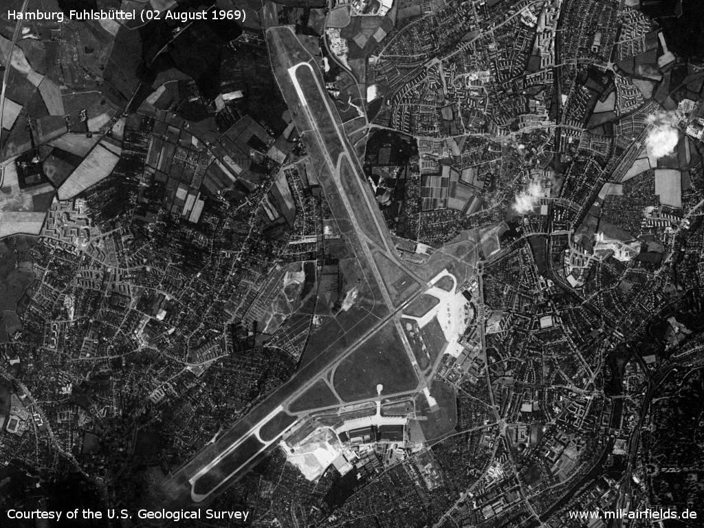
Satellite image 02 August 1969 (Source: U.S. Geological Survey)
Index to the objects shown on the maps
Airspace:
Radio beacons:
- Hamburg NDB "DHB", "DLH", Locator "HF", "HH", ILS "DLH", Outer Marker, Middle Marker
Air traffic control
- Hamburg Approach Control, Hamburg Tower
Source for all maps, if not marked otherwise: US Department of Defense (US DoD)
Title image: Swiss Air Lines Douglas DC-3-227A HB-IRO at Hamburg. Source: ETH-Bibliothek Zürich, Bildarchiv/Stiftung Luftbild Schweiz / Fotograf: Gardi, René / LBS_SR12-51-0754, License: CC BY-SA 4.0
Recommended


Image credits are shown on the respective target page, click on the preview to open it.
 mil-airfields.de at Facebook