Alicante Rabasa Airport
Historical approach and aerodrome charts
Aeródromo de Rabassa / Aeropuerto de Alicante, Rabasa - Cartas de aproximación históricos
For historical information only, do not use for navigation or aviation purposes!
| Coordinates | N382255 W0003046 (WGS84) Google Maps |
Location Indicator: LEAL (same as today's Alicante-Elche Airport)
The airport is closed, the control tower still exists and stands today on the premises of the University of Alicante (Universidad de Alicante) in San Vicente del Raspeig.
In the 1960s
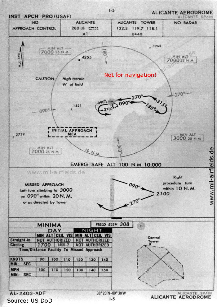
NDB approach (October 1960)
The field has no runways, the size of the unpaved movement area is given in feet: 1397 m (4583 feet) x 1100 m (3609 feet).
(Source: US DoD)
The field has no runways, the size of the unpaved movement area is given in feet: 1397 m (4583 feet) x 1100 m (3609 feet).
(Source: US DoD)
Source for all maps, if not marked otherwise: US Department of Defense (US DoD)
Recommended
Image credits are shown on the respective target page, click on the preview to open it.