Getafe Air Base
Base Aérea de Getafe
Historical approach and aerodrome charts
Base Aérea de Getafe - Cartas de aproximación históricos
For historical information only, do not use for navigation or aviation purposes!
| Coordinates | N401736 W0034324 |
Location Indicator: LEGT
In the 1950s
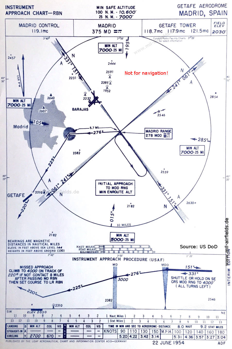
Range approach (June 1954)
(Source: US DoD)
(Source: US DoD)
In the 1960s
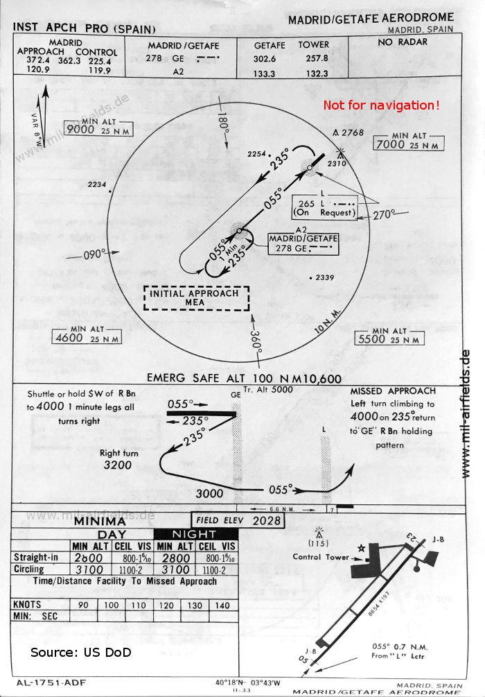
NDB approach runway 05 (May 1966)
(Source: US DoD)
(Source: US DoD)
Source for all maps, if not marked otherwise: US Department of Defense (US DoD)
Index to the objects shown on the maps
Aerodromes / Aeropuertos
- Getafe
- Madrid Barajas
Radio beacons / Radiofaro:
- Madrid/Getafe NDB GE
- Madrid/Getafe Locator L
- Madrid Range MDD
Air traffic control / Control del tráfico aéreo:
- Madrid Control
- Getafe Tower
Recommended

Image credits are shown on the respective target page, click on the preview to open it.
 mil-airfields.de at Facebook