San Luis Aerodrome
Aeródromo de San Luis, Mahón
Historical approach and aerodrome charts
Aeródromo de San Luis
For historical information only, do not use for navigation or aviation purposes!
| Coordinates | N395142 E0041507 (WGS84) Google Maps |
Airfield
Region: Menorca, Mahón / Maó
Location indicator: LESL
The field was the airport of Menorca until 1969.
In the 1960s
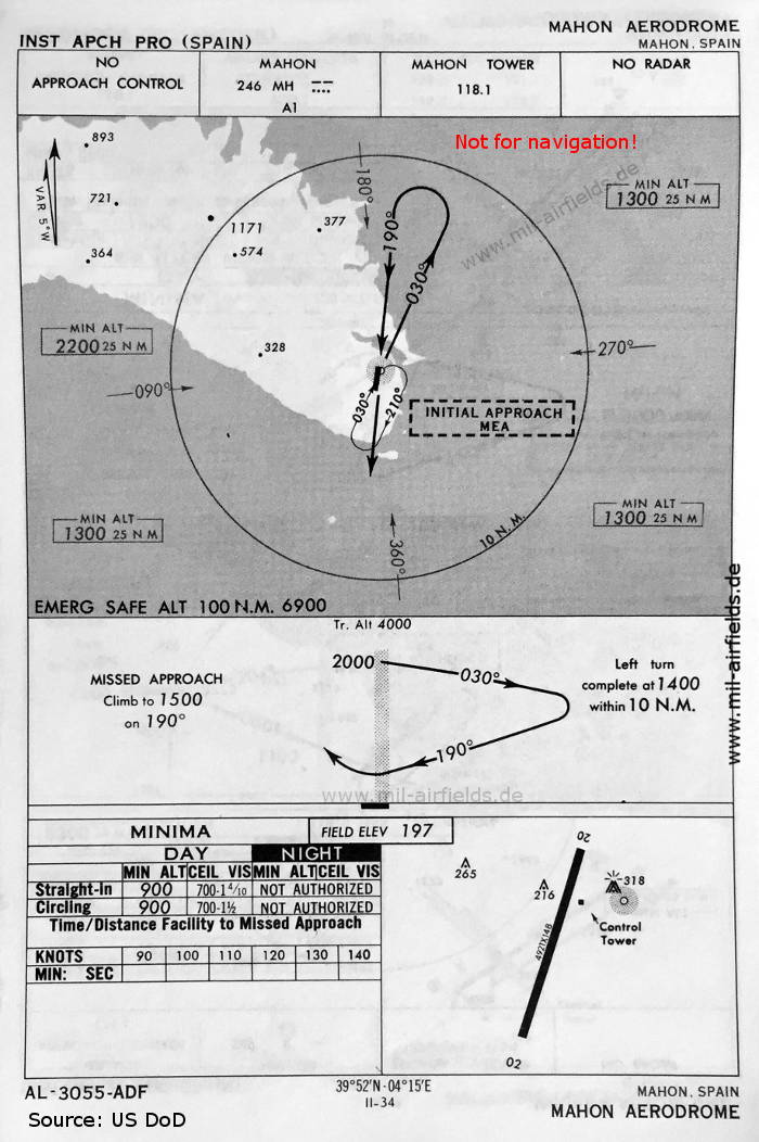
NDB approach runway 20 (May 1966)
There is one runway - 02/20: length 1500 m, width 45 m (4921 feet x 148 feet).
(Source: US DoD)
There is one runway - 02/20: length 1500 m, width 45 m (4921 feet x 148 feet).
(Source: US DoD)
Index to the objects shown on the maps
Radio beacons / Radiofaro:
- Mahon NDB "MH"
Air traffic control / Control del tráfico aéreo:
- Mahon Tower
Source for all maps, if not marked otherwise: US Department of Defense (US DoD)
Recommended

Image credits are shown on the respective target page, click on the preview to open it.
 mil-airfields.de at Facebook