Zaragoza Airport
Historical approach and aerodrome charts
Aeropuerto de Zaragoza, Base Aérea de Zaragoza, Zaragoza Air Base
For historical information only, do not use for navigation or aviation purposes!
| Coordinates | N413958 W0010231 (WGS84) Google Maps |
Airfield
Region: Aragon, Aragó, Río Huerva, Ebro
Location indicator: LEZG
User: Ejército del Aire, US Air Force (USAF)
In the 1960s
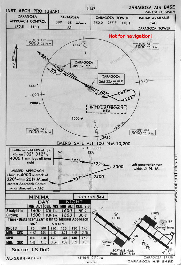
NDB approach runway 31R (October 1960)
There are two runways - 13L/31R: length 3024 m, width 60 m (9921 feet x 197 feet), 13R/31L: length 3718 m, width 61 m (12200 feet x 200 feet).
(Source: US DoD)
There are two runways - 13L/31R: length 3024 m, width 60 m (9921 feet x 197 feet), 13R/31L: length 3718 m, width 61 m (12200 feet x 200 feet).
(Source: US DoD)
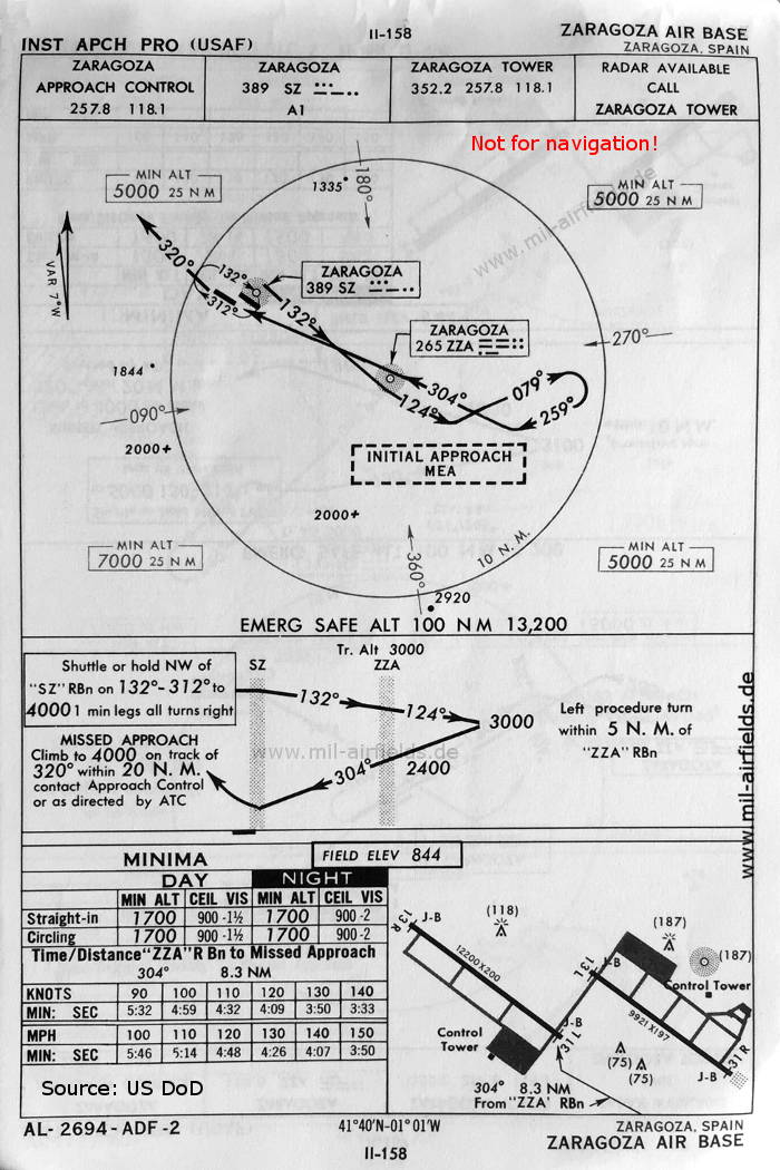
NDB approach runway 31L (October 1960)
(Source: US DoD)
(Source: US DoD)
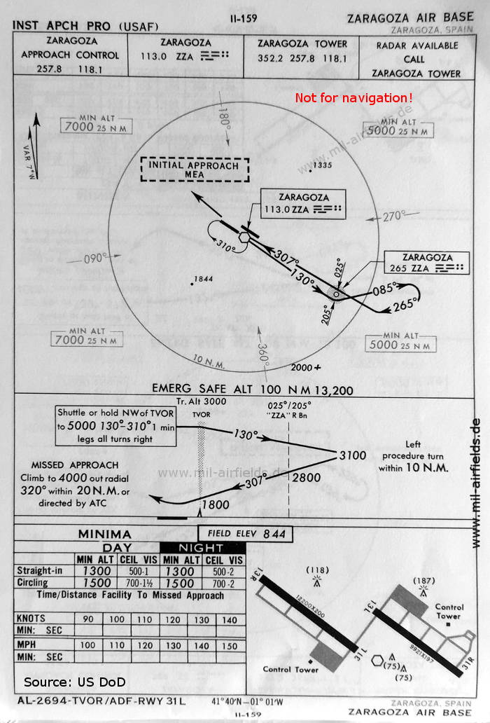
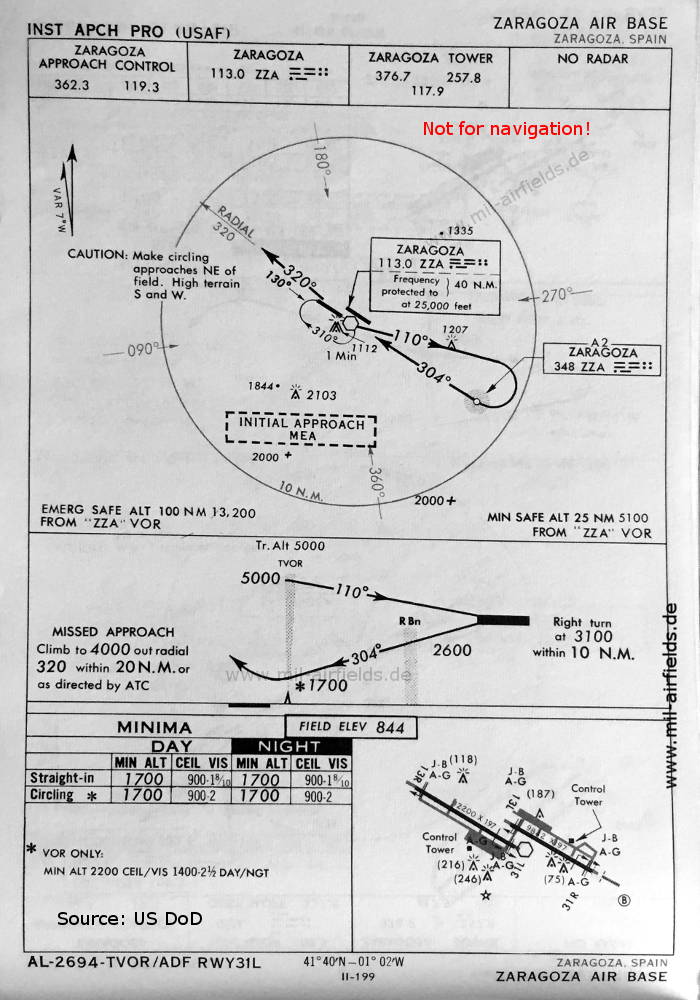
VOR-NDB approach runway 31L (October 1960)
(Source: US DoD)
(Source: US DoD)
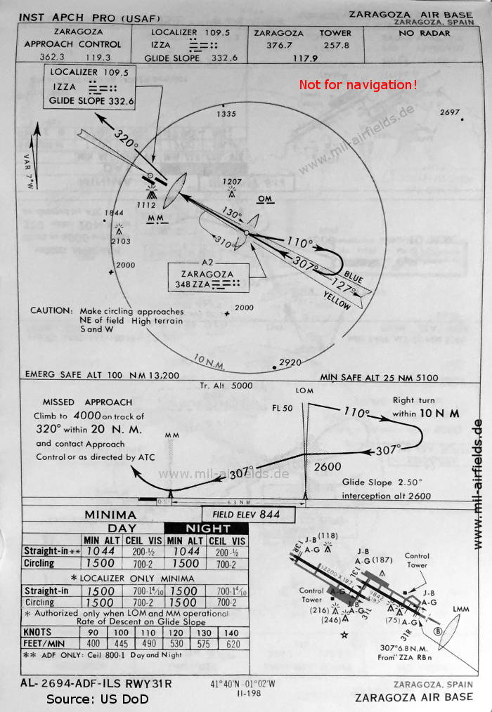
ILS approach runway 31R (May 1966)
Now the runways are shown - 13L/31R: length 3000 m, width 60 m (9842 feet x 197 feet), 13R/31L: length 3718 m, width 60 m (12200 feet x 197 feet).
(Source: US DoD)
Now the runways are shown - 13L/31R: length 3000 m, width 60 m (9842 feet x 197 feet), 13R/31L: length 3718 m, width 60 m (12200 feet x 197 feet).
(Source: US DoD)
VOR-NDB approach runway 31L (May 1966)
(Source: US DoD)
(Source: US DoD)
Index to the objects shown on the maps
Aerodromes / Aeropuertos:
Radio beacons / Radiofaro:
- Zaragoza NDB "SZ", "ZZA", VOR "ZZA", ILS "IZZA", Outer Marker, Middle Marker
Air traffic control / Control del tráfico aéreo:
- Zaragoza Approach Control, Zaragoza Tower
Source for all maps, if not marked otherwise: US Department of Defense (US DoD)
Recommended


Image credits are shown on the respective target page, click on the preview to open it.
 mil-airfields.de at Facebook