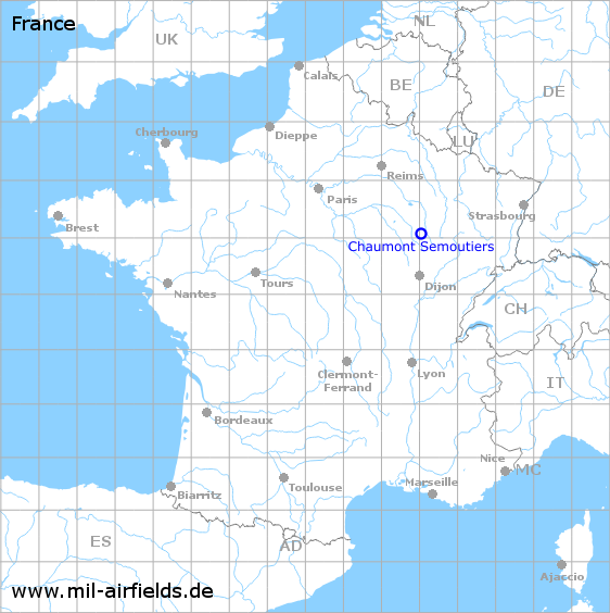
Chaumont Semoutiers Air Base
Aérodrome de Chaumont-Semoutiers, Quartier General d’Aboville
Historical approach and aerodrome charts
Base aérienne de Chaumont-Semoutiers - Cartes d'approche / d'atterrissage historiques
For historical information only, do not use for navigation or aviation purposes!
| Coordinates | N480455 E0050252 (WGS84) Google Maps |
| Region | Region Grand Est, Département Haute-Marne |
| Location indicator | LFQU (USAF), LFJA (civ) |
| Operator | US Air Force |
In the 1950s
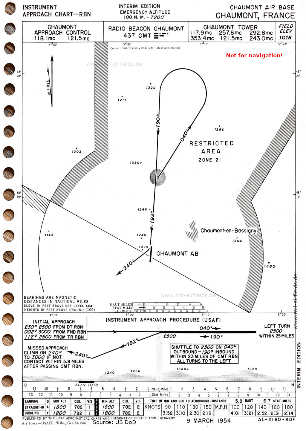
NDB approach runway 19 (March 1954) (Source: US DoD)
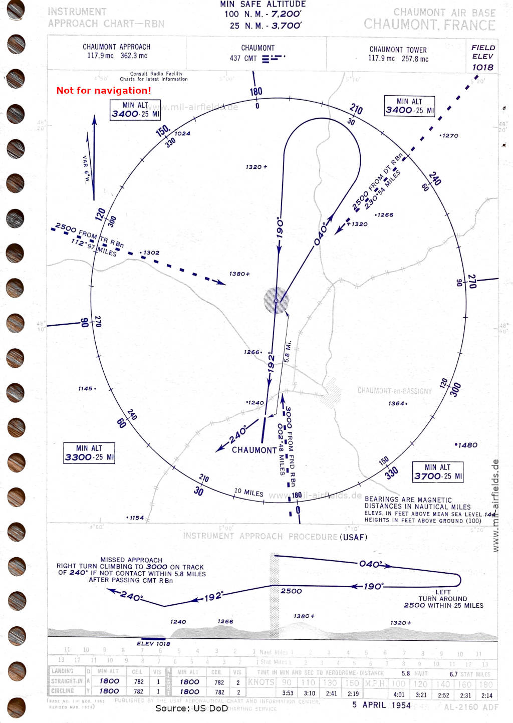
NDB approach runway 19 (April 1954) (Source: US DoD)
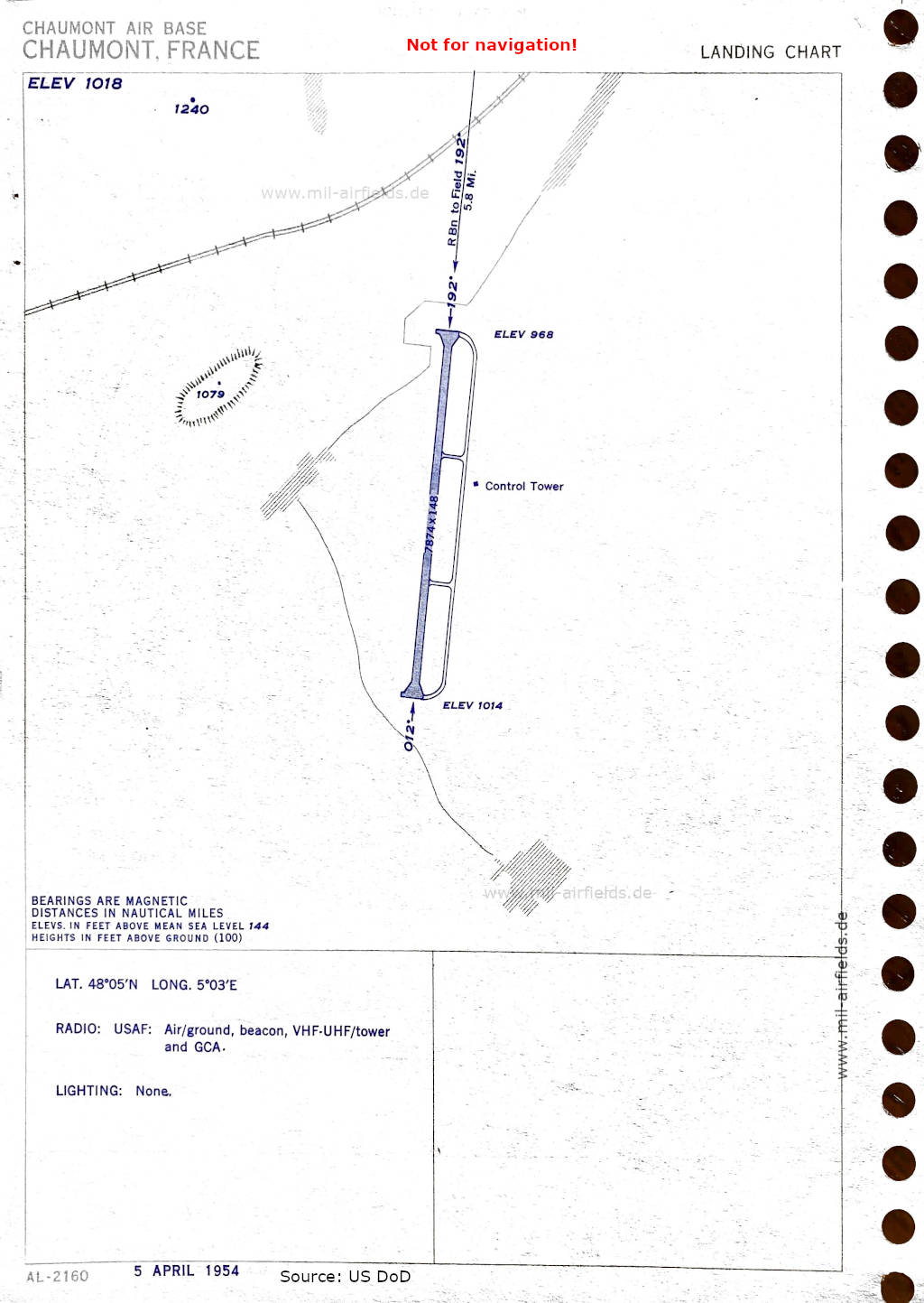
Aerodrome (April 1954) - There is one runway - 012/192: length 2400 m, width 45 m (7874 feet x 148 feet). (Source: US DoD)
In the 1960s
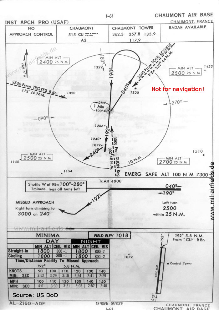
NDB approach runway 19 (October 1960) - There is one runway - 01/19: length 2438 m, width 45 m (8000 feet x 148 feet). (Source: US DoD)
Index to the objects shown on the maps
Airspace / Espace aérien:
- Restricted Area Zone 21
Radio beacons with Identifier / Radiophares aéronautiques:
- Chaumont NDB "CU"
Air traffic control / Communications / Contrôle de la circulation aérienne:
- Chaumont Approach Control, Chaumont Tower
Places:
- Chaumont-en-Bassigny
Source for all maps, if not marked otherwise: US Department of Defense (US DoD)
Recommended
Image credits are shown on the respective target page, click on the preview to open it.
 mil-airfields.de at Facebook