Vouziers Séchault Air Base
Historical approach and aerodrome charts
Base Aérienne Vouziers Séchault
For historical information only, do not use for navigation or aviation purposes!
| Coordinates | N491637 E0044511 (WGS84) Google Maps |
| Region | Grand Est, Département Ardennes |
| Location indicator | LFZY |
In the 1960s

NDB approach runway 08 (October 1960) - There is one runway - 08/26: length 2582 m, width 46 m (8472 feet x 150 feet). (Source: US DoD)
In the 1970s
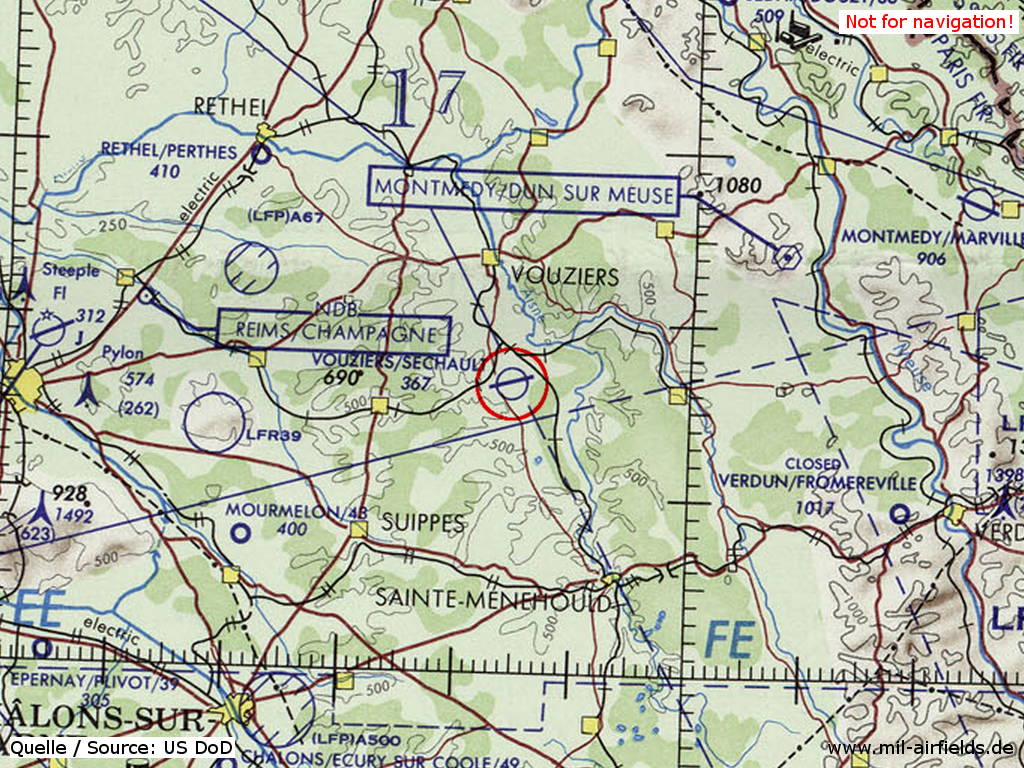
Vouziers Séchault Air Base on a map of the US Department of Defense from 1972 (Source: ONC E-2 (1972), Perry-Castañeda Library Map Collection, University of Texas at Austin)
Index to the objects shown on the maps
Radio beacons / Radiophares aéronautiques:
- Vouziers NDB "VR"
Air traffic control / Contrôle de la circulation aérienne:
- Moselle Control, Vouziers Tower
Source for all maps, if not marked otherwise: US Department of Defense (US DoD)
Recommended


Image credits are shown on the respective target page, click on the preview to open it.
 mil-airfields.de at Facebook