Brindisi Campo Casale Airport
Casale, Aeroporto di Brindisi-Casale, Aeroporto del Salento
Historical approach and aerodrome charts
Aeroporto di Brindisi-Casale: Carte di avvicinamento
For historical information only, do not use for navigation or aviation purposes!
| Coordinates | N403954 E0175620 (WGS84) Google Maps |
| Region | Adriatic Sea |
| Location indicator | LIBR |
In the 1950s

NDB approach (October 1953) (Source: US DoD)
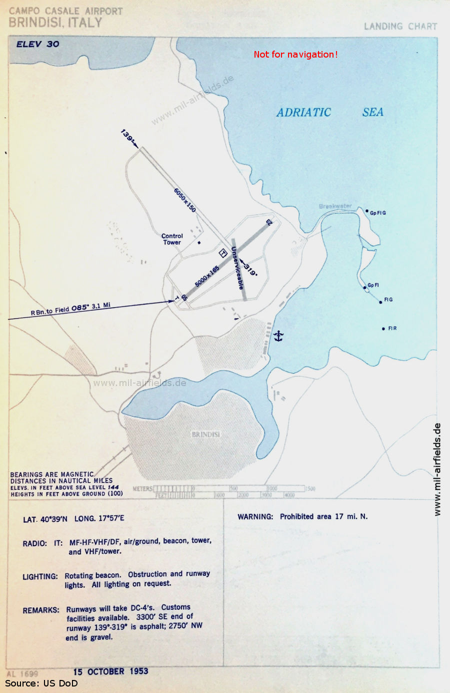
Airport map (October 1953) - The runway lengths are given in feet. The paved runway 05/23 is 1,524 m (5,000 feet) long, the grass runway 139°/319° is 1,844 m (6,050 feet) long. The anchor symbol southeast indicates a seaplane base. (Source: US DoD)
In the 1960s
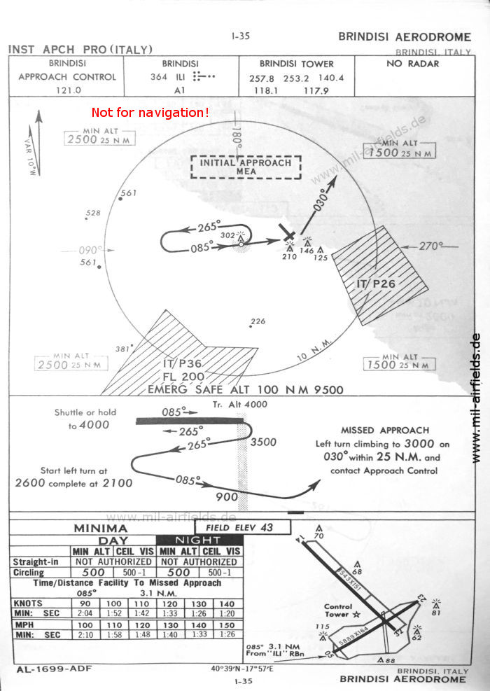
NDB approach (October 1960) (Source: US DoD)
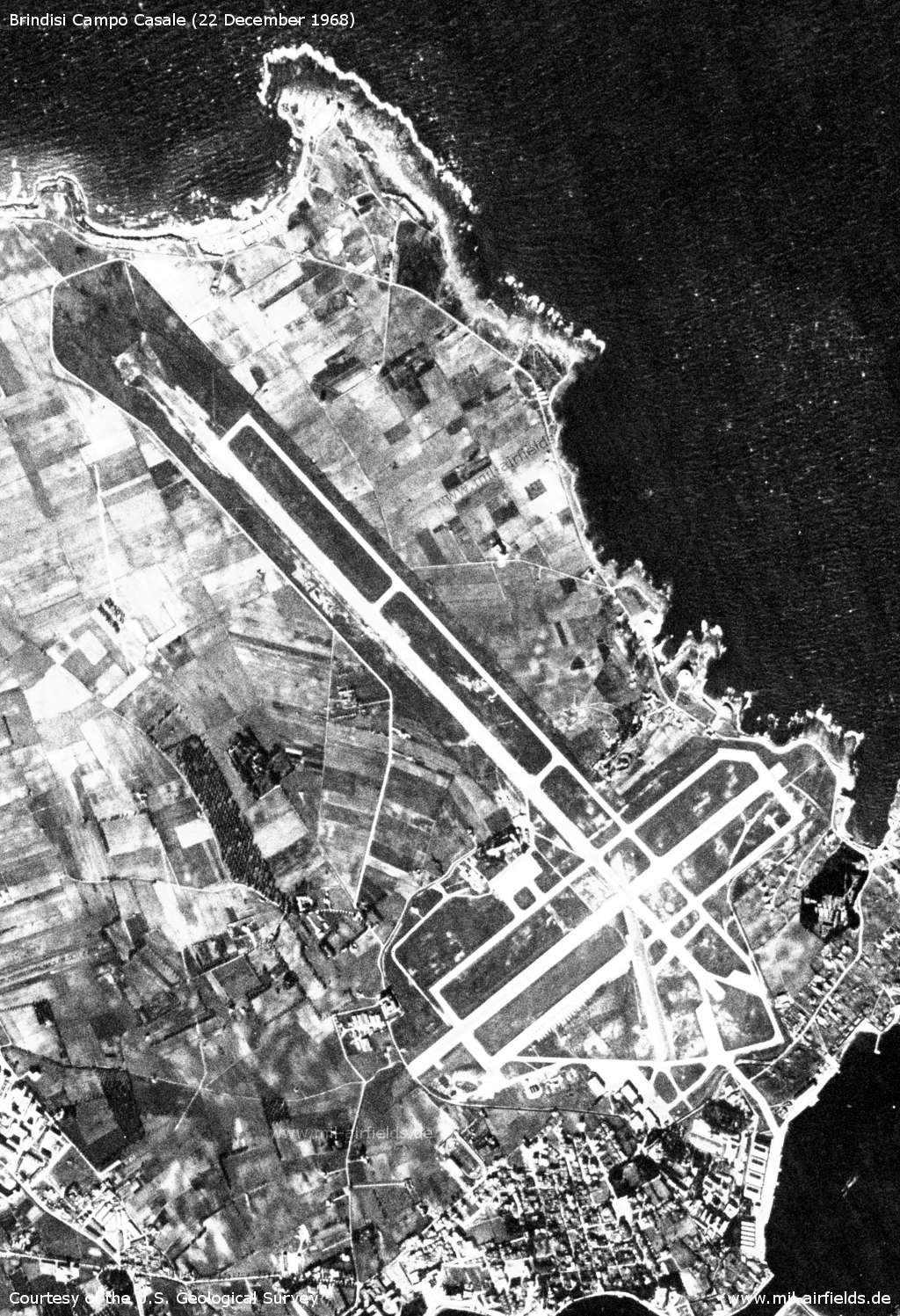
Satellite image from 22 December 1968 - At the bottom right is the seaplane base. The image was taken from a US reconnaissance satellite and was previously subject to strict secrecy. (Source: U.S. Geological Survey)
Index to the objects shown on the maps
Aerodromes / Aeroporti:
- Brindisi Casale
Airspace / Spazio aereo:
- IT(P) 26, IT(P) 36
Radio beacons / Radiofaro:
- Brindisi NDB ILI
Air traffic control / Controllo del traffico aereo / Communications:
- Brindisi Approach Control, Brindisi Tower
Landmarks and places:
- Brindisi, Latiano, Mesagne, San Pietro Vernotico, San Vito dei Normanni, Squinzano, Torchiarolo, Torre Santa Susanna
Source for all maps, if not marked otherwise: US Department of Defense (US DoD)
Recommended


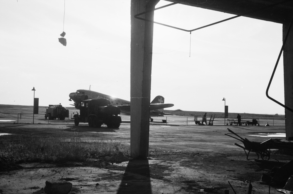
Image credits are shown on the respective target page, click on the preview to open it.