Fürth: Industrieflughafen Airport
Nuremberg-Fürth Industriehafen Airfield, Fürth Industrie
For historical information only, do not use for navigation or aviation purposes!
| Coordinates | N492854 E0105712 (WGS84) Google Maps |
| Elevation | 1046 ft |
| Federal state | Bayern (Bavaria) |
Germany during the Cold War
The history of the Cold War airfields: Fürth Industrie
General
Until 1945, the airfield was used as a factory airfield. At the end of World War II, the field was occupied by US troops. Later it also served as a temporary civil airport for Nuremberg, until it was replaced in 1955 by the newly built airport Nuremberg (Kraftshof).
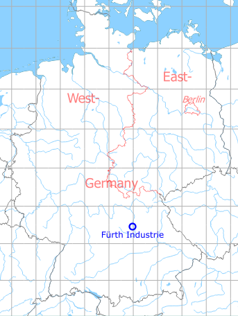
Location of airfield
The airfield was located in the western part of the city of Fürth, at today's Hardhöhe settlement. On the western side, the former site is limited by the Main-Donau Canal. This is not shown on old maps, since it was built later.
During World War II
Use
The airfield was used as a factory airfield.
Situation
Fürth Industrie Airfield in World War II on a US map from 1944
Source: McMaster University Library Digital Archive, Lizenz: Creative Commons Attribution-NonCommercial 2.5 CC BY-NC 2.5 CA
During the Cold War
During the 1950s: Nuremberg airport
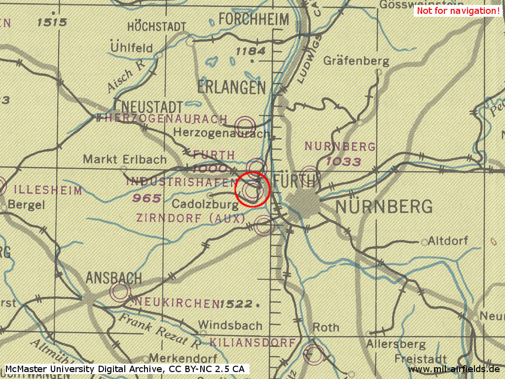
Overview
The airfield on a map from 1952
Source: USAF
Map from 1954
Source: AMS M841 GSGS 4414, Courtesy Harold B. Lee Library, Brigham Young University
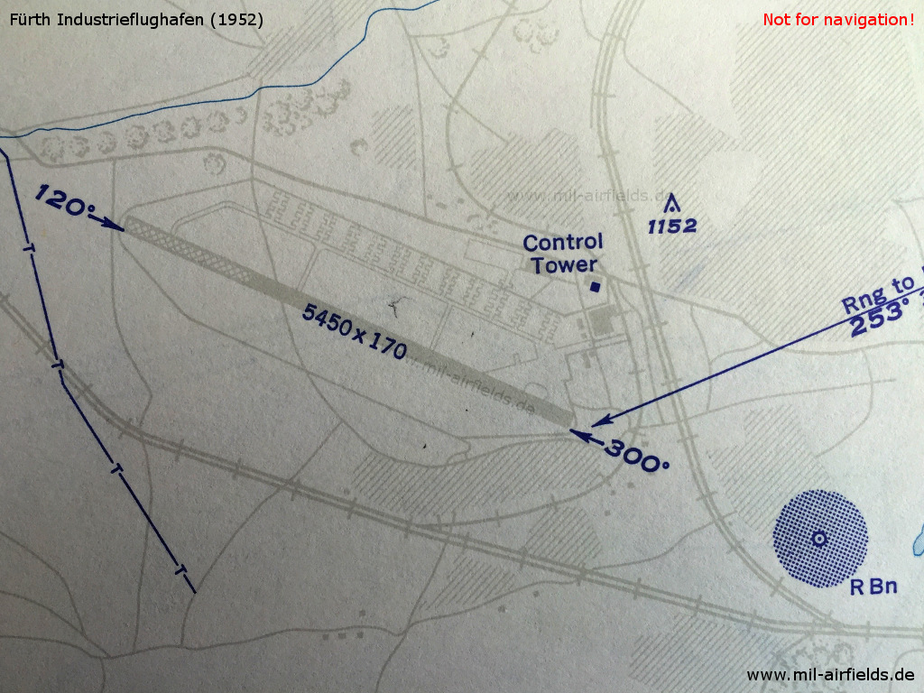
Runways
- 12/30: 1661 m (5450 ft) x 52 m (170 ft) , runway will take DC-4s
Radio beacons
- L 30: 415 "DLN"
- L 30: 291,5 "NB"
Radio communication
- Nurnberg Tower 3023.5, 118.3
Airspace and procedures
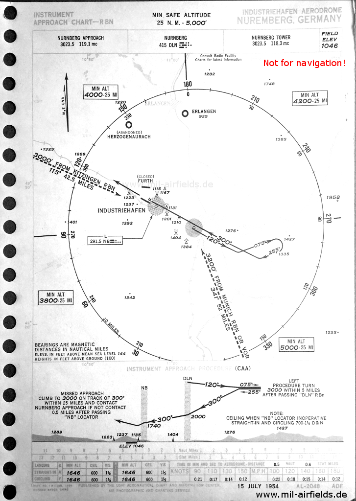
Approach in 1954
Source: USAF
Images
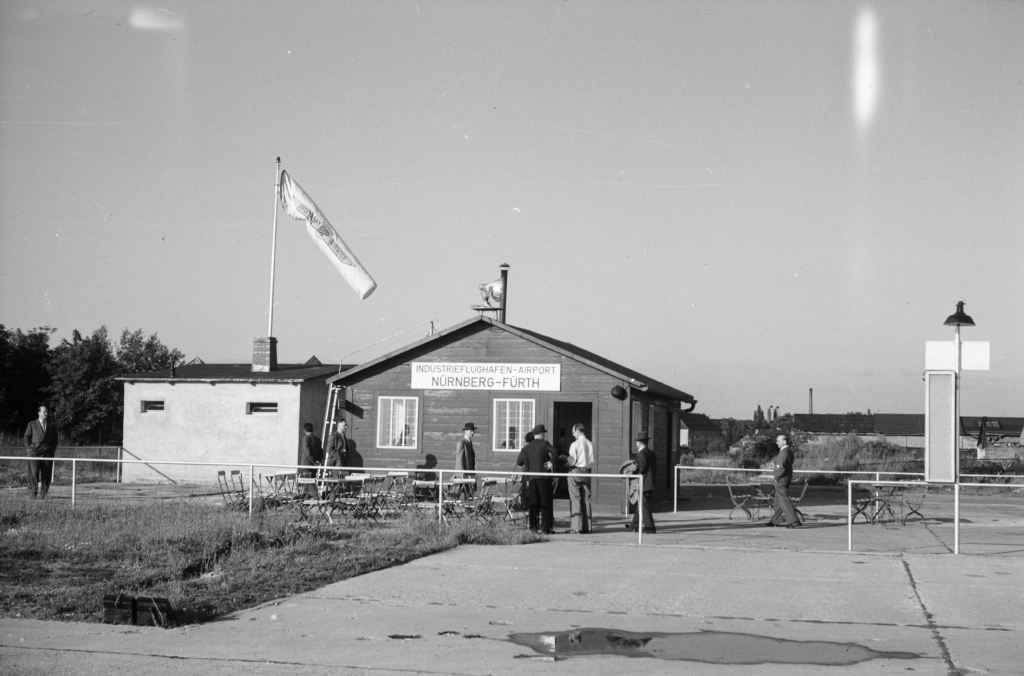
Building (1950) - Source: ETH-Bibliothek Zürich, Bildarchiv/Stiftung Luftbild Schweiz / Fotograf: Gardi, René / LBS_SR12-51-0742 / CC BY-SA 4.0 /ETH/
Source: ETH-Bibliothek Zürich, Bildarchiv/Stiftung Luftbild Schweiz / Fotograf: Gardi, René / LBS_SR12-51-0742 / CC BY-SA 4.0
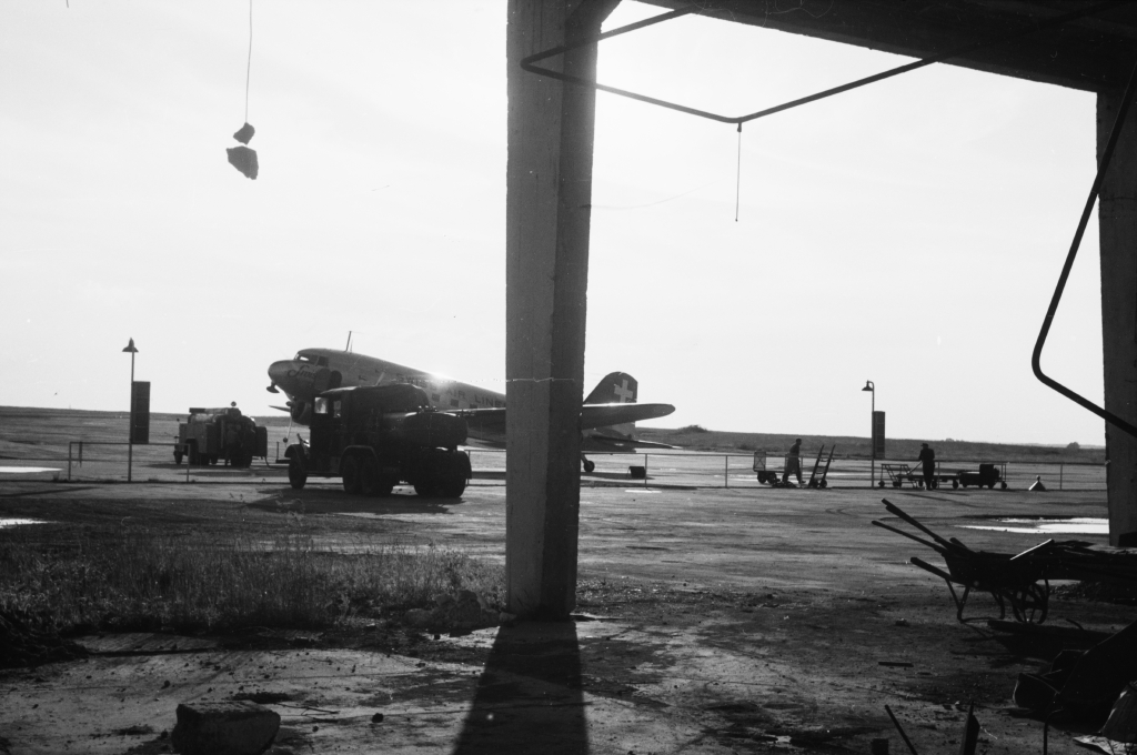
Swissair DC-3 (1950)
Source: ETH-Bibliothek Zürich, Bildarchiv/Stiftung Luftbild Schweiz / Fotograf: Gardi, René / LBS_SR12-51-0744 / CC BY-SA 4.0
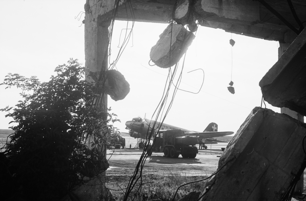
Damaged object (1950)
Source: ETH-Bibliothek Zürich, Bildarchiv/Stiftung Luftbild Schweiz / Fotograf: Gardi, René / LBS_SR12-51-0745 / CC BY-SA 4.0
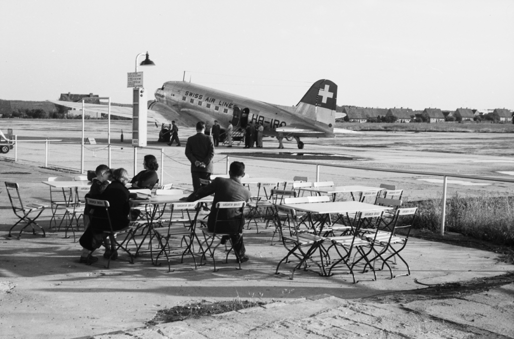
Swissair DC-3 and Restaurant (1950)
Source: ETH-Bibliothek Zürich, Bildarchiv/Stiftung Luftbild Schweiz / Fotograf: Gardi, René / LBS_SR12-51-0747 / CC BY-SA 4.0
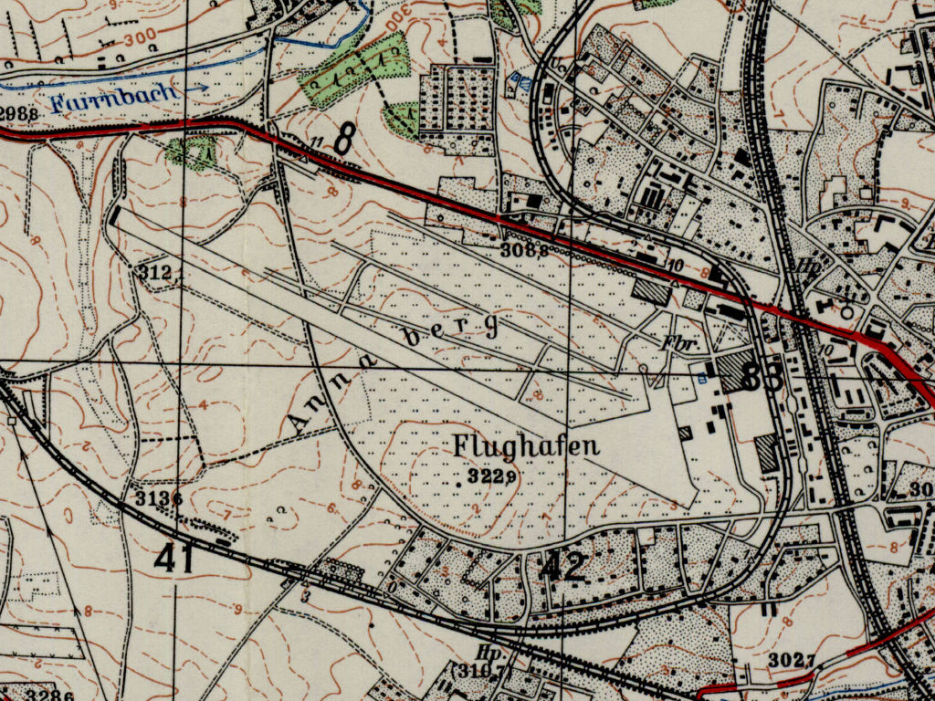
Today
Use
Closed. The area is overbuilt and is part of the Hardhöhe borough.
Links
- /ETH/:
http://www.e-pics.ethz.ch/ - E-Pics - /BYU/:
http://lib.byu.edu/collections/german-maps/ - German Maps (Topographische Karte 1:25,000)
Airfields in the vicinity
- 011°/2km Fürth: Army Airfield AAF (Nürnberg-Fürth Airport, Atzenhof, Monteith Barracks Army Heliport Furth)
- 155°/2km Fürth: Dambach Housing Area Helipad
- 025°/13km Erlangen: Army Airfield AAF (Ferris Barracks Army Heliport AHP)
- 118°/13km Nürnberg: Soldiers Field Army Airfield (AAF, Nurnberg New, Great Road)
- 123°/19km Feucht: Army Airfield AAF (Feucht Army Airfield AAF)
- 230°/30km Ansbach: Army Airfield / Heliport (Katterbach Kaserne)
- 160°/31km Roth: Airfield (Kiliansdorf)
- 235°/34km Ansbach: Hindenburg Kaserne Army Heliport (AHP)
Recommended
Image credits are shown on the respective target page, click on the preview to open it.
 Follow mil-airfields on Facebook