Catania Fontanarossa Airport
Fontanarossa
Historical approach and aerodrome charts
For historical information only, do not use for navigation or aviation purposes!
| Coordinates | N372801 E0150401 (WGS84) Google Maps |
Airfield
Region: Sicily, Simeto
Location indicator: LICC
In the 1940s
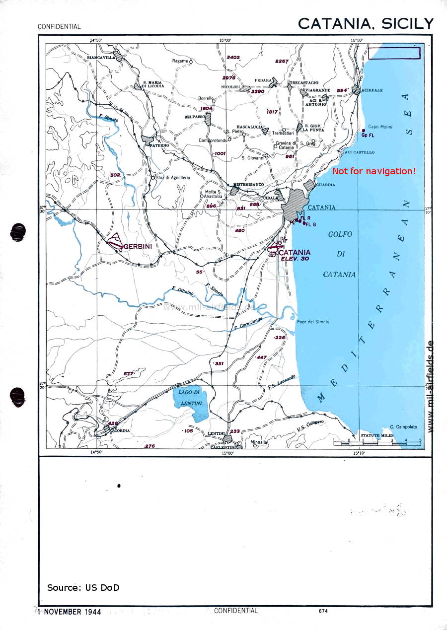
Area chart (November 1944) (Source: US DoD)
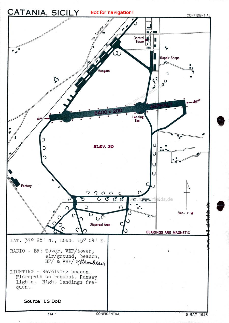
Aerodrome (May 1945) - There is one runway - 087/267: length 1646 m, width 61 m (5400 feet x 200 feet). (Source: US DoD)
Index to the objects shown on the maps
Aerodromes / Aeroporti:
- Catania, Gerbini
Source for all maps, if not marked otherwise: US Department of Defense (US DoD)
Recommended

Image credits are shown on the respective target page, click on the preview to open it.
 mil-airfields.de at Facebook