Sigonella Naval Air Station
Historical approach and aerodrome charts
Base aerea di Sigonella: Carte di avvicinamento
For historical information only, do not use for navigation or aviation purposes!
| Coordinates | N372406 E0145520 (WGS84) Google Maps |
| Region | Sicily, Catania |
| Location indicator | LICZ |
| Operator | Aeronautica Militare, US Navy |
In the 1960s
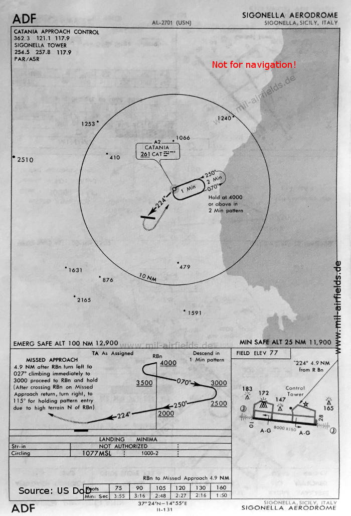
NDB approach (May 1966) - There is one runway - 10/28: length 2438 m, width 46 m (8000 feet x 150 feet). (Source: US DoD)
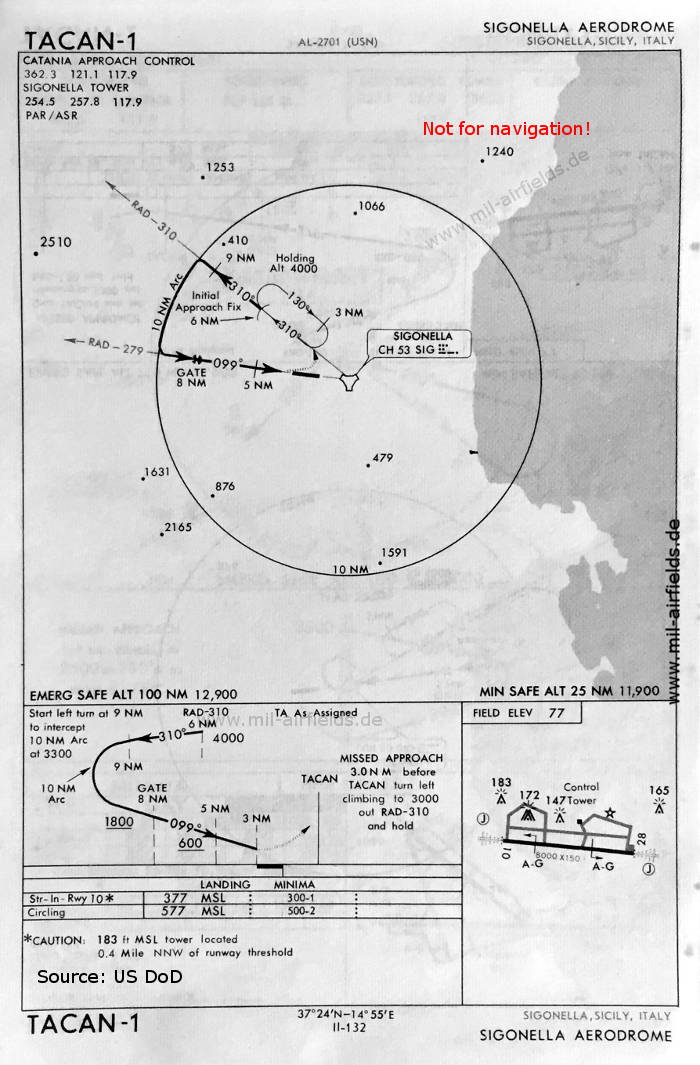
TACAN approach runway 10 (May 1966) (Source: US DoD)
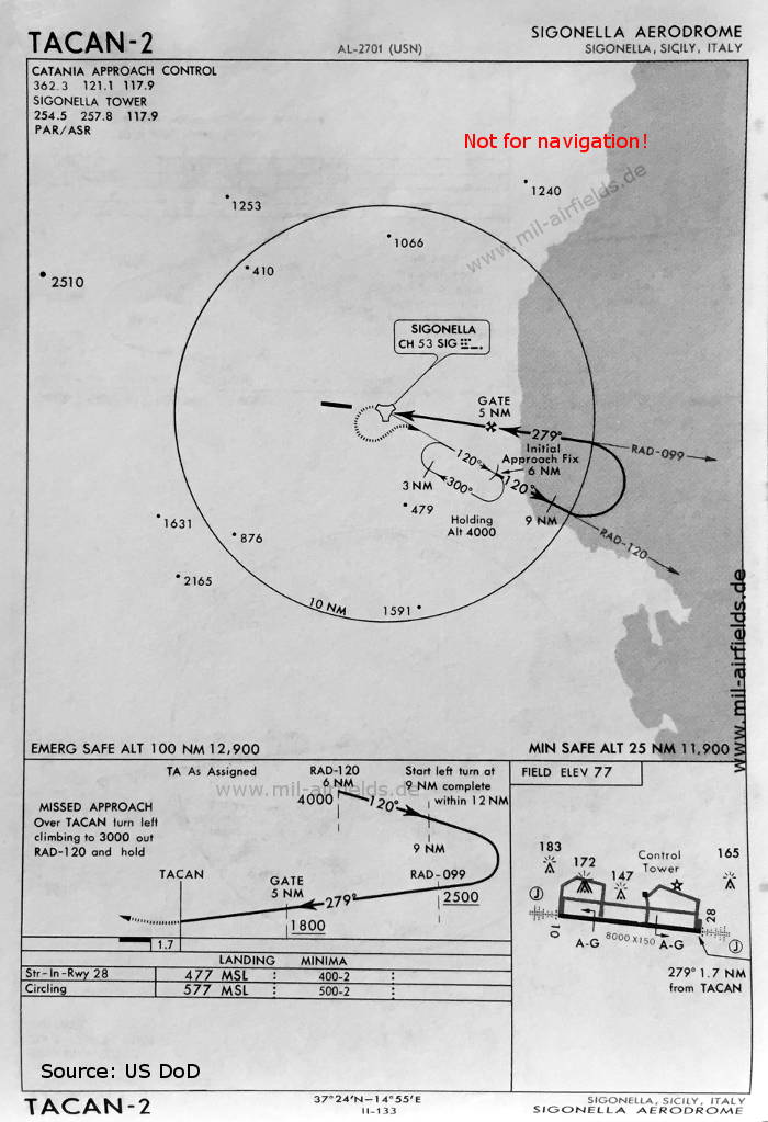
TACAN approach runway 28 (May 1966) (Source: US DoD)
Index to the objects shown on the maps
Radio beacons with identifier / Radiofaro:
- Catania NDB "CAT", Sigonella TACAN "SIG"
Air traffic control / Controllo del traffico aereo / Communications:
- Catania Approach Control, Sigonella Tower
Source for all maps, if not marked otherwise: US Department of Defense (US DoD)
Recommended

Image credits are shown on the respective target page, click on the preview to open it.
 mil-airfields.de at Facebook