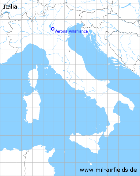
Verona Villafranca Airport / Air Base
Aeroporto di Verona-Villafranca "Valerio Catullo"
Historical approach and aerodrome charts
Aeroporto di Verona-Villafranca "Valerio Catullo": Carte di avvicinamento
For historical information only, do not use for navigation or aviation purposes!
| Coordinates | N452349 E0105325 (WGS84) Google Maps |
| Region | Regione del Veneto, Province of Verona / Provincia di Verona, Villafranca di Verona, Tione |
| Location indicator | LIPX |
| Operator | Italian Air Force / Aeronautica Militare |
In the 1960s
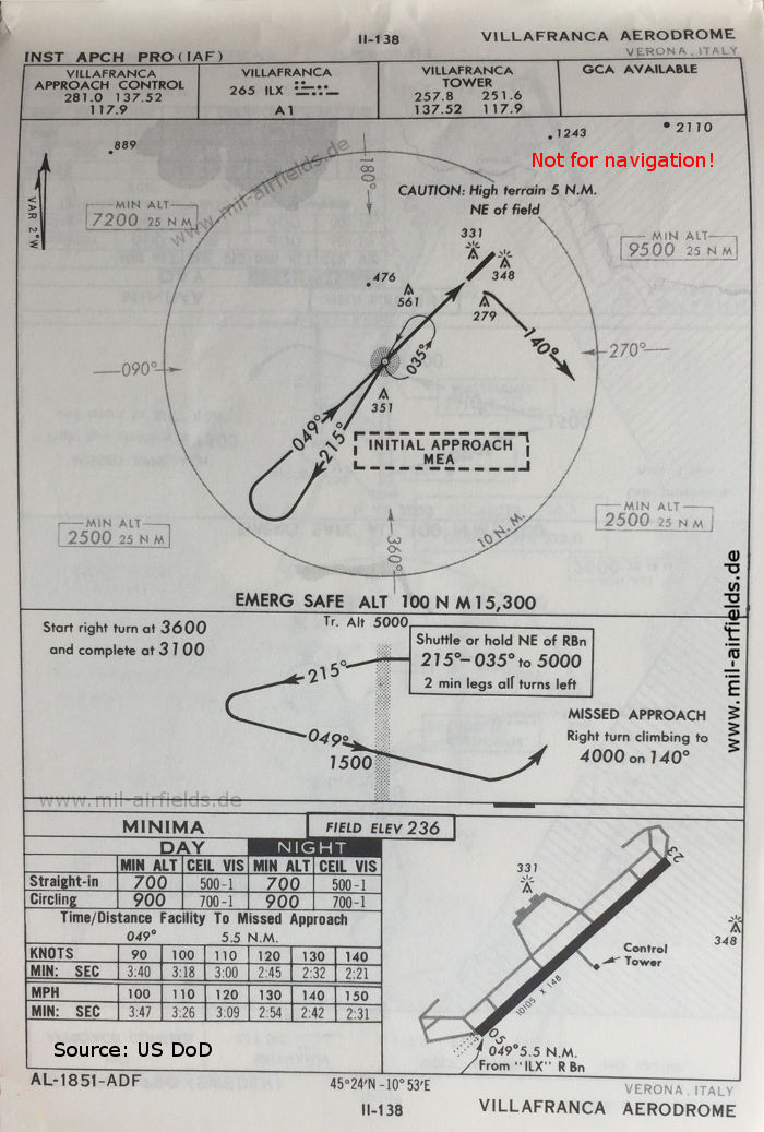
NDB approach runway 05 (October 1960) (Source: US DoD)
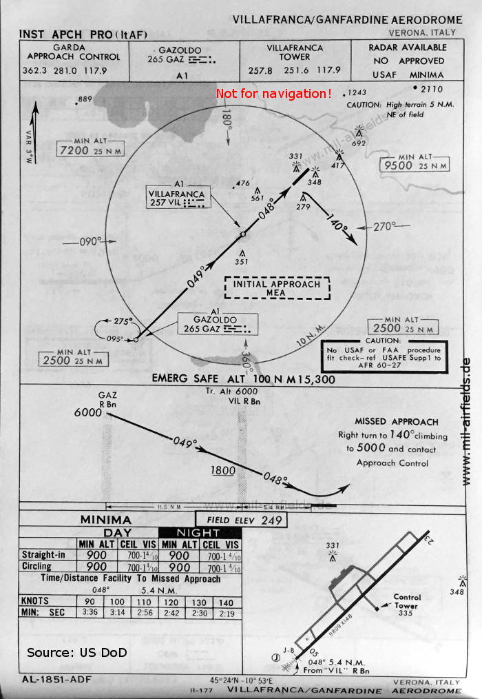
NDB approach runway 05 (May 1966) (Source: US DoD)
Index to the objects shown on the maps
Aerodromes / Aeroporti:
- Verona Villafranca
Radio beacons with identifier / Radiofaro:
- Gazoldo NDB "GAZ"
- Villafranca NDB "ILX", NDB "VIL"
Air traffic control / Controllo del traffico aereo / Communications:
- Garda Approach Control
- Villafranca Approach Control, Villafranca Tower
Source for all maps, if not marked otherwise: US Department of Defense (US DoD)
Recommended

Image credits are shown on the respective target page, click on the preview to open it.