Ota Air Base
Historical approach and aerodrome charts
Base Aérea da Ota - Cartas de aproximação históricos
For historical information only, do not use for navigation or aviation purposes!
| Coordinates | N390525 W0085744 (WGS84) Google Maps |
| Region | Alenquer |
| Location indicator | LPOT |
In the 1950s
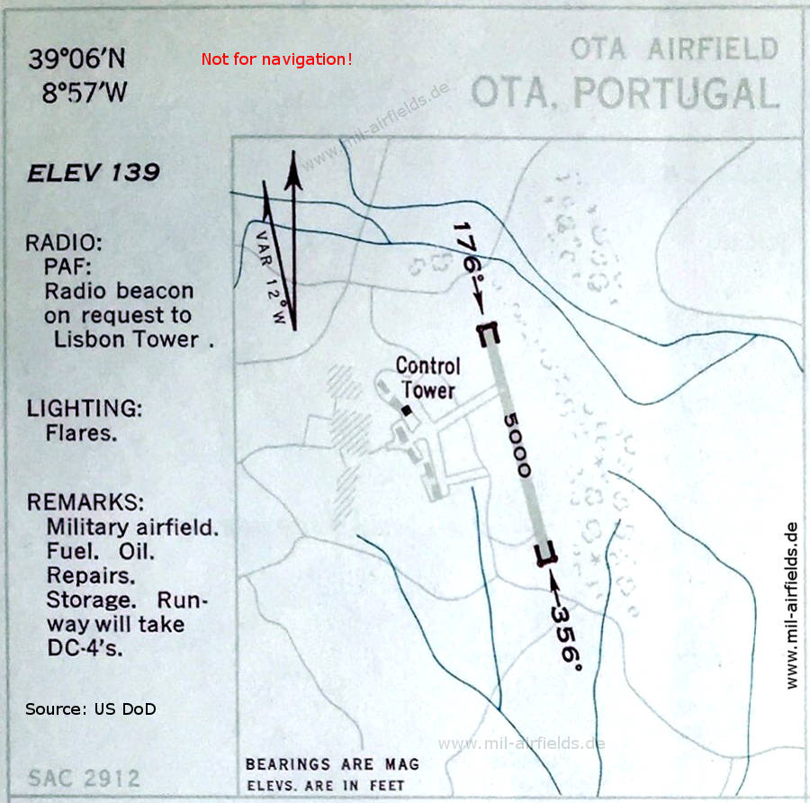
Airfield map (October 1950) - There is one runway with a length of 1524 m (5000 feet). (Source: US DoD)
In the 1960s
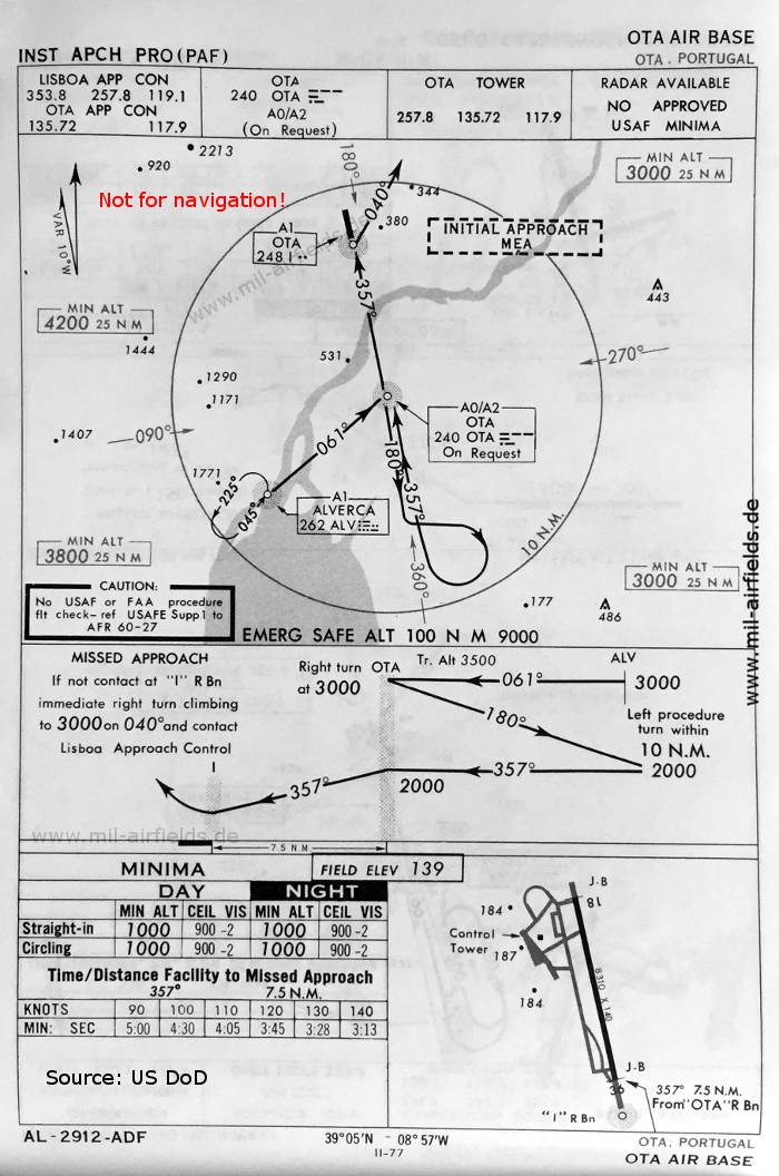
NDB approach runway 36 (May 1966) - Dimensions of the runway: 18/36 with 2533 m x 43 m (8310 feet x 140 feet). (Source: US DoD)
In the 1970s
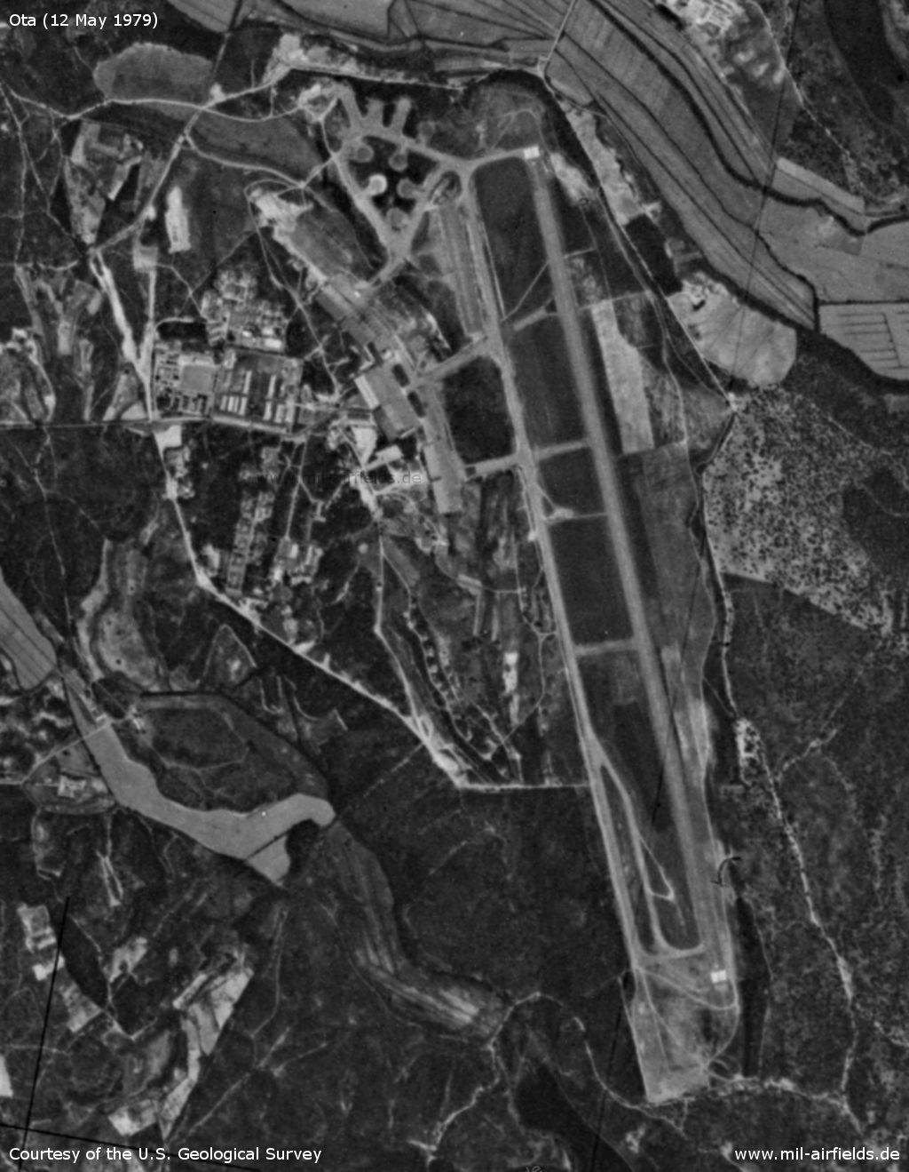
Satellite image 12 May 1979 (Source: U.S. Geological Survey)
In the 1990s
Ota Air Base on a map of the US Department of Defense from 1991 (Source: TPC G-1A (1991), Perry-Castañeda Library Map Collection, University of Texas at Austin)
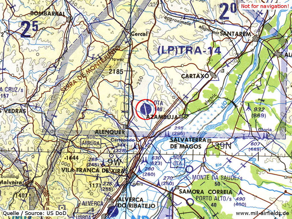
Index to the objects shown on the maps
Aerodromes / Aeródromos:
- Alverca
- Monte da Saude
- Ota
- Porto Alto
Airspace / Espaço aéreo:
- LP(TRA)-14
Radio beacons / Radiofarol:
- Alverca NDB "ALV"
- Ota NDB "OTA", "I"
Air traffic control / Controlo do Tráfego Aéreo:
- Lisboa Approach Control
- Ota Approach Control, Ota Tower
Source for all maps, if not marked otherwise: US Department of Defense (US DoD)
Recommended
Image credits are shown on the respective target page, click on the preview to open it.
 mil-airfields.de at Facebook