RAF Brize Norton
RAF Brize Norton
Historical approach and aerodrome charts / Airfield history
For historical information only, do not use for navigation or aviation purposes!
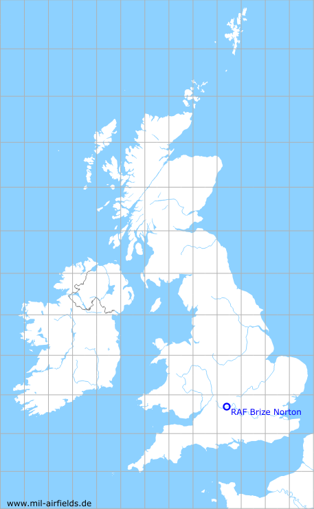
| Coordinates | N514500 W0013457 (WGS84) Google Maps |
| Region | Oxfordshire |
| Location indicator | MAYN, EGVN |
| Operator | US Air Force (USAF), Royal Air Force (RAF) |
In the 1950s
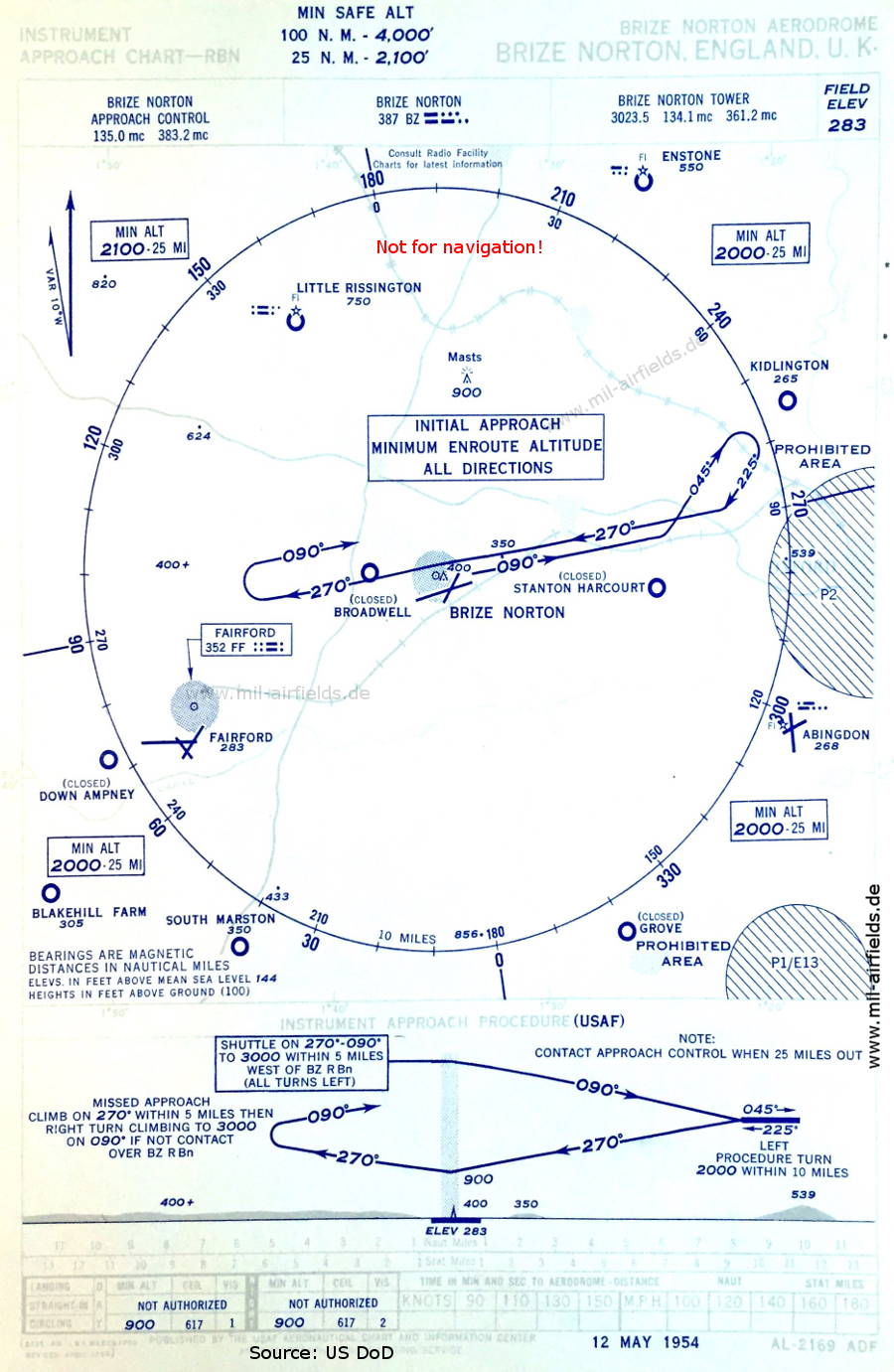
NDB approach (May 1954) - Airfields in the vicinity: Abingdon, Blakehill Farm, Broadwell, Down Ampney, Enstone, Fairford, Grove, Kidlington, Little Rissington, South Marston, Stanton Harcourt (Source: US DoD)

Aerodrome chart (May 1954) - During this time the airfield was operated by the US Air Force (USAF). (Source: US DoD)
In the 1960s
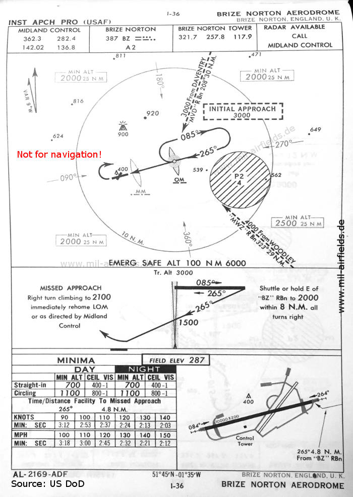
NDB approach runway 26 (October 1960) (Source: US DoD)
VOR approach runway 26 (October 1960) (Source: US DoD)
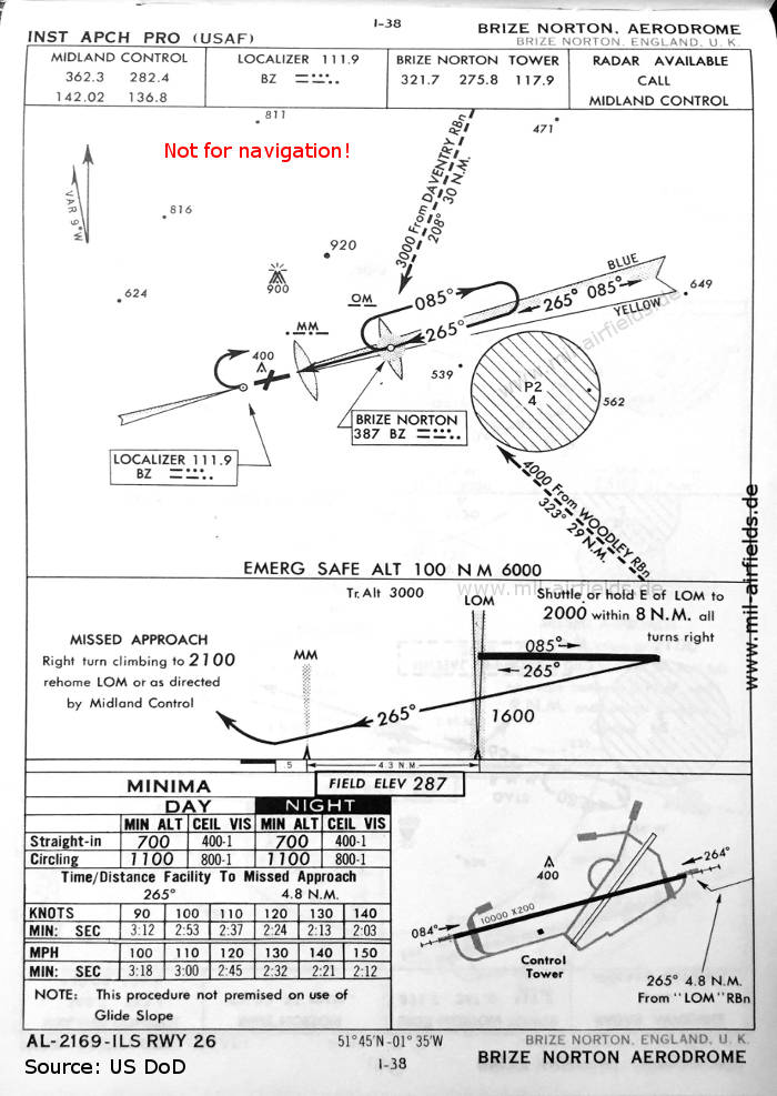
ILS approach runway 26 (October 1960) (Source: US DoD)
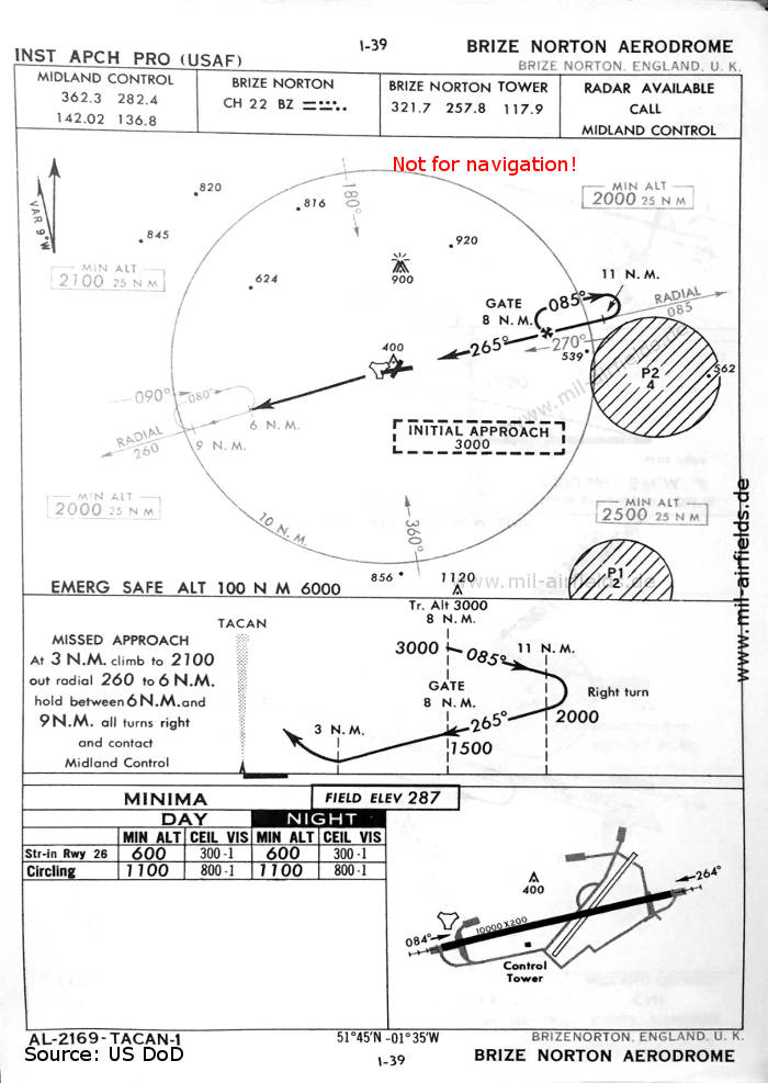
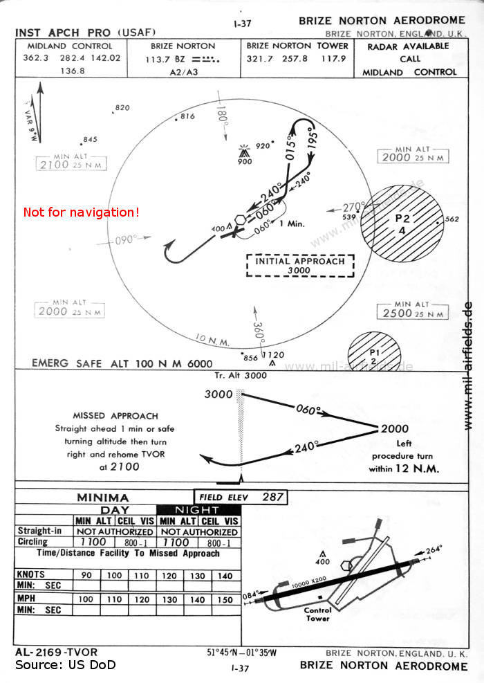
TACAN approach runway 26 (October 1960) (Source: US DoD)

TACAN approach runway 08 (October 1960) (Source: US DoD)
Source for all maps, if not marked otherwise: US Department of Defense (US DoD)
Recommended
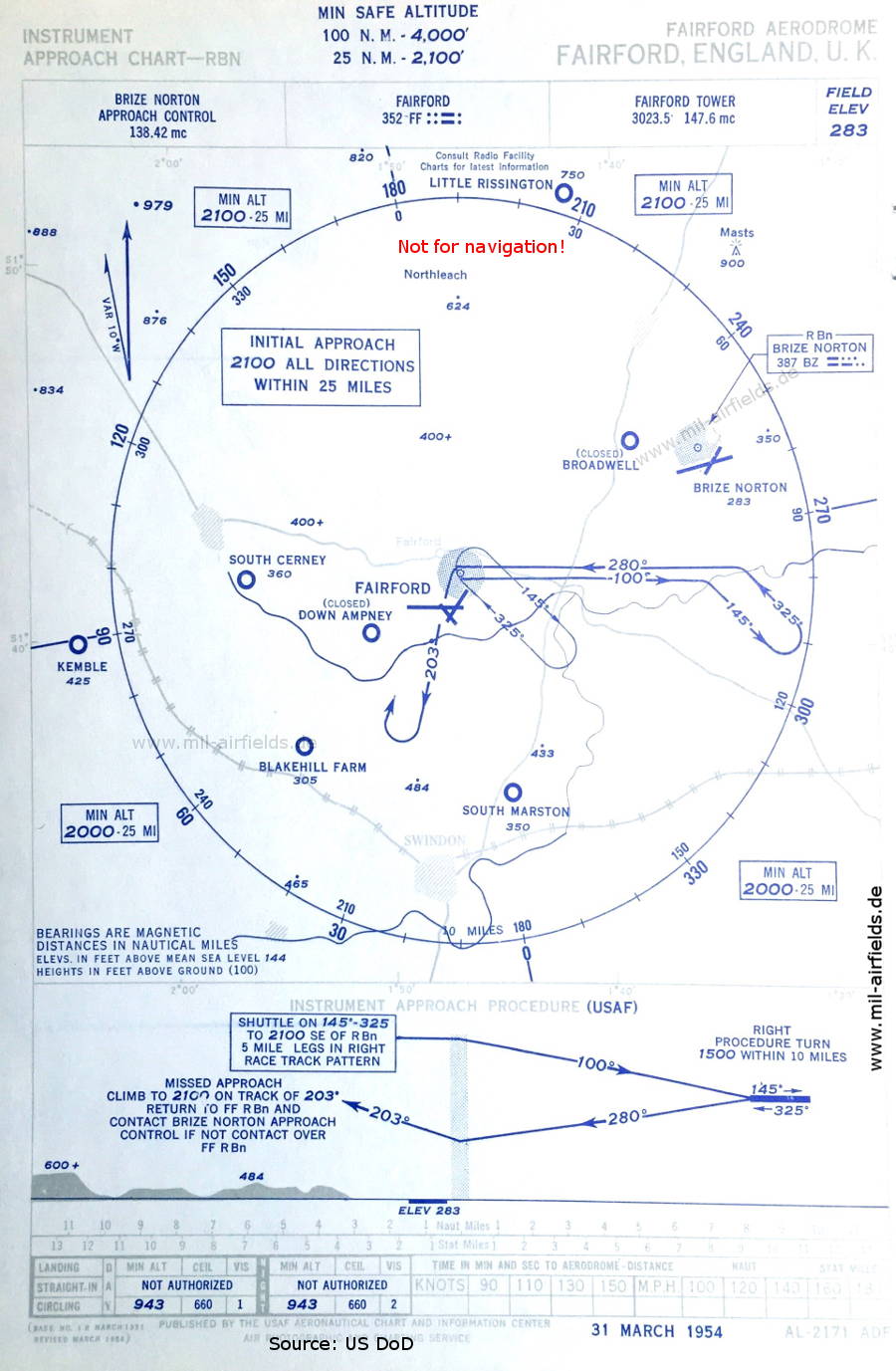

Image credits are shown on the respective target page, click on the preview to open it.
 mil-airfields.de at Facebook