RAF Greenham Common Airfield
Historical approach and aerodrome charts / Airfield history
For historical information only, do not use for navigation or aviation purposes!
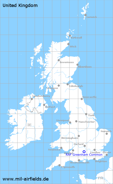
| Coordinates | N512244 W0011651 (WGS84) Google Maps |
| Region | Newbury, Berkshire |
| Location indicator | MAYI, EGVI |
| Operator | US Air Force (USAF) |
In the 1950s
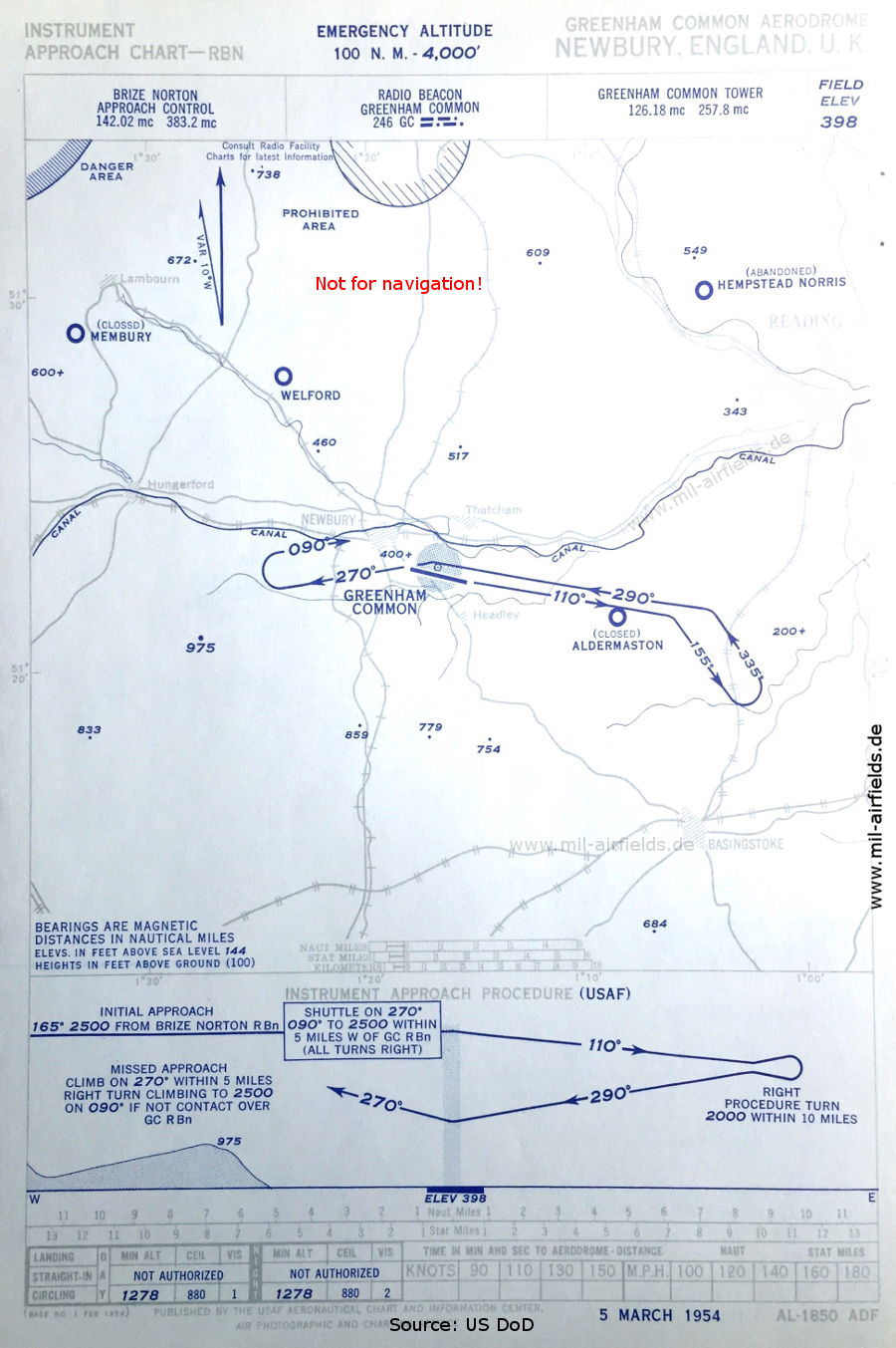
NDB approach runway 29 (March 1954) - Airfields in the vicinity: Aldermaston, Hempstead Norris, Membury, Welford, (Source: US DoD)
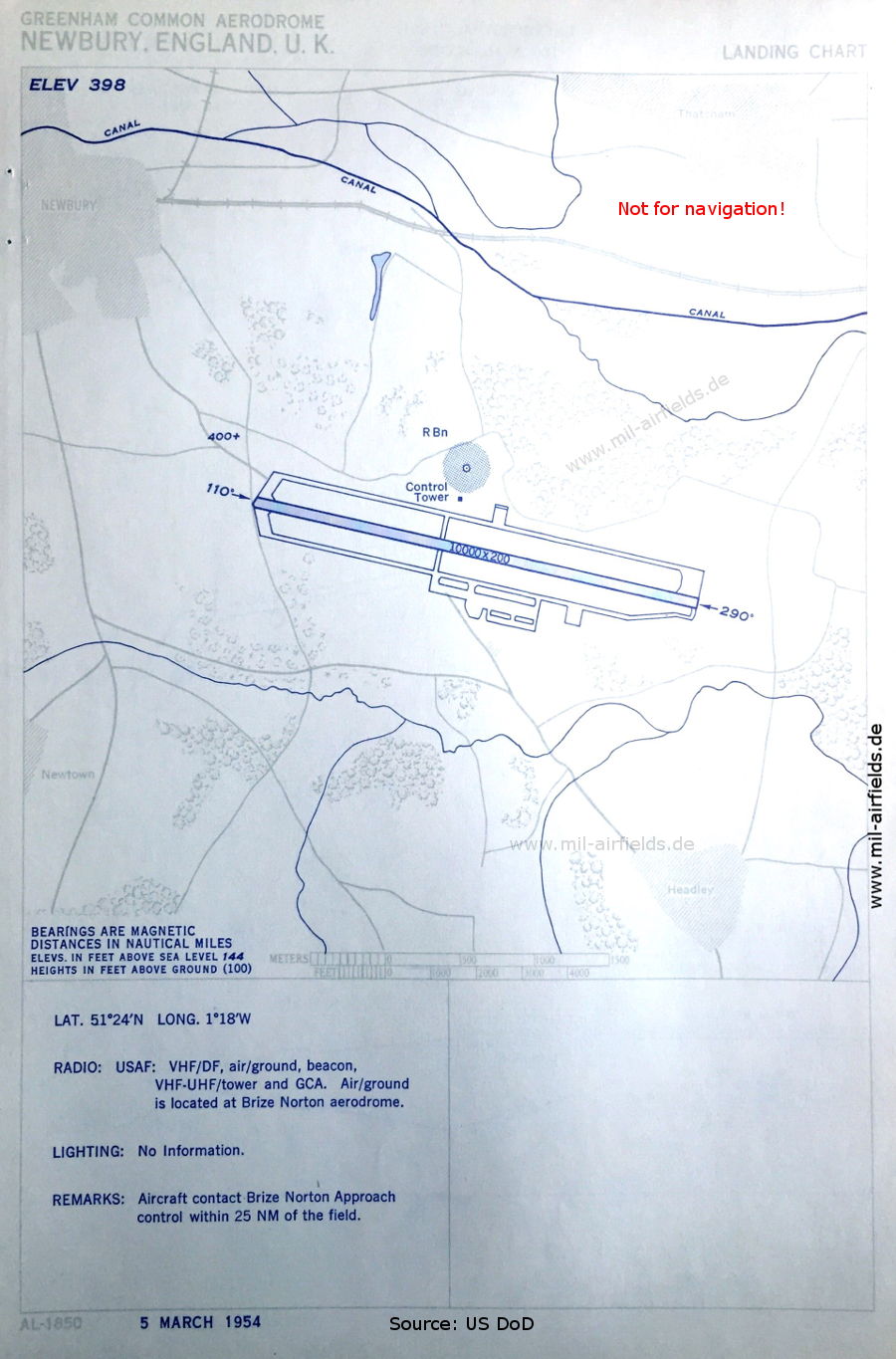
Aerodrome (March 1954) - There is one runway - 11/29: length 3048 m, width 61 m (10000 feet x 200 feet). (Source: US DoD)
In the 1960s
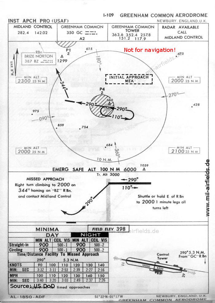
NDB approach runway 29 (October 1960) (Source: US DoD)
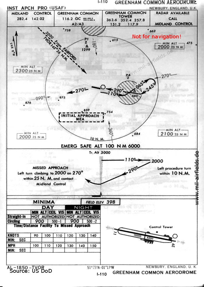
VOR approach runway 29 (October 1960) (Source: US DoD)
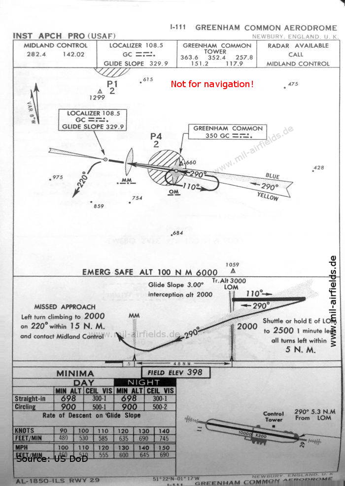
ILS approach runway 29 (October 1960) (Source: US DoD)
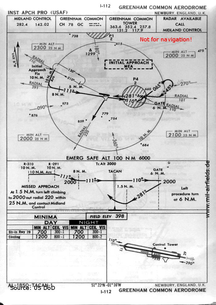
TACAN approach runway 29 (October 1960) (Source: US DoD)
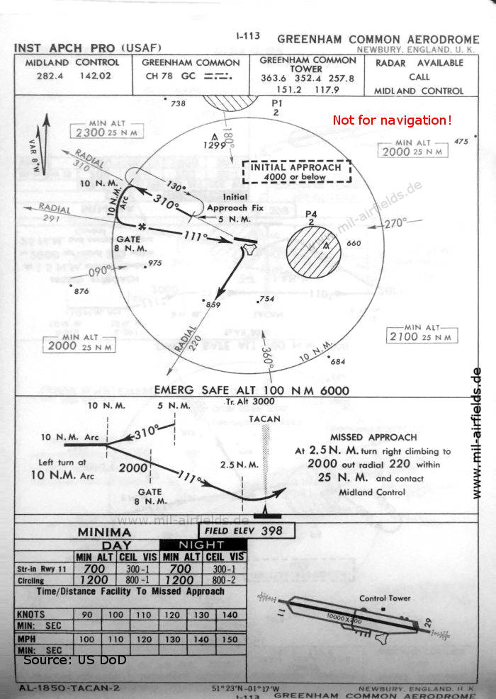
TACAN approach runway 11 (October 1960) (Source: US DoD)
In the 1970s
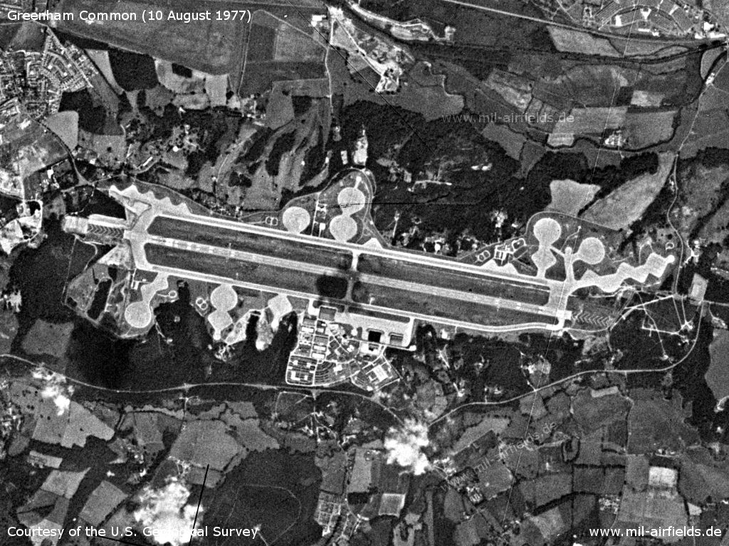
Satellite image of the airfield from 10 August 1977 - The huge GLCM Alert and Maintenance Area (GAMA) for the protected storage of the BGM-109G cruise missiles was built later. (Source: U.S. Geological Survey)
In the 1990s
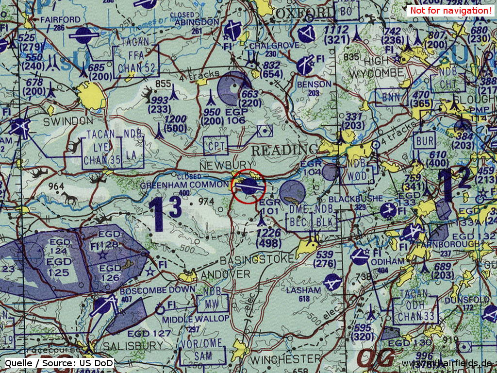
RAF Greenham Common on a map of the US Department of Defense from 1993 - The field is shown as closed. (Source: ONC E-2 (1993), Perry-Castañeda Library Map Collection, University of Texas at Austin)
Index to the objects shown on the maps
Aerodromes:
- Abingdon, Aldermaston
- Benson, Blackbushe, Bocombe Down
- Chalgrove
- Dunsfold
- Fairford, Farnborough
- Hempstead Norris
- Lasham, Lyneham
- Membury, Middle Wallop
- Odiham
- Welford
Radio beacons:
- Blackbushe NDB "BLK", DME "BLC"
- Brize Norton NDB "BZ"
- Fairford TACAN "FFA"
- Greenham Common NDB "GC", VOR "GC", TACAN "GC", ILS LLZ "GC", Outer Marker, Middle Marker
- Lyneham NDB "LA", TACAN "LYE"
- Middle Wallop NDB "MW"
- Odiham TACAN "ODH"
Air traffic control:
- Brize Norton Approach Control
- Greenham Common Tower
- Midland Control
Source for all maps, if not marked otherwise: US Department of Defense (US DoD)
Title image: GLCM Alert and Maintenance Area (GAMA) for BGM-109G cruise missiles of the 501st Tactical Missile Wing, Greenham Common, Source: US DoD / National Archives 6437310
Recommended


Image credits are shown on the respective target page, click on the preview to open it.
 mil-airfields.de at Facebook