RAF Fairford
RAF Fairford
Historical approach and aerodrome charts / Airfield history
For historical information only, do not use for navigation or aviation purposes!
| Coordinates | N514101 W0014720 (WGS84) Google Maps |
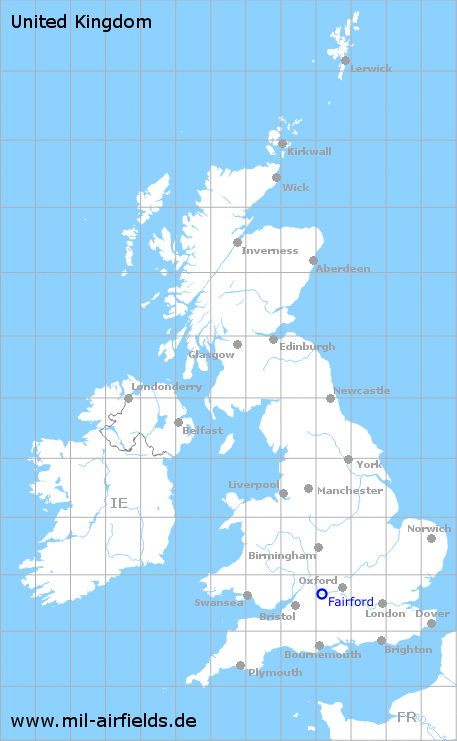
| Region | Gloucestershire, England |
| Location indicator | MAYA, EGVA |
| Operator | US Air Force (USAF) |
In the 1950s
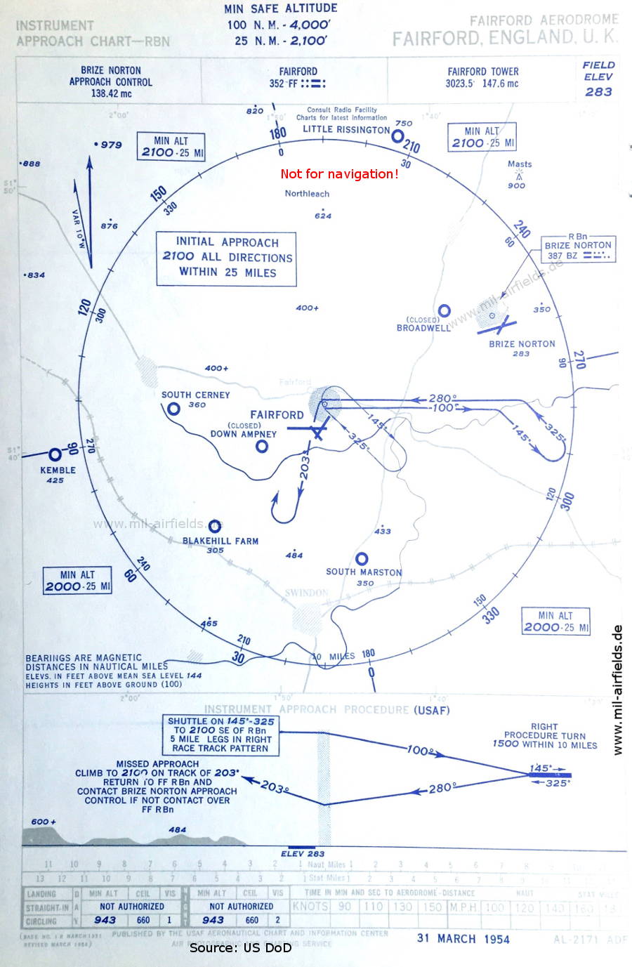
NDB approach (March 1954) - Airfields in the vicinity: Blakehill Farm, Brize Norton, Broadwell, Down Ampney, Kemble, Little Rissington, South Cerney, South Marston (Source: US DoD / USAF)
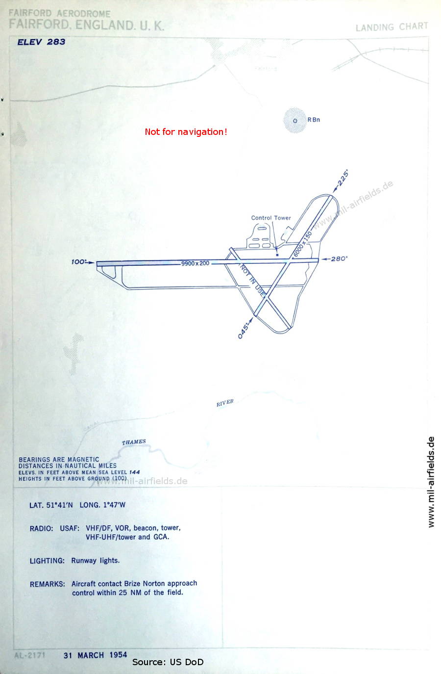
Aerodrome chart (March 1954) - There are two runways - 045/225: length 1829 m, width 46 m (6000 feet x 150 feet), 100/280: length 3017 m, width 61 m (9900 feet x 200 feet). (Source: US DoD / USAF)
In the 1960s
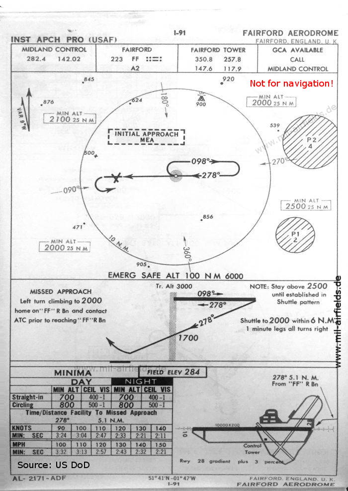
NDB approach runway 28 (October 1960) - There is one runway - 10/28: length 3048 m, width 61 m (10000 feet x 200 feet). (Source: US DoD)
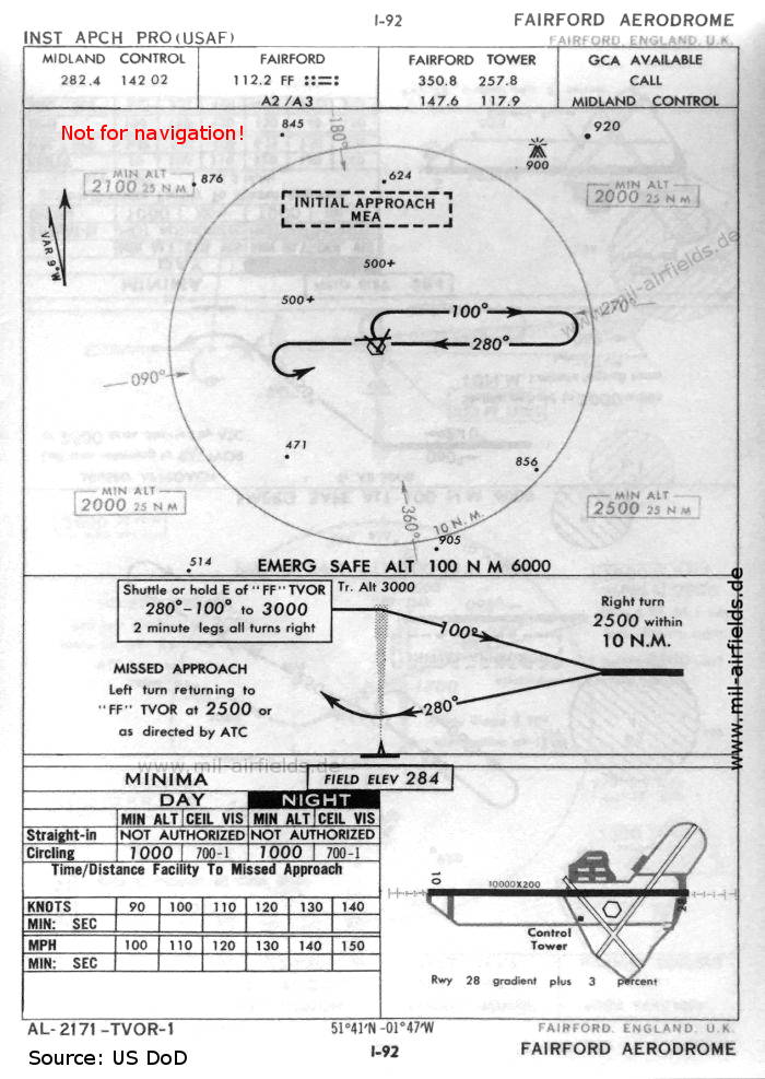
VOR approach runway 28 (October 1960) - As many other US Air Force bases, Fairford had a VOR beacon for a few years. (Source: US DoD)
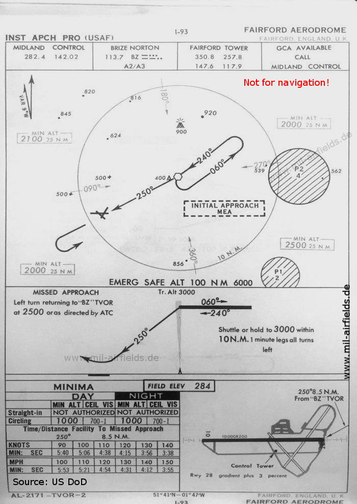
VOR approach runway 28 (October 1960) - This approach uses the VOR from Brize Norton airfield, located in the northeast. At this time, Brize Norton is also occupied by the US Air Force. (Source: US DoD)

ILS approach runway 28 (October 1960) - In contrast to "real" Royal Air Force airfields, here the localizer transmitter is located in the extension of the runway, so that the ILS approach can be flown on the centerline. (Source: US DoD)
In the 1990s
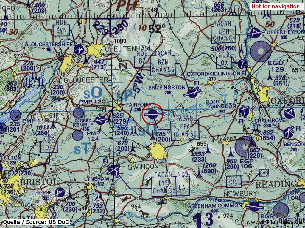
RAF Fairford on a map of the US Department of Defense from 1993 (Source: ONC E-2 (1993), Perry-Castañeda Library Map Collection, University of Texas at Austin)
Index to the objects shown on the maps
Aerodromes:
- Abingdon
- Benson, Blakehill Farm, Brize Norton, Broadwell
- Chalgrove, Colerne
- Down Ampney
- Gloucestershire, Greenham Common
- Kemble
- Little Rissington, Lyneham
- Oxford/Kidlington
- South Cerney, South Marston
- Upper Heyford
Radio beacons:
- Brize Norton NDB "BZ", VOR "BZ", TACAN "BZN"
- Compton VORDME "CPT"
- Fairford NDB "FF", VOR "FF", TACAN "FFA", ILS "FF", Outer Marker, Middle Marker
- Filton NDB "OF"
- Lyneham NDB "LA", TACAN "LYE"
- Staverton NDB "SVN"
- Upper Heyford TACAN "UPH"
Air traffic control
- Brize Norton Approach Control
- Fairford Tower
- Midland Control
Source for all maps, if not marked otherwise: US Department of Defense (US DoD)
Title image: US Air Force (USAF) B-52H Stratofortress bombers sit on the ramp at Royal Air Force (RAF) Base Fairford, England. Source: US DoD, Scene Camera Operator: MSGT Andrew E. Lynch, USAF / National Archives 6643148
Recommended
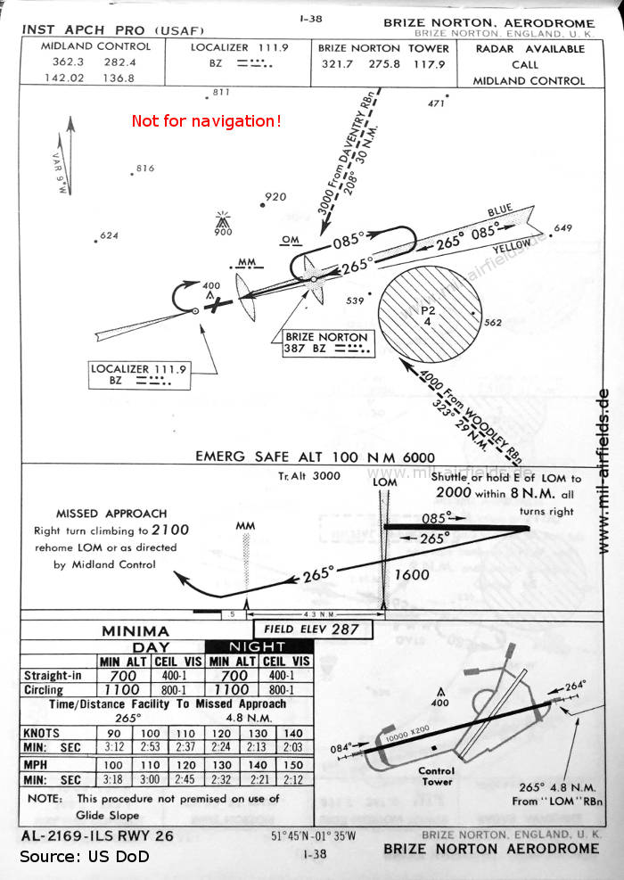

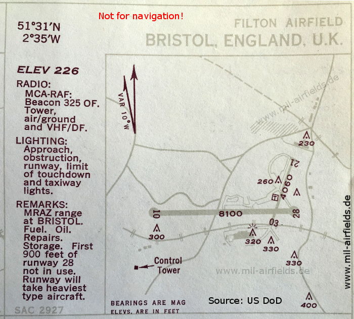
Image credits are shown on the respective target page, click on the preview to open it.
 mil-airfields.de at Facebook