RAF Bruntingthorpe Airfield
Historical approach and aerodrome / Airfield history
For historical information only, do not use for navigation or aviation purposes!
| Coordinates | N522929 W0010752 (WGS84) Google Maps |
| Region | Leicestershire, England |
| Operator | US Air Force (USAF) |
In the 1960s
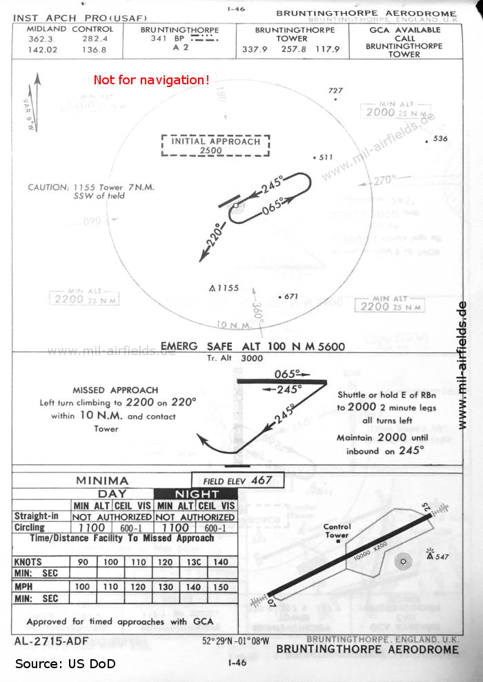
NDB approach runway 25 (October 1960) (Source: US DoD)
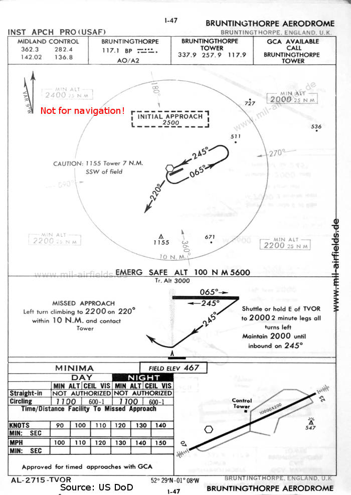
VOR approach runway 25 (October 1960) (Source: US DoD)
In the 1970s
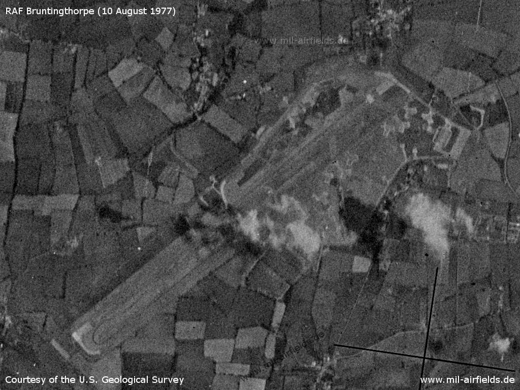
Satellite image from 10 August 1977 (Source: U.S. Geological Survey)
Source for all maps, if not marked otherwise: US Department of Defense (US DoD)
Recommended
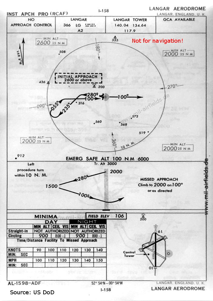

Image credits are shown on the respective target page, click on the preview to open it.
 mil-airfields.de at Facebook