RAF Langar
Historical approach and aerodrome charts for free download
For historical information only, do not use for navigation or aviation purposes!
| Coordinates | N525334 W0005404 (WGS84) Google Maps |

Airfield
Region: Nottinghamshire, East Midlands, England
Location Indicator: GJKY, EGYL
User: Royal Canadian Air Force (RCAF)
In the 1950s
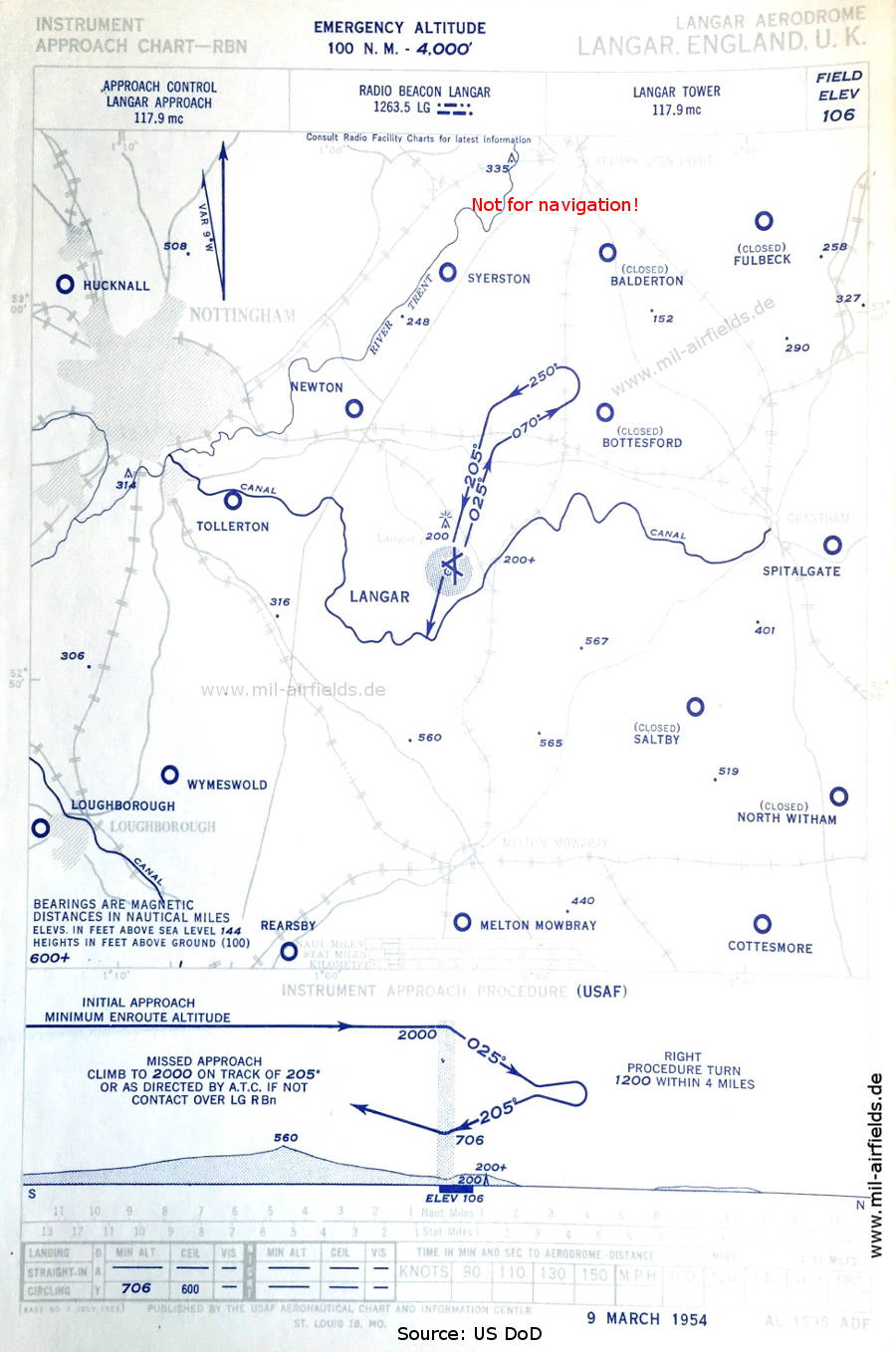
NDB approach (March 1954)
Airfields in the vicinity: Balderton, Bottesford, Cottesmore, Fulbeck, Hucknall, Loughborough, Melton Mowbray, Newton, North Witham, Rearsby, Saltby, Spitalgate, Syerston, Tollerton, Wymeswold,
(Source: US DoD)
Airfields in the vicinity: Balderton, Bottesford, Cottesmore, Fulbeck, Hucknall, Loughborough, Melton Mowbray, Newton, North Witham, Rearsby, Saltby, Spitalgate, Syerston, Tollerton, Wymeswold,
(Source: US DoD)
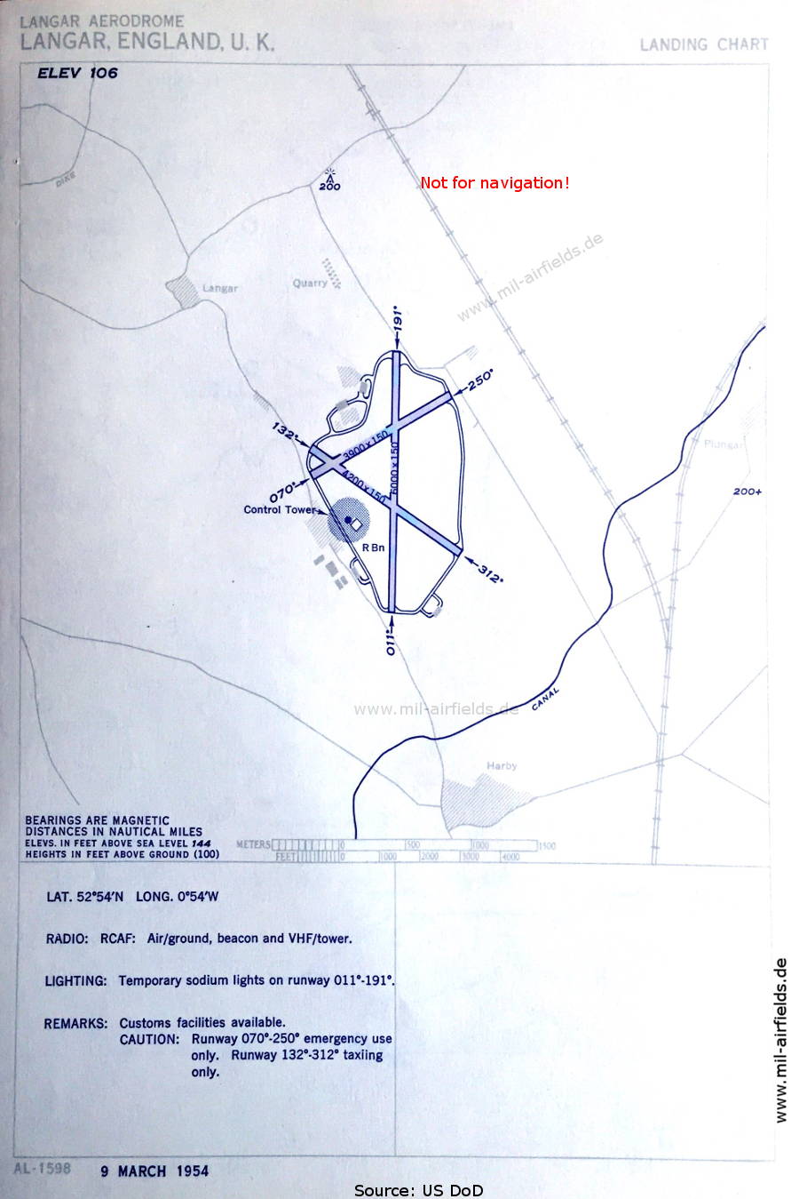
Aerodrome chart (March 1954)
The airfield is operated by the Royal Canadian Air Force (RCAF). There are three runways - 011/191: length 1829 m, width 46 m (6000 feet x 150 feet), 070/250: length 1189 m, width 46 m (3900 feet x 150 feet), 132/312: length 1280 m, width 46 m (4200 feet x 150 feet).
(Source: US DoD)
The airfield is operated by the Royal Canadian Air Force (RCAF). There are three runways - 011/191: length 1829 m, width 46 m (6000 feet x 150 feet), 070/250: length 1189 m, width 46 m (3900 feet x 150 feet), 132/312: length 1280 m, width 46 m (4200 feet x 150 feet).
(Source: US DoD)
In the 1960s
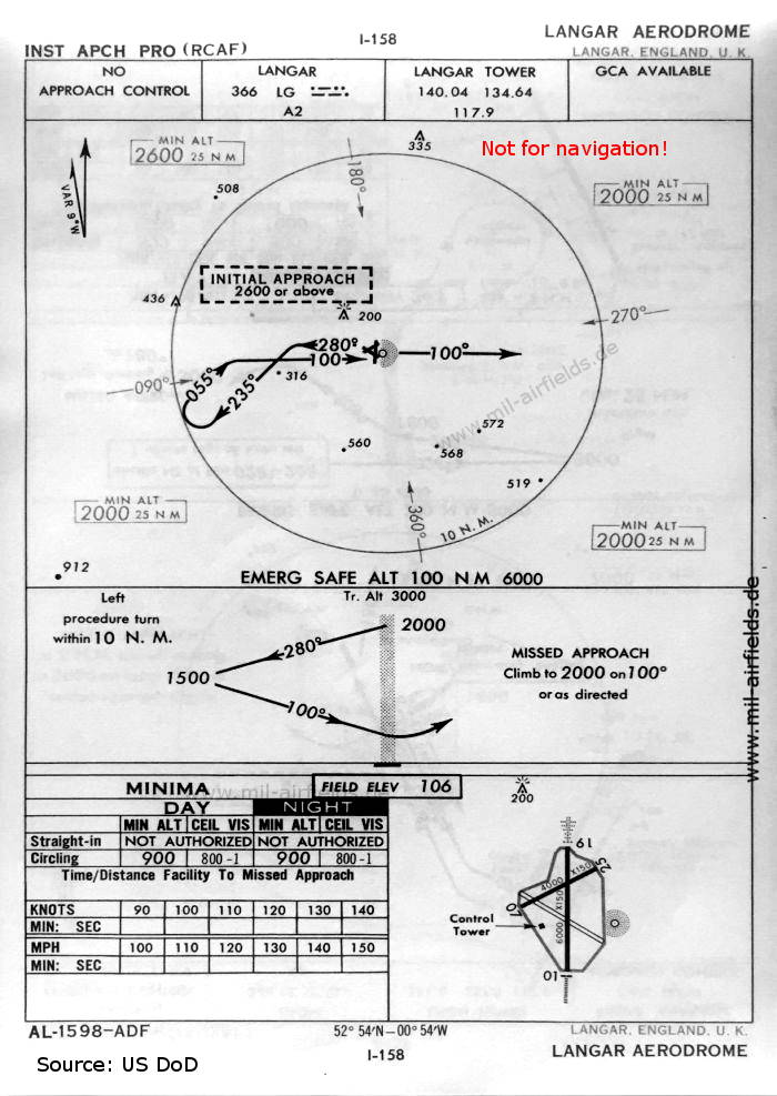
NDB approach (October 1960)
Now there are two runways - 01/19: length 1829 m, width 46 m (6000 feet x 150 feet), 07/25: length 1219 m, width 46 m (4000 feet x 150 feet).
(Source: US DoD)
Now there are two runways - 01/19: length 1829 m, width 46 m (6000 feet x 150 feet), 07/25: length 1219 m, width 46 m (4000 feet x 150 feet).
(Source: US DoD)
Source for all maps, if not marked otherwise: US Department of Defense (US DoD)
Index to the objects shown on the maps
Radio beacons:
- Langar NDB "LG"
Air traffic control
- Langar Approach, Langar Tower
Source for all maps, if not marked otherwise: US Department of Defense (US DoD)
Recommended

Image credits are shown on the respective target page, click on the preview to open it.
 mil-airfields.de at Facebook