RAF Grove
Historical approach and aerodrome charts
For historical information only, do not use for navigation or aviation purposes!
| Coordinates | N513624 W0012616 (WGS84) Google Maps |
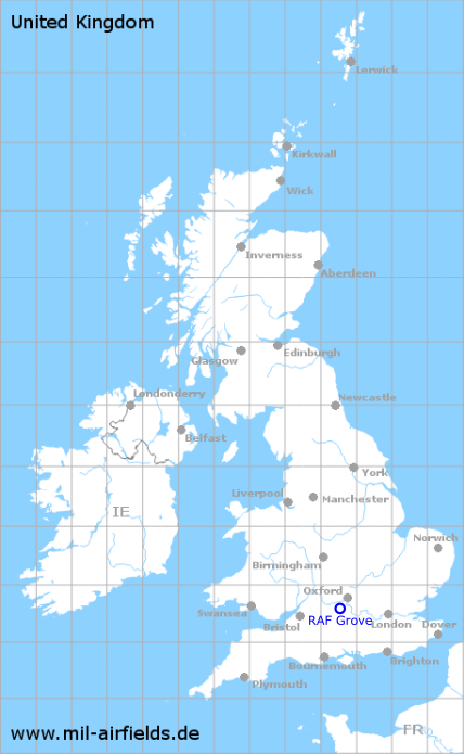
| Region | Wantage, Berkshire / Oxfordshire, England |
RAF Grove was an airfield of the Royal Air Force and the United States Army Air Forces, which was used from 1942 until after World War II. The field was located immediately northwest of Wantage, Oxfordshire.
In the 1940s
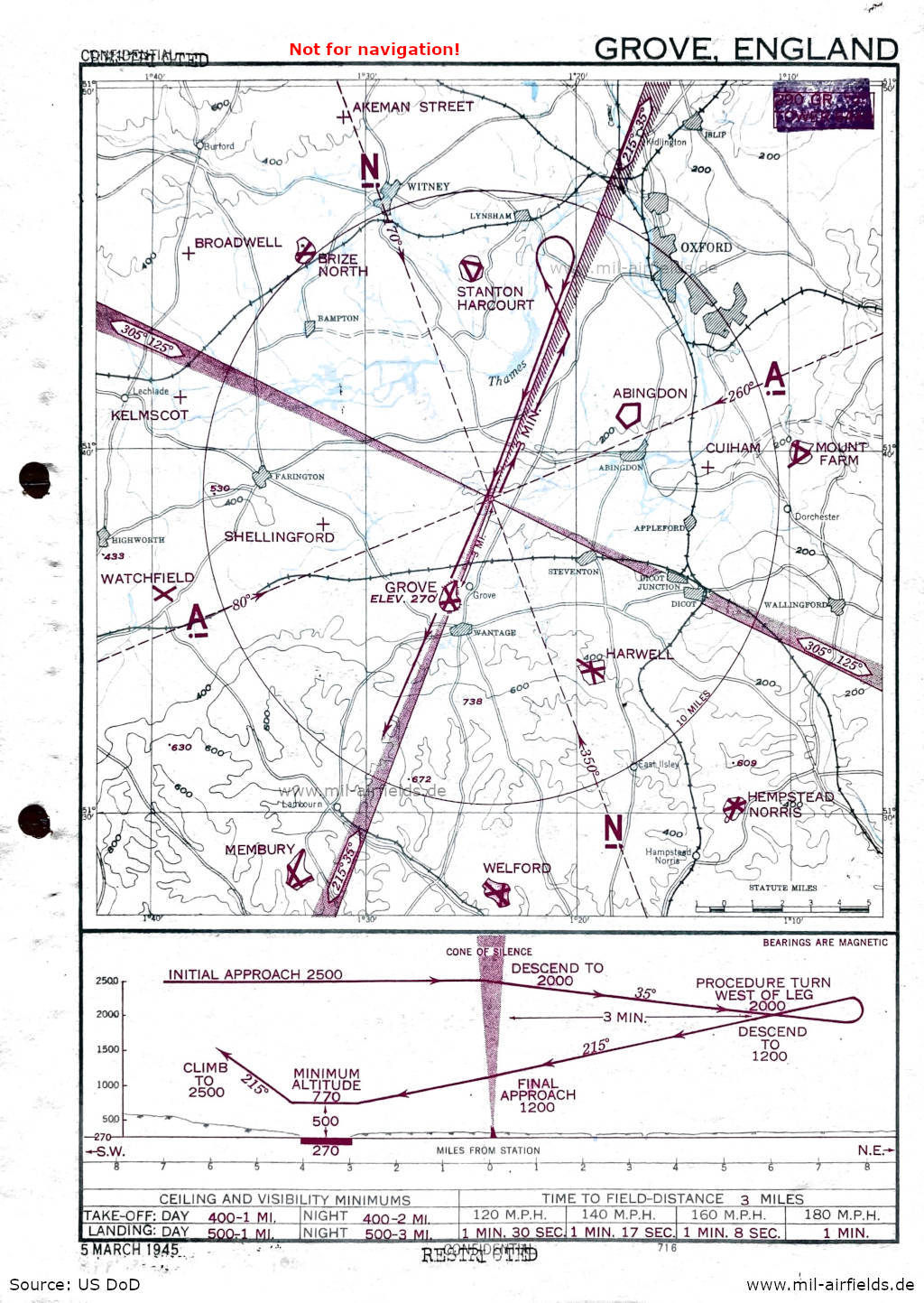
Approach (05 March 1945) - The map was initially classified as "Confidential" and was then downgraded to "Restricted". (Source: US DoD)
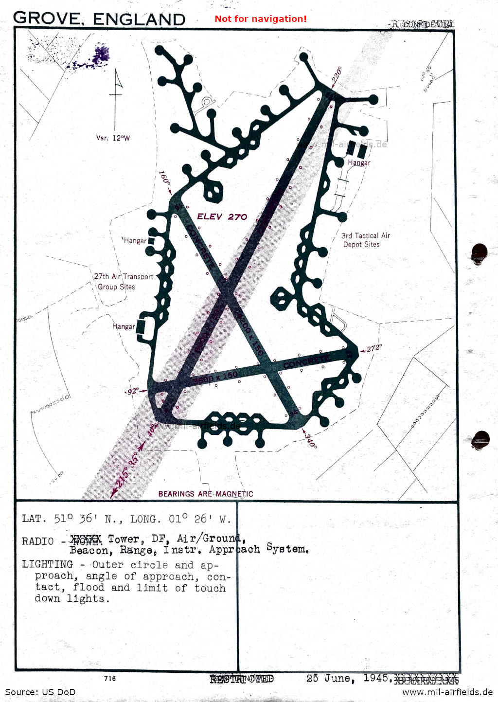
Airfield (25 June 1945) - There are three runways - 040/220: length 1829 m, width 46 m (6000 feet x 150 feet), 092/272: length 1097 m, width 46 m (3600 feet x 150 feet), 160/340: length 1280 m, width 46 m (4200 feet x 150 feet). Sites: 3rd Tactical Air Deport, 27th Air Transport Group. (Source: US DoD)
Index to the objects shown on the maps
Aerodromes:
- RAF Abingdon, Akeman Street, Brize Norton, Broadwell, Cuiham, Harwell, Hempstead Norris, Kelmscot, Membury, Mount Farm, Shellingford, Stanton Harcourt, Watchfield, Welford
Radio beacons:
- Beacon, Range, Instrument Approach System
Air traffic control / Communications:
- Tower, Direction Finder (DF), Air/Ground
Source for all maps, if not marked otherwise: US Department of Defense (US DoD)
Recommended


Image credits are shown on the respective target page, click on the preview to open it.
 mil-airfields.de at Facebook