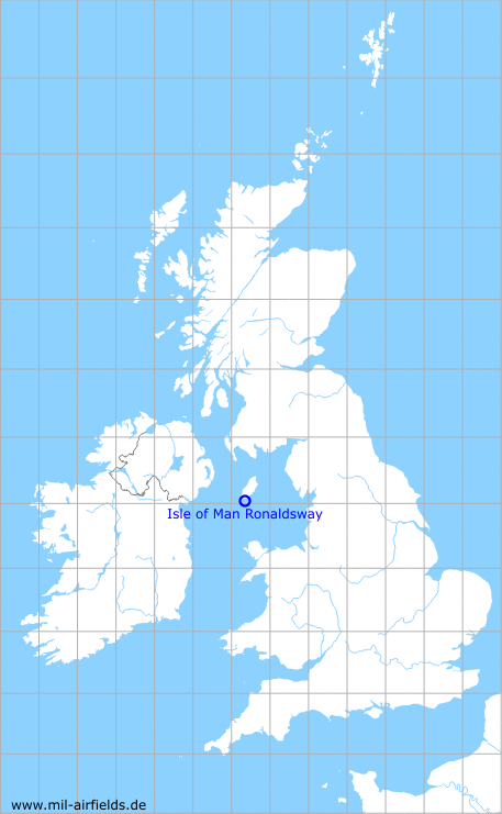
Isle of Man Ronaldsway Airport
Ronaldsway
Historical approach and aerodrome charts for free download
For historical information only, do not use for navigation or aviation purposes!
| Coordinates | N540460 W0043727 (WGS84) Google Maps |
| Location indicator | GJFA, EGGS, EGNS |

In the 1950s

Airport (October 1950) (Source: US DoD)
Source for all maps, if not marked otherwise: US Department of Defense (US DoD)
Links
http://www.island-images.co.uk/ATC/zIOM_ATC.html - Isle of Man Air Traffic Control - A lot of information on the history of air traffic control since 1937
Recommended


Image credits are shown on the respective target page, click on the preview to open it.
 mil-airfields.de at Facebook