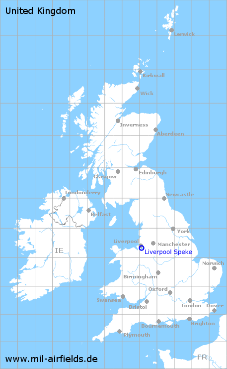
Liverpool Speke Airport
Speke Airport, John Lennon Airport
Historical approach and aerodrome charts
For historical information only, do not use for navigation or aviation purposes!
| Coordinates | N532001 W0025055 (WGS84) Google Maps |
| Location indicator | GJEA, EGGP |

In the 1950s
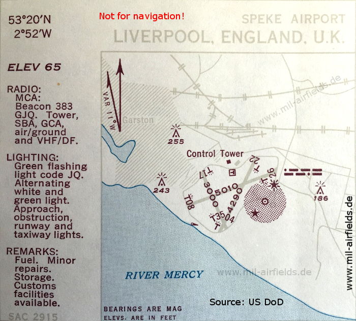
Airport map (October 1950) - There are three runways - 04/22: length 1308 m (4290 feet), 08/26: length 1527 m (5010 feet), 17/35: length 914 m (3000 feet). (Source: US DoD)
In the 1960s

NDB approach runway 26 (May 1966) - Now there are only two runways - 08/26: length 1715 m, width 46 m (5627 feet x 150 feet), 17/35: length 973 m, width 46 m (3192 feet x 150 feet). (Source: US DoD)
Index to the objects shown on the maps
Radio beacons:
- Liverpool NDB "GJQ", "OE"
Air traffic control:
- Liverpool Approach Control, Liverpool Tower
Source for all maps, if not marked otherwise: US Department of Defense (US DoD)
Recommended
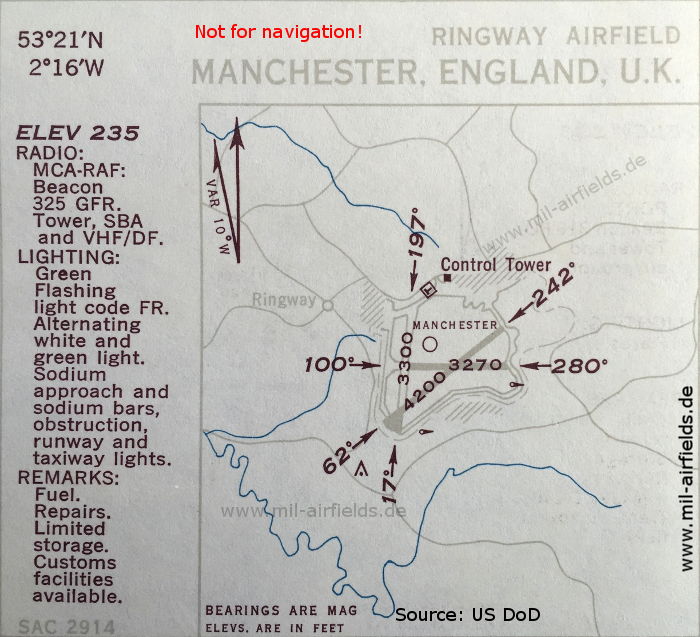

Image credits are shown on the respective target page, click on the preview to open it.
 mil-airfields.de at Facebook