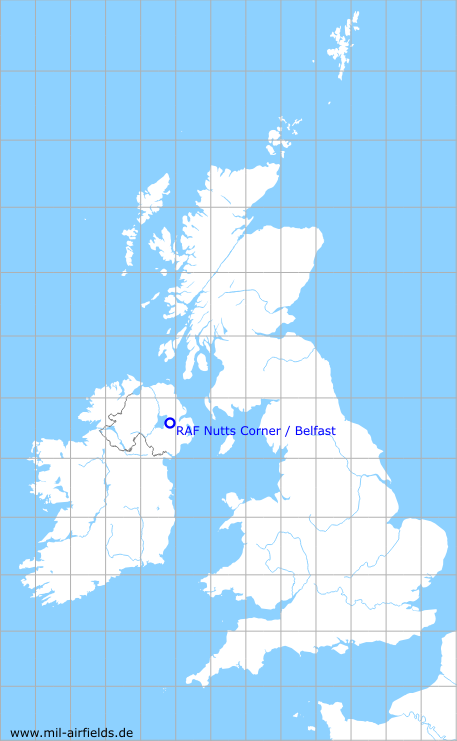
RAF Nutts Corner / Belfast
Belfast-Nutts Corner Airport
Historical approach and aerodrome charts
For historical information only, do not use for navigation or aviation purposes!
| Coordinates | N543752 W0060918 (WGS84) Google Maps |
| Region | Crumlin, County Antrim, Northern Ireland |
| Location indicator | GJHA, EGAA |
| Operator | Royal Air Force (RAF); from 1946 to 1963, Nutts Corner was the airport for Belfast. |

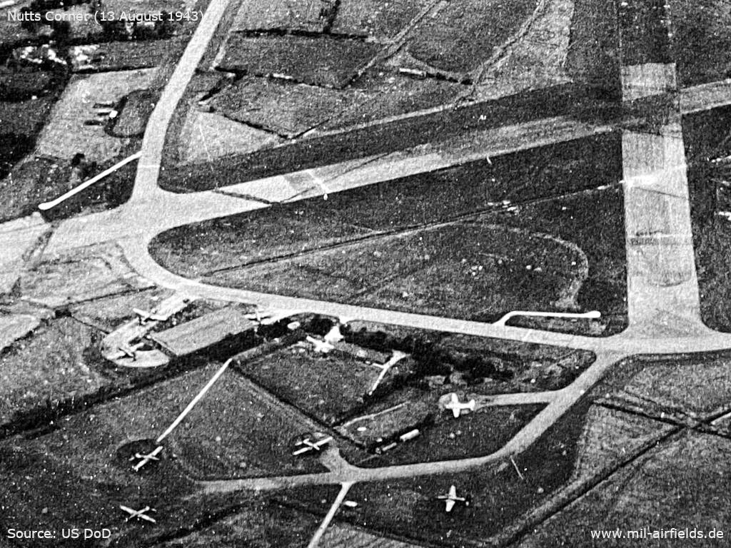
In the 1940s

Aerial view from 31 August 1943 - Viewing direction is northwest. Originally, the image was classified as "Restricted". (Source: US DoD)

Enlargement: Northwestern part (Source: US DoD)

Enlargement: Northeastern part - Here you can also see the northern parking area where some aircraft are parked. Another aircraft is on the taxiway on the right side of the photo.. (Source: US DoD)
Enlargement: Southern part - Southern dispersal area with aircraft (Source: US DoD)
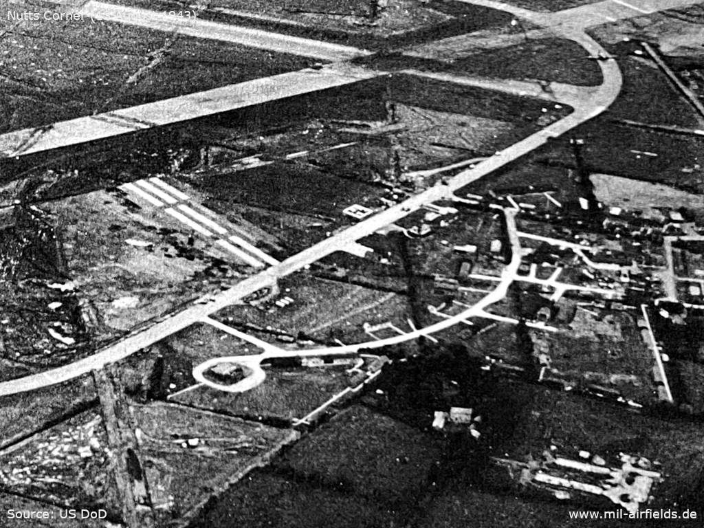
Enlargement: Eastern part (Source: US DoD)
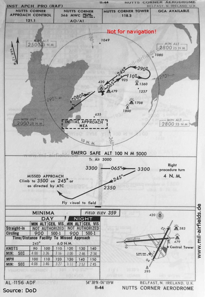
In the 1950s

NDB approach (April 1954) - The approach is unusual: The plane will first fly to the beacon at the airfield, cross it at 2360 feet and then descent further southwest to finally reverse and approach the airfield visually.
Other airfields on this map: Aldergrove, Langford Lodge, Long Kesh, Maghaberry, Sydenham, Toome. (Source: US DoD)

Aerodrome chart (April 1954) - There are two runways - 04/22: length 1463 m, width 46 m (4800 feet x 150 feet), 10/28: length 1829 m, width 46 m (6000 feet x 150 feet). GCA radar (Ground Controlled Approach Radar) and SBA (Standard Beam Approach) are available as approach aids. (Source: US DoD)
In the 1960s
NDB approach (October 1960) (Source: US DoD)
Index to the objects shown on the maps
Aerodromes:
- Belfast Aldergrove, Langford Lodge, Long Kesh, Maghaberry, Sydenham, Toome
Radio beacons:
- Nutts Corner NDB "MWC"
Air traffic control / Communications:
- Nutts Corner Approach Control, Nutts Corner Tower
Places:
- Antrim, Antrim Bay, Belfast Lough, Doagh, Lough Neagh, Lurgan, Ram's Island, Randalstown, Templepatrick
Source for all maps, if not marked otherwise: US Department of Defense (US DoD)
Recommended


Image credits are shown on the respective target page, click on the preview to open it.
 mil-airfields.de at Facebook