RAF Kinloss
Historical approach and aerodrome charts / Airfield history
For historical information only, do not use for navigation or aviation purposes!
| Coordinates | N573858 W0033337 (WGS84) Google Maps |
| Region | Moray, Scotland |
| Location indicator | EGQK |
| Operator | Royal Air Force (RAF) |


In the 1960s
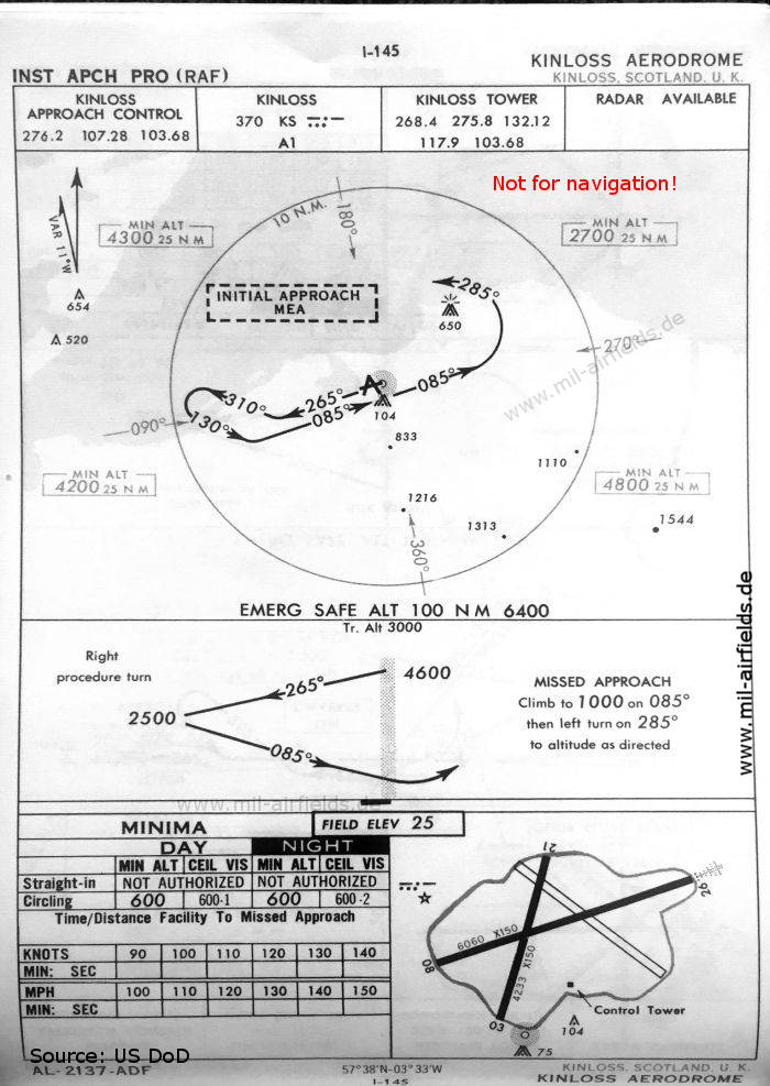
NDB approach (October 1960) - There are two runways - 03/21: length 1290 m, width 46 m (4233 feet x 150 feet), 08/26: length 1847 m, width 46 m (6060 feet x 150 feet). (Source: US DoD)
In the 1990s
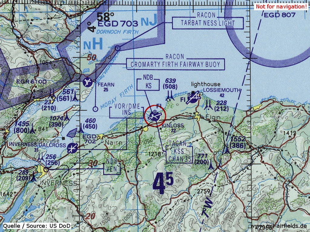
RAF Kinloss on a map of the US Department of Defense from 1993 (Source: ONC E-2 (1993), Perry-Castañeda Library Map Collection, University of Texas at Austin)
Index to the objects shown on the maps
Radio beacons:
- Inverness NDB "VEN", VORDME "INS"
- Kinloss NDB "KS", TACAN "KSS"
Air traffic control
- Kinloss Approach Control, Kinloss Tower
Source for all maps, if not marked otherwise: US Department of Defense (US DoD)
Recommended
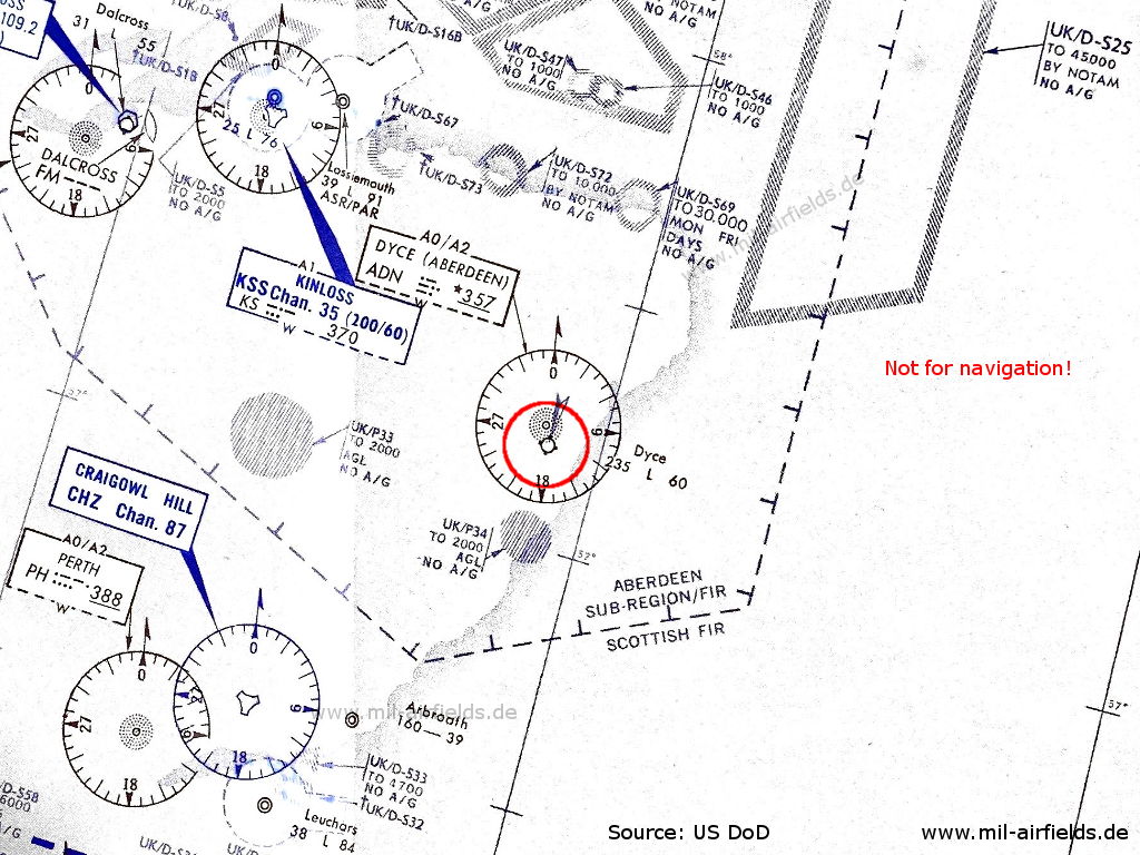
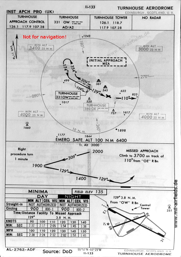

Image credits are shown on the respective target page, click on the preview to open it.
 mil-airfields.de at Facebook