RAF Leuchars
Historical approach and aerodrome charts / Airfield history
For historical information only, do not use for navigation or aviation purposes!
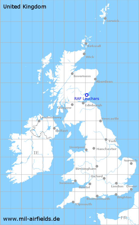
| Coordinates | N562230 W0025132 (WGS84) Google Maps |
| Region | Fife, St Andrews, Scotland |
| Location indicator | EGQL |
| Operator | Royal Air Force (RAF) |
In the 1960s
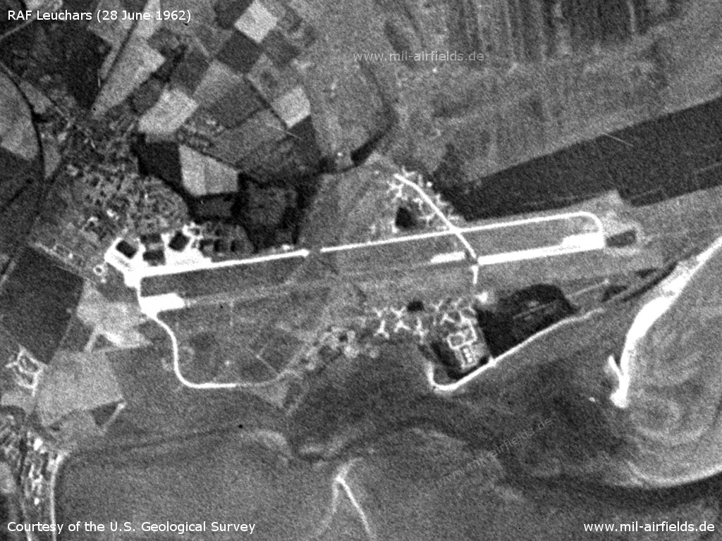
Satellite image from 28 June 1962 - At this time, there were no Hardened Aircraft Shelters. (Source: U.S. Geological Survey)
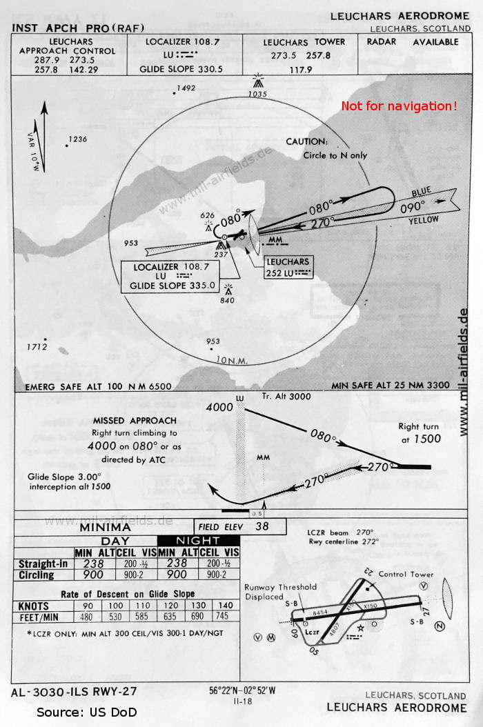
ILS approach runway 27 (May 1966) - There are two runways: 05/23 with 1465 m x 46 m (4807 feet x 150 feet), 09/27 with 2577 m x 46 m (8454 feet x 150 feet). As on many RAF airfields, the ILS landing course at Leuchars has an offset to the runway centre line (here 2°). (Source: US DoD)
In the 1990s
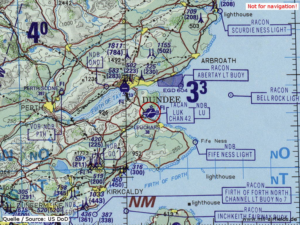
RAF Leuchars on a map of the US Department of Defense from 1993 (Source: ONC E-2 (1993), Perry-Castañeda Library Map Collection, University of Texas at Austin)
Index to the objects shown on the maps
Aerodromes:
- Dundee
- Leuchars
Radio beacons:
- Dundee NDB "DND"
- Leuchars NDB "LU", TACAN "LUK", ILS "LU", Middle Marker
- Perth NDB "PTH", VOR "PTH"
Air traffic control:
- Leuchars Approach Control, Leuchars Tower
Source for all maps, if not marked otherwise: US Department of Defense (US DoD)
Recommended
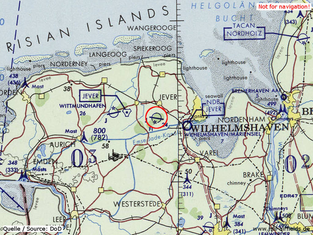

Image credits are shown on the respective target page, click on the preview to open it.
 mil-airfields.de at Facebook