For historical information only, do not use for navigation or aviation purposes!
| Coordinates | N533201 E0075315 (WGS84) Google Maps |
| Federal state | Niedersachsen (Lower Saxony) |
| Location indicator | DAJE (195x), EDNJ (196x-1995), ETNJ (1995-2013) |
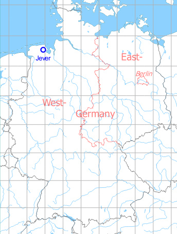
Germany during the Cold War Map
The history of the Cold War airfields: Jever
General
Jever started in 1936 as a Luftwaffe air base. From 1951 until 1961 it was used by the Royal Air Force. Finally, the airfield was taken over by German Air Force, operated by Waffenschule 10 (Weapons School 10) and from 1983 to 2005 by Jagdbombergeschwader 38 (Fighter Bomber Wing 38). Last flying operation took place in September 2013. Today the area is still used by Bundeswehr.
During World War II
Situation
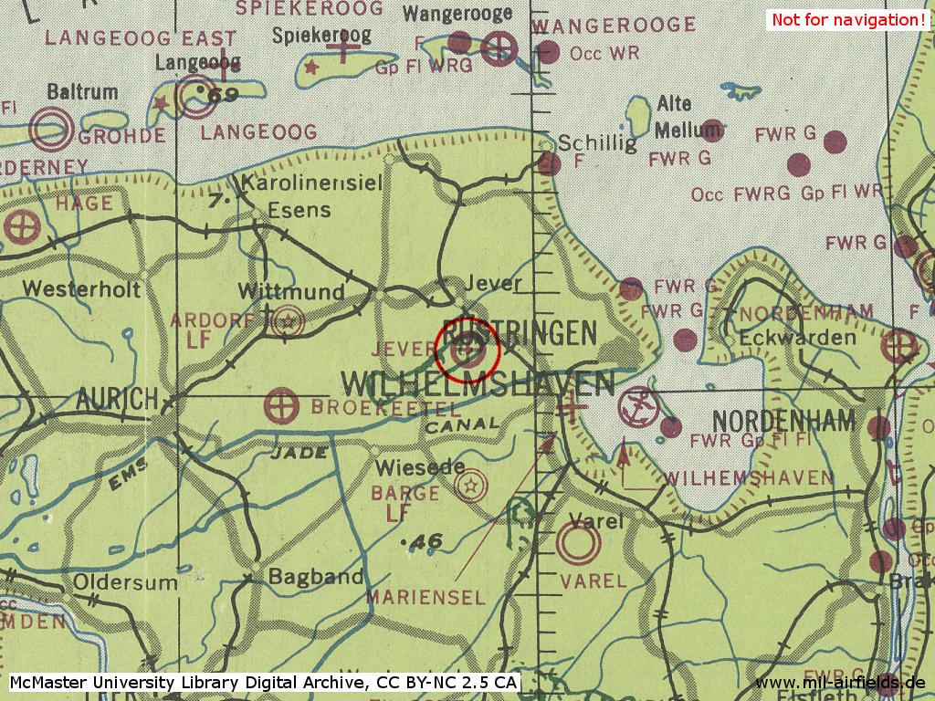
Jever Air Base in World War II on a US map from 1943 - (McMaster University Library Digital Archive, License: Creative Commons Attribution-NonCommercial 2.5 CC BY-NC 2.5 CA /MULDA/)
During the Cold War
In the 1950s
Use
Royal Air Force air base, location indicator DAJE.
Situation
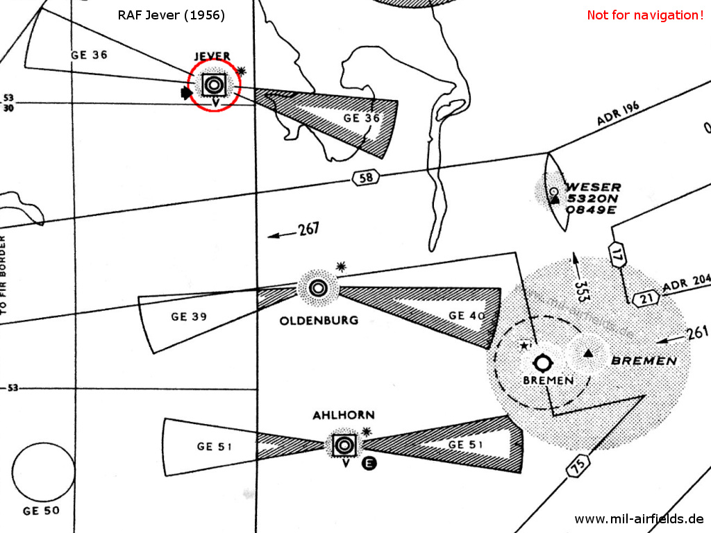
RAF Jever on a map from 1956 - The approach areas of the three British airfields Ahlhorn, Oldenburg and Jever are protected by restricted areas. The white "E" in the circle symbolizes the Eureka radio beacon, used by the British at this time. The square around the airport symbol with the "V" underneath shows an VHF direction finder. The black star stands for the coded beacons which is characteristical for British airfields
Lights
Red identification beacon "JV"
Radio beacons
- NDB: 368 "JV", at field, power 300 W (previously on frequency 168 kcs)
Obviously, there was no Eureka radio beacon at Jever, as it was common for many RAF airfields at this time.
Radio communication
- Approach 111.42, 117.9, 147.78, 147.96, 154.26, 121.5, 131.58
- Tower 107.28, 154.26, 111.42, 117.9, 121.5, 147.96, 243.0, 302.4, 323.8, 147.78
A cathode ray VHF direction finder was available.
Airspace and procedures
The approach sectors in the east and west were protected by restricted areas. Each area extended 10° to the right and left of the extended runway centerline to a distance of 18 nautical miles. The upper limit was 20.000 feet.
The airfield was operated Monday, Tuesday, Thursday and Friday from 07:00 to 16:00, Wednesday and Saturday from 07:00 to 11:00.
In the 1960s/1970s
Situation
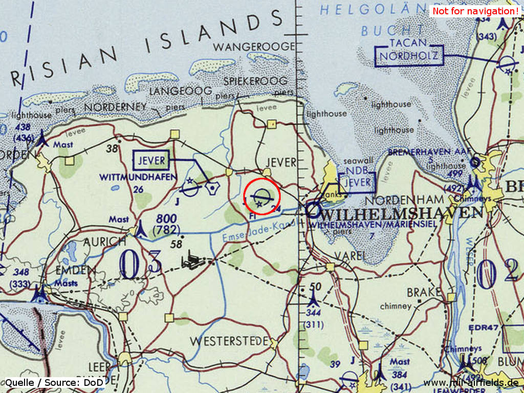
Jever Air Base on a map of the US Department of Defense from 1972 - (ONC E-2 (1972), Perry-Castañeda Library Map Collection, University of Texas at Austin /PCL MC/)
Maps

NDB approach in 1960. The field is still operated by the Royal Air Force (RAF). The airfield map at the bottom right shows the identification beacon, which is typical for UK airfields (here with the ident "JV") (Source: USAF/USN FLIP 1960)
In 1966, the air base is operated by the German Air Force. The beacon has disappeared and the tower has been moved to the southern side of the runway. Weser Control is now managing the approaches. (Source: USAF/USN FLIP 1966)
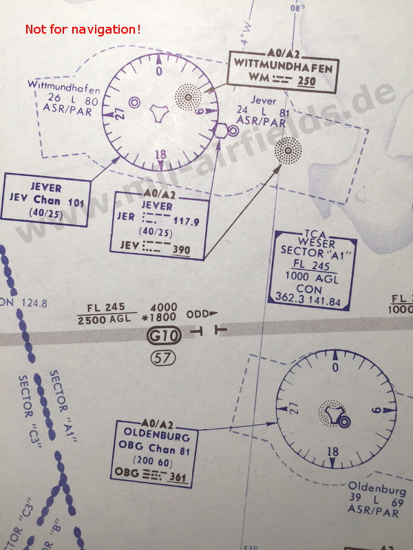
In 1968, the field does not only have a NDB and a TACAN. There is also a VOR "JER" at the airfield, which was rather unusual for German air bases. Shortly afterwards, the VOR has disappeared again. (Source: DoD FLIP 1968) *
* Bernhard from fliegerhorste.de writes: The first generation of training aircraft at Waffenschule 10 in Jever was the F-104F. Instead of a TACAN, these were only equipped with a VOR. For better identification, the planes had a registration "29+..". They were already withdrawn from service in the early 1970s and replaced by the TF-104G. - Thanks!
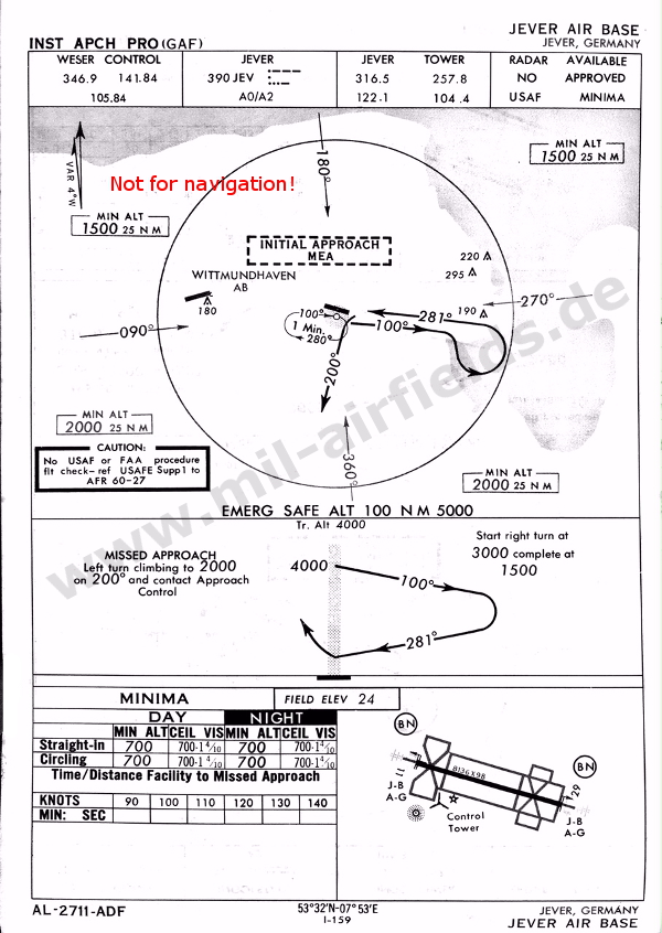
In the 1980s
Runways
- 10/28: 2480 m x 30 m Concrete
Radio beacons
- NDB: 390 "JEV", 283° / 4.6 NM to field
Today
Use
The airfield is closed since 2013.
Links
- http://www.luftwaffe.de/portal/a/luftwaffe/!ut/p/c... - Last flying day at Upjever air base (German language)
Videos
- https://www.youtube.com/watch?v=wYp13tTVXAQ - Jever - A normal flying afternoon at JaboG 38 "F" (Fighter Bomber Wing 38) in 2003.
 Follow mil-airfields on Facebook