London Gatwick Airport
Historical approach and aerodrome charts
For historical information only, do not use for navigation or aviation purposes!
| Coordinates | N510856 W0001126 (WGS84) Google Maps |

Region: West Sussex
Location Indicator: EGKK
In the 1960s
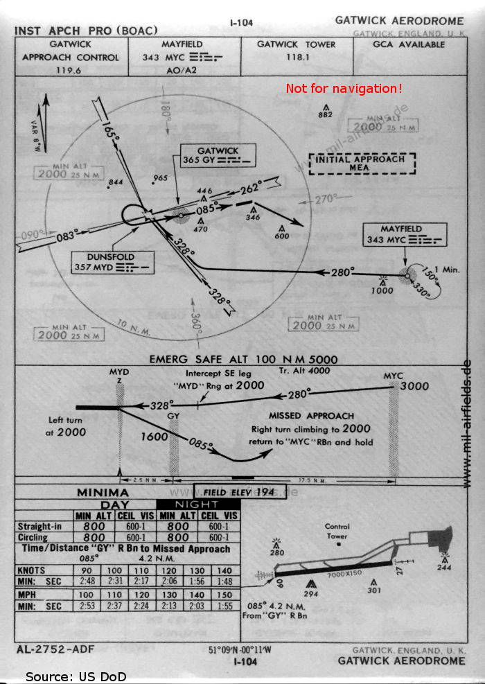
NDB approach runway 09 (October 1960)
There is one runway - 09/27: length 2133 m, width 46 m (7000 feet x 150 feet).
(Source: US DoD)
There is one runway - 09/27: length 2133 m, width 46 m (7000 feet x 150 feet).
(Source: US DoD)
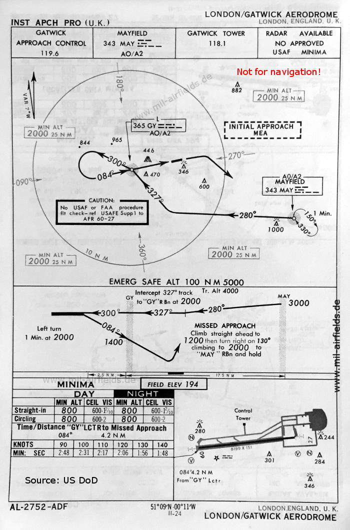
NDB approach runway 09 (May 1966)
The dimensions of runway 09/27 are 2499 m x 46 m (8199 feet x 151 feet)
(Source: US DoD)
The dimensions of runway 09/27 are 2499 m x 46 m (8199 feet x 151 feet)
(Source: US DoD)
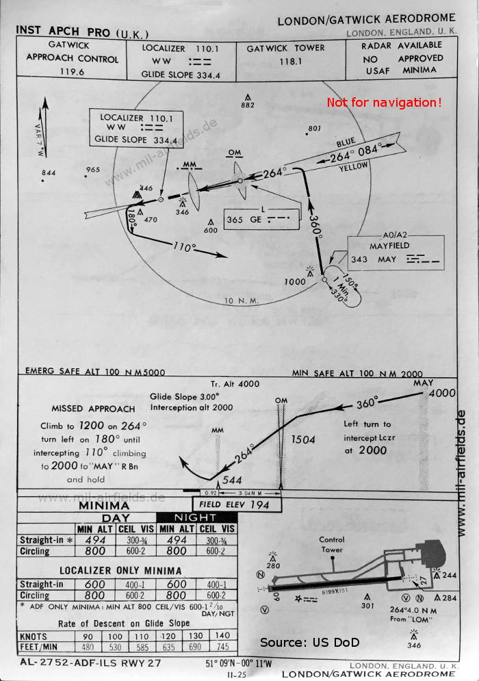
ILS approach runway 27 (May 1966)
(Source: US DoD)
(Source: US DoD)
Index to the objects shown on the maps
Radio beacons:
- Dunsfold Range "MYD"
- Gatwick NDB "GY", Locator "GE", ILS "WW", Outer Marker, Middle Marker
- Mayfield NDB "MYC"
Air traffic control:
- Gatwick Approach Control, Gatwick Tower
Source for all maps, if not marked otherwise: US Department of Defense (US DoD)
Recommended


Image credits are shown on the respective target page, click on the preview to open it.
 mil-airfields.de at Facebook