RAF Marham
Historical approach and aerodrome charts for free download
For historical information only, do not use for navigation or aviation purposes!
| Coordinates | N523844 E0003307 (WGS84) Google Maps |
| Location indicator | MAYM, EGYM |
| Operator | Royal Air Force (RAF) |
In the 1950s
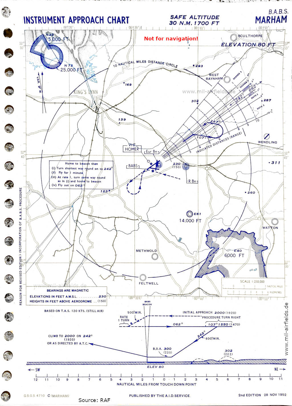
BABS approach runway 24 (November 1952) (Source: RAF)
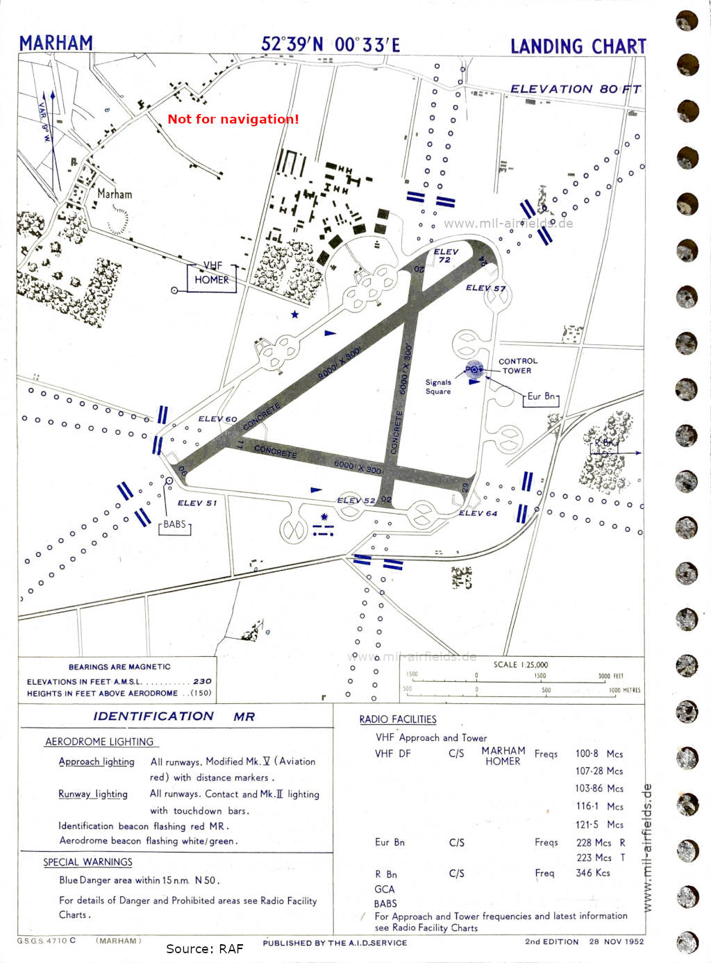
Aerodrome chart (1952) - There are three runways - 02/20: length 1829 m, width 91 m (6000 feet x 300 feet), 06/24: length 2743 m, width 91 m (9000 feet x 300 feet), 11/29: length 1829 m, width 91 m (6000 feet x 300 feet). (Source: RAF)
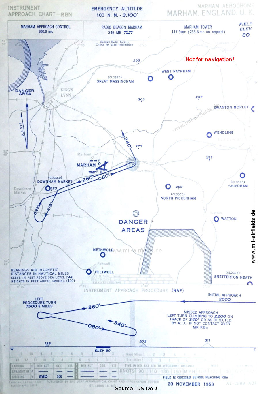
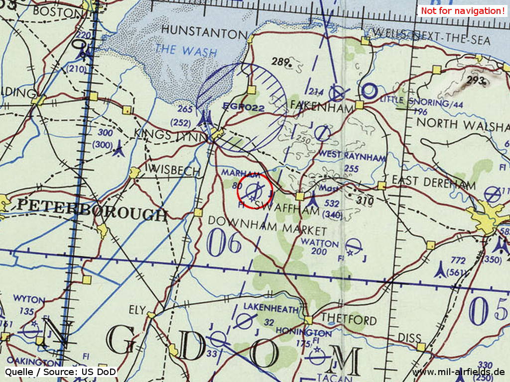
NDB approach (November 1953) - Airfields in the vicinity: Downham Market, Feltwell, Great Massingham, Methwold, North Pickenham, Shipdham, Snatterton Heath, Swanton Morley, Watton, Wendling, West Raynham (Source: US DoD)
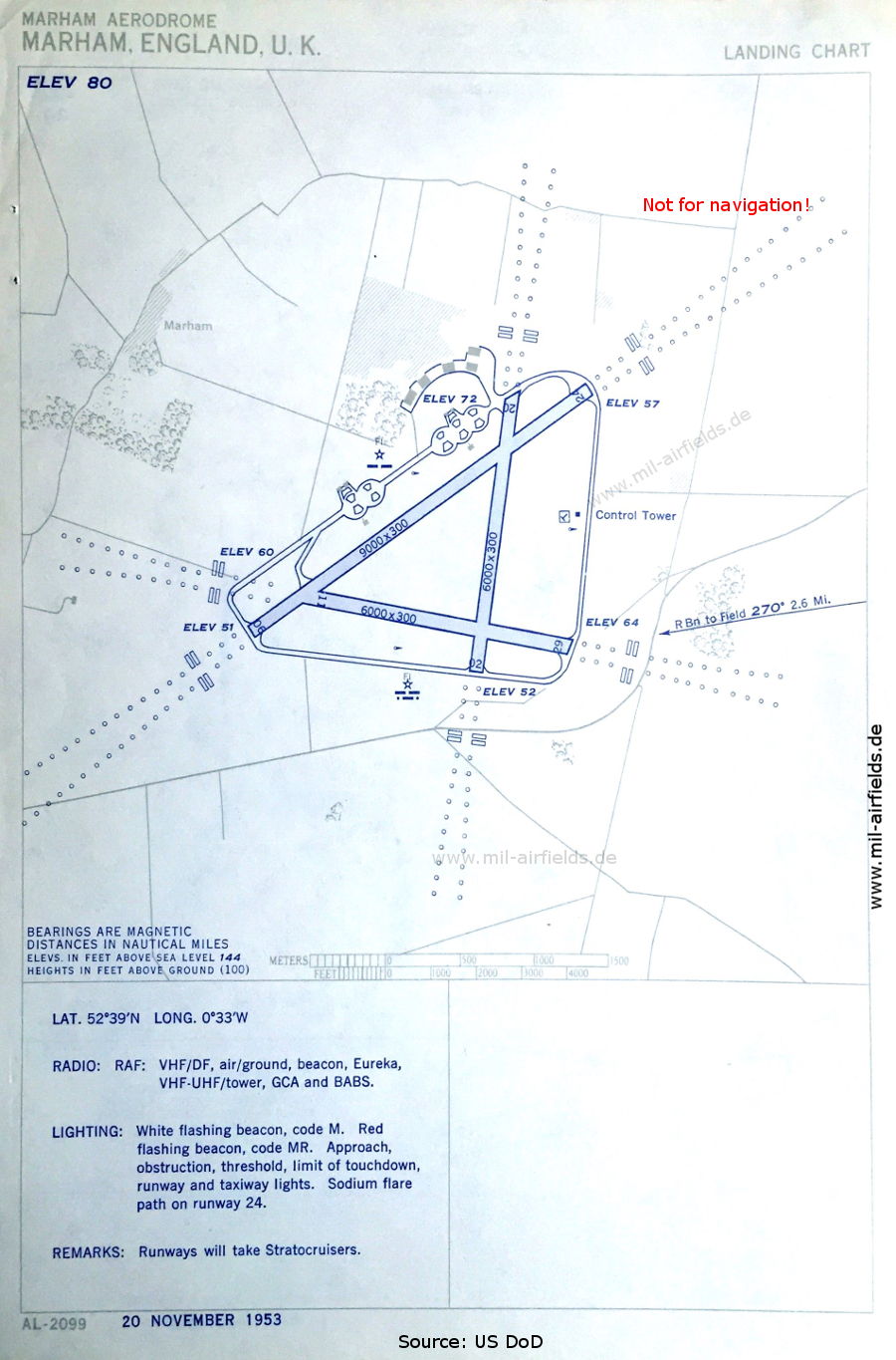
Aerodrome (November 1953) (Source: US DoD)
In the 1970s
RAF Marham on a map of the US Department of Defense from 1972 (Source: ONC E-2 (1972), Perry-Castañeda Library Map Collection, University of Texas at Austin)
Index to the objects shown on the maps
Aerodromes:
- Downham Market
- Feltwell
- Great Massingham
- Honington
- Lakenheath, Little Snoring
- Marham, Methwold, Mildenhall
- North Pickenham, Norwich
- Sculthorpe, Shipdham, Snetterton Heath, Swanton Morley
- Watton, Wendling, West Raynham, Wyton
Airspace:
- EG(P) 022
Radio beacons:
- Marham NDB "MR"
- Marham EUREKA "MR"
- Marham BABA
Air traffic control:
- Marham Approach Control, Marham Tower
Source for all maps, if not marked otherwise: US Department of Defense (US DoD)
Recommended
Image credits are shown on the respective target page, click on the preview to open it.
 mil-airfields.de at Facebook