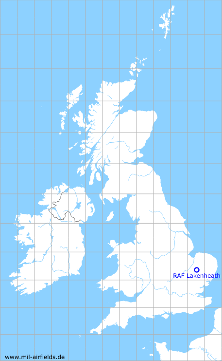
RAF Lakenheath
Historical approach and aerodrome charts for free download
For historical information only, do not use for navigation or aviation purposes!
| Coordinates | N522434 E0003341 (WGS84) Google Maps |
| Region | Suffolk, East Anglia |
| Location indicator | MAXL, EGUL |
| Operator | US Air Force (USAF) |

In the 1950s
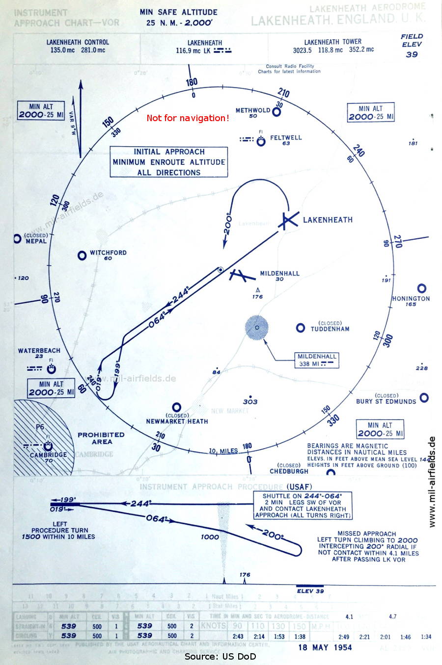
VOR approach (May 1954) - Like other airfields of the US Air Force, Lakenheath also had a VOR for a few years. (Source: US DoD / USAF)
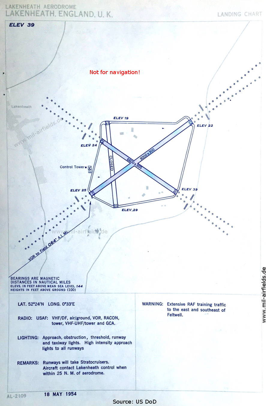
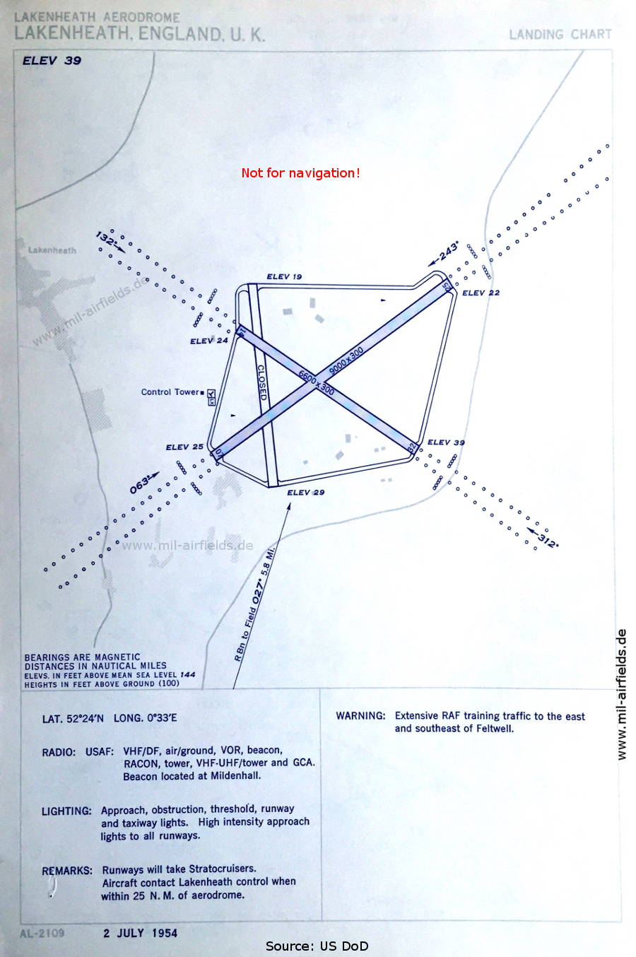
Aerodrome chart (May 1954) - There are three runways - 01/19: closed, 07/25: length 2743 m, width 91 m (9000 feet x 300 feet), 14/32: length 2012 m, width 91 m (6600 feet x 300 feet). The width of 91 m is remarkable. (Source: US DoD / USAF)
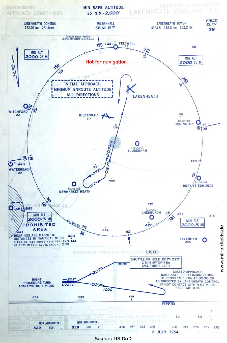
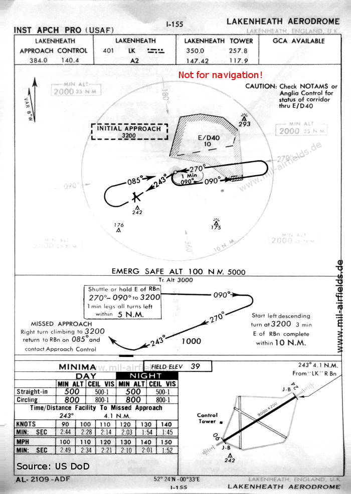
NDB approach via the Mildenhall beacon (July 1954) - Airfields in the vicinity: Bury St. Edmunds, Cambridge, Chedburgh, Feltwell, Honington, Lavenham, Mepal, Methwold, Mildenhall, Newmarket Heath, Tuddenham, Waterbeach, Witchford, (Source: US DoD / USAF)
Aerodrome map (July 1954) (Source: US DoD / USAF)
In the 1960s
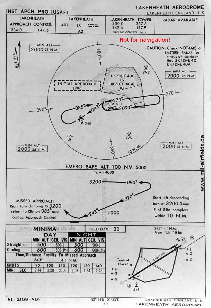
NDB approach runway 24 (October 1960) - Now there is only one runway - 06/24: length 2743 m, width 61 m (9000 feet x 200 feet). (Source: US DoD)
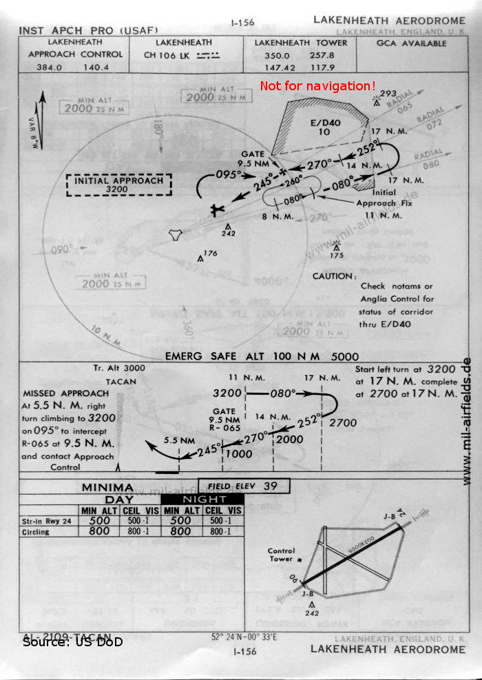
TACAN approach runway 24 (October 1960) (Source: US DoD)
NDB approach runway 24 (May 1966) (Source: US DoD)
Index to the objects shown on the maps
Aerodromes:
- Bury St. Edmunds, Cambridge, Chedburgh, Feltwell, Honington, Lavenham, Mepal, Methwold, Mildenhall, Newmarket Heath, Tuddenham, Waterbeach, Witchford
Airspace:
- E/D40, P6, UK/D(-E 40), UK/D(-E 40A)
Radio beacons:
- Lakenheath NDB "LK", Lakenheath VOR "LK"
- Mildenhall NDB "MI"
Air traffic control:
- Lakenheath Control, Lakenheath Approach Control, Lakenheath Tower, Ground Control
Source for all maps, if not marked otherwise: US Department of Defense (US DoD)
Title image: F-15E Strike Eagles, 48th Fighter Wing, RAF Lakenheath, line up on the taxiway preparing to move onto the runway for takeoff, Source: US DoD Scene Camera Operator: SSGT William Greer, USAF / National Archives 6605273
Recommended

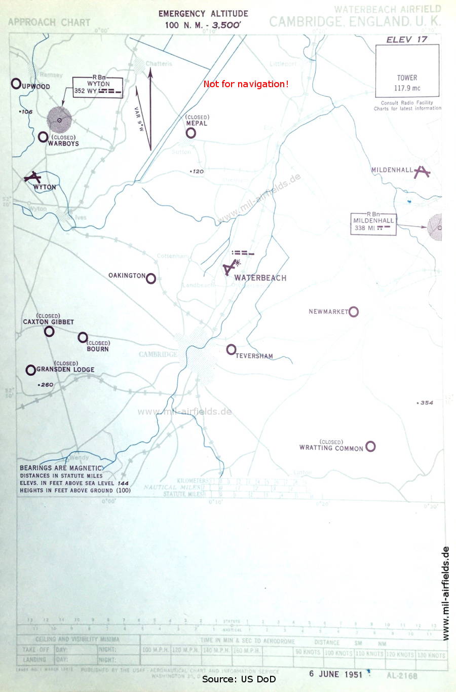
Image credits are shown on the respective target page, click on the preview to open it.
 mil-airfields.de at Facebook