RAF Metfield
Historical approach and aerodrome charts
For historical information only, do not use for navigation or aviation purposes!
| Coordinates | N522201 E0012339 (WGS84) Google Maps |
| Region | Suffolk, England |
| Operator | United States Army Air Forces (USAAF), Royal Air Force (RAF) |
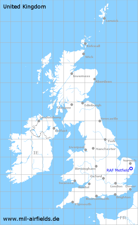
RAF Metfield was an airfield during World War II, used by fighter planes and bombers of the United States Army Air Forces (USAAF). After the war, the airfield went out of service again.
In the 1940s
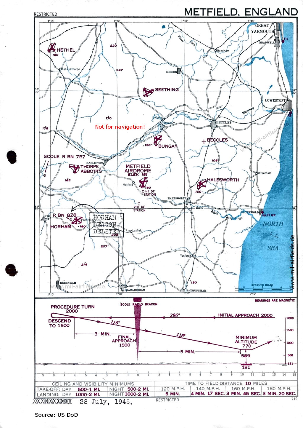
Approach Chart (July 1945) (Source: US DoD)
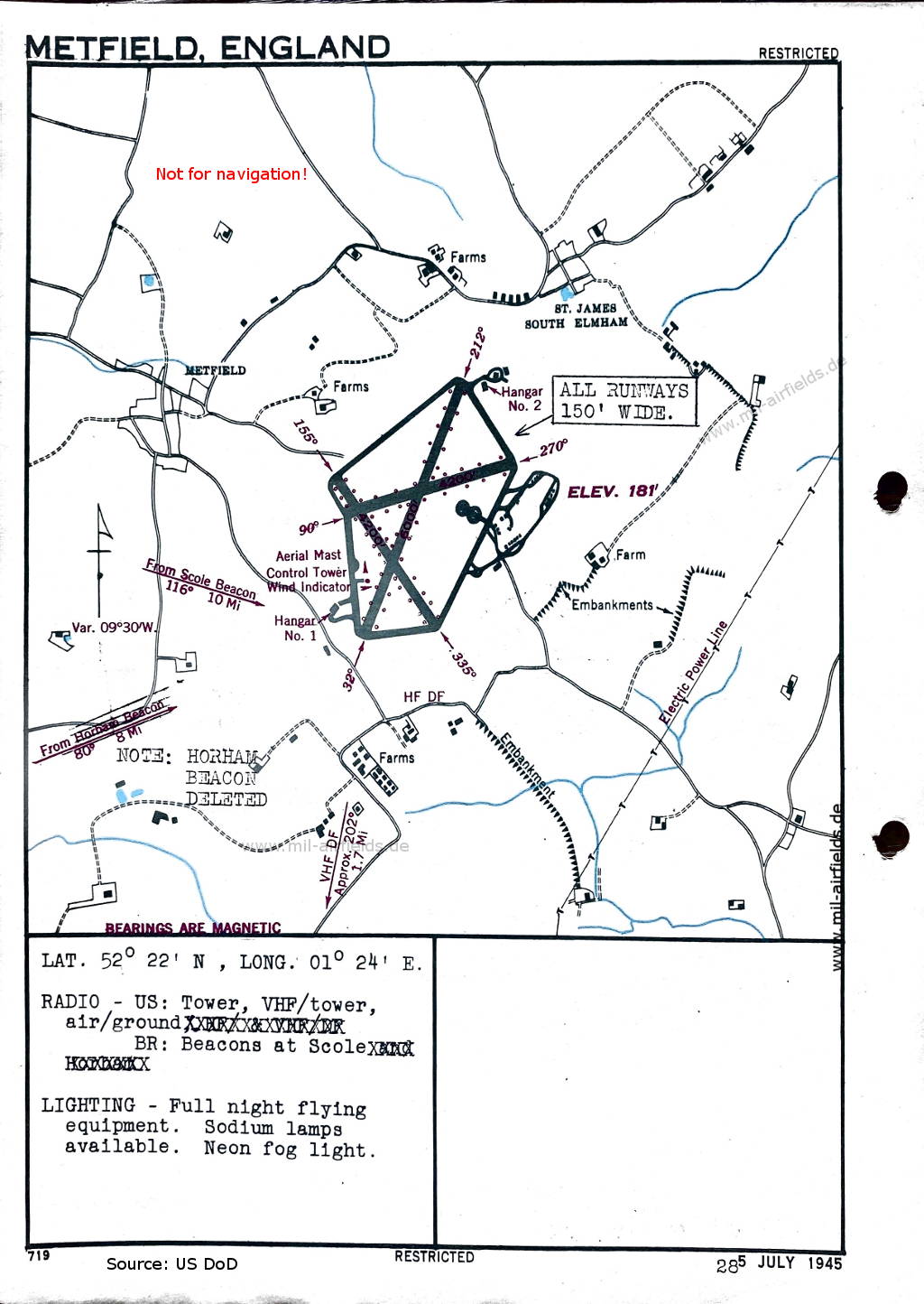
Aerodrome Map (July 1945) - There are three runways - 032/212: length 1829 m, width 46 m (6000 feet x 150 feet), 090/270: length 1280 m, width 46 m (4200 feet x 150 feet), 155/335: length 1280 m, width 46 m (4200 feet x 150 feet). (Source: US DoD)
Index to the objects shown on the maps
Aerodromes:
- Beccles, Bungay, Halesworth, Hethel, Horham, Methfield, Seething, Thorpe Abbotts
Radio beacons:
- Horham Radio Beacon
- Scole Radio Beacon,
Places:
- Ashwellthorpe, Beccles, Bradwell, Broome, Bungay, Debenham, Framlingham, Great Yarmouth, Halesworth, Harleston, Laxfield, Loddon, Lowestoft, Reedham, River Blyth, River Waveney, River Yare, Southwold, Stradbroke, Wrentham, Yoxford
Source for all maps, if not marked otherwise: US Department of Defense (US DoD)
Title image: Formation of four B-24 Liberator aircraft. Source: National Archives 6365079
Links
https://en.wikipedia.org/wiki/RAF_Metfield - RAF Metfield
https://archives.gov/ - National Archives
Recommended

Image credits are shown on the respective target page, click on the preview to open it.
 mil-airfields.de at Facebook