Stornoway Airport (Steòrnabhagh)
RAF Stornoway
Historical approach and aerodrome charts / Airfield history
For historical information only, do not use for navigation or aviation purposes!
| Coordinates | N581255 W0061952 (WGS84) Google Maps |
| Region | Outer Hebrides / Western Isles / Na h-Eileanan Siar, Lewis and Harris / Isle of Lewis |
| Location indicator | GGCB, EGPO |
In the 1940s
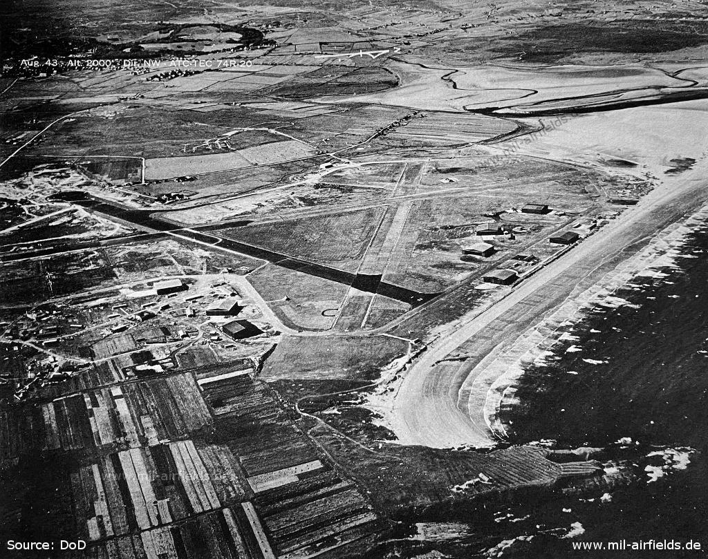
Aerial view August 1943 - Viewing direction northwest (Source: US DoD)
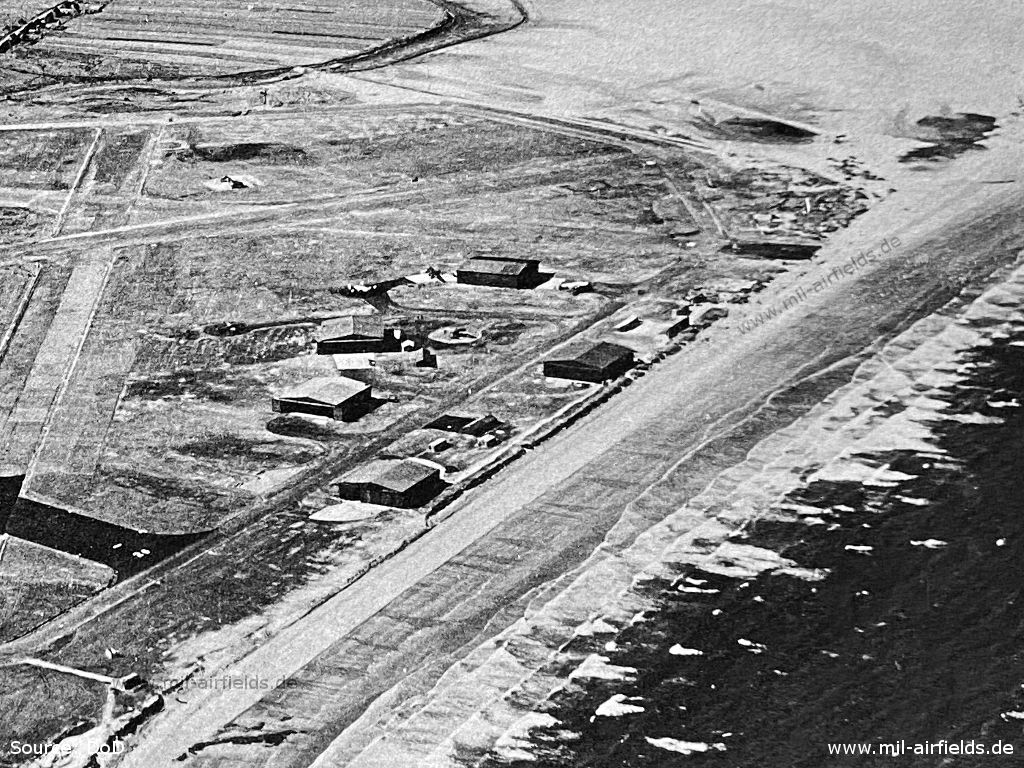
Enlargement: Hangars near the beach (Source: US DoD)
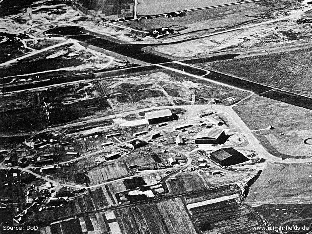
Enlargement: Installations in the southeast (Source: US DoD)
In the 1950s
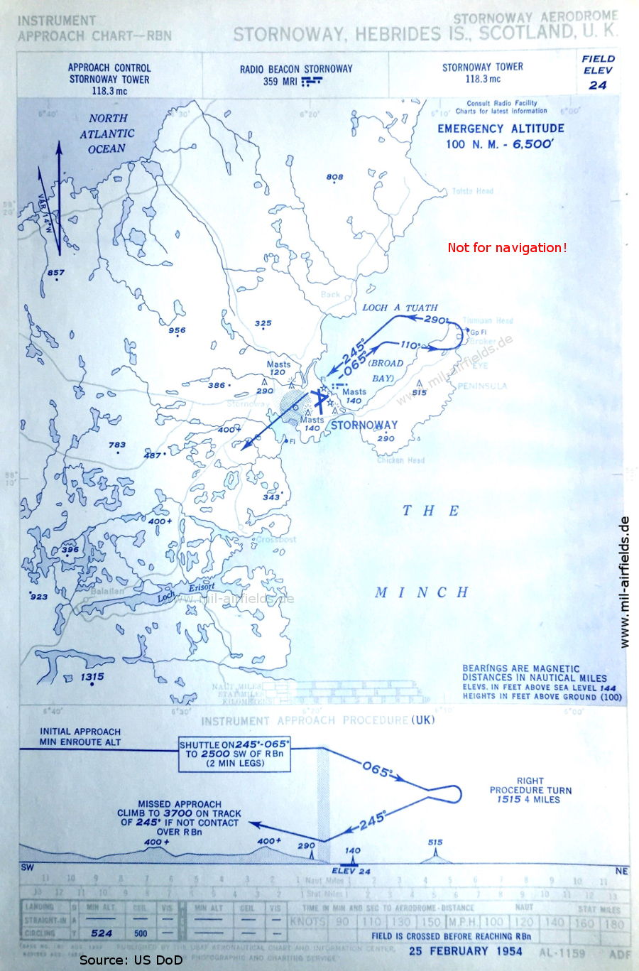
NDB approach (February 1954) (Source: US DoD)
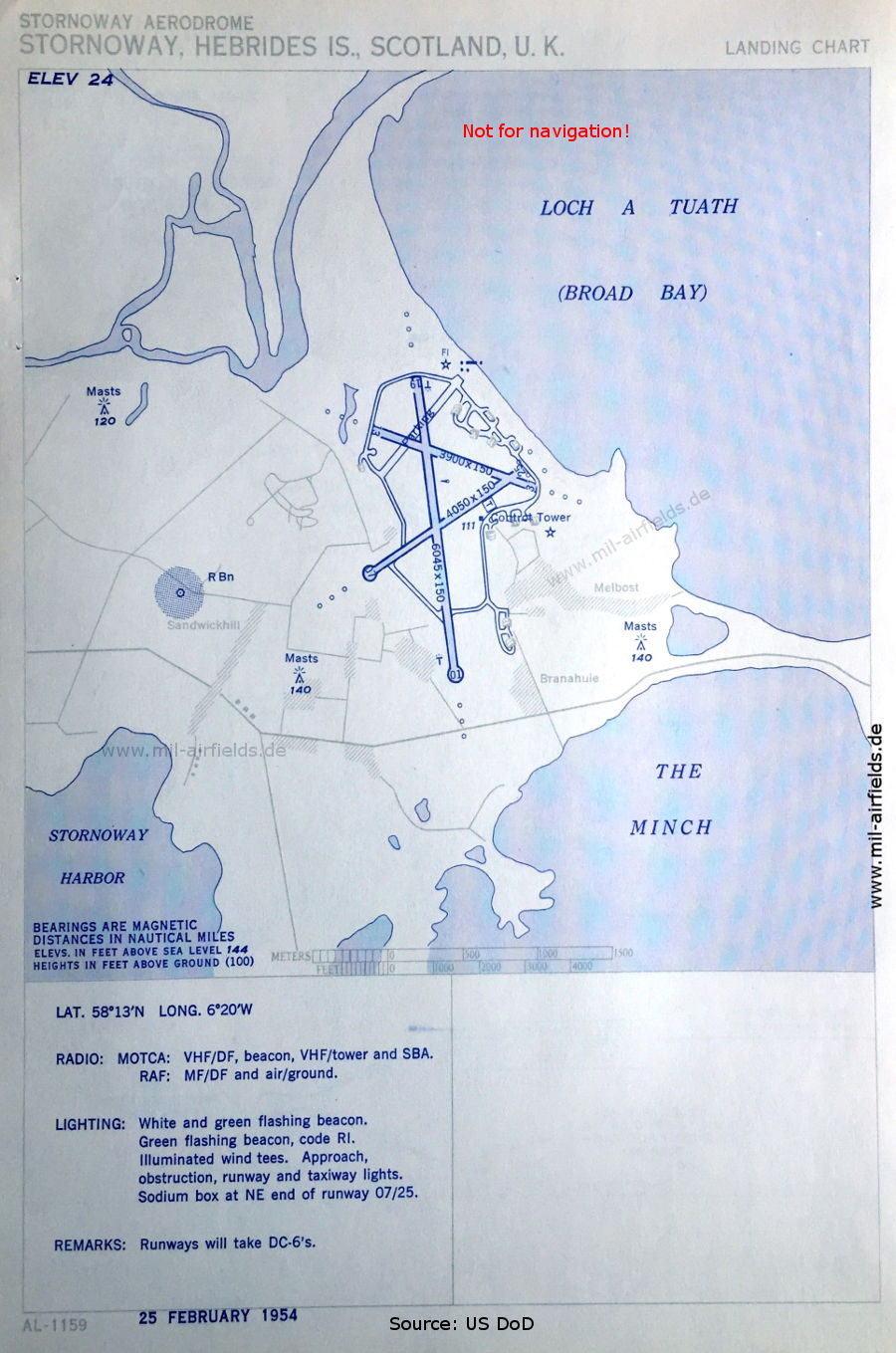
Airport chart (February 1954) - There are three runways - 01/19: length 1842 m, width 46 m (6045 feet x 150 feet), 07/25: length 1234 m, width 46 m (4050 feet x 150 feet), 13/31: length 1189 m, width 46 m (3900 feet x 150 feet). A Standard Beam Approach (SBA) is also available for the approach. (Source: US DoD)
In the 1990s
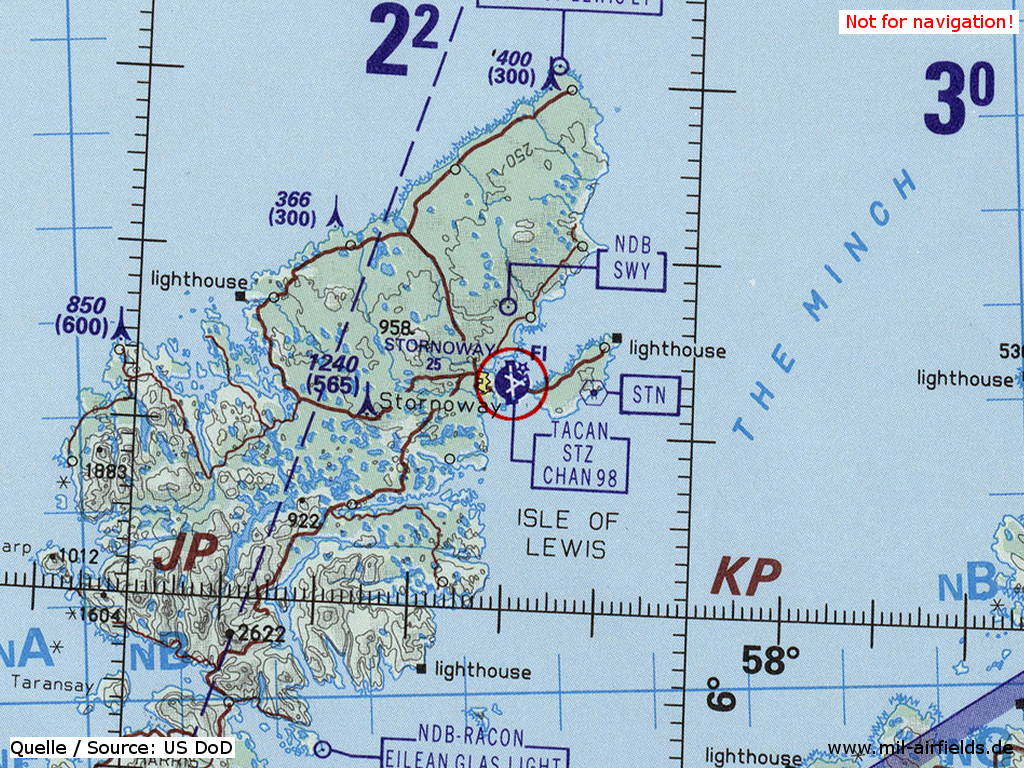
Stornoway Airport (Steòrnabhagh) on a map of the US Department of Defense from 1993 (Source: ONC E-2 (1993), Perry-Castañeda Library Map Collection, University of Texas at Austin)
Index to the objects shown on the maps
Radio beacons:
- Stornoway NDB "MRI"
Air traffic control:
- Stornoway Tower
Places:
- Back, Balallan, Branahuie, Crosbost, Eye Peninsula, Loch a Tuath, Melbost, Sandwickhill, The Minch, Tiumpan Head, Tolsta Head
Source for all maps, if not marked otherwise: US Department of Defense (US DoD)
Recommended
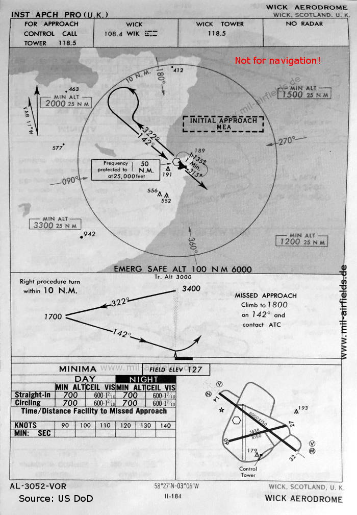
Image credits are shown on the respective target page, click on the preview to open it.
 mil-airfields.de at Facebook