Tiree Airport / Tiriodh
Historical approach and aerodrome charts / Airfield history
For historical information only, do not use for navigation or aviation purposes!
| Coordinates | N562958 W0065218 (WGS84) Google Maps |
| Region | Inner Hebrides, Na h-Eileanan a-staigh |
| Location indicator | GGIA, EGPU |
In the 1950s
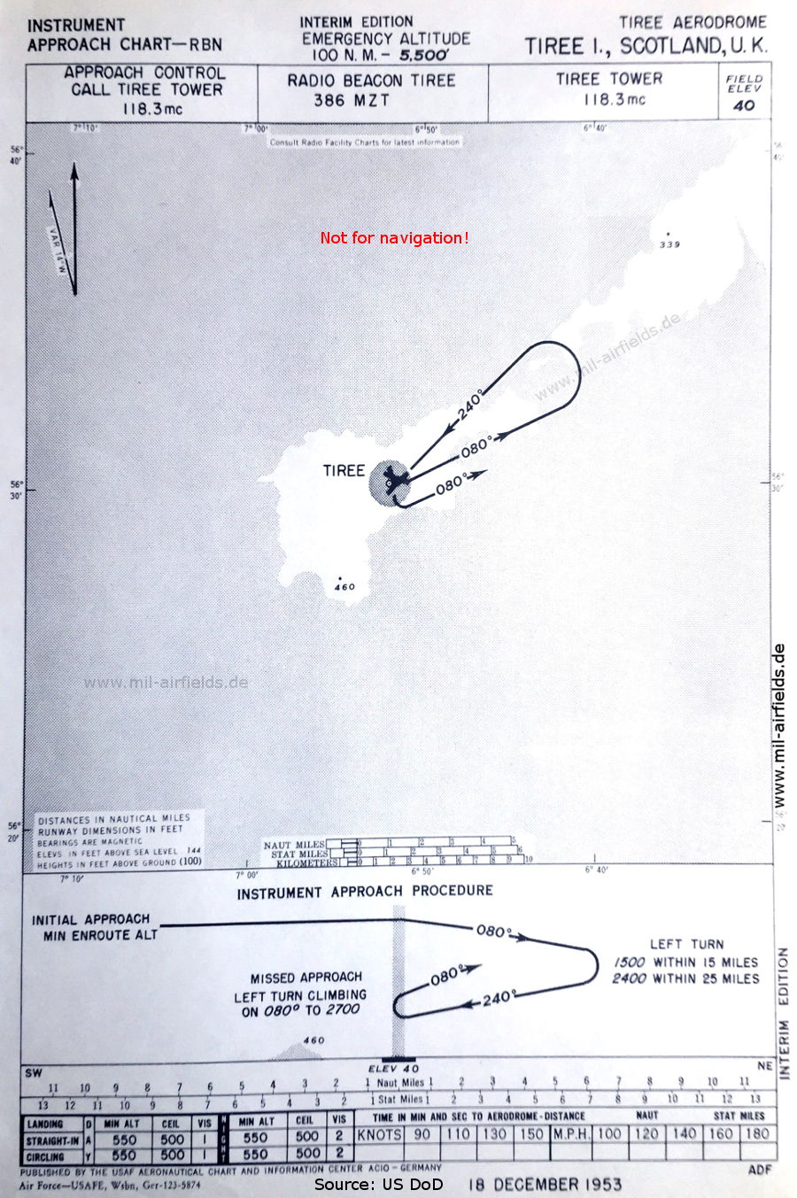
NDB approach runway 24 (December 1953) - Interim edition (Source: US DoD)
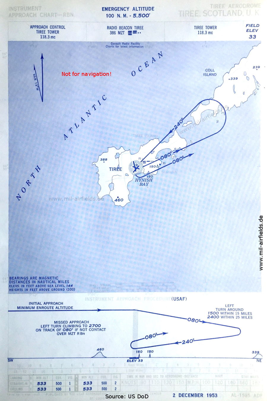
NDB approach runway 24 (December 1953) (Source: US DoD)
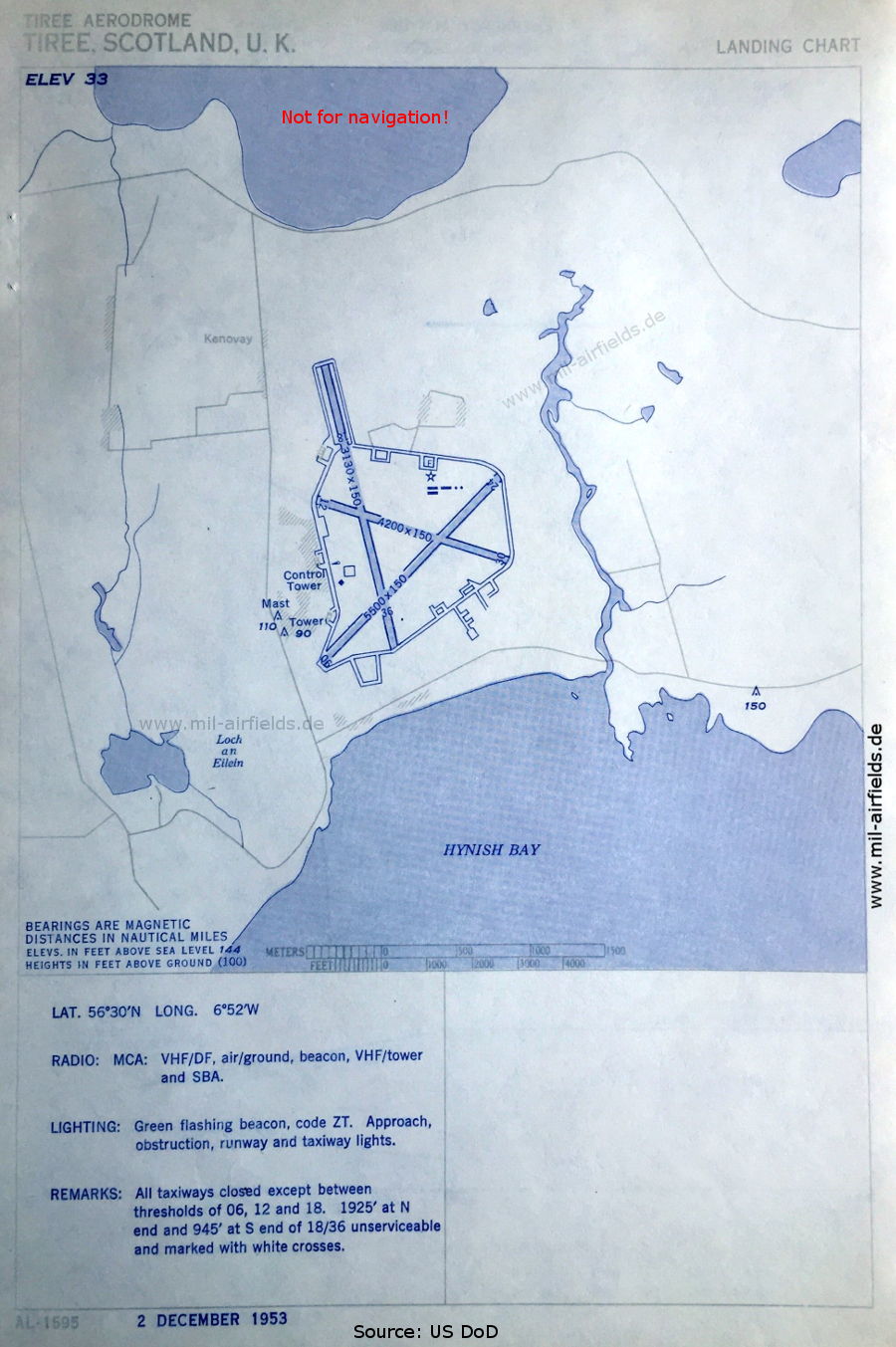
Airport (December 1953) - There are three runways - 06/24: length 1676 m, width 46 m (5500 feet x 150 feet), 12/30: length 1280 m, width 46 m (4200 feet x 150 feet), 18/36: length 954 m, width 46 m (3130 feet x 150 feet). A Standard Beam Approach (SBA) is also available for the approach. (Source: US DoD)
In the 1990s
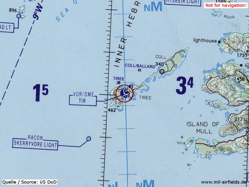
Tiree Airport / Tiriodh on a map of the US Department of Defense from 1993 (Source: ONC E-2 (1993), Perry-Castañeda Library Map Collection, University of Texas at Austin)
Index to the objects shown on the maps
Radio beacons:
- Tiree NDB "MZT"
Air traffic control:
- Tiree Tower
Places:
- Coll Island, Hynish Bay, Kenovay, Loch an Eilein Tiree
Source for all maps, if not marked otherwise: US Department of Defense (US DoD)
Recommended
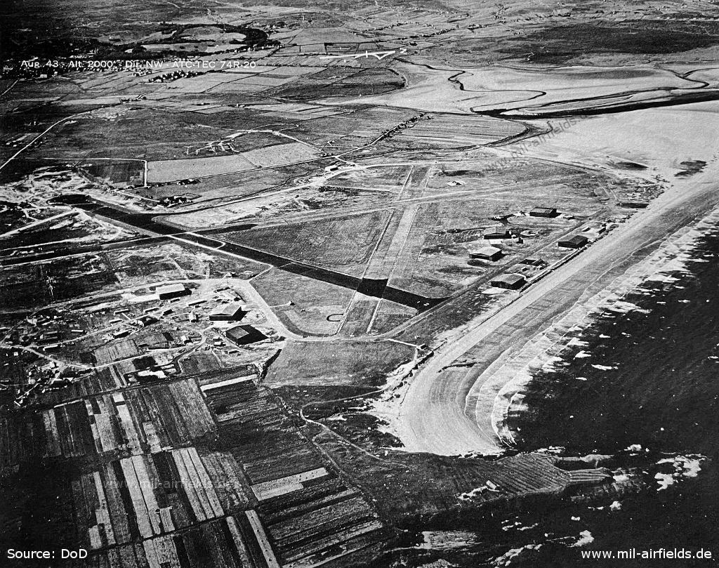

Image credits are shown on the respective target page, click on the preview to open it.
 mil-airfields.de at Facebook