RAF Wethersfield
Historical approach and aerodrome charts
For historical information only, do not use for navigation or aviation purposes!
| Coordinates | N515827 E0003027 (WGS84) Google Maps |
| Region | Essex, Braintree |
| Location indicator | MAYV, EGVT |
| Operator | US Air Force (USAF) |
In the 1960s
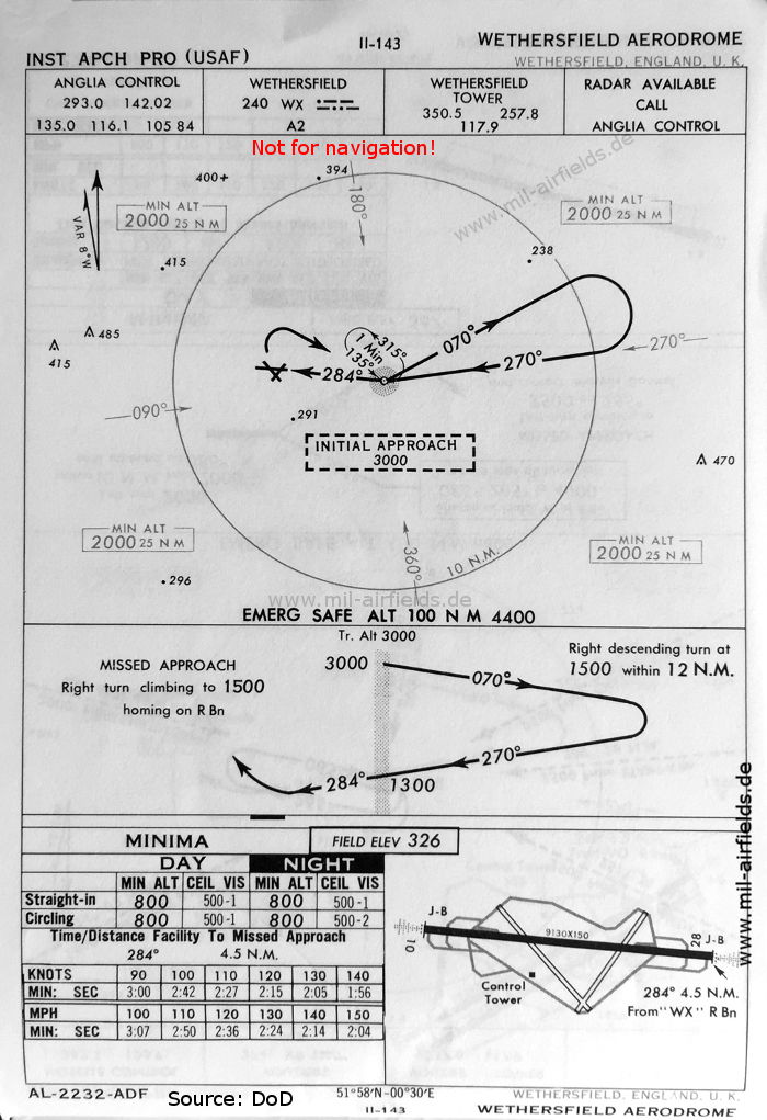
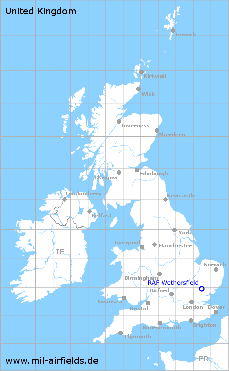
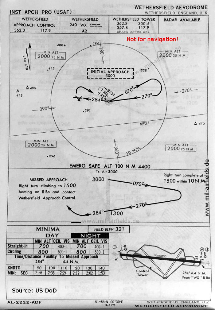
NDB approach (October 1960) - There is one runway - 10/28: length 2783 m, width 46 m (9130 feet x 150 feet). (Source: DoD)
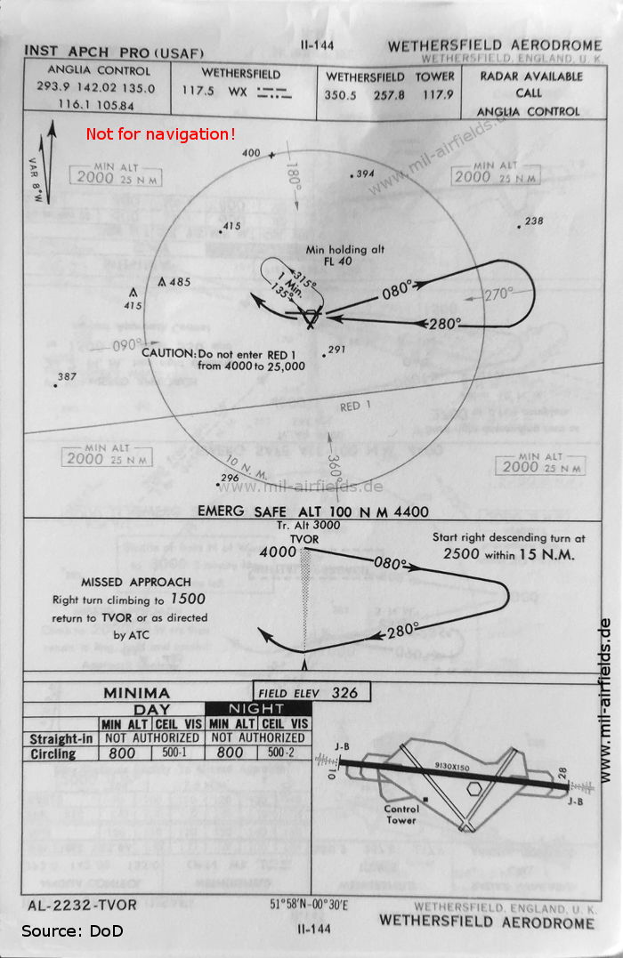
VOR approach (October 1960) - Also this US Air Base had a VOR radio beacon for a short time. South of the field is the airway RED 1. (Source: DoD)
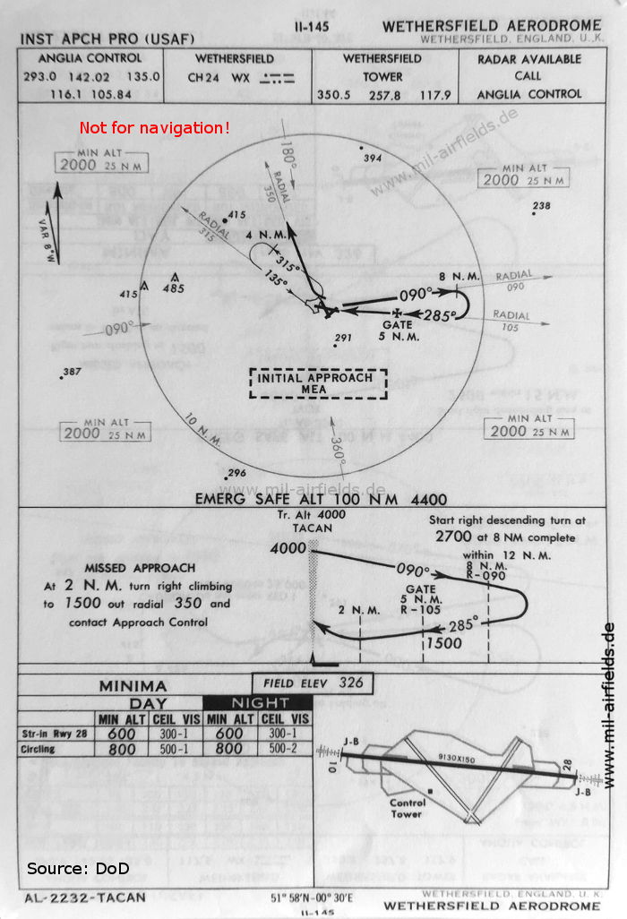
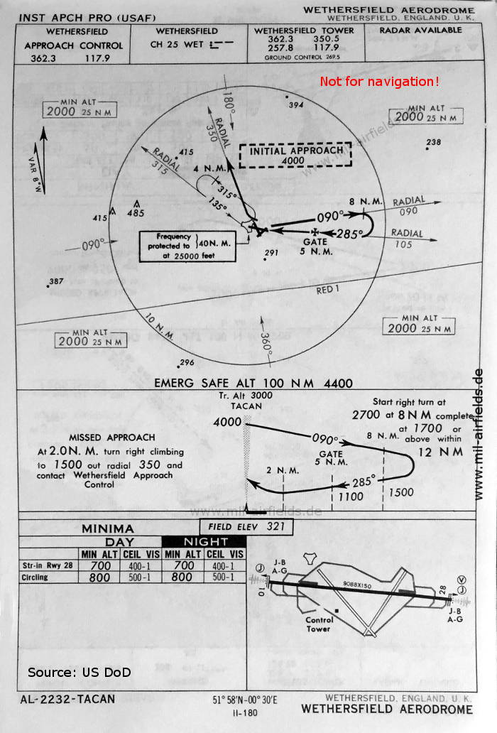
TACAN approach (October 1960) (Source: DoD)
NDB approach runway 28 (May 1966) - Now the runway is shown with - 10/28: length 2770 m, width 46 m (9088 feet x 150 feet). (Source: US DoD)
TACAN approach runway 28 (May 1966) (Source: US DoD)
In the 1990s
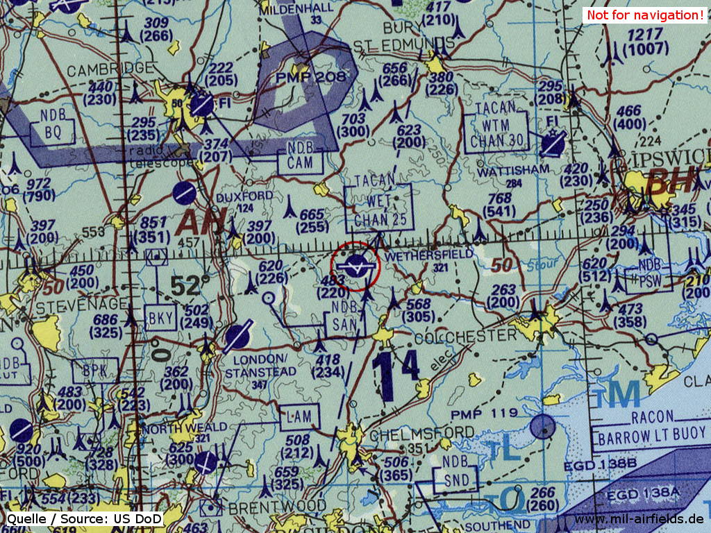
RAF Wethersfield on a map of the US Department of Defense from 1993 (Source: ONC E-2 (1993), Perry-Castañeda Library Map Collection, University of Texas at Austin)
Index to the objects shown on the maps
Airspace:
- Airway RED 1
Radio beacons:
- Wethersfield NDB "WX", VOR "WX", TACAN "WX", "WET"
Air traffic control
- Anglia Control
- Wethersfield Approach Control, Wethersfield Tower, Ground Control
Source for all maps, if not marked otherwise: US Department of Defense (US DoD)
Recommended


Image credits are shown on the respective target page, click on the preview to open it.
 mil-airfields.de at Facebook