For historical information only, do not use for navigation or aviation purposes!
| Coordinates | N511137 E0143111 (WGS84) Google Maps |
| Elevation | 167 m |
| Former East Germany (GDR) | District of Dresden |
| Federal state | Sachsen (Saxony) |
| Location indicator | EDAB (2000) |
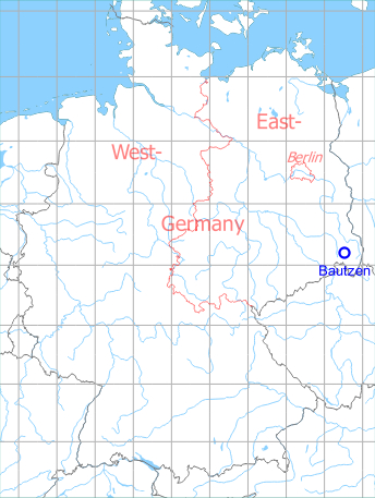
Germany during the Cold War Map
The history of the Cold War airfields: Bautzen
During World War II
Usage until 1945
Luftwaffe airfield.
During the Cold War
Use
Air Base of former East German Air Force (LSK/LV). Here the beginner training on jet airplanes took place, first with airplanes Aero L-29 Delfin (NATO designation Maya), and starting from the end of the 1970s with Aero L-39 Albatros. The airfield had no aircraft shelters and no railway connection. In the National People's Army of the GDR it had the airfield number 2125.
In the 1960s
Overview
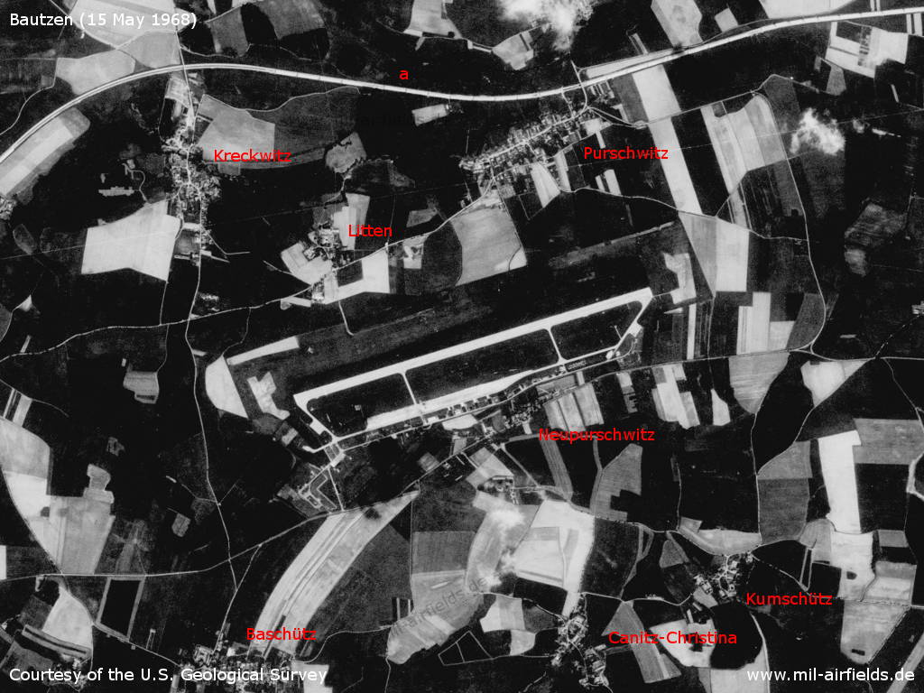
Bautzen Air Base and vicinity on a US satellite image from 15 May 1968 - a: Autobahn Dresden-Görlitz. Places: Baschütz, Canitz-Christina, Kreckwitz, Kumschütz, Litten, Neupurschwitz, Purschwitz.
Source: U.S. Geological Survey
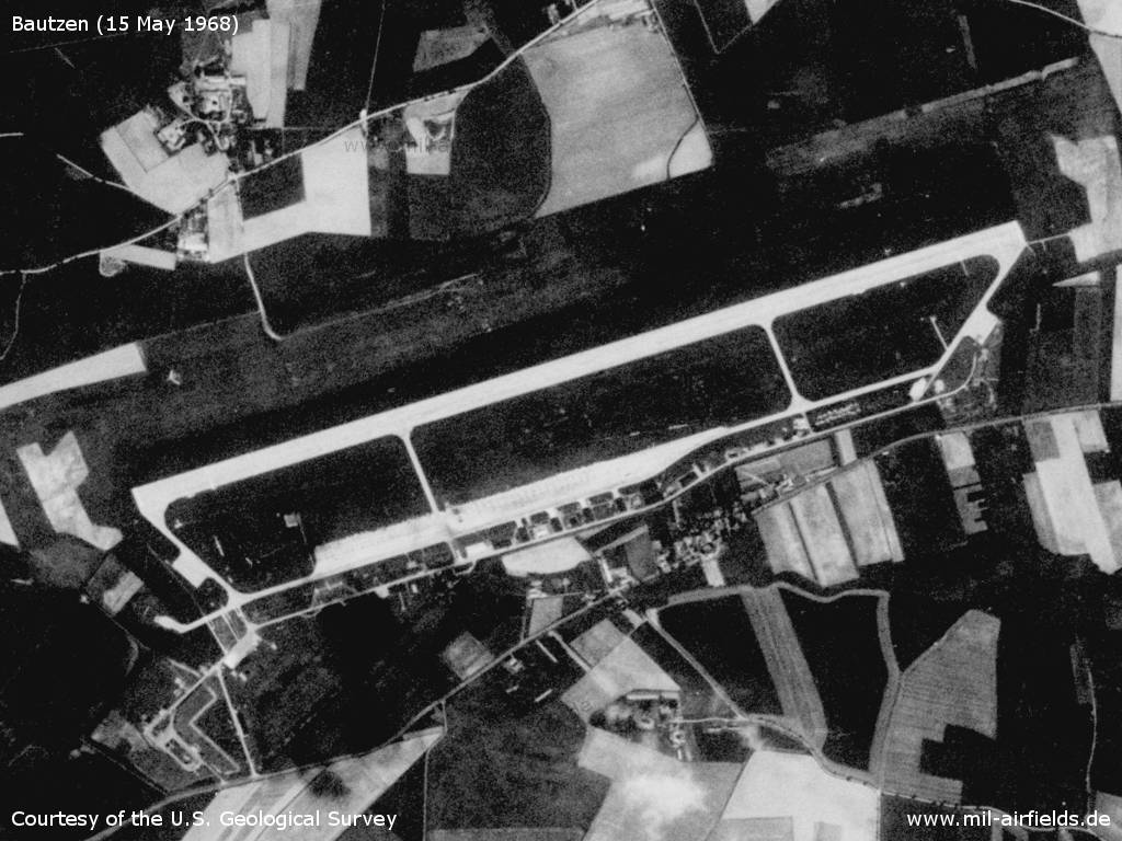
Airfield
Source: U.S. Geological Survey
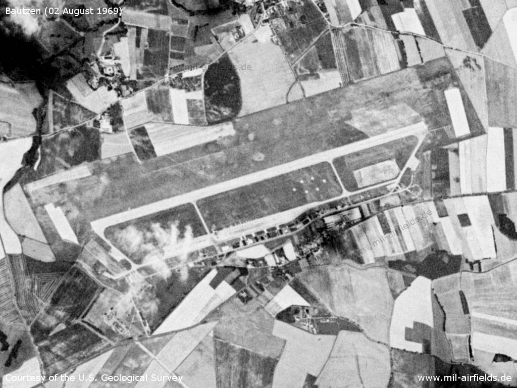
Bautzen Air Base on 02 August 1969 - Compared to the image from 1968, the earth brake surfaces at both ends of the runway have a clearer structure. Interesting is the hexagonal structure next to the runway.
Source: U.S. Geological Survey
In the 1970s
Situation
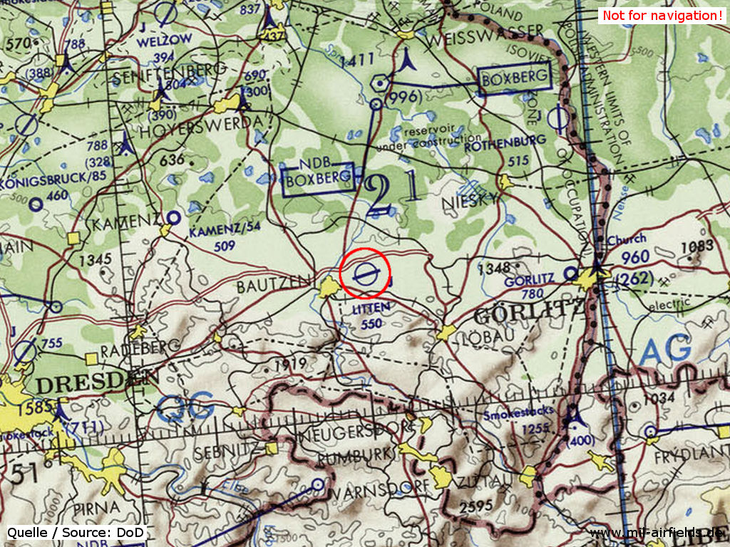
Bautzen Air Base on a map of the US Department of Defense from 1972
Source: ONC E-2 (1972), Perry-Castañeda Library Map Collection, University of Texas at Austin
Overview
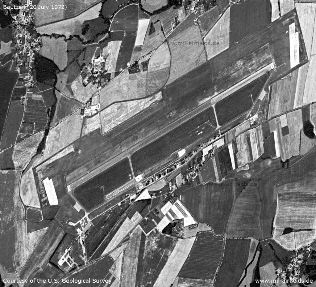
The East German Bautzen air base on 20 July 1972
Source: U.S. Geological Survey
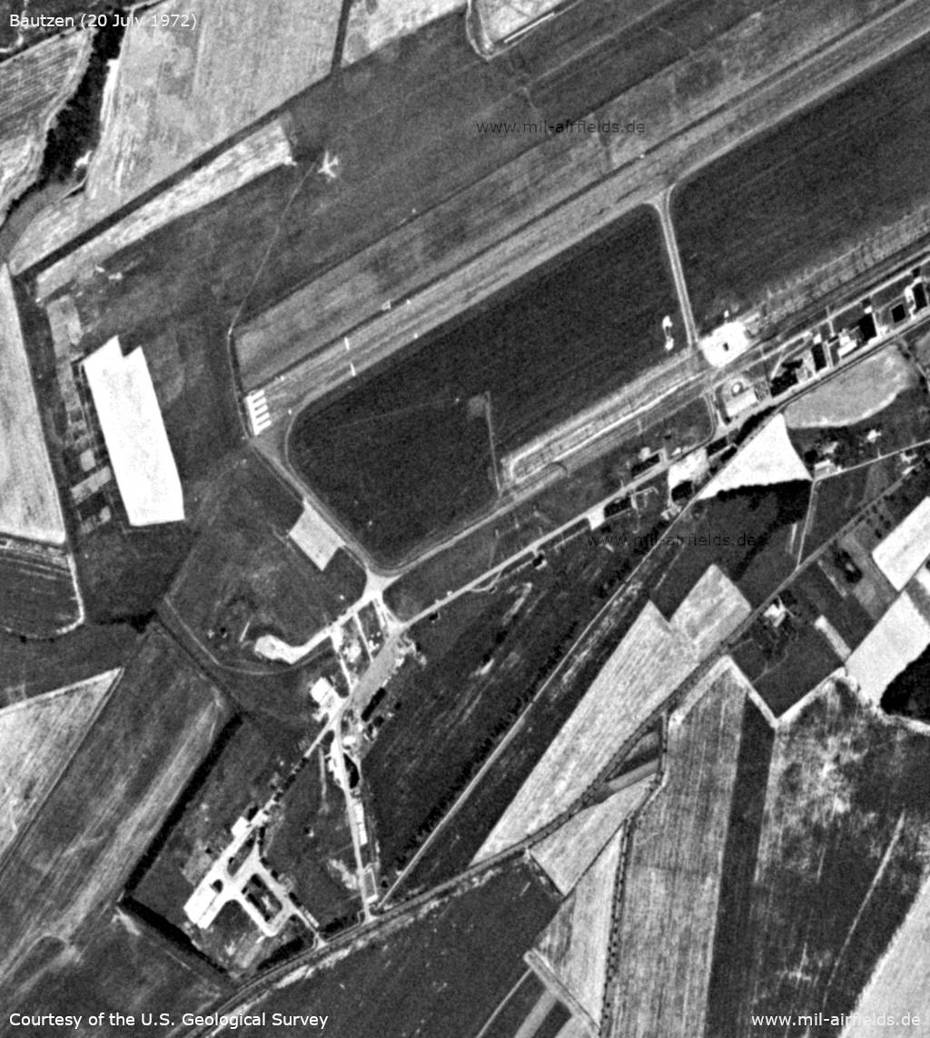
Enlargement: Western part of the airfield - North of the runway, an airplane silhouette is painted on the ground as target.
Source: U.S. Geological Survey
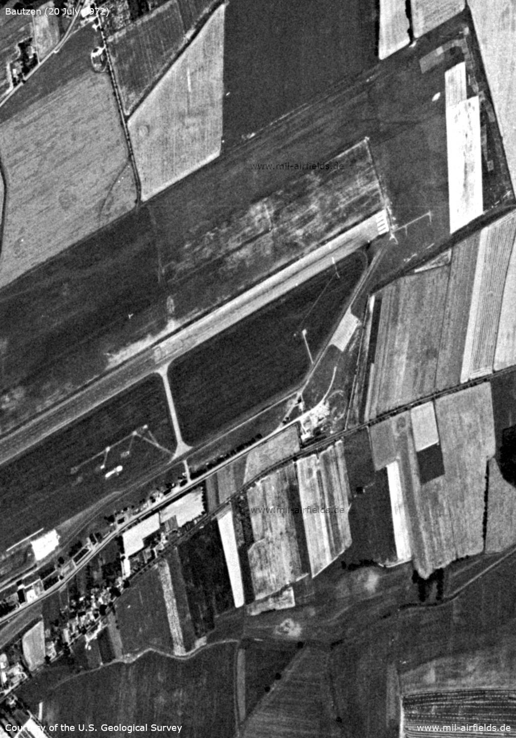
Enlargement: Eastern part of the airfield - At this time, the painting of the runway does not yet meet international standards. North of the runway is the Landing-T.
Source: U.S. Geological Survey
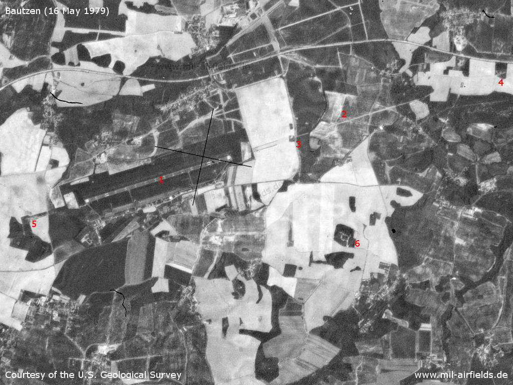
The airfield on 16 May 1979 - 1: airfield; 2: In the east there is now a four km long aisle; 3: inner radio beacon east; 4: outer radio beacon east; 5: inner radio beacon west; 6: ammunition dump? near Drehsa.
Source: U.S. Geological Survey
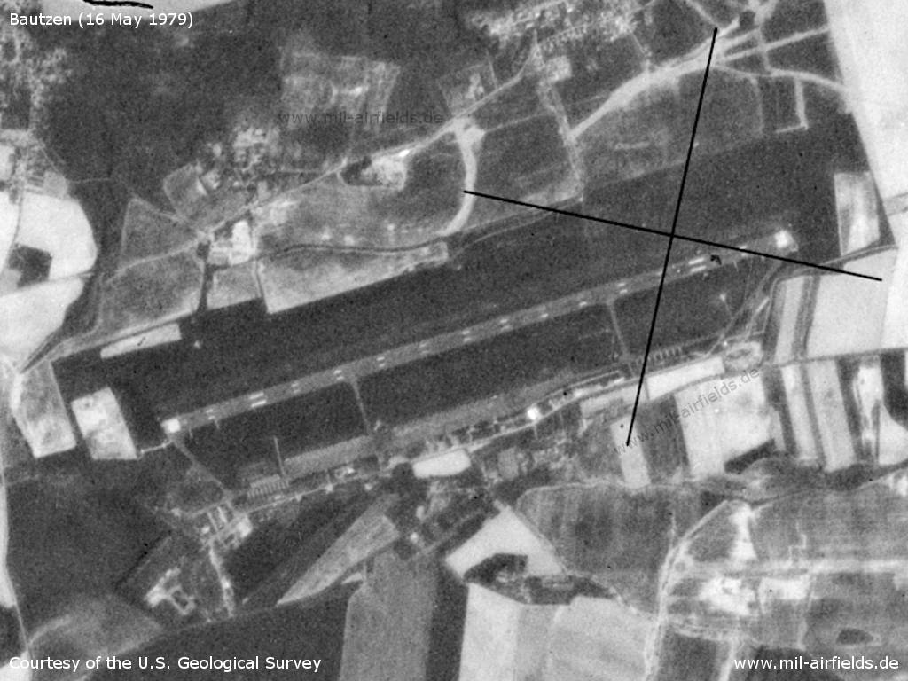
Airfield
Source: U.S. Geological Survey
Additional information
1972 Absturz einer L-29 mit 2 Fluglehrern unter mysteriösen Umständen auf einem Werkstattflug.
Beide Besatzungsmitglieder tot. Bis zur Klärung der Unfallursache ruhte der weitere
Flugbetrieb (Quelle: Lutz K.)
Beide Besatzungsmitglieder tot. Bis zur Klärung der Unfallursache ruhte der weitere
Flugbetrieb (Quelle: Lutz K.)
In the 1980s and early 1990s
Runways
Das Protokoll des Nationalen Verteidigungsrates vom 11.11.1985 nennt als geplante Bauinvestitionen für Bautzen: SLB, Hauptrollbahn, Vorstartlinie; Kosten: 45,6 Mio M; Zeitraum 1987..1988.
(Quelle: Bundesarchiv)
(Quelle: Bundesarchiv)
- 07/25: 2200 m x 50 m Concrete
- 07/25: 2200 m x 50 m Grass
Radio beacons
- PRMG: CH 40
- LOM 25: 418 "HN", 4125 m
- LMM 25: 852 "H", 1020 m
- LOM 07: 418 "NH", 3538 m
- LMM 07: 852 "N", 930 m
Radio communication
The radio call sign of the airfield was HARTMANN.
Tower: 137.25 (Channel 7) and 124.0 (Common channel 1), call sign HARTMANN-START. Homer / direction finder: HARTMANN-PELENG, 130.0 (Common channel 4).
Telephone
Former East German Stabsnetz S1 network:
Stabsnetz S1 9823, code name "Arzneimittel" and "Erlenholz" in 1990.
Maps
Maps from the "Directory 012" (Verzeichnis 012), containing aeronautical information about military airfields of the former East Germany National People's Army (NVA) and Border Troops (GT). The document was classified as "secret".
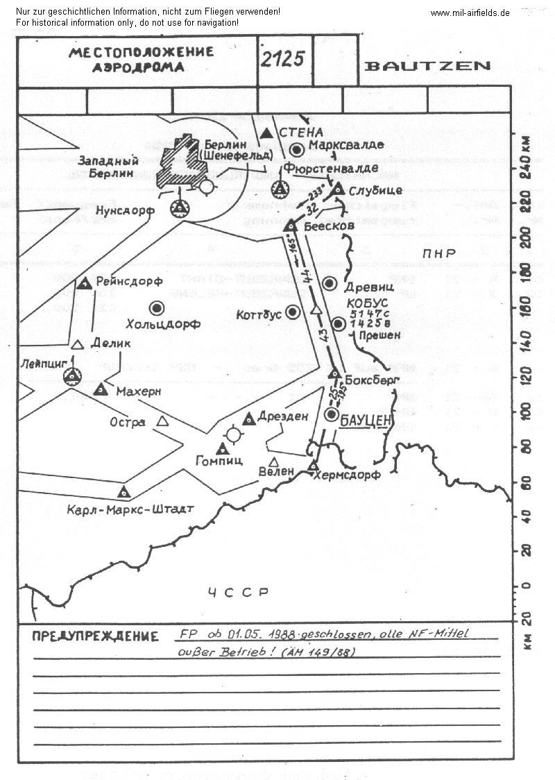
Location of airfield with radio beacons and airways.
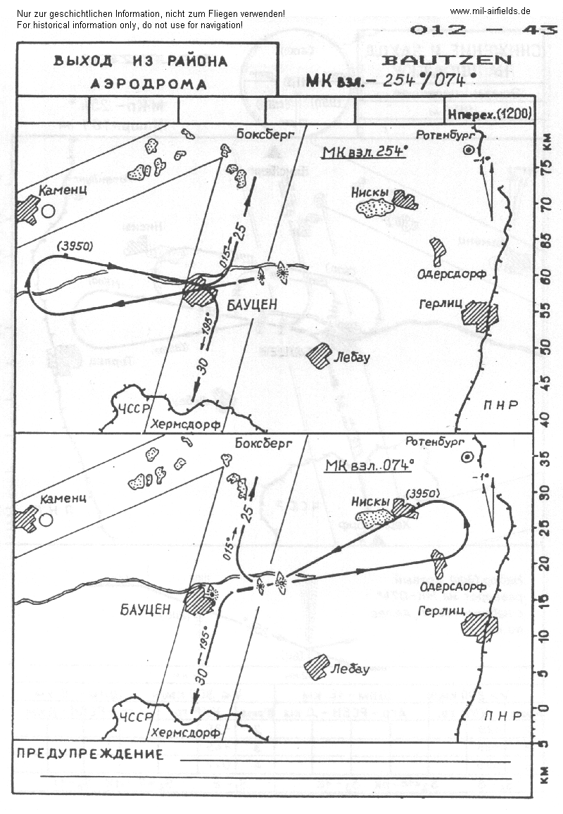
Departure routes for take-off directions 254° and 074° to airway A4
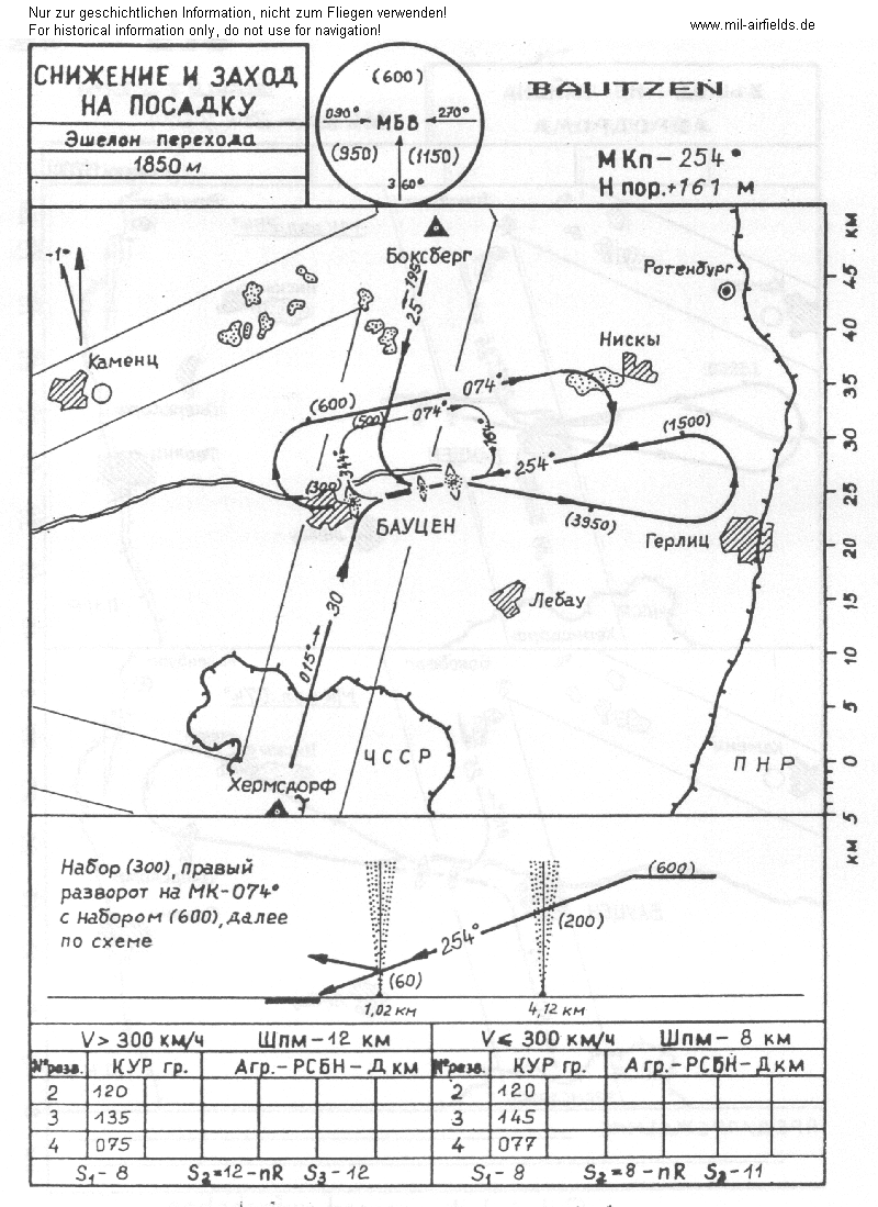
Approach for main landing direction 254°
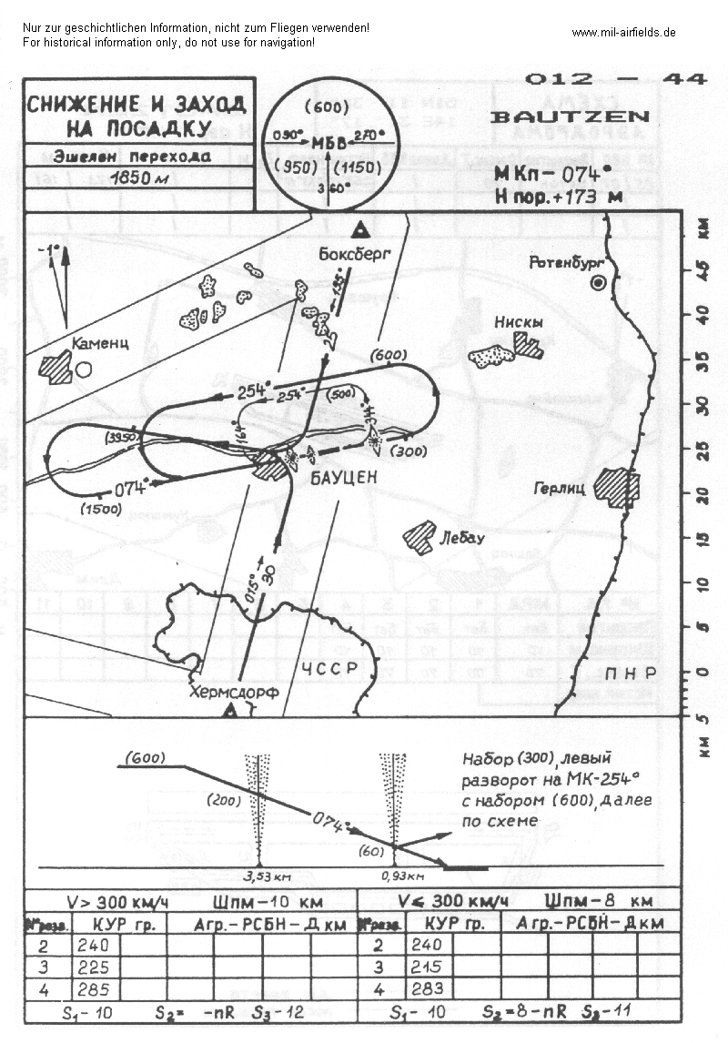
Approach for secondary landing direction 074°
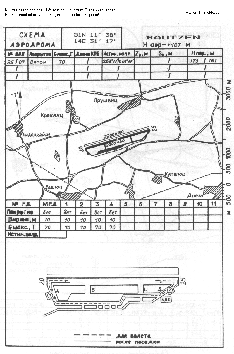
Airfield map
Standard training routes
"Flüge der LSK/LV der NVA und der LSK der GSSD im Rahmen der Gefechtsausbildung sind entsprechend der Grafik der Flugtage / -nächte auf der Grundlage der "Hauptflugregeln zum Fliegen im Luftraum der Deutschen Demokratischen Republik" auf Standardflugstrecken in den dazu festgelegten Flughöhen durchzuführen. ..." (Quelle: "Verzeichnis der Standardflugstrecken der LSK/LV der NVA und der LSK der GSSD"
For the year 1989:
772 Bautzen, Bad Schandau, Freiberg, Riesa, Kamenz, Bautzen
Altitude: 4250 bis 4900 m
Climb: Freiberg
Descend: Kamenz
Interception leg: Freiberg, Kamenz
(Flights only in coordination with VHZ)
Altitude: 4250 bis 4900 m
Climb: Freiberg
Descend: Kamenz
Interception leg: Freiberg, Kamenz
(Flights only in coordination with VHZ)
773 Bautzen, Bad Schandau, Wolkenstein, right turn, Kamenz, Bautzen
Altitude: 5500 m
Climb: Traverse Glashütte
Descend: Kamenz
Interception leg: Traverse Glashütte, Kamenz
Altitude: 5500 m
Climb: Traverse Glashütte
Descend: Kamenz
Interception leg: Traverse Glashütte, Kamenz
774 Bautzen, Spreefurt, Hohnstein, Rumburk, Bautzen
Altitude: 100 bis 900 m
Climb: Spreefurt
Descent: Rumburk
Interception leg: Spreefurt, Hohnstein
Altitude: 100 bis 900 m
Climb: Spreefurt
Descent: Rumburk
Interception leg: Spreefurt, Hohnstein
775 Bautzen, Weissenberg, firing range Neudorf, Bautzen
Altitude: 100 bis 1200 m
Climb: Weissenberg
Descend: Bautzen FMP
Altitude: 100 bis 1200 m
Climb: Weissenberg
Descend: Bautzen FMP
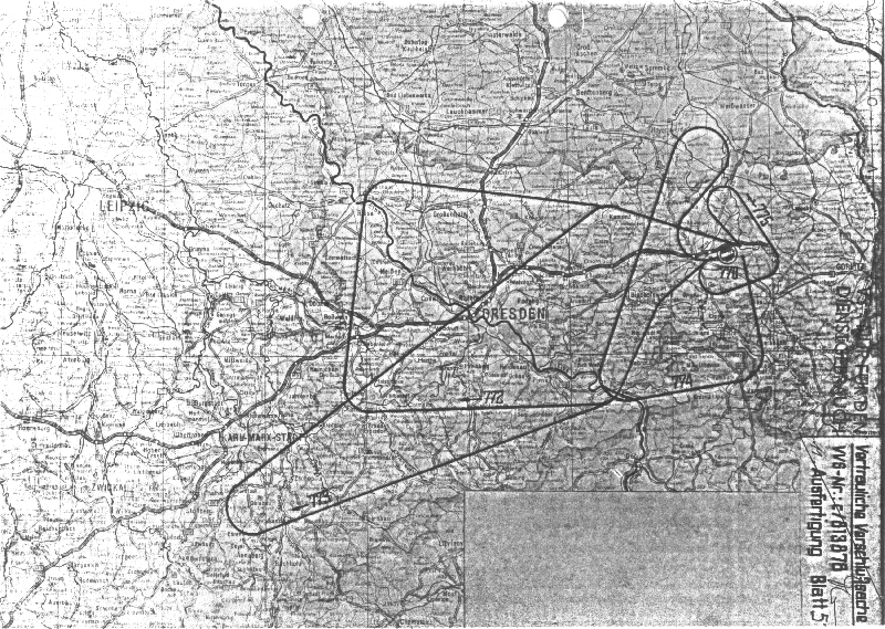
Map of standard training routes
Units
East german airforce units at Bautzen in 1990:
- Offiziershochschule der LSK/LV für Militärflieger "Otto Lilienthal" (OHS MF, Postfach 35881)
- Nachr.- u. Flugsich.werkst. u. Lager (OHS MF NFWL, Postfach 35898)
- Fliegerausbildungsgeschwader 25 "Leander Ratz" (FAG-25, PF 35838) ausgerüstet mit L-39ZO
- Fliegertechnisches Bataillon 25 (FTB-25, PF 56048)
- Nachrichten- und Flugsicherungsbataillon 25 (NFB-25, PF 78339)
- NFB-25 Radarstellung (PF 35863)
- Waffenwerkstatt und -lager 14 (WWL-14, PF 65916)
Real property
| Installation Id | Object | Area | Quarters | Address |
|---|---|---|---|---|
| 12/085 | Kaserne | Käthe-Kollwitz-Str. 17 | ||
| 12/086 | Flugplatz | 221,8 | 14 | |
| 12/087 | Training area FAG-25 | 17,5 | Spreewiese, In der Lungenwiese | |
| 12/100 | Radar site NFB-25 | Zschillichau, Jörksberg | ||
| 12/151 | Storage area FAG-25 | 0,6 | Kubschütz, near railway | |
| 12/173 | Housing FTB-25 | 0,2 | 56 | Bautzen, Paulistr. 1A |
| 12/187 | Amunition depot FTB-25 | 8,4 | 5 | Drehsa, east of Carlsberg |
| 12/286 | Recreation object FAG-25 | Bautzen, An der Talsperre | ||
| 06/330 | Object FTB-25 | 0,1 | 8 | Goyatz, Schwielochsee |
The former National People's Army installation id was made of the district number (06: Cottbus, 12: Dresden) and a sequence number.
Today
Use
After reunification collection point for surplus military equipment. Now general aviation.
Real property
The following picture was provided by csc. Thanks a lot!
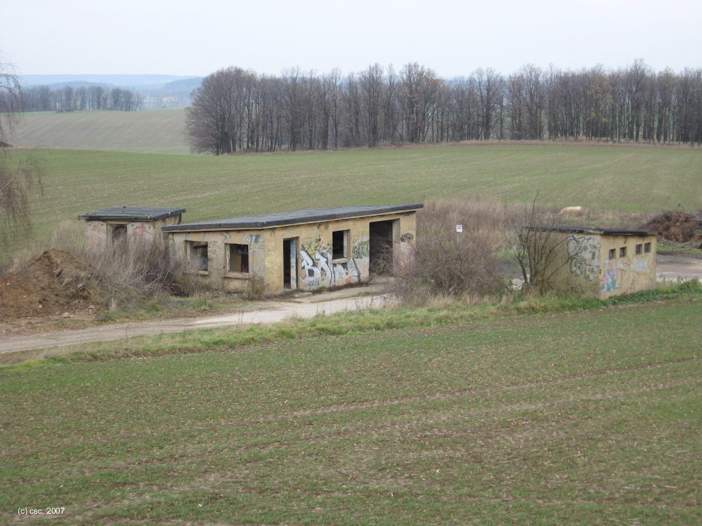
Relicts of the FAG-25 storage area at Kubschuetz (2007)
Source: csc
Links
- http://www.history.hqusareur.army.mil/uslmannual.htm (offline): USMLM Unit History 1972 - Notice about deployment of L-29 from Bautzen to Demmin-Tutow for 45 days in March 1972
- http://www.history.hqusareur.army.mil/uslmannual.htm (offline): USMLM Unit History 1978 - Notice about reequipment from L-29 to L-39; Notice and picture of the precision approach radar at Bautzen (modified HAY POLE)
- http://www.history.hqusareur.army.mil/uslmannual.htm (offline): USMLM Unit History 1979 - Notice about L-39 with unguided rockets.
- http://www.history.hqusareur.army.mil/uslmannual.htm (offline): USMLM Unit History 1982 - Sighting of a unknown RSBN system at Bautzen at the 10 July 1982 (with two pictures)
Bibliography
- : "Fliegerrevue 1/1983" - This east german publication shows a picture with some approach maps of Bautzen in the background. This is remarkable, as such information was usually kept secret. The publication was possibly unintentionally.
- Freundt, Lutz: "Sowjetische Fliegerkräfte in Deutschland 1945-1994, Band 4" Edition Freundt Eigenverlag, Diepholz 2000 - Short notice about soviet flying units at Bautzen.
- Bußmann, Kleest, Freundt: ""11-80, katapultieren Sie!"" AeroLit - Verlag und Medienvertrieb, Berlin, 2004 - Short descriptions about aircraft accidents, including some at Bautzen.
- Banach, Bußmann, Girke, Meißner, Willisch, Freundt: "MiG, Mi, Su & Co." AeroLit - Verlag und Medienvertrieb, Berlin, 2002 - Some pictures from Bautzen airbase.
- Billig, Detlef; Meyer, Manfred: "Flugzeuge der DDR, II. Band bis 1972" TOM Modellbau, Friedland, 2002 - Several pictures of L-29 at Bautzen
- Billig, Detlef; Meyer, Manfred: "Flugzeuge der DDR, III. Band bis 1990" TOM Modellbau, Friedland, 2003 - Picture of a L-39 at the flightline at Bautzen
- Billig, Detlef; Meyer, Manfred: "Flugzeuge der DDR, IV. Band" TOM Modellbau, Friedland, 2004 - Pictures of L-29 and L-39; one picture shows both types at the flightline.
Related topics
Airfields in the vicinity
- 349°/7km Zschillichau: Helipad 3052 (HSLP / HLP 3052)
- 053°/28km Hähnichen: Helipad 3038 (HSLP / HLP 3038)
- 097°/30km Görlitz: Airfield (Zhorjelc)
- 293°/30km Kamenz: Airfield
Categories
Military Airfields GermanyMilitary Airfields in former East GermanyAir bases of former National People's ArmyRecommended
Image credits are shown on the respective target page, click on the preview to open it.
