For historical information only, do not use for navigation or aviation purposes!
| Coordinates | N525053 E0134325 (WGS84) Google Maps |
| Former East Germany (GDR) | District of Frankfurt/O |
| Federal state | Brandenburg |
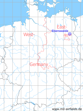
Germany during the Cold War Map
The history of the Cold War airfields: Eberswalde
Location of airfield
Northern edge of Finow
Usage during the Cold War
Helipad 1036 for Tank Equipment Depot 32 (Panzergerätelager 32, PGL-32) of former East German Ministry of National Defense (MfNV/NVA).
Use today
Closed.
Runways, taxiways, aprons
Dimensions: 64 m x 106 m,
Main takeoff and landing direction: 0°, 90°,
Surface: Grass (Athletic field),
Capacity: 2 helicopters.
Main takeoff and landing direction: 0°, 90°,
Surface: Grass (Athletic field),
Capacity: 2 helicopters.
Airspace and procedures
Alert time: 180 minutes.
Obstacles
Water tower: direction 180°, distance 200 m, height 54 m;
Smokestacks: direction 270°, distance 300 - 400 m, height 50 - 60 m.
Smokestacks: direction 270°, distance 300 - 400 m, height 50 - 60 m.
Units
Tank Equipment Depot 32 (PGL-32) was directly subordinated to the Ministry of National Defense (MfNV).
- Postal address: PO box 56020
- Address: Altenhofer Str., 1300 Eberswalde-Finow
- National People's Army installation ID: 05/083.
- Postal address: PO box 56020
- Address: Altenhofer Str., 1300 Eberswalde-Finow
- National People's Army installation ID: 05/083.
Airfields in the vicinity
Categories
Military Airfields GermanyMilitary Airfields in former East GermanyHelipads of former National People's ArmyRecommended
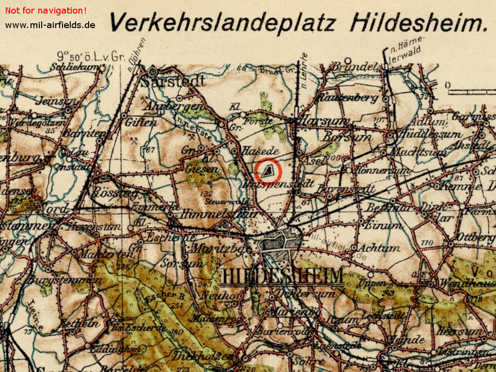
Image credits are shown on the respective target page, click on the preview to open it.
 Follow mil-airfields on Facebook