For historical information only, do not use for navigation or aviation purposes!
| Coordinates | N524844 E0134612 (WGS84) Google Maps |
| Former East Germany (GDR) | District of Frankfurt/O |
| Federal state | Brandenburg |
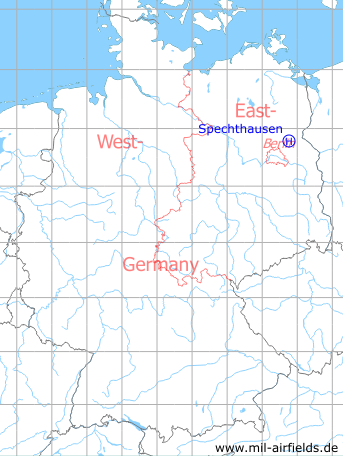
Germany during the Cold War Map
The history of the Cold War airfields: Spechthausen
Location of airfield
500 m west-northwest of Spechthausen center, probably on the athletic field.
Usage during the Cold War
Helipad 1026 for Material Depot 2 (MaL-2) of former East German Ministry of National Defense (MfNV/NVA).
Use today
Closed.
Runways, taxiways, aprons
Dimensions: 72 m x 48 m,
Main takeoff and landing direction: Südost,
Surface: Grass,
Capacity: 1 helicopter.
Main takeoff and landing direction: Südost,
Surface: Grass,
Capacity: 1 helicopter.
Telephone
Sondernetz/Stabsnetz S1 5887
Airspace and procedures
Usable at day during good weather conditions.
Alert time: 30 minutes.
Alert time: 30 minutes.
Obstacles
Except for southeastern direction: pine trees 18 m - 23 m height, in a distance of 35..75 m from the center.
Units
Material Depot 2 (Materiallager 2, MaL-2) was directly subordinated to the Ministry of National Defense (MfNV).
- Postal address: PO Box 46131,
- Address: 1301 Spechthausen, Dorfstr. 1,
- National People's Army installation ID: 05/084.
- Postal address: PO Box 46131,
- Address: 1301 Spechthausen, Dorfstr. 1,
- National People's Army installation ID: 05/084.
Airfields in the vicinity
- 288°/5km Finow: Air Base (Eberswalde-Finow, Аэродром Финов)
- 322°/5km Eberswalde: Helipad 1036 (HSLP / HLP 1036, Eberswalde-Finow)
- 123°/15km Wollenberg: Helipad 3025 (HSLP 3025)
- 211°/15km Albertshof: Airfield
- 224°/15km Ladeburg: Helipad 3106 (HSLP 3106)
- 236°/19km Ladeburg: Object 5020
- 180°/20km Werneuchen: Air Base (Аэродром Вернейхен (ГДР))
- 080°/21km Altglietzen: Airfield (Alt-Glietzen)
 Follow mil-airfields on Facebook