For historical information only, do not use for navigation or aviation purposes!
| Coordinates | N515323 E0143200 (WGS84) Google Maps |
| Elevation | 80 m |
| Former East Germany (GDR) | District of Cottbus |
| Federal state | Brandenburg |
| Location indicator | EDCD (2000) |
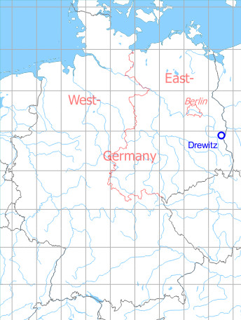
Germany during the Cold War Map
The history of the Cold War airfields: Drewitz
Location of airfield
Southeast of Drewitz, northwest of Jänschwalde.
During World War II
Use
Luftwaffe airfield.
Situation
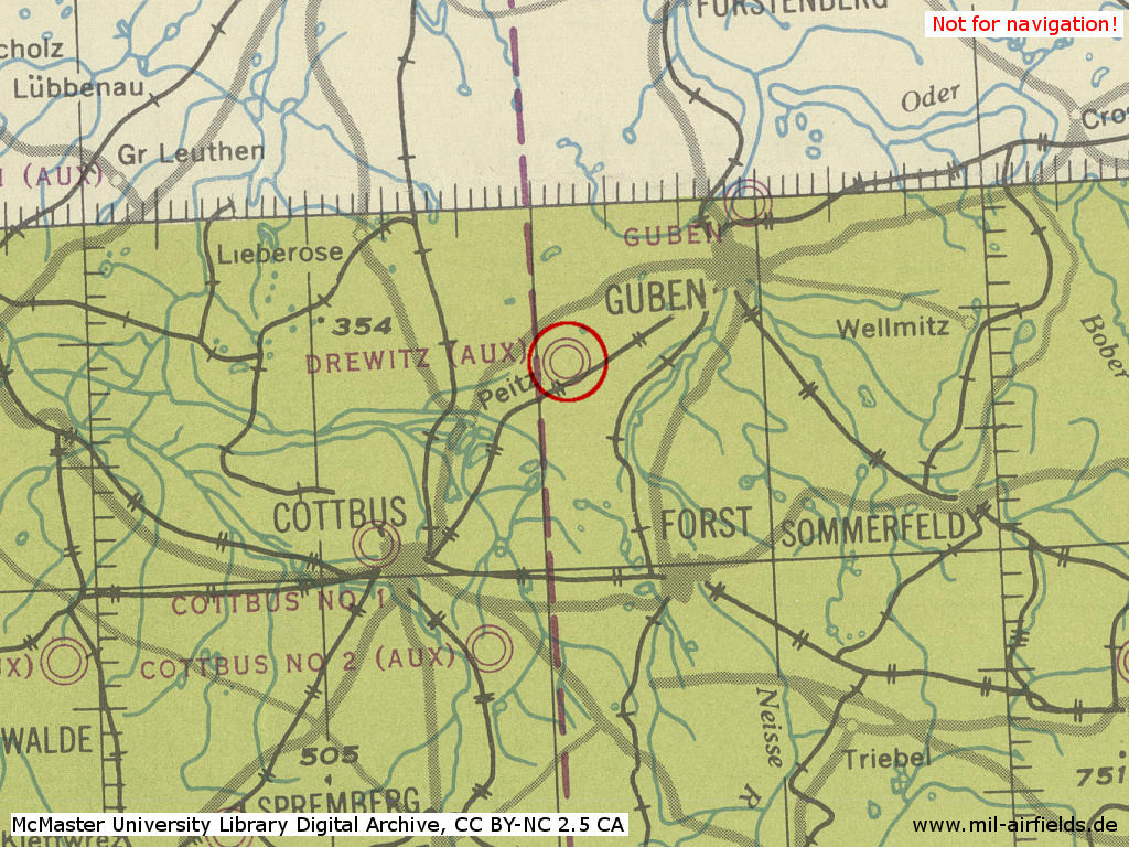
Drewitz airfield in World War II on a US map from 1943
Source: McMaster University Library Digital Archive, License: Creative Commons Attribution-NonCommercial 2.5 CC BY-NC 2.5 CA /MULDA/
During the Cold War
Use
Airbase for former East German Air Force (LSK/LV). Fighter Wing 7 (JG-7) until 1989, Fighter-Bomber Wing 37 (JBG-37) and Tactical Reconnaissance Squadron (TAFS-87).
History
- 1949
The is no unit permanently stationed at the field, but occasionally Drewitz is used by Soviet ground attack units.. - April 1950
A Soviet bomber regiment with 30 to 40 Pe-2 aircraft is transferred from Cottbus to Drewitz. - October 1950
The Soviet bomber regiment moves back again from Drewitz to Cottbus - July 1951
Drewitz airfield is being surveyed. The airfield is to be extended. - August 1951
60 workers erect temporary buildings. The construction is supposed to start after the work on the Welzow Air Base has been completed. - September 1951
The landing field is covered with high grass. The wooden buildings north of the field, which had been occupied by refugees, were partly evacuated recently. But construction work has not begun. - May 1952
The wooden buildings are occupied by construction workers. Clearing work is in progress. The airfield to be build will resemble the two large bomber airfields in Brand and Werneuchen. Construction is done by Bauunion Dresden. - June 1952
480 workers are employed at the field and the number increases daily. Preliminary work started for the construction of a 2,5-meter high wooden fence around the field. For 1952, construction of the runway, the southern taxiway with hardstands and of a cantonment is planned. Barracks installations and hangars are scheduled to be build in 1952/53, and an aircraft plant is to be built in 1953. The construction is under Soviet supervision from Werder. - July 1952
Bauunion Dresden starts the construction work. The planned date of completion is set at May 1954. - September 1952
Concreting of the runway in east-west-direction has begun. It is 2,480 m long and 80 m wide. A second runway is planned, 3,250 m long and 85 m wide. - December 1952
The runway is completed. - May 1953
In the night of 1 to 2 May 1953, a large wooden storage shed at the field burns down. Other sources speak of multiple fires in which several field rail locomotives were destroyed. - Die KVP-Einheit 302 verlegt von Kamenz nach Drewitz.
- June 1953
2,500 to 3,000 workers are employed on the project. The majority of the workers came from the airfield construction project at Bautzen-Litten. - Juni 1953
Several MiG-15 and Yak-11 are stationed at the field. They were hurriedly transfered to Cottbus after 17 June. - July 1953
The southern taxiway with attached aircraft revetments is finished. - April 1954
Drewitz is occupied by the "Aeroclub 700" and the Technical Base 302. - 03 June 1954
Crash of a Yak in bad weather near Niesky. Both pilots were killed. - 20 June 1955
Aircraft in Drewitz: 4 Yak-11, 9 Yak-18, 1 Po-2 - 25 June 1955
Crash of an aircraft in the vicinity of Zeithain (?), killing the pilot. - 1957
The field is occupied by the HQ 3rd Fighter Division, the 7th Wing (with 4 squadrons) and the 9th Wing (with 3 squadrons). Both wings have 34 MiG-15/MiG-15UTI and 12 Yak-11. - 16 March 1985
On the approach to Drewitz, MiG-21 "590" of Fighter Wing 7 crashes into a dormitory of the Cottbus university. Pilot can safely eject, two injured on the ground.
In the 1950s
Overview
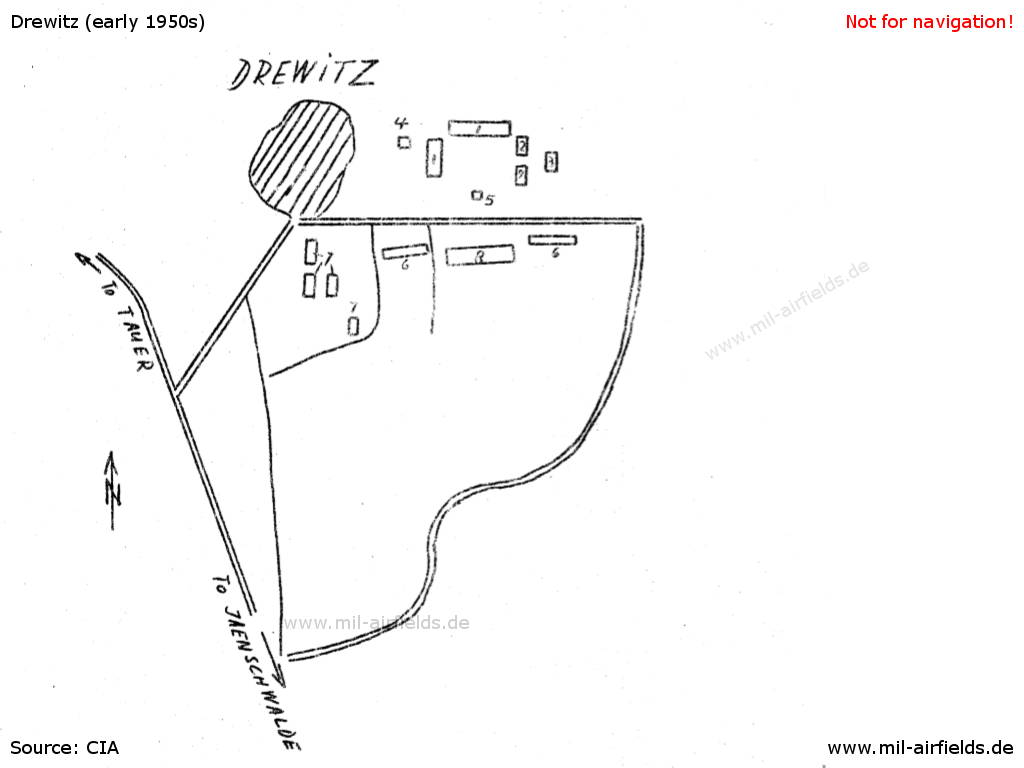
The airfield before extension, ca. 1951
Source: CIA
| 1 | Barracks installations with 20 windows each |
| 2 | Barracks installations with 8 windows each |
| 3 | Barracks installations with 6 windows |
| 4 | Watchtower, about 20 meters high |
| 5 | ? |
| 6 | ? |
| 7 | Barracks installations occupied by civilians |
| 8 | Hangar |
In the 1960s
Overview
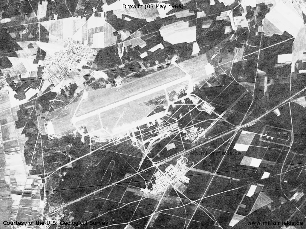
Drewitz Air Base on a US satellite image from 03 May 1965
Source: U.S. Geological Survey
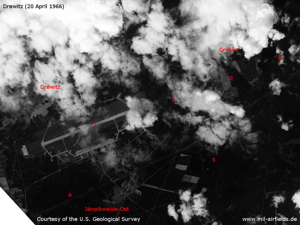
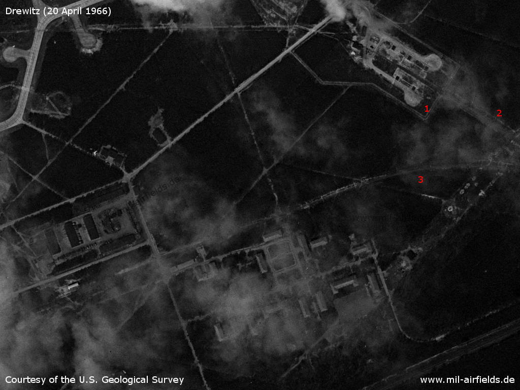
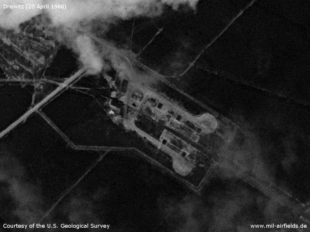
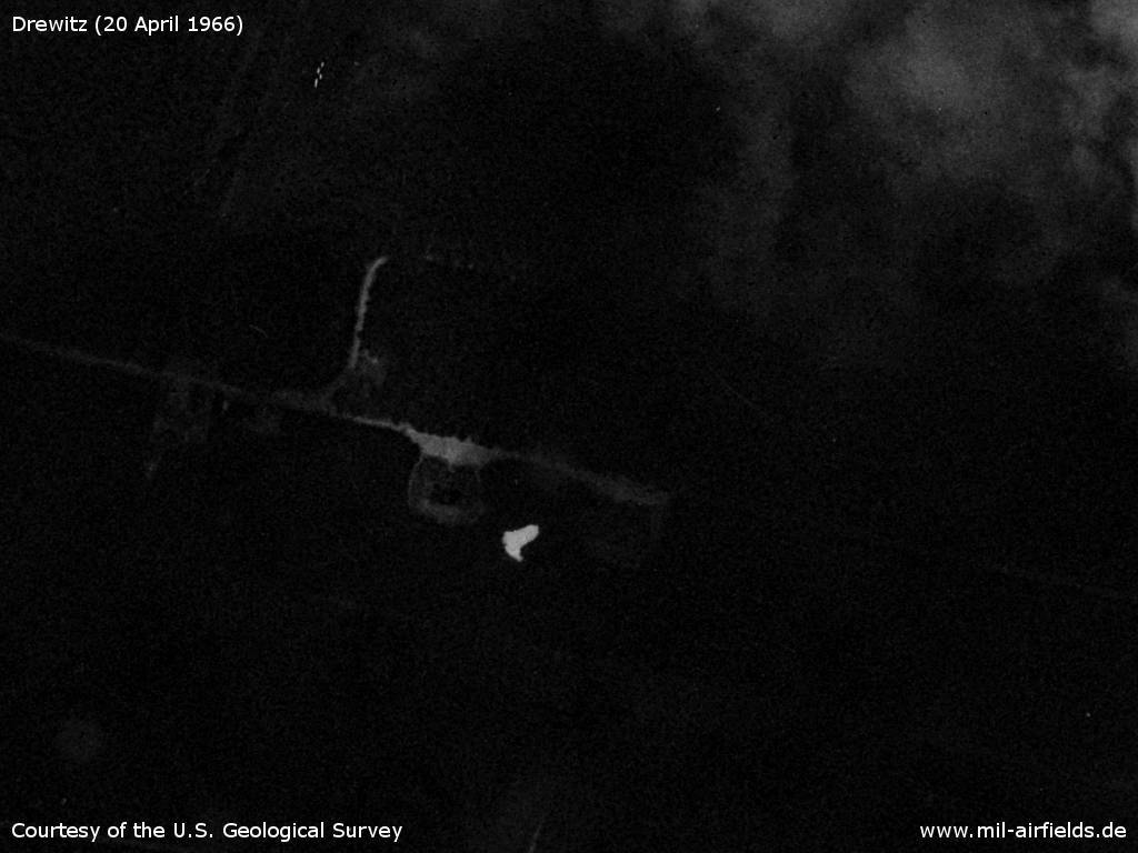
Drewitz on 20 April 1966 - 1: air base; 2: inner radio beacon; 3: direction finder? 4: outer radio beacon; 5: ammunition dump. a: Railway line Guben-Cottbus. Other places: Grabkow, Jänschwalde-Ost.
Source: U.S. Geological Survey
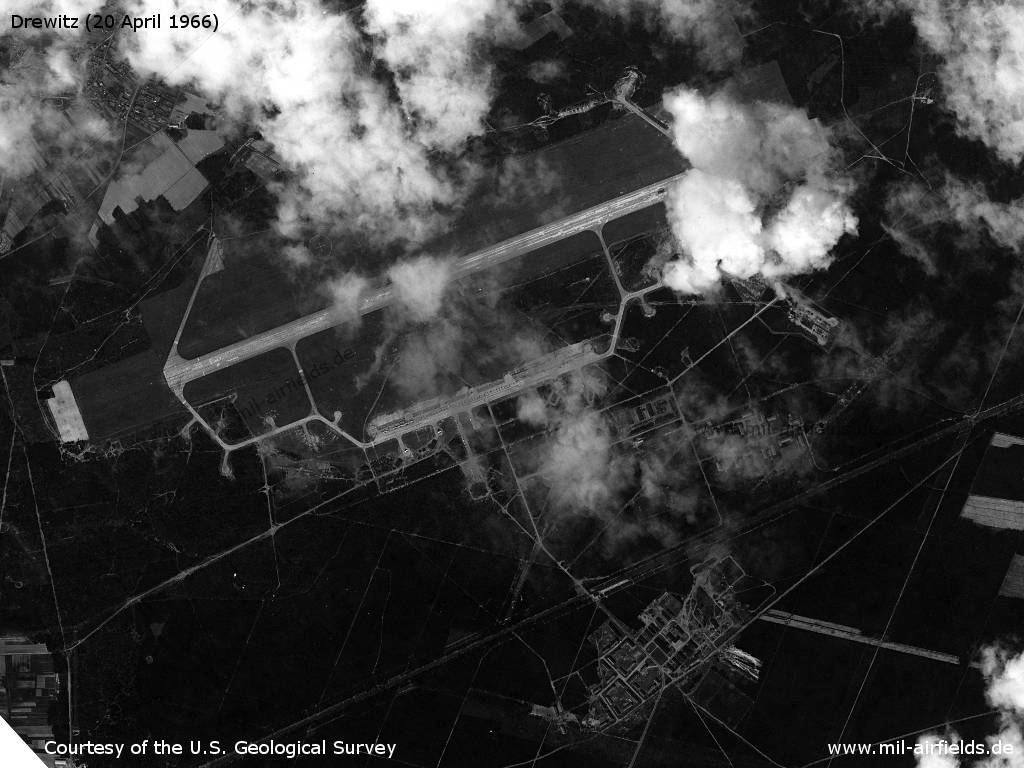
The airfield
Source: U.S. Geological Survey
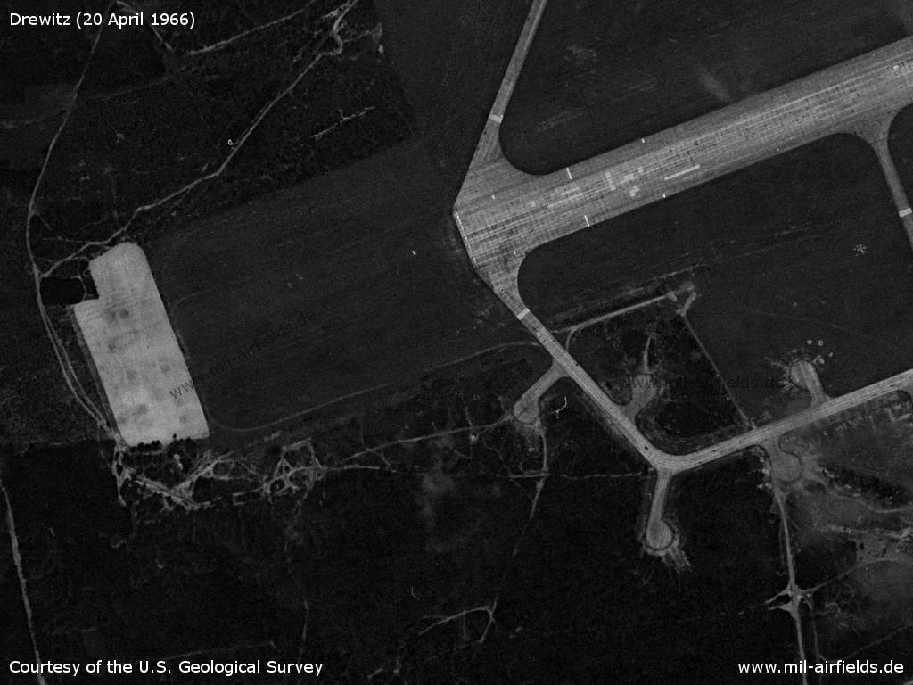
Northwestern part - The installations in the north are still incomplete, the taxiway leads away from the runway to the north east, but ends there.
Source: U.S. Geological Survey
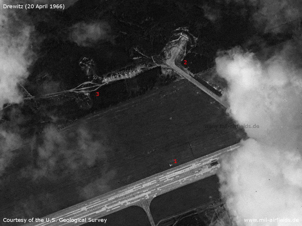
Northeastern part - 1: landing T; 2: zeroing-in stand; 3: Further parking pads have already been cleared, but not yet built.
Source: U.S. Geological Survey
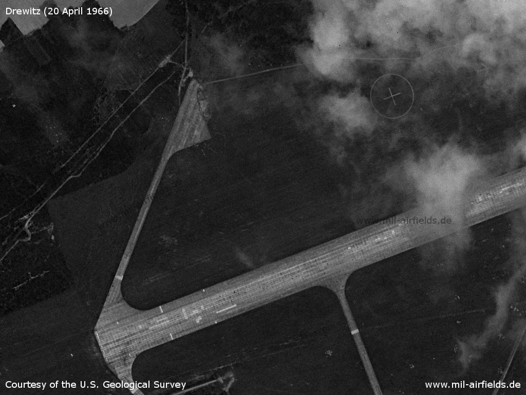
Western end of the runway - The bright surface on the left side is the so-called earth brake surface. It is used to brake aircraft that have rolled over the end of the runway.
Source: U.S. Geological Survey
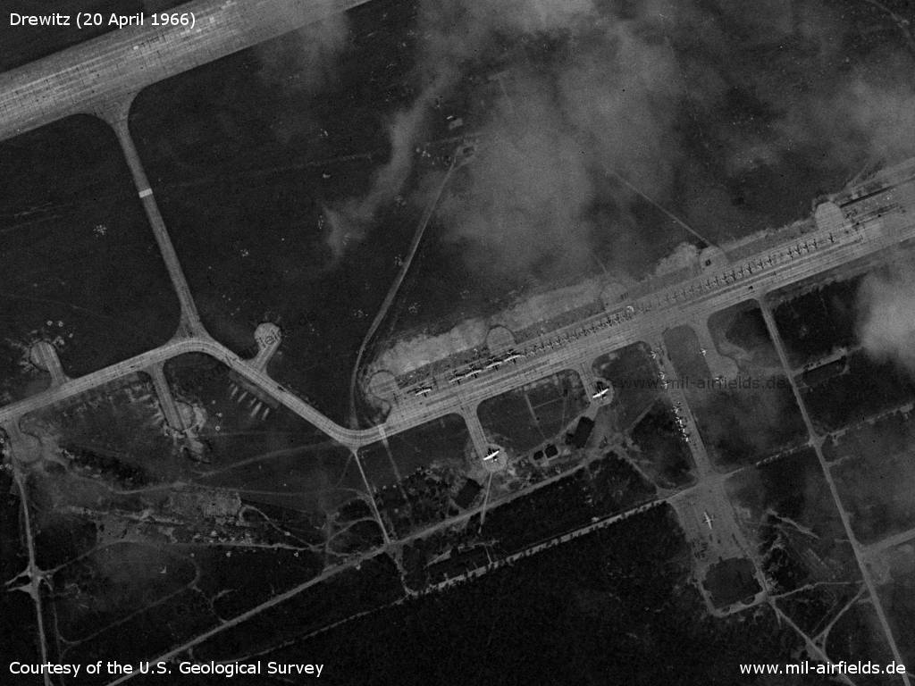
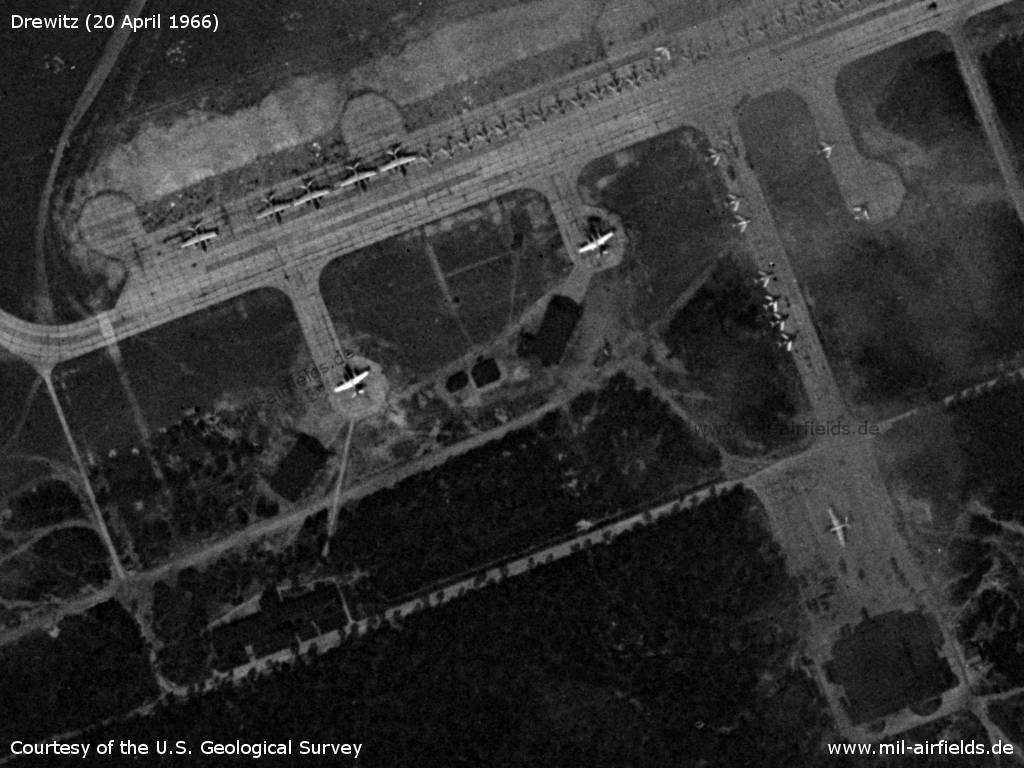
Western part of the flightline - There are planes Il-28 and MiG-15/MiG-17.
Source: U.S. Geological Survey
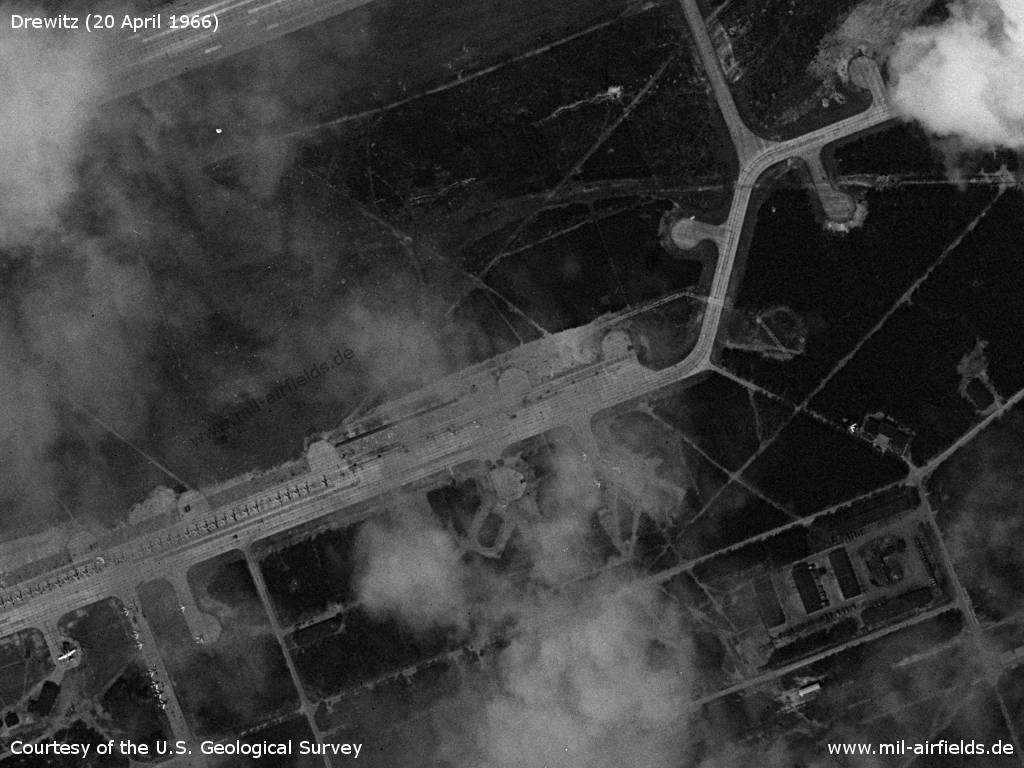
Eastern part of the flightline
Source: U.S. Geological Survey
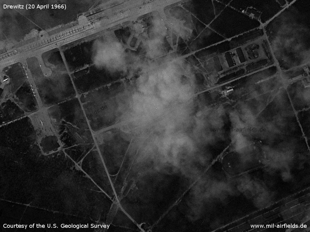
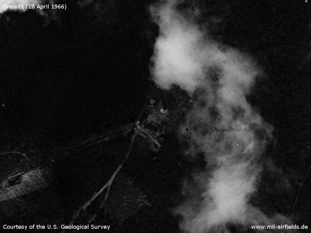
Buildings south
Source: U.S. Geological Survey
Further installations - 1: fuel dump; 2, 3: railway sidings
Source: U.S. Geological Survey
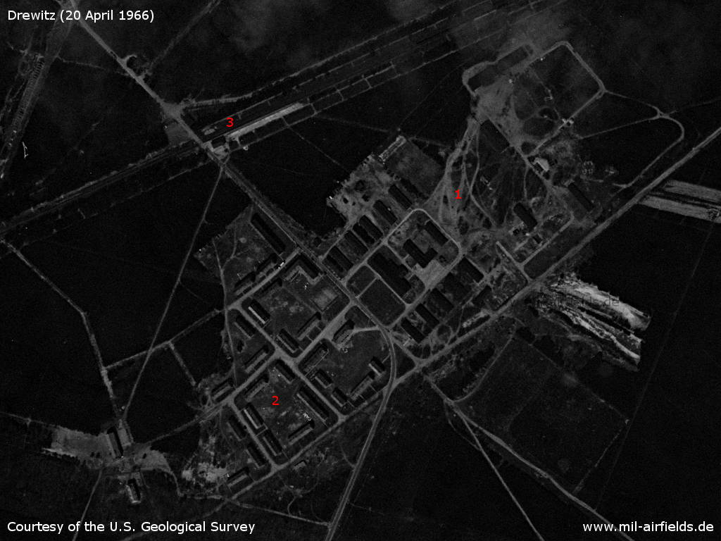
Installations south of the railway - 1: Barracks; 2: National People's Army housing area; 3: Jänschwalde-Ost railway station.
Source: U.S. Geological Survey
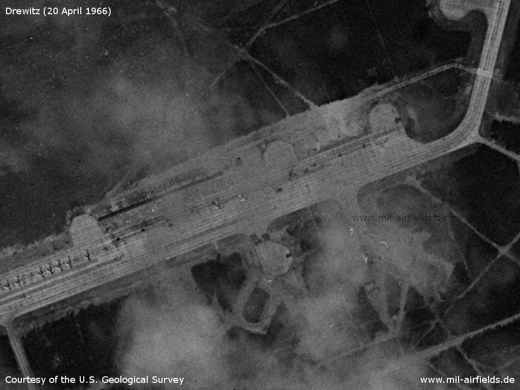
Aircraft - The picture shows eight aircraft of the type Ilyushin Il-28, which were used in the East German National People's Army for the target towing.
Source: U.S. Geological Survey
Further airplanes
Source: U.S. Geological Survey
Fuel dump with railway spur - In the northwestern part of the tank farm there are 5 cars on the siding, probably tank cars.
Source: U.S. Geological Survey
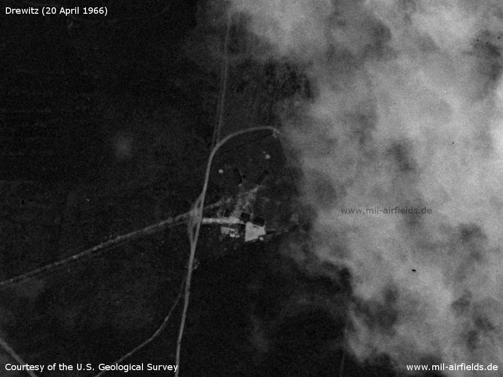
Inner radio beacon, approx. 1,000 m from the runway
Source: U.S. Geological Survey
Direction finder? approx. 2,500 m from the runway
Source: U.S. Geological Survey
Outer radio beacon, approx. 3,900 m from the runway
Source: U.S. Geological Survey
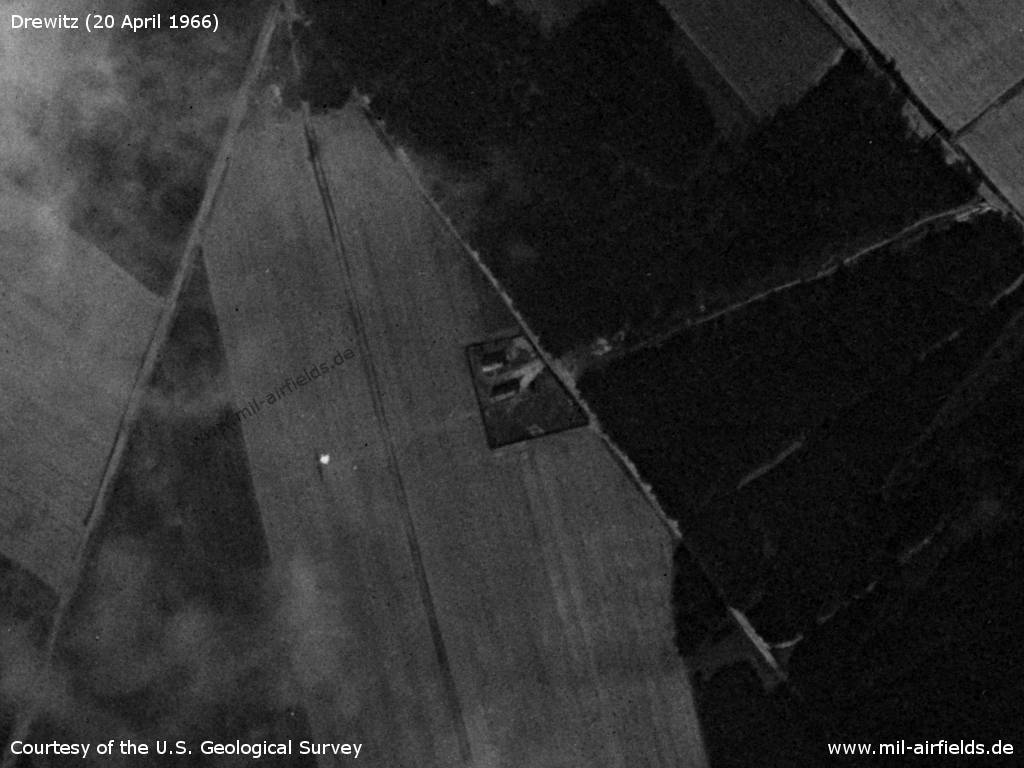
Ammunition dump
Source: U.S. Geological Survey
In the 1970s
Situation
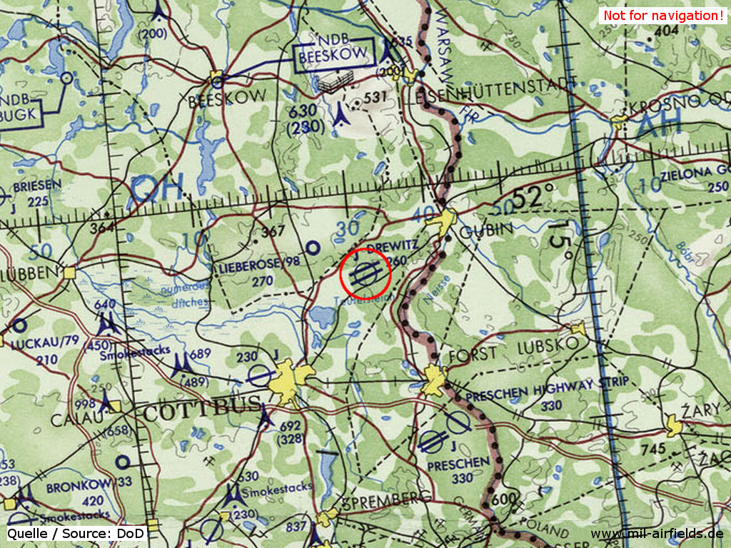
Drewitz airfield on a map of the US Department of Defense from 1972
Source: ONC E-2 (1972), Perry-Castañeda Library Map Collection, University of Texas at Austin
Overview
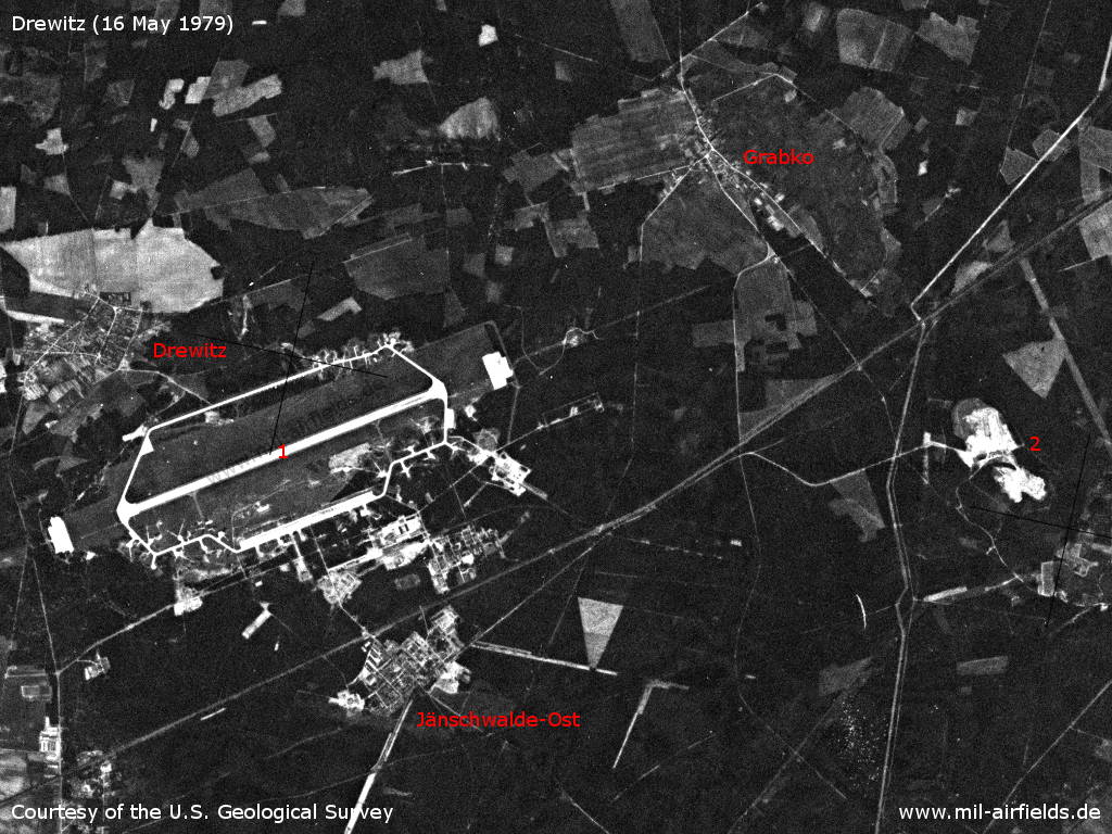
Drewitz National People's Army Air Base on Wednesday 16 May 1979 - 1: airfield; 2: command post and radar site near Taubendorf
Source: U.S. Geological Survey
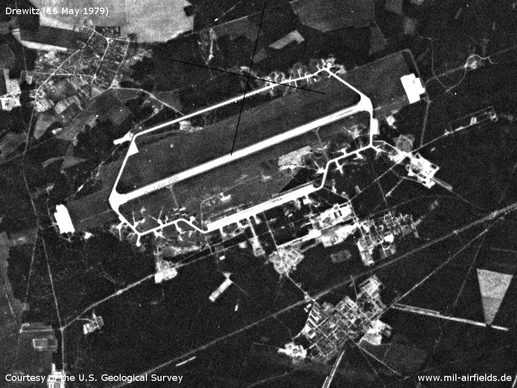
Enlargement
Source: U.S. Geological Survey
In the 1980s and early 1990s
Overview
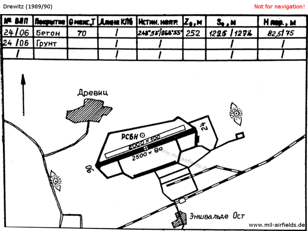
Drewitz air base on a map in the East German "Directory 012" (Verzeichnis 012, formerly "Top Secret") from about 1989/1990. - Hand-drawn maps were quite common in the Eastern bloc. The map shows the villages Drewitz and Jänschwalde-Ost, the airfield with concrete and grass runway, the taxiways, the two locators/middle markers and the RSBN radio beacon.
Runways
- 06/24: 2500 m x 80 m Concrete
- 06/24: 2000 m x 100 m Grass north of the hard-surfaced runway
Die Höhen der Schwellen über NN betrugen: Schwelle Ost 82,5 m und Schwelle West 75 m.
Both landing directions were equiped with a landing system SP-2
Radio beacons
- RSBN: CH13 "RD", N515332 E0143158 (S43/82?)
- LOM 24: 769,0 "RD", 3960 m to threshold 24
- LMM 24: 378,5 "R", 1000 m to threshold 24
- KRM/GRM 24: CH15
- LOM 06: 769,0 "DR", 4000 m to threshold 06
- LMM 06: 378,5 "D", 1000 m to threshold 06
- KRM/GRM 06: CH15
Die Kennungen wurden wie im Warschauer Pakt üblich aus dem ersten und letzten Buchstaben des Rufzeichens (REINHARD) abgeleitet.
Vom Punkt der berechneten Linie bis 5000 m vor dem Aufsetzpunkt tritt eine unkonstante Anzeige des ARK bis max. + 10 Grad auf.
Radio communication
The radio call sign of the airfield was REINHARD. Tower REINHARD-START 138.0 (Channel 7), 124.0 (Channel 1)
Telephone
Stabsnetz S1 9823. The code names were "Zauberflöte" (?) und "Torez" (Command post) (?)
Units
- JG-7 "Wilhelm Pieck": MiG-21
- JGB-37 "Klement Gottwald": MiG-23BN, MiG-23UB; TAFS-87: MiG-21M (PF 94415)
- TAFS-87 (PF 94422)
- FBas-57 (PF 94438), FTB-37 (PF 94455), NFK-37 (PF 94492)
Real property
Objects 1989/1990, in conjunction with the airfield
- 06/015: Flugplatz
- 06/014: Depot JG-7 (29 ha, S der Eisenbahn Cottbus-Guben)
- 06/054: Übungsgelände FBas-57 (7,7 ha, Striesow, Marienberge)
- 06/202: Objekt JG-7 (0,5 ha, Straße Tauer-Jänschwalde)
- 06/309: Objekt JG-7 (0,2 ha, Tauer, Großsee Südufer)
Today
Use
General aviation.
Links
- http://www.mig-21-online.de/ - Die MiG-21 in den LSK/LV der DDR
- http://www.jbg37.de/ - JBG-37
Airfields in the vicinity
Categories
Military Airfields GermanyMilitary Airfields in former East GermanyAir bases of former National People's ArmyRecommended
Image credits are shown on the respective target page, click on the preview to open it.
 Follow mil-airfields on Facebook