For historical information only, do not use for navigation or aviation purposes!
| Coordinates | N515522 E0081822 (WGS84) Google Maps |
| Elevation | 236 ft |
| Federal state | Nordrhein-Westfalen (North Rhine-Westphalia) |
| Location indicator | EDUO (-1995), ETUO (1995-2013) |
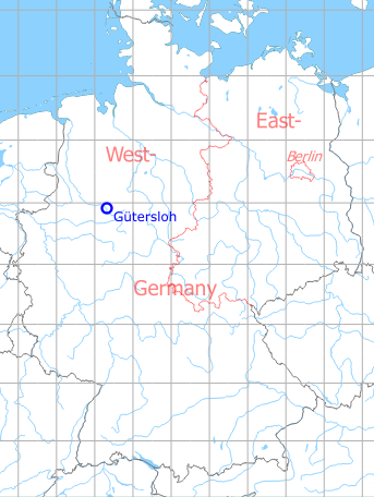
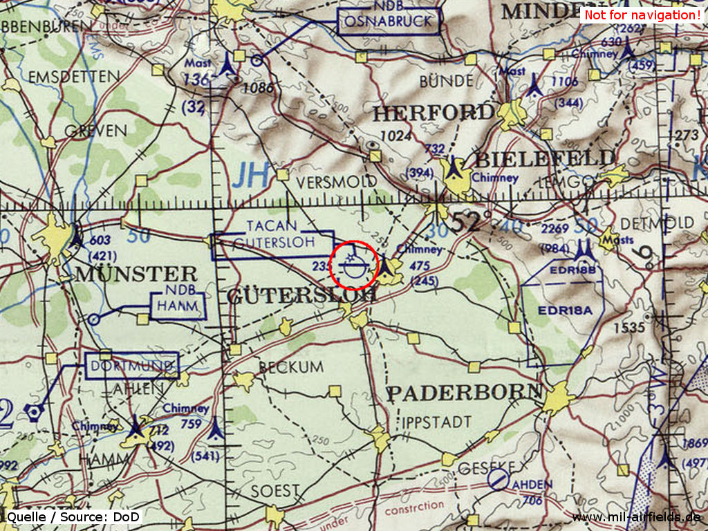
Germany during the Cold War Map
The history of the Cold War airfields: Gütersloh
During World War II
Use
Luftwaffe air base (Fliegerhorst).
Situation
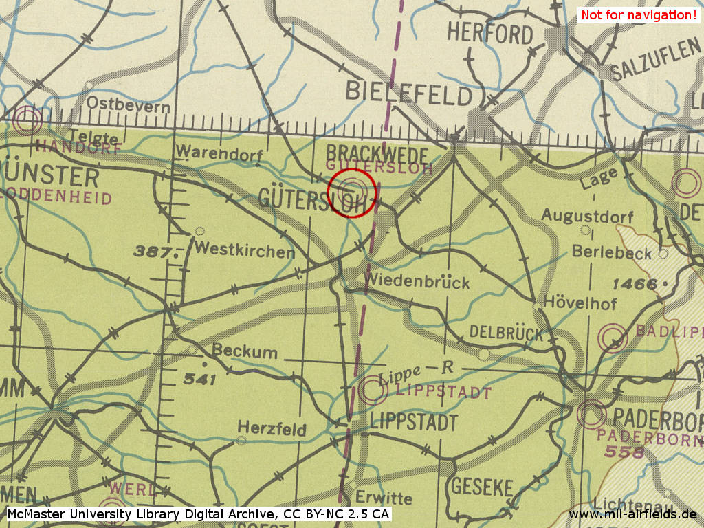
Gütersloh Air Base in World War II on a US map from 1944
Source: McMaster University Library Digital Archive, Lizenz: Creative Commons Attribution-NonCommercial 2.5 CC BY-NC 2.5 CA
During the Cold War
Use
Royal Air Force base.
In the 1950s
Situation
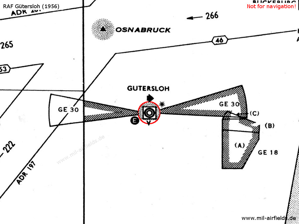
Airspace in 1956 - The approach sectors are protected by restricted areas. The white "E" in the circle symbolizes the Eureka radio beacon, used by the British at this time. The square around the airport symbol with the "V" underneath shows an VHF direction finder. The black star stands for the coded beacons which is characteristical for British airfields
Overview
RAF Gütersloh on a US map from 1952
Source: AMS M841 GSGS 4414, Courtesy Harold B. Lee Library, Brigham Young University
In the 1960s
Runways
- 10/28: 1829 m (6000 ft) x 46 m (150 ft) paved
- 10/28: 1698 m (5570 ft) x 66 m (216 ft) Grass
- 12/30: 506 m (1660 ft) x 102 m (335 ft) Grass
Lights
Identification beacon with morse code "GS".
Radio beacons
- NDB: 439 "GS", at field
Radio communication
- Gütersloh Approach Control 131.58, 102.6
- Gütersloh Tower 257.8, 135.72, 119.7, 117.9
In the 1970s
Situation
RAF Gütersloh on a map of the US Department of Defense from 1972
Source: ONC E-2 (1972), Perry-Castañeda Library Map Collection, University of Texas at Austin
Overview
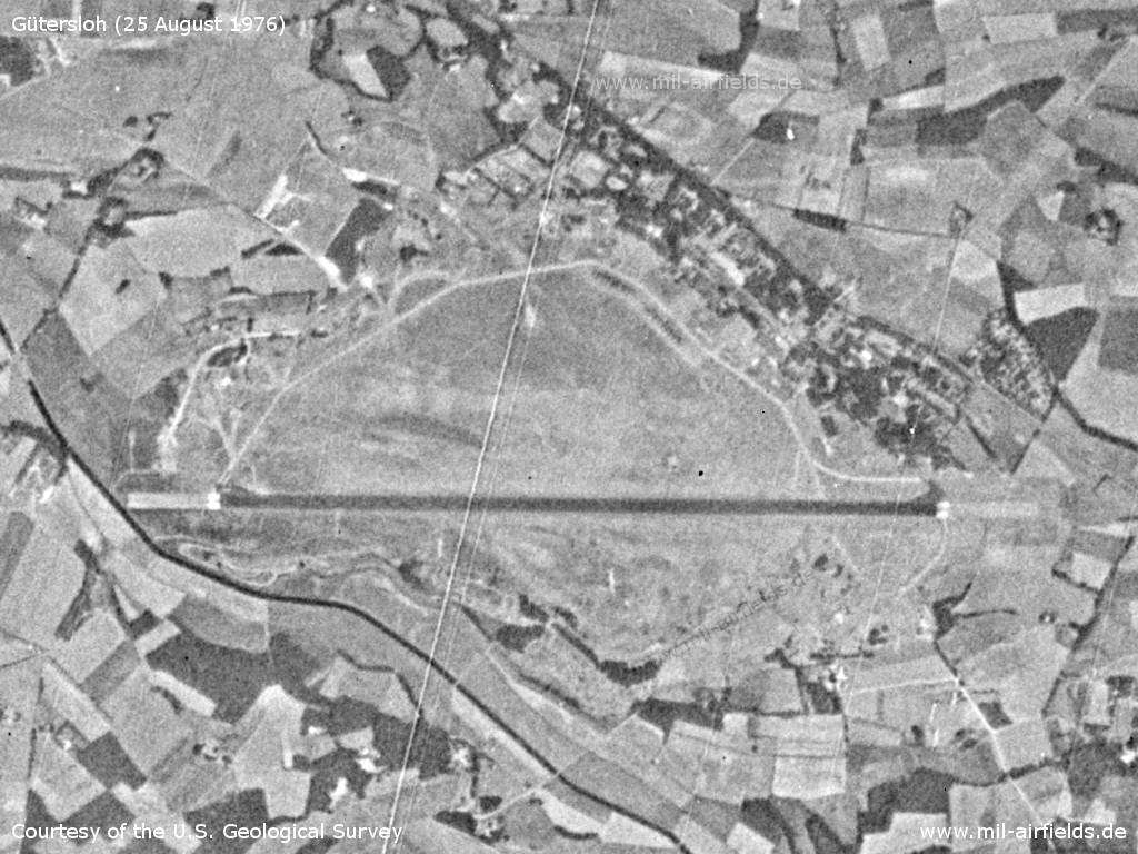
Gütersloh Air Base on a US satellite image from Wednesday 25 August 1976
Source: U.S. Geological Survey
In the 1980s
Overview
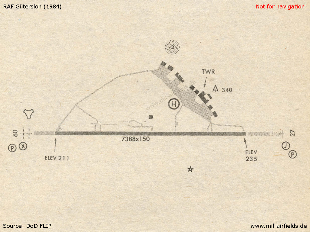
Karte 1984
Source: US DoD
Source: Datenquelle: Land NRW (2019), Datenlizenz Deutschland - Namensnennung - Version 2.0, www.govdata.de/dl-de/by-2.0
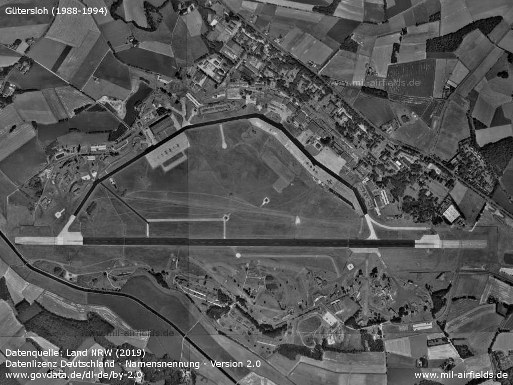
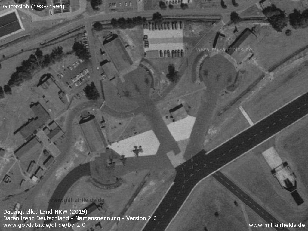
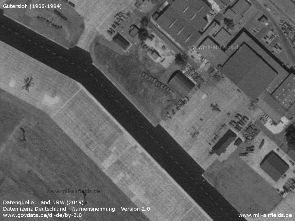
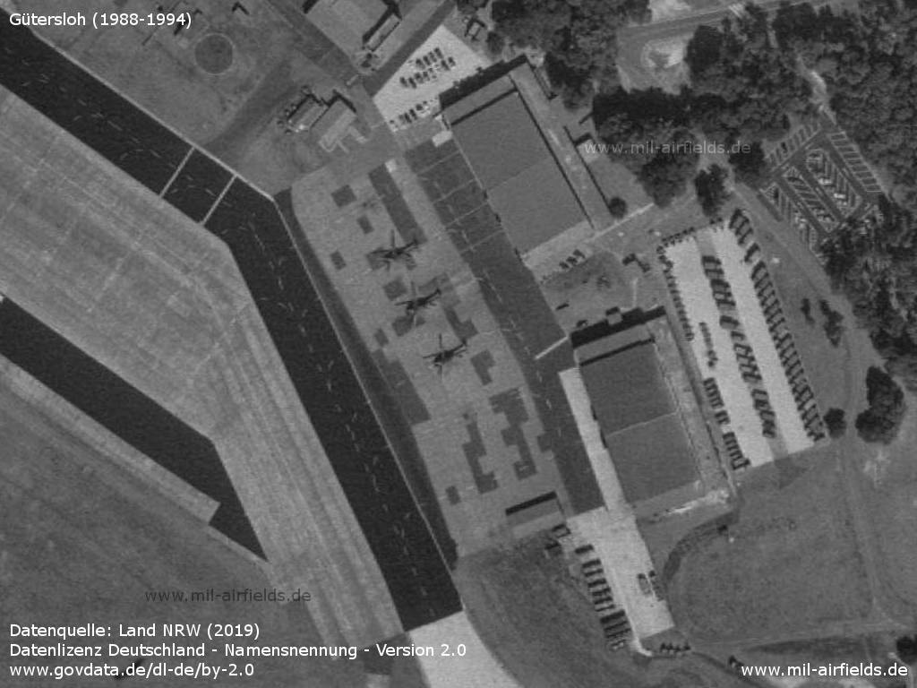
Aerial image (1988-1994)
Three Harrier in the northwestern are
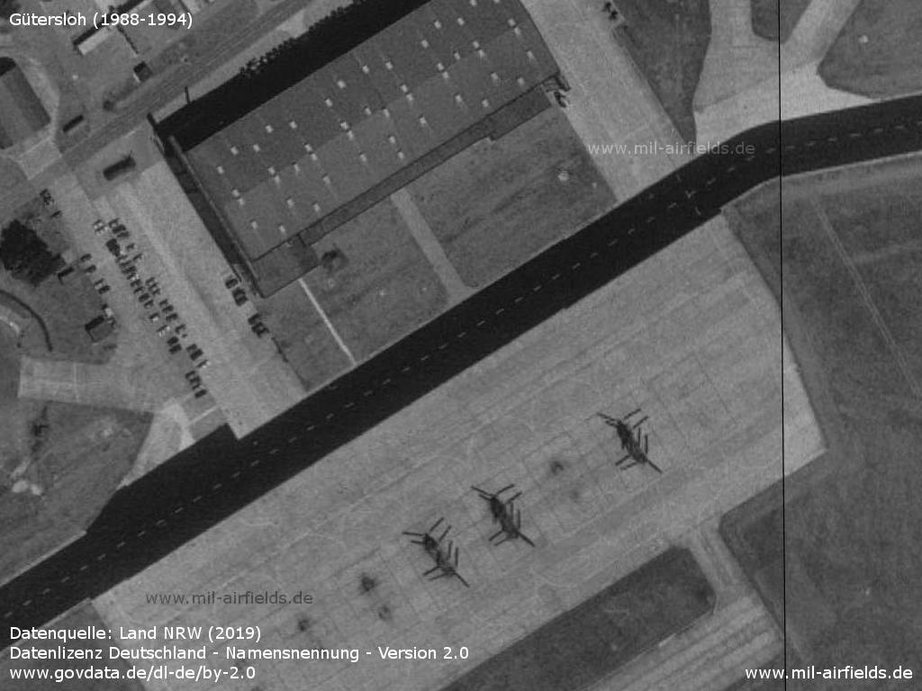
Three helicopters CH-47 Chinook
Helicopter and Harrier in the northern part
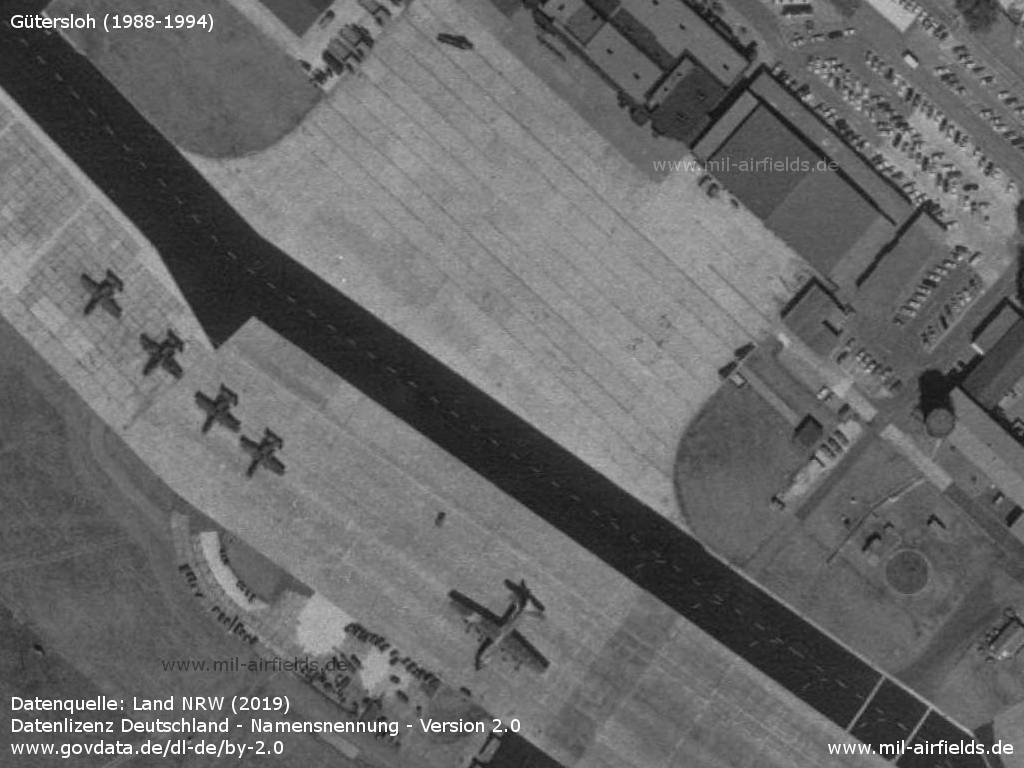
Four aircraft A-10 Thunderbolt II and one C-130 Hercules
Three helicopters

Multiple Harrier in the southestern part
Runways
- 09/27: 2252 m (7388 ft)
Radio beacons
- TACAN: CH108 "GSO"
- NDB: 412 "GS", at field
- ILS 27: 110.7 "GS"
Radio communication
- Lippe Radar 309.5, 388.1
- Approach 236.8, 130.8, 362.3, 119.7
- Zone 130.8
- Director 250.3, 344.0, 130.8, 119.7
- Talkdown 312.3, 130.5, 385.4, 123.3
- Tower 324.6, 122.1, 257.8
- Ground 285.5
Today
Use
Closed.
Overview
Source: Datenquelle: Land NRW (2019), Datenlizenz Deutschland - Namensnennung - Version 2.0, www.govdata.de/dl-de/by-2.0
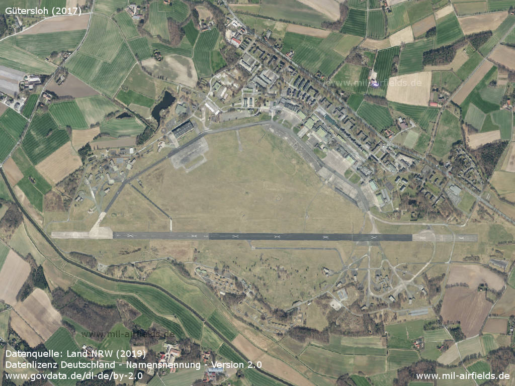
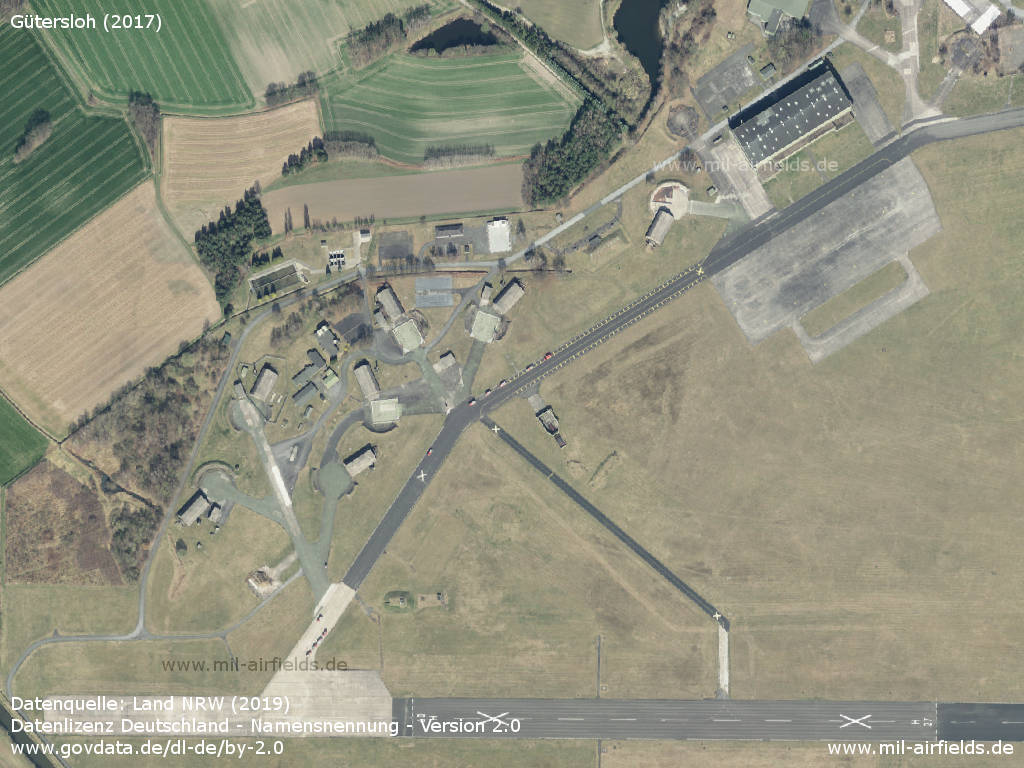
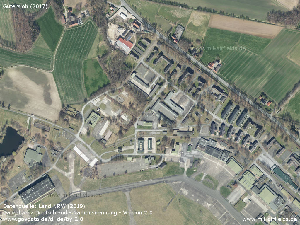
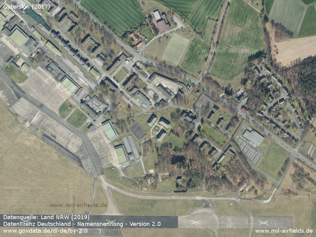
Aerial image (2017)
Western part
Northern part
Northeastern part
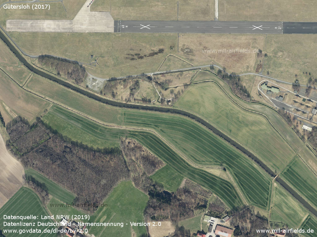
Southwestern part - The runway is marked as closed by white crosses.
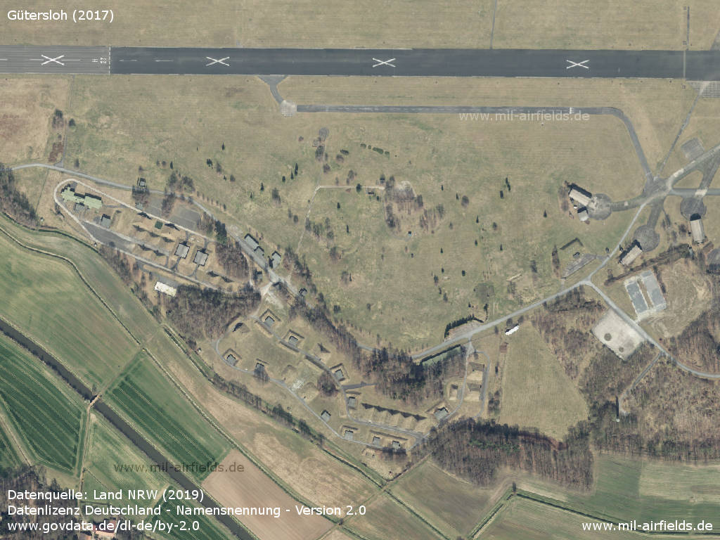
Southern part with former ammunition dump
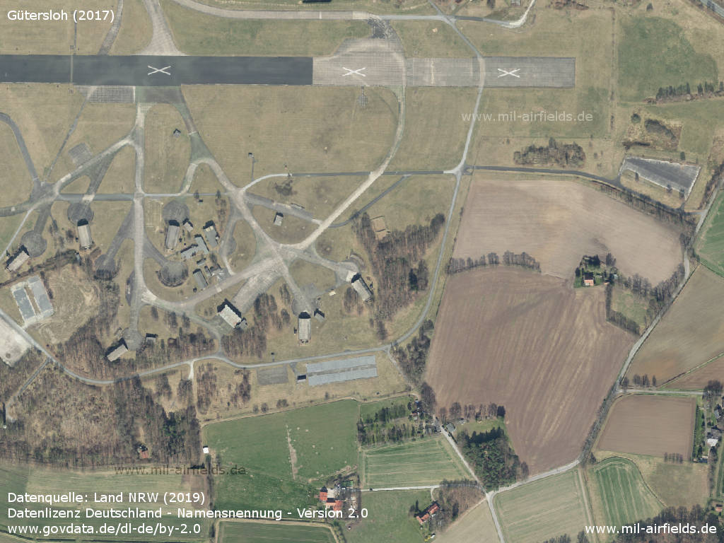
Southeastern part
Sources
- https://www.geoportal.nrw/ - Geoportal NRW
Links
- http://sg-etuo.de/ - Spotting Group Gütersloh
- http://www.xn--flugplatzmuseum-gtersloh-ctc.de/ - Flugplatzmuseum Gütersloh
Videos
- https://www.youtube.com/watch?v=zf2AU4hb4O4 - RAF Gütersloh Winterflugbetrieb
- https://www.youtube.com/watch?v=SFG8HNBGilk - RAF Gütersloh USAF F-100
- https://www.youtube.com/watch?v=SKZiNO7Vq9Q - RAF Gütersloh - Lightning und Mirage III
- https://www.youtube.com/watch?v=TBIVN-2L1xE - RAF Gütersloh - 26.5.1965 Hoher Besuch
- https://www.youtube.com/watch?v=8yTeRIGc5gY - 92 Squadron Lightnings at RAF Gutersloh
- https://www.youtube.com/watch?v=Si7-Ex9t7NA - RAF Gütersloh - Impressionen, Mitte 60-er Jahre
- https://www.youtube.com/watch?v=BvgWuKmNEoU - RAF Gütersloh - Flugbetrieb, Mitte 60-er Jahre
- https://www.youtube.com/watch?v=k6l3LhZJ7w0 - RAF Gütersloh Flugbetrieb 1966
- https://www.youtube.com/watch?v=ByX1NQS67Hs - RAF Gütersloh Lightnings der 92 Sqn
- https://www.youtube.com/watch?v=dlwrwCj-A94 - The last days of Harrier GR3 3(F) Sqn RAF Gutersloh Summer 1989
- https://www.youtube.com/watch?v=9b41yneW73k - Truppenverlegeübung in Gütersloh
- https://www.youtube.com/watch?v=TRTfN7IOwnk - Harrier 3Sqn RAF Gütersloh in der Ems 30.9.1991 A Harrier aborted takeoff and ended up in the Ems river
- https://www.youtube.com/watch?v=jdDFSM5SXUo - Harrier Farewell Gütersloh 27.11.1992
- https://www.youtube.com/watch?v=-N3YC5GtTSA - Abschiedsparade RAF Gütersloh 30.3.1993
- https://www.youtube.com/watch?v=PkAS28Cc4CU - RAF Gutersloh in March 1993
- https://www.youtube.com/watch?v=qKlztmAwsa0 - RAF Gütersloh
Airfields in the vicinity
Categories
Military Airfields GermanyMilitary Airfields in former West GermanyRoyal Air Force (RAF) Bases in GermanyRecommended
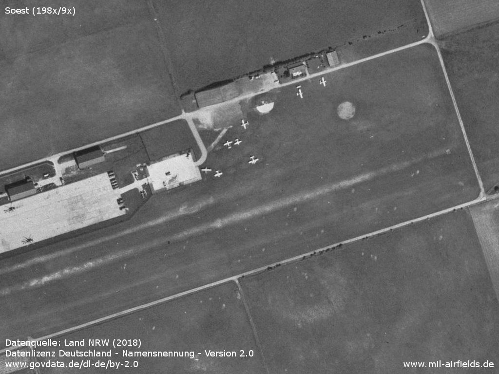
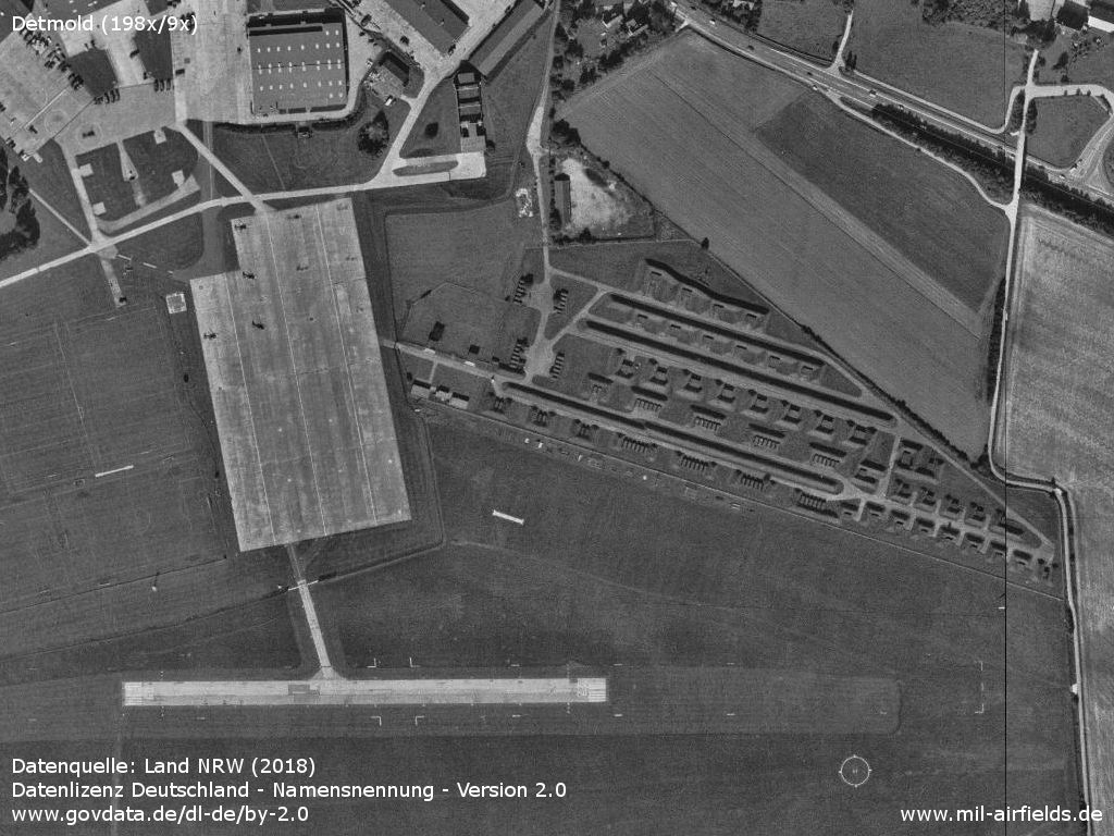
Image credits are shown on the respective target page, click on the preview to open it.
 Follow mil-airfields on Facebook