Babenhausen: Army Airfield
For historical information only, do not use for navigation or aviation purposes!
| Coordinates | N495710 E0085809 (WGS84) Google Maps |
| Elevation | 430 ft |
| Federal state | Hessen (Hesse) |
| Location indicator | EDEF |
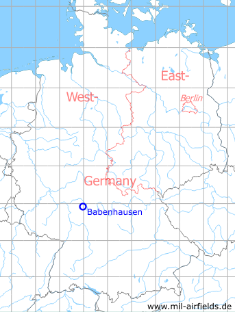
Germany during the Cold War Map
The history of the Cold War airfields: Babenhausen
During World War II
Use
Luftwaffe airfield.
During the Cold War
Use
US Army airfield and heliport.
In the 1970s
Overview
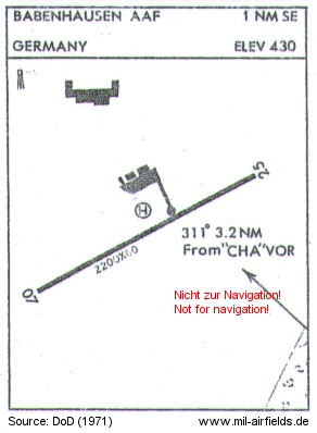
Map from 1971 - The dimensions of runway 07/25 are given in feet: 671 m x 18 m (2,200 ft x 60 ft). The direction and distance from Charlie VOR "CHA" radio beacon is indicated with 311°, 3.2 nautical miles (NM)
Source: US DoD
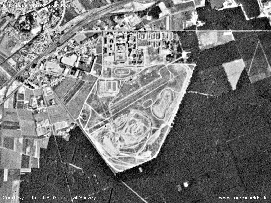
Babenhausen Army Airfield on a US satellite image from 03 July 1977
Source: U.S. Geological Survey
In the 1980s and early 1990s
Overview
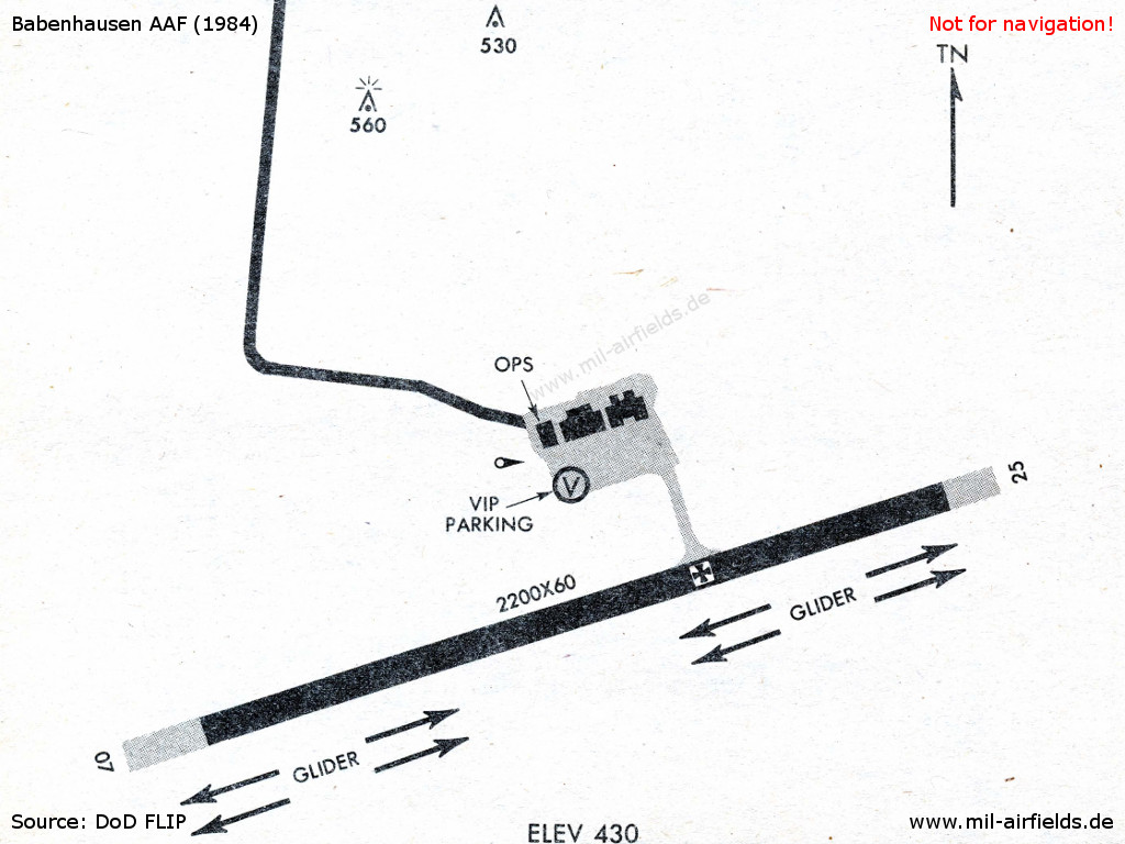
Babenhausen Army Airfield in 1984 - "GLIDER" south of the runway indicates the area for use by civilian gliders.
Source: US DoD
Runways
- 07/25: 671 m x 18 m Asphalt
Today
Use
General Aviation.
Sources
- https://www.usgs.gov/ - USGS: U.S. Geological Survey
Links
- https://lsc-babenhausen.de/ - Luftsportclub Babenhausen e.V.
Airfields in the vicinity
- 087°/11km Aschaffenburg: Army Airfield AAF
- 359°/24km Hanau: Army Air Field AAF (Erlensee, Langendiebach)
Categories
Military Airfields GermanyMilitary Airfields in former West GermanyUS Army Airfields and Heliports in GermanyAirfields in HesseRecommended
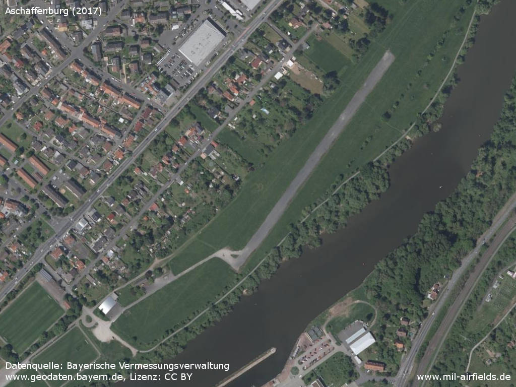
Image credits are shown on the respective target page, click on the preview to open it.