Zeithain: Airfield
For historical information only, do not use for navigation or aviation purposes!
| Coordinates | N512434 E0132014 (WGS84) Google Maps |
| Former East Germany (GDR) | District of Dresden |
| Federal state | Sachsen (Saxony) |
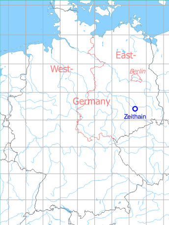
Germany during the Cold War Map
The history of the Cold War airfields: Zeithain
General
On the Soviet military training ground north of Riesa (former "GDR") there was an airfield with an unpaved runway. On western maps the field was called "Zeithain". Little is known about the aeronautical use. At the latest since the withdrawal of the Soviet / Russian occupation forces in the early 1990s, the airfield has been out of service, probably it was not used for a long time before that.
Today the whole area is called "Gohrischheide and Elbniederterrasse Zeithain".
Location of airfield
8 km north of Zeithain.
During the Cold War
Use
Soviet reserve airfield on Zeithain training ground.
Situation
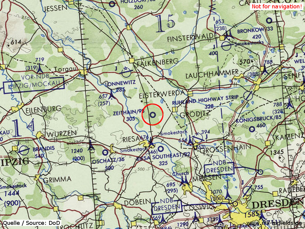
Zeithain airfield on a map of the US Department of Defense from 1972
Source: ONC E-2 (1972), Perry-Castañeda Library Map Collection, University of Texas at Austin
Overview
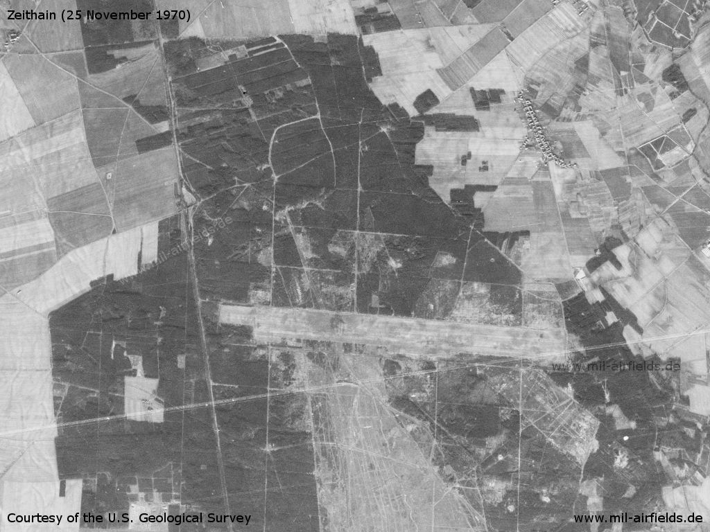
Zeithain Airfield on a US satellite image from 1970 - Clearly visible is the situation in the northern part of the Soviet training ground
Source: U.S. Geological Survey
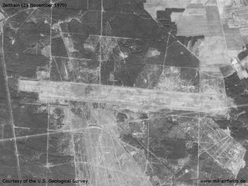
Enlargement - The runway is unpaved
Source: U.S. Geological Survey
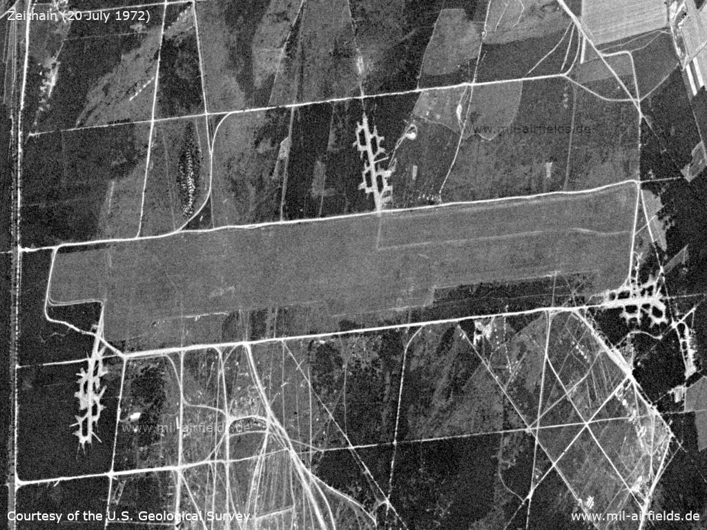
The airfield on July 20, 1972 - There are three decentralization areas that look freshly created
Source: U.S. Geological Survey
Runways
Data for the year 1990:
- 10/28: 3400 m Grass
Today
Use
Closed.
Airfields in the vicinity
Categories
Military Airfields GermanyMilitary Airfields in former East GermanyAirfields of the Soviet Forces in GermanyRecommended
Image credits are shown on the respective target page, click on the preview to open it.
 Follow mil-airfields on Facebook