For historical information only, do not use for navigation or aviation purposes!
| Coordinates | N563103 E0210551 (WGS84) Google Maps |
| Location indicator | EVLA |
The history of the Cold War airfields: Liepāja
General
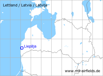
Liepāja is located in the soutwest of Latvia. The airfield is in east of the city. During the Cold War, Liepāja was first an air base of the Soviet Air Force and later an airport. Today, it is operated as a regional airport.
During the Cold War
Use
The airfield was initially used for military purposes and was later converted into an airport.
Units
Occupation by Soviet units (courtesy of "Unter dem Radar"):
- March/April 1951 - 1958/1960: HQ of a Fighter Division of the Red-Banner Baltic Fleet with two Fighter Regiments (Baltic Fleet) (La-11, MiG-15, MiG-17)
In the 1950s
History
- October 1957
US agencies count on the airfield about 60 to 65 MiG fighter and 1 transport aircraft, probably Li-2 CAB. (Source: CIA)
In the 1960s
History
- 1966
The US National Photographic Interpretation Center discovers on a satellite image: Ground support equipment, similar to that observed at the Tallin probable long range SAM launch complex (SA-5 Gammon at Keila Joa) is parked in a secured open storage area at Liepaja airfield east. This equipment consists of 30 covered launchers, 60 probable missile dollies, and approximately 120 vans/vehicles/pieces of equipment. A radar similar to those observed at Leningrad, Tallin, Cherepovets und Sary-Shagan is observed adjacent to the parked launchers and appears to be connected to a nearby van. (Source: CIA) 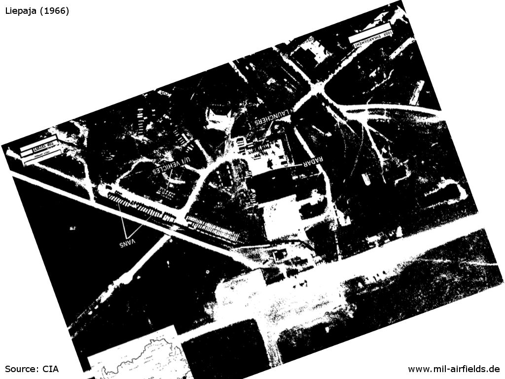 US satellite image from 1966 - The picture is northbound and shows the barracks area in the north of the airfield. There are the launchers, vans, (unidentified) vehicles and the radar.Source: CIA
In the 1970s
Situation
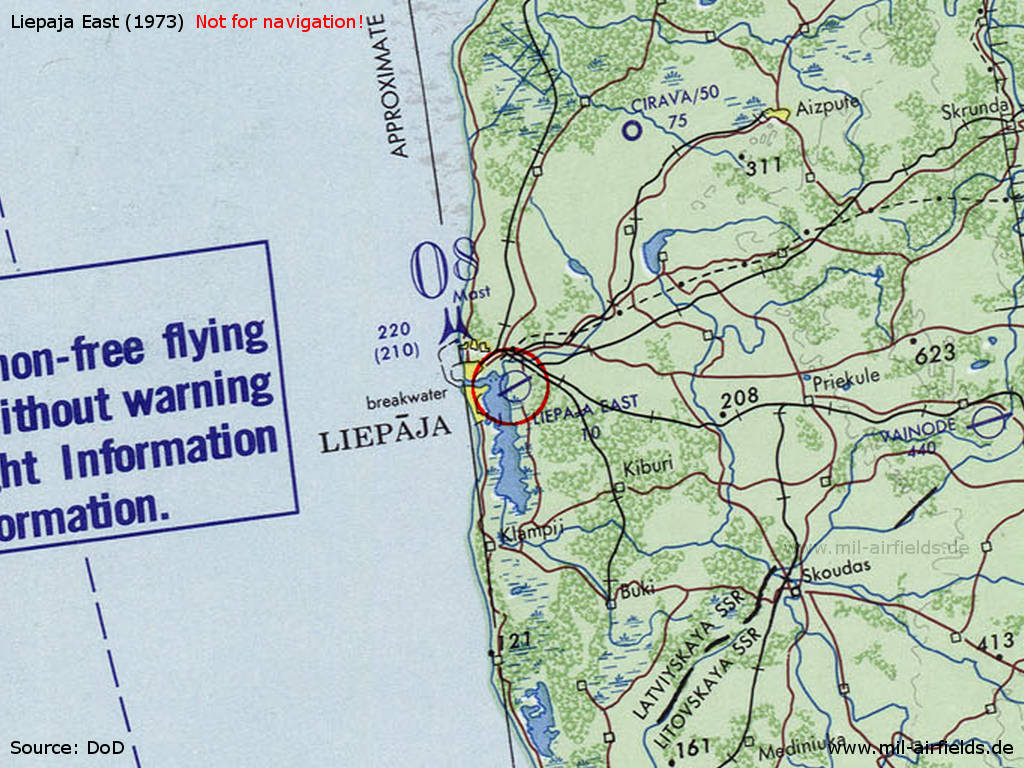
Liepāja Airfield on a map of the US Department of Defense from 1973
Source: ONC D-2 (1973), Perry-Castañeda Library Map Collection, University of Texas at Austin /PCL MC/
Overview
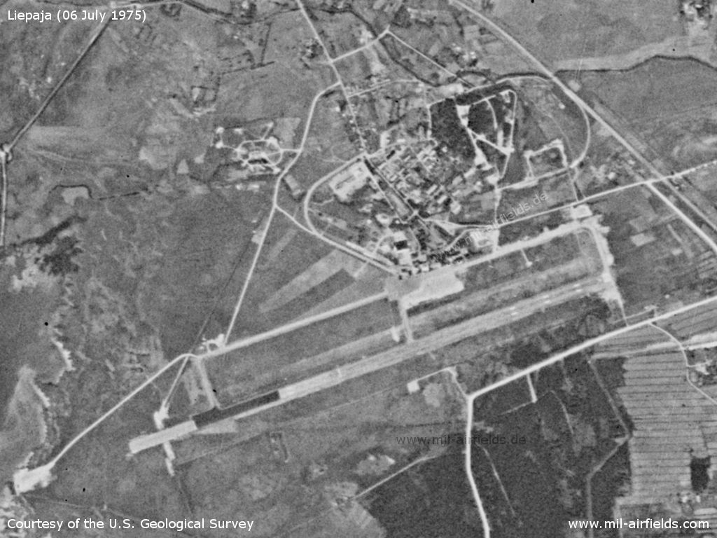
Liepāja airfield on a US satellite image from 1975
Source: U.S. Geological Survey
Runways
- 07/25: 2000 m x 47 m
Railway siding
To the east of the airfield there is a railway line from which a siding branches off to the area in the north.
Today
Use
Regional airport.
Airfields in the vicinity
- 301°/7km Liepāja: Seaplane station
- 056°/20km Durbe: Seaplane Station
- 120°/22km Paplaka: Heliport (Паплака)
- 104°/50km Vaiņode: Air Base (Vaiņodes lidlauks, Аэродром Вайнёде)
 Follow mil-airfields on Facebook