Radio navigation in Belgium in the 1950s
Radiophares en Belgique dans les années 1950 / Radiobakens in België in de jaren 1950
For historical information only, do not use for navigation or aviation purposes!
The following list contains the aeronautical radio beacons that were active in Belgium in the mid of the 1950s. All information is outdated and may not be used for navigational purposes.
At this time, there were mainly Non-Directional Beacons (NDB). At Brussels Airport there was still a Range beacon. Also here, a VOR was in test operation and runway 25 had an ILS.
Title image: Sabena DC-3 OO-AUN. Source: ETH-Bibliothek Zürich, Bildarchiv/Stiftung Luftbild Schweiz / Fotograf: Swissair / LBS_SR01-04433-01, License: CC BY-SA 4.0
Radio beacons and airways in 1955
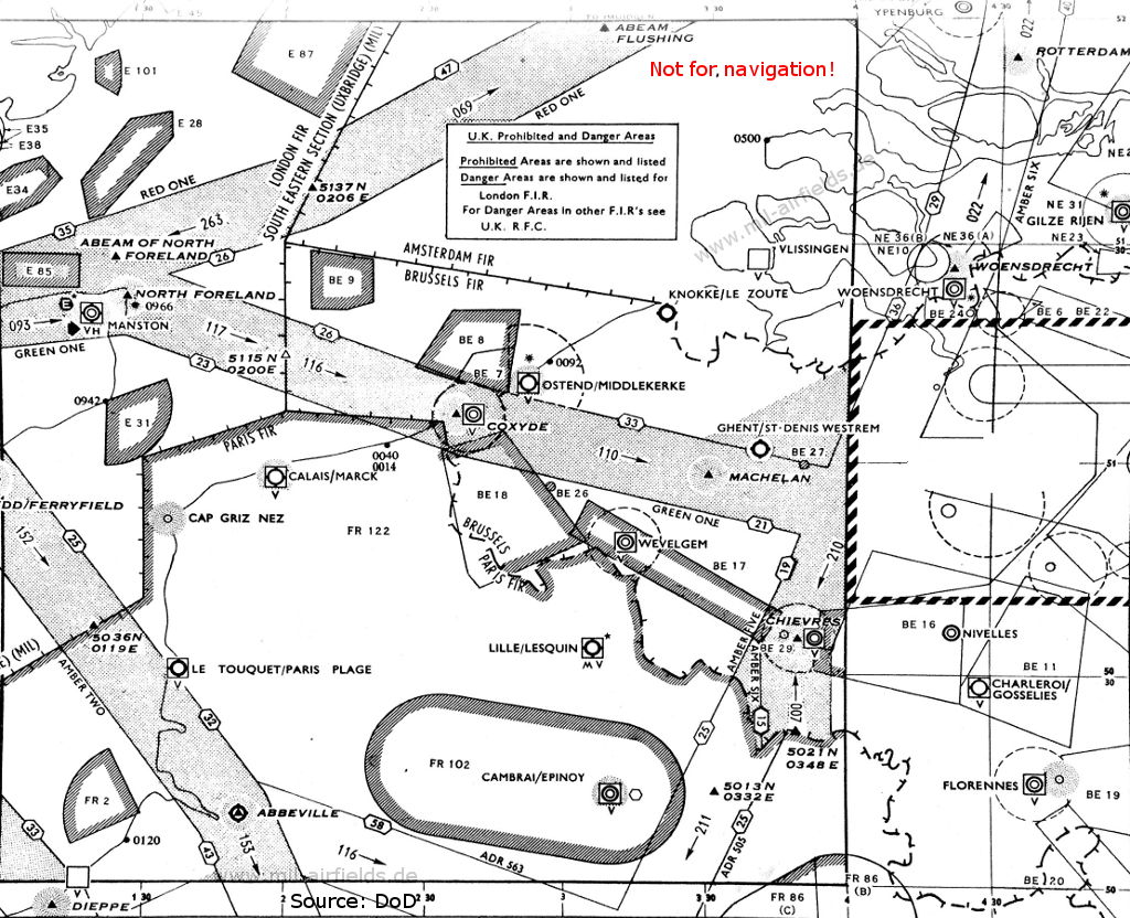
English Channel, Oostende, Chievres (Source: DoD)
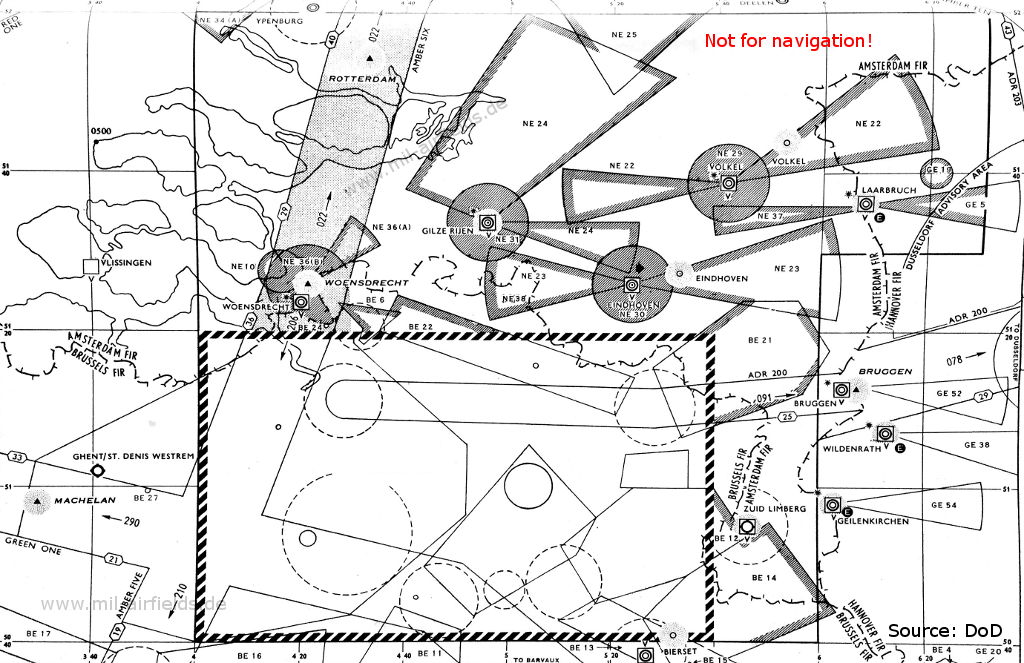
Ghent to Liège Bierset (Source: DoD)
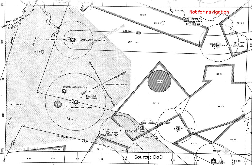
Enlargement: Brussels (Source: DoD)
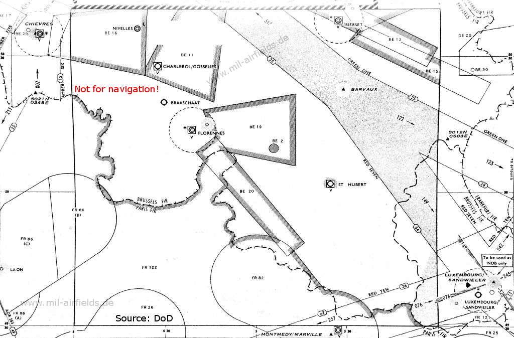
Florennes, Liège Bierset, Luxembourg (Source: DoD)
Explanations
![]()
Abbreviations
| approx. | approximately | |
| civ | civil | civil operator |
| GP | Glide path | Glide path transmitter |
| ILS | Instrument Landing System | (Approach and landing aid) |
| IM | Inner Marker | Marker beacon just in front the runway |
| kHz | Kilohertz | (Unit for frequency) |
| L | Locator | Non-directional beacon for the approach |
| LLZ | Localizer | Localizer transmitter |
| LMM | Locator Middle Marker | Combination of Middle Marker and Locator |
| LOM | Locator Outer Marker | Combination of Outer Marker and Locator |
| m | Meter | (Unit for length) |
| MHz | Megahertz | (Unit for frequency) |
| mil | military | military operator |
| MM | Middle Marker | Marker beacon |
| NDB | Non-directional beacon | Non-directional beacon on long or medium waves |
| NM | Nautical Miles | (Unit for length) |
| OM | Outer Marker | Marker beacon |
| PRMG | ПРМГ Посадочная радиомаячная группа | Soviet / russian military instrument landing system |
| RSBN | РСБН Rадиотехническая система ближней навигации | Soviet / russian military radio navigation system |
| SBA | Standard Beam Approach | Approach system, Lorenz system, predecessor of the ILS |
| THR | Threshold | Runway threshold (most often with number of runway) |
| transf. | transformed | Coordinates were converted from a different reference system, therefore there may be deviations. |
| VAR | Visual-Aural Rnange | |
| VOR | VHF Omnidirectional Radio Range | |
| W | Watt | (Unit for power) |
| WGS84 | World Geodetic System 1984 | (geospatial reference system, GPS coordinates) |
Directory
For historical information only, do not use for navigation or aviation purposes!
Antwerpen: Deurne Airport
Beauvechain: Air Base (Base aérienne de Beauvechain, Kwartier basis luitenant-kolonel vlieger Charles Roman)
Brussels: Airport (National, Zaventem, Melsbroek, Luchthaven Brussel-Nationaal, Aéroport Bruxelles-National)
Brüssel: Haren (civ)
N5053 E00426 (approx.), 067°/2.3 NM to THR 07 Google Maps
ONB, 393 kHz
N5053 E00426 (approx.), 067°/2.3 NM to THR 07 Google Maps
ONB, 393 kHz
At the former Haren/Evere airfield.
Runway 25:
Brüssel: Range/Z Marker (civ)
N5059 E00440 (approx.), 247/7.4 NM to THR 25 Google Maps
Range: BR, 254 kHz
Z Marker: 75 MHz
N5059 E00440 (approx.), 247/7.4 NM to THR 25 Google Maps
Range: BR, 254 kHz
Z Marker: 75 MHz
Brüssel: ILS
BR, 110.3 MHz
BR, 110.3 MHz
Brüssel: LOM (civ)
N5057 E00435 (approx.), 247°/3.8 NM to THR 25 Google Maps
Locator: OB, 293 kHz
Outer Marker: 75 MHz
N5057 E00435 (approx.), 247°/3.8 NM to THR 25 Google Maps
Locator: OB, 293 kHz
Outer Marker: 75 MHz
Brüssel: LMM (civ)
N5055 E00431 (approx.), 247°/0.5 NM to THR 25 Google Maps
Locator: MM, 308/548 kHz
Middle Marker: 75 MHz
N5055 E00431 (approx.), 247°/0.5 NM to THR 25 Google Maps
Locator: MM, 308/548 kHz
Middle Marker: 75 MHz
Chièvres: Air Base (Base aérienne de Chièvres, Caserne Daumerie)
For historical information only, do not use for navigation or aviation purposes!
Florennes: Air Base (Base aérienne de Florennes, Quartier base Offenbach)
Kleine Brogel: Air Base (Vliegbasis Kleine-Brogel, Base aérienne de Kleine-Brogel, Basis generaal-majoor vlieger graaf Ivan du Monceau de Bergendal)
Koksijde: Air Base (Vliegbasis Koksijde, Vliegbasis adjudent vlieger Frans Allaeys)
Liège Bierset: Airfield (Base aérienne de Bierset, Aéroport de Liège, Base aérienne et caserne De Cubber)
Oostende: Airport
Oostende: NDB
N5112 E00253 (approx.), 266°/0.39 NM Google Maps
ONO, 224.5 kHz
N5112 E00253 (approx.), 266°/0.39 NM Google Maps
ONO, 224.5 kHz
On request to Tower or ATCC Brussels.
St. Hubert: Airfield
For historical information only, do not use for navigation or aviation purposes!
Recommended

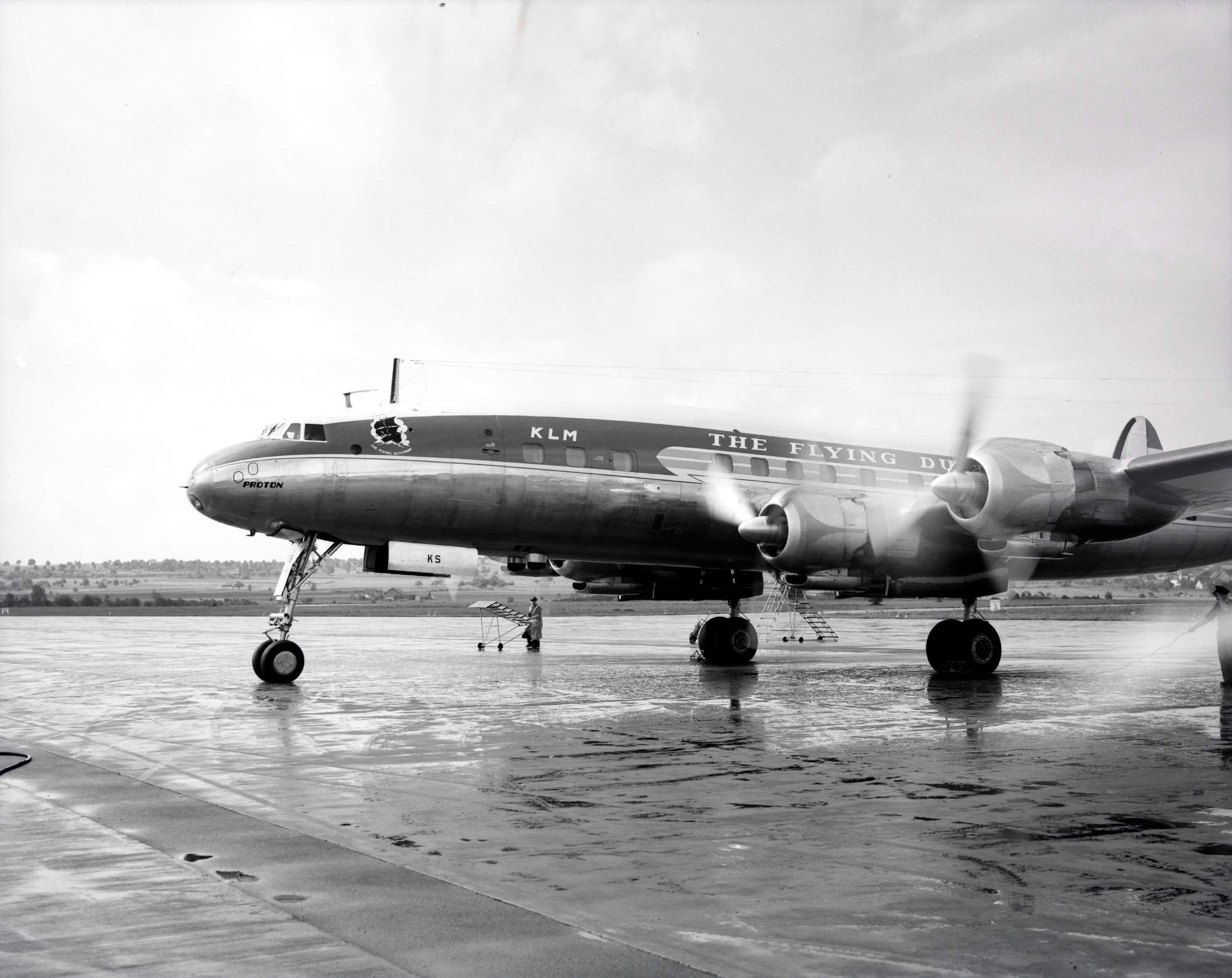
Image credits are shown on the respective target page, click on the preview to open it.