Alteno Military Airfield, East Germany
Luckau
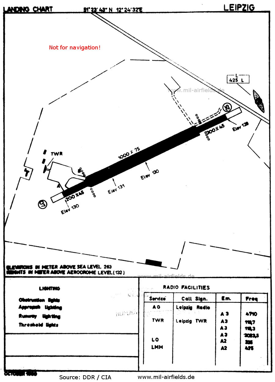
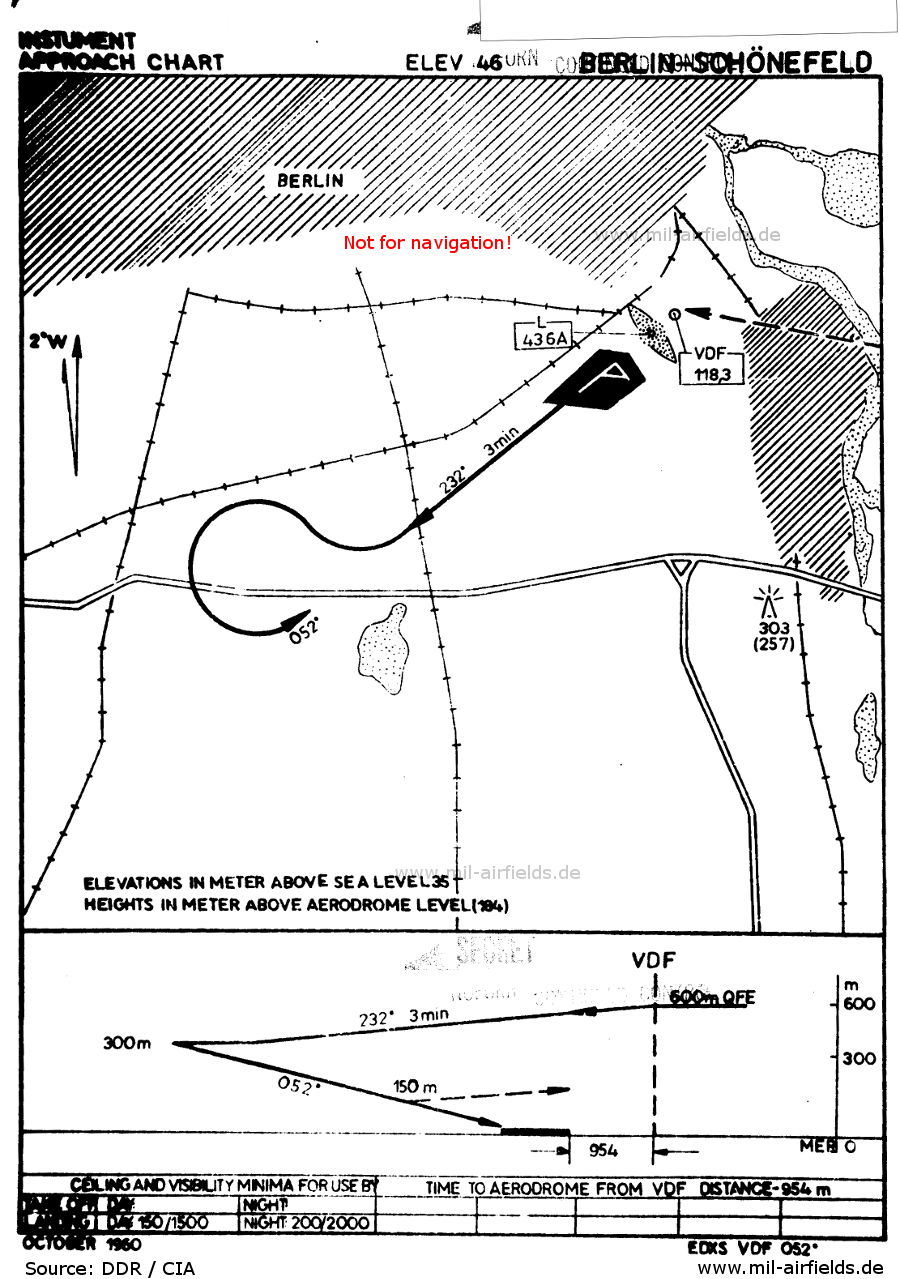
Historical approach and aerodrome charts
| Coordinates | N515203 E0134655 (WGS84) Google Maps |
| Elevation | 62m / 203 ft |
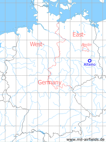
| Former East Germany (GDR) | District of Cottbus |
| Federal state | Brandenburg |
Alteno was an auxiliary airfield of the East German National People's Army (NVA). The military airfield was used for exercises and other occasions, aircraft were not permanently stationed. Today, the airfield is not used anymore.
In the 1980s and early 1990s
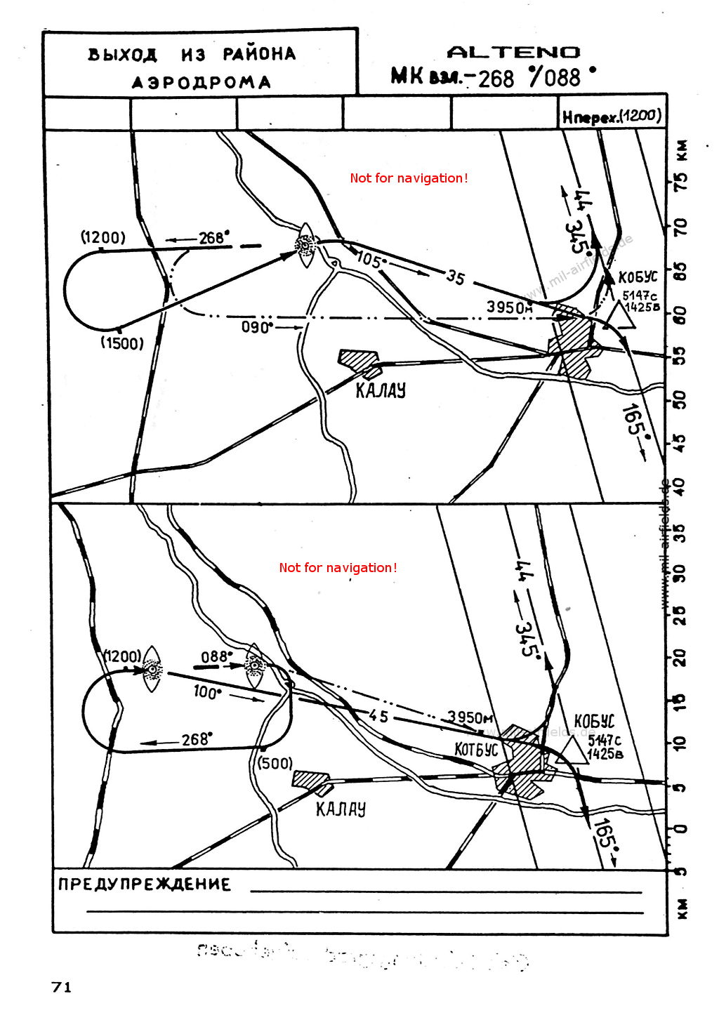
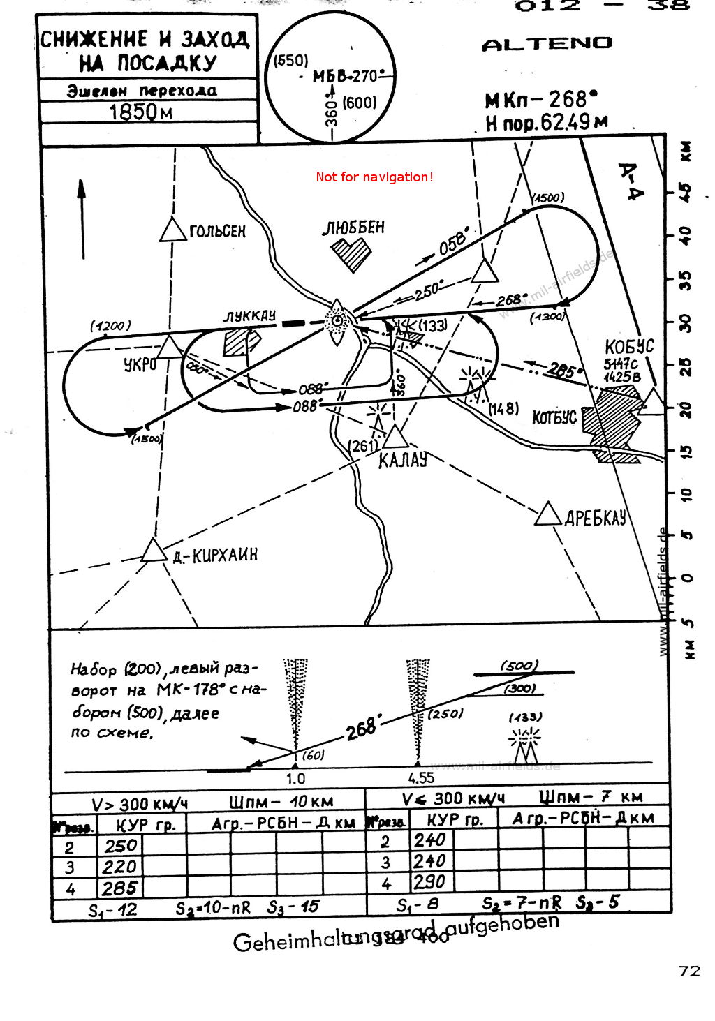
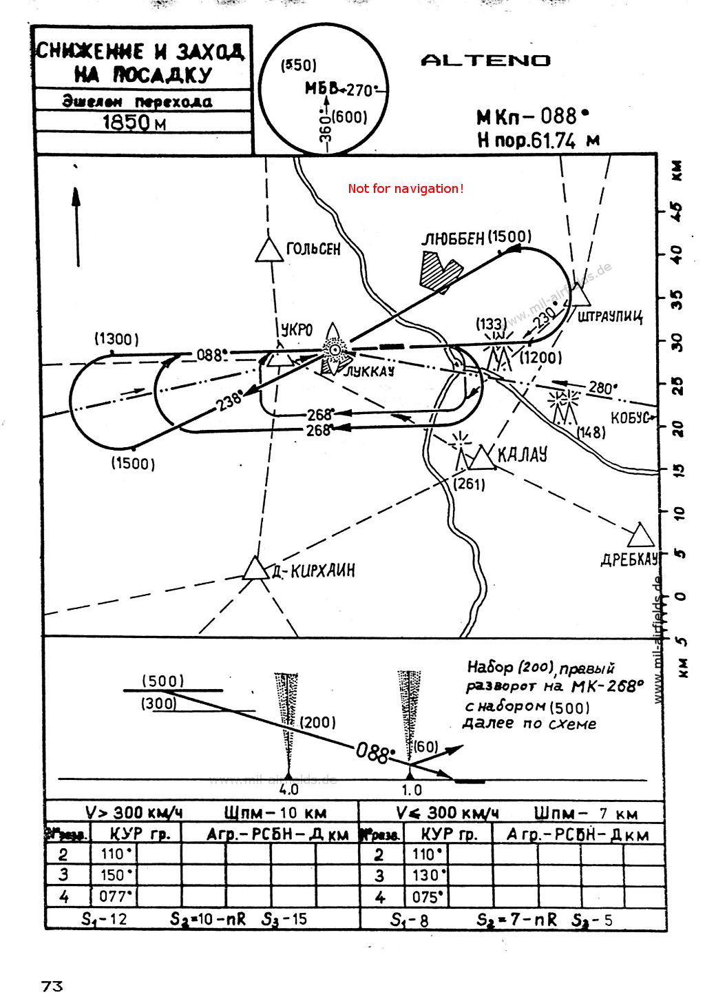
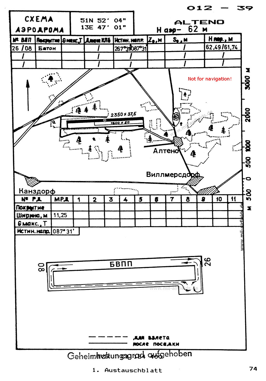
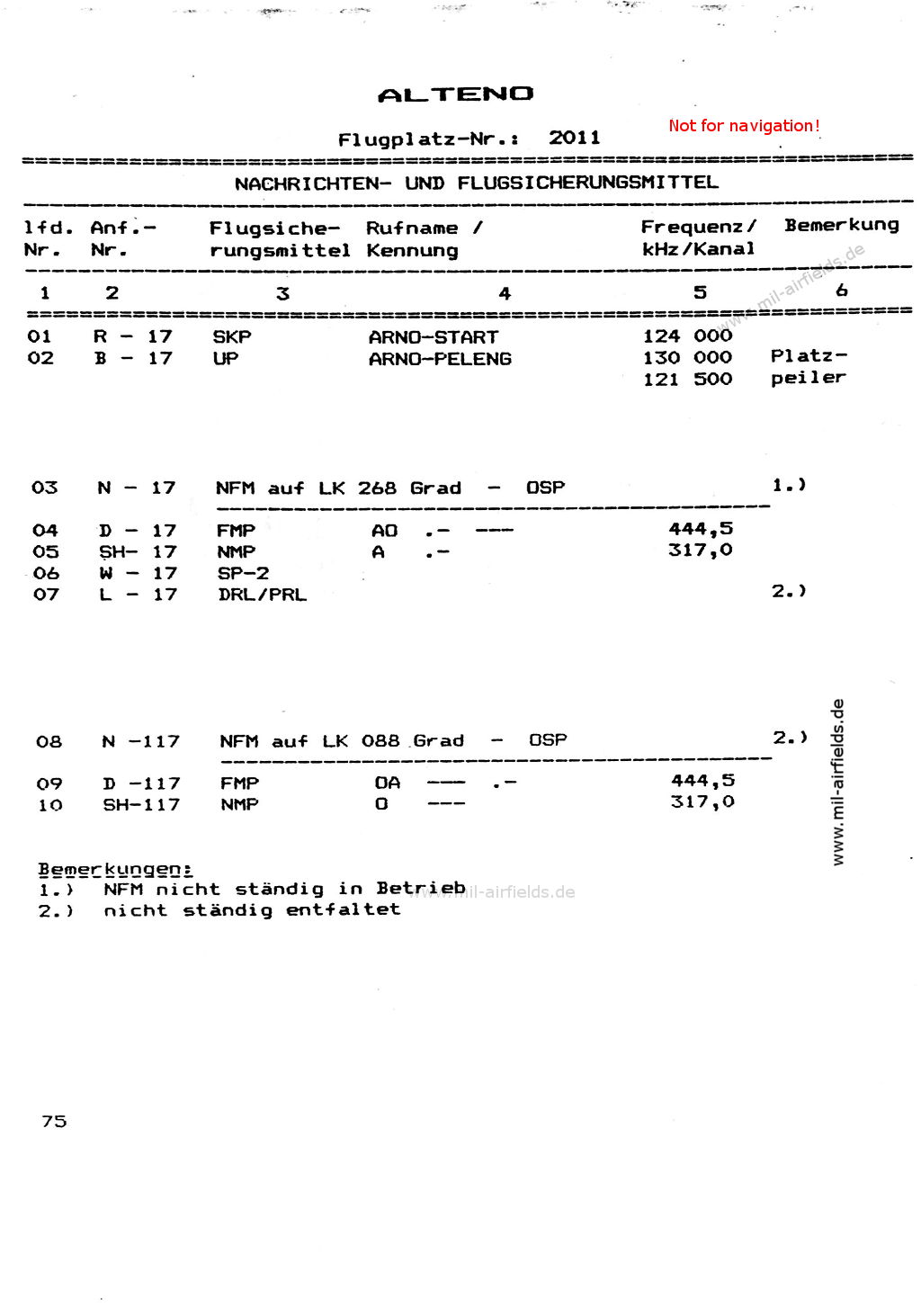
The following maps were taken from "Directory 012 - Aeronautical Information for the Airfields of the National People's Army of the GDR" (Verzeichnis 012 - Flugnavigationsinformationen der Flugplätze der NVA der DDR), which was classified as "Top Secret" (Geheime Verschlußsache). This second highest classification is an example for the completely exaggerated secrecy and information security in East Germany and the NVA, in comparison to the West. The vast majority of the contents of directory 012 would have been "unclassified" in the West.
The charts were valid in the years 1989/90. The lettering is Cyrillic / Russian. Heights / altitudes are given in meters, without brackets Standard Atmosphere (QNH), in brackets above the airfield (QFE).
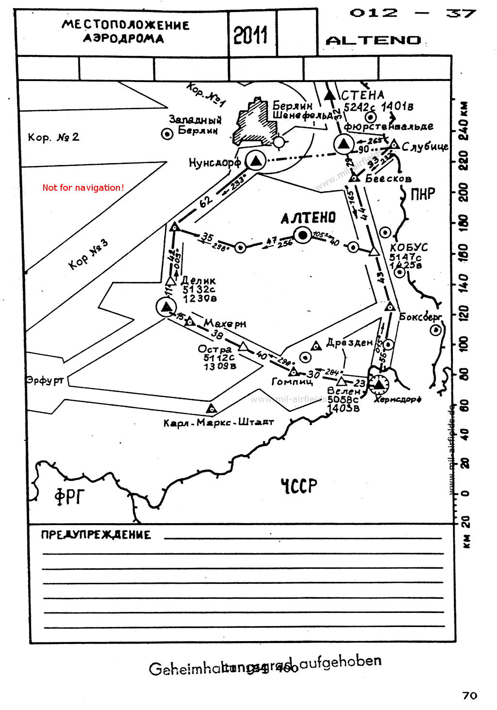
Index to the objects shown on the maps
Radio beacons:
- Alteno outer radio beacon "AO", "OA", inner radio beacon "A", "O"
- Beeskow NDB "BKW"
- Boxberg NDB "BOG"
- Fürstenwalde VOR "FWE"
- Hermsdorf VOR "HDO"
- Karl-Marx-Stadt NDB "KMS"
- Machern NDB "MA"
- Nunsdorf VOR "NUF"
- Slubice Subi NDB "SUI"
Air traffic control / Communications:
- Arno Start, Arno Peleng
Source for all maps, if not marked otherwise: US Department of Defense (US DoD)
 mil-airfields.de at Facebook