Celle Airfield, Germany
RAF Celle
Historical approach and aerodrome charts
For historical information only, do not use for navigation or aviation purposes!
| Coordinates | N523529 E0100125 (WGS84) Google Maps |
| Federal state | Niedersachsen (Lower Saxony) |
| Location indicator | DECE (195x), EDCL (196x-199x), ETHC (199x-) |

Airfield
Region: Niedersachsen
Location indicator: DECE, EDCL, ETHC
User: German Air Force (GAF), German Army
In the 1960s
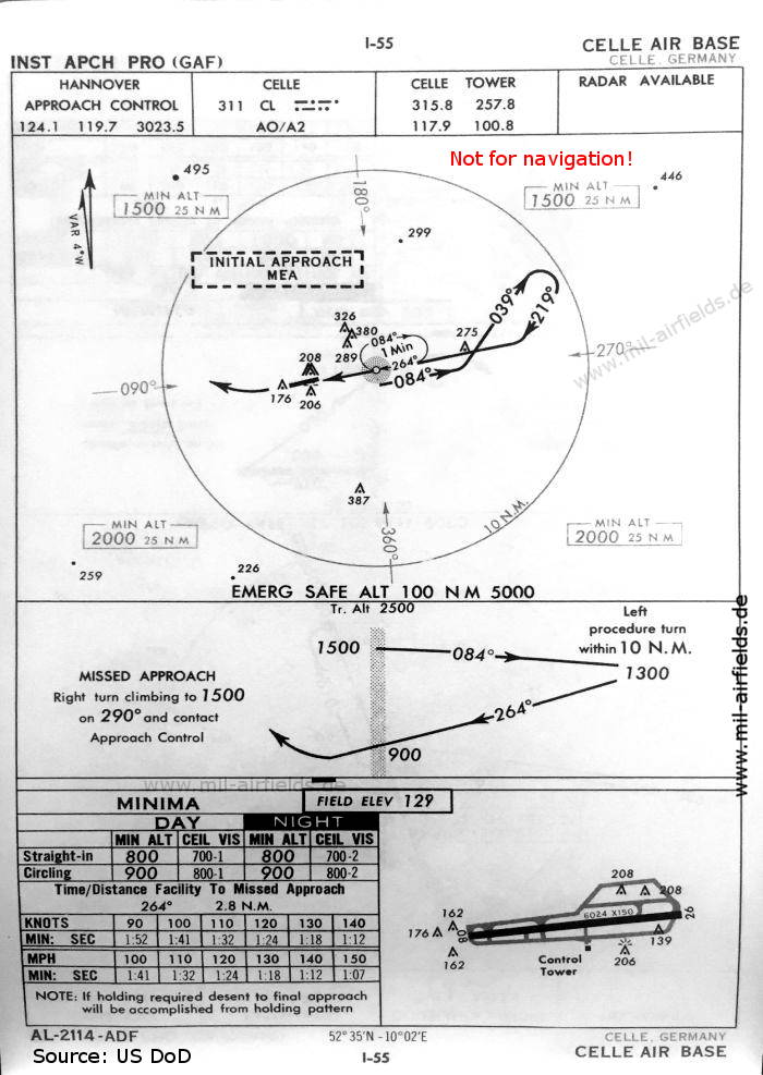
NDB approach runway 26 (October 1960) - There is one runway - 08/26: length 1836 m, width 46 m (6024 feet x 150 feet). (Source: US DoD)
Index to the objects shown on the maps
Radio beacons:
- Celle NDB
Air traffic control
- Celle Tower
- Hannover Approach Control
Source for all maps, if not marked otherwise: US Department of Defense (US DoD)
Recommended

Image credits are shown on the respective target page, click on the preview to open it.
Navigation
Approach and airfield charts - Federal Republic of Germany