RAF Llandow
Historical approach and aerodrome charts
For historical information only, do not use for navigation or aviation purposes!
| Coordinates | N512604 W0032948 (WGS84) Google Maps |
| Region | South Wales, Vale of Glamorgan |
| Location indicator | MDXW |
| Operator | Royal Air Force (RAF) |

In the 1950s

Aerodrome (October 1950) - The map is from the time a few months after the plane crash in Llandow. Apparently it is operated as a civilian airfield. There are three runways - 056/236: length 914 m (3000 feet), 100/280: length 1463 m (4800 feet), 147/327: length 914 m (3000 feet). (Source: US DoD)
In the 1970s
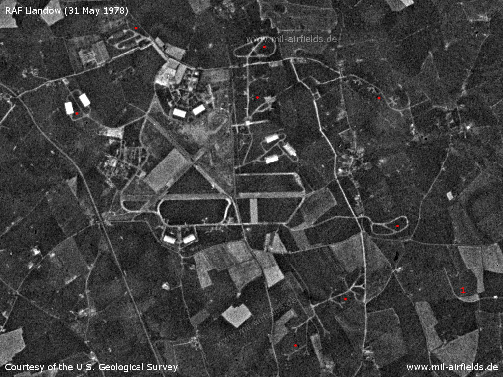
Satellite image from 31 May 1978 - The airfield is closed, but the old structures are still clearly visible. There were extensive remote dispersal areas, which are marked with a red dot on the picture. The "1" at the lower right corner marks the western extension of the remote dispersal areas of RAF St. Athan airfield, which is located about 5 km southeast of RAF Llandow. (Source: U.S. Geological Survey)
Source for all maps, if not marked otherwise: US Department of Defense (US DoD)
Recommended


Image credits are shown on the respective target page, click on the preview to open it.
 mil-airfields.de at Facebook