For historical information only, do not use for navigation or aviation purposes!
| Coordinates | N501157 E0100648 (WGS84) Google Maps |
| Elevation | 1170 ft |
| Federal state | Bayern (Bavaria) |
| Location indicator | EDEG (1990) |
Germany during the Cold War
The history of the Cold War airfields: Bad Kissingen Army Airfield
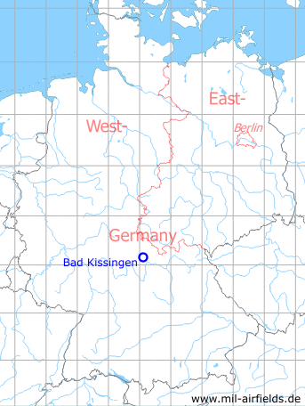
Location of airfield
Southeast of Bad Kissingen, Reiterswiesen.
During the Cold War
General
US Army airfield.
Noticeable:
- The airfield was located within the Air Defense Identification Zone (ADIZ)
- Only 30 km away from the inner-German border
Situation
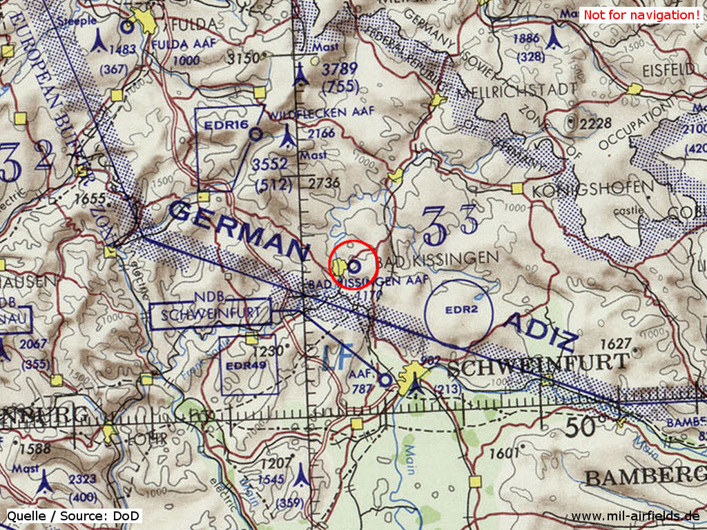
Bad Kissingen Army Airfield AAF on a map of the US Department of Defense from 1972 - The field is located within the ADIZ (Air Defense Identification Zone). In the northeast is the border to East Germany (Soviet Zone).
Source: ONC E-2 (1972), Perry-Castañeda Library Map Collection, University of Texas at Austin
Overview
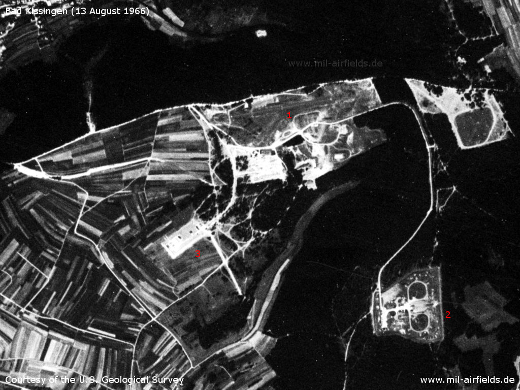
Bad Kissingen Reiterswiesen on US satellite image from 13 August 1966 - 1: airfield, 2: Hawk battery, 3: other installations.
Source: U.S. Geological Survey
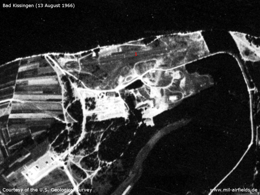
Enlargement: Bad Kissingen Army Airfield - The runway (1) is hardly visible.
Source: U.S. Geological Survey
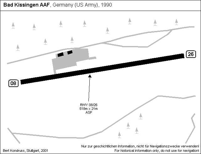
Runways
Data for the year 1990:
- 08/26: 518 m x 21 m Asphalt
Telephone
DSN 354-2xxx (1990).
Real property
The airfield had an area of 8 ha.
Today
Use
Closed.
Overview
Source: Datenquelle: Bayerische Vermessungsverwaltung www.geodaten.bayern.de, License: Creative Commons Namensnennung 3.0 Deutschland (CC BY 3.0 DE)
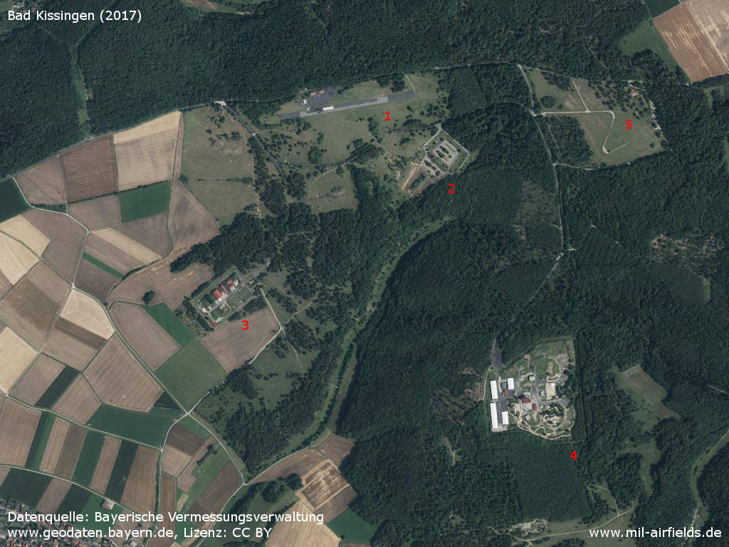
Aerial image (2017) - 1: Flugplatz; 2: QRS; 3: ammunition dump (Special Weapons Storage?); 4: Hawk-surface-to-air missile site; 5: training site. All facilities are out of operation.
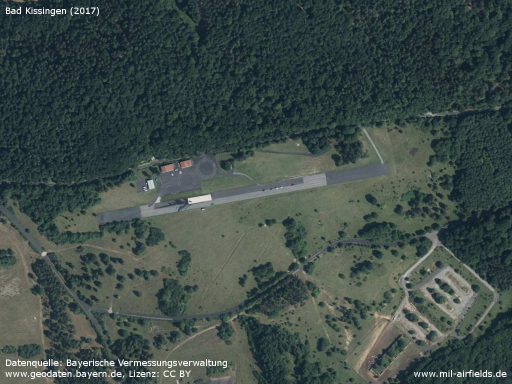
Airfield
Sources
- https://geoportal.bayern.de/ - Geoportal Bayern
Links
- http://www.fulda-gap.de/bad_kissingen.htm - Bad Kissingen airfield today
Airfields in the vicinity
Categories
Military Airfields GermanyMilitary Airfields in former West GermanyUS Army Airfields and Heliports in GermanyRecommended
Image credits are shown on the respective target page, click on the preview to open it.
 Follow mil-airfields on Facebook