For historical information only, do not use for navigation or aviation purposes!
| Coordinates | N524919 E0132555 (WGS84) Google Maps |
| Former East Germany (GDR) | District of Potsdam |
| Federal state | Brandenburg |
| Region | Barnim, Havel |

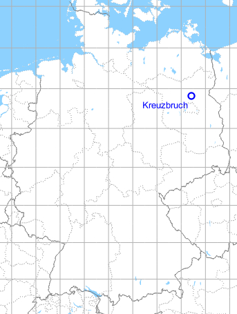
Germany during the Cold War Map
The history of the Cold War airfields: Kreuzbruch
Location
Federal State of Brandenburg.
Location of airfield
4,5 km northwest of Klosterfelde.
During the Cold War
Use
Airfield of the former East German pre-military organization Gesellschaft für Sport und Technik (GST). The airfield was closed in 1979. Thereafter Helipad 3114 for Anti-aircraft Missile Unit 4123 (Fla-Raketenabteilung 4123, FRA-4123, Klosterfelde) of the former East German Air Force (LSK/LV). And helipad 6102 "Airfield Kreuzbruch" of former East German National People's Army (NVA).
In the 1950s
Use
The airfield is used by the Soviet Air Forc as an air-ground firing range.
Overview
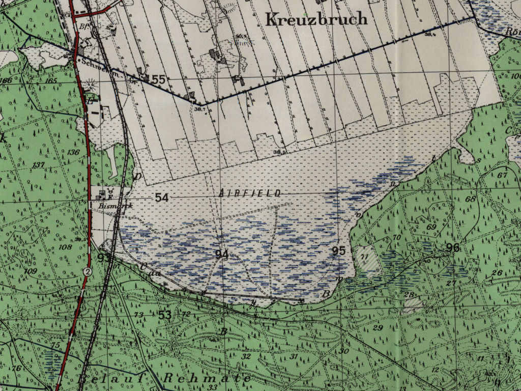
Kreuzbruch airfield on a US map from 1952
Source: AMS M841 GSGS 4414, Courtesy Harold B. Lee Library, Brigham Young University
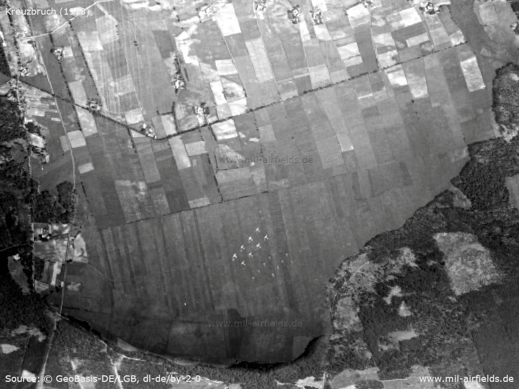
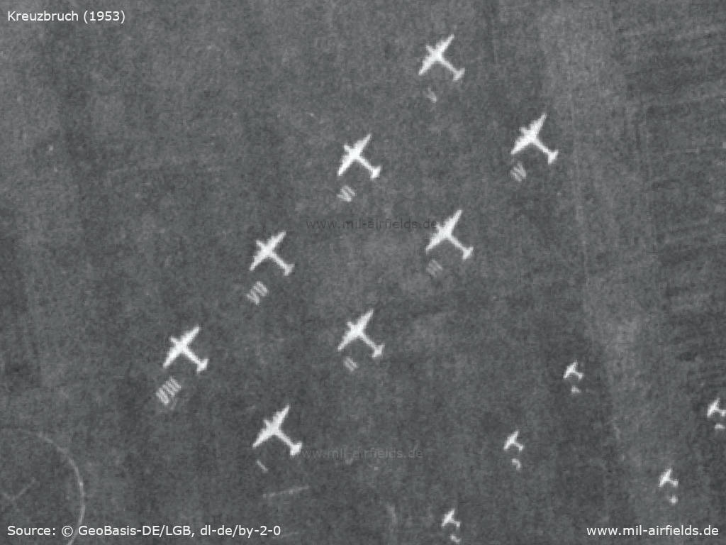
Aerial image 1953 - For use as an air-to-ground firing range, aircraft silhouettes are provided.
Source: Landesvermessung und Geobasisinformation Brandenburg (LGB), Datenlizenz Deutschland - Namensnennung - Version 2.0, © GeoBasis-DE/LGB, dl-de/by-2-0, (Kontrast erhöht)
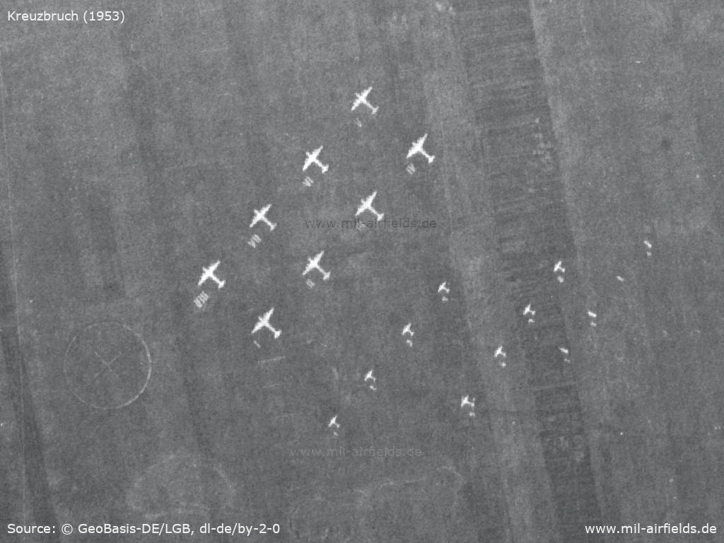
There are 5 target rows - The two rows with the largest aircraft are numbered with Roman numerals (top row backward from VIII to V, below forward from I to IV). The two rows with the middle targets have numbers from 1 to 4 and from 5 to 8. The small targets on the right/bottom are numbered consecutively from 1 to 4.
Source: Landesvermessung und Geobasisinformation Brandenburg (LGB), Datenlizenz Deutschland - Namensnennung - Version 2.0, © GeoBasis-DE/LGB, dl-de/by-2-0, (Kontrast erhöht)
Source: Landesvermessung und Geobasisinformation Brandenburg (LGB), Datenlizenz Deutschland - Namensnennung - Version 2.0, © GeoBasis-DE/LGB, dl-de/by-2-0, (Kontrast erhöht)
In the 1970s
History
- August 27, 1972
At around 12:05 p.m., a glider crashes on approach to the Kreuzbruch airfield. The pilot is seriously injured and is taken to Oranienburg hospital.
In the 1980s and early 1990s
Overview
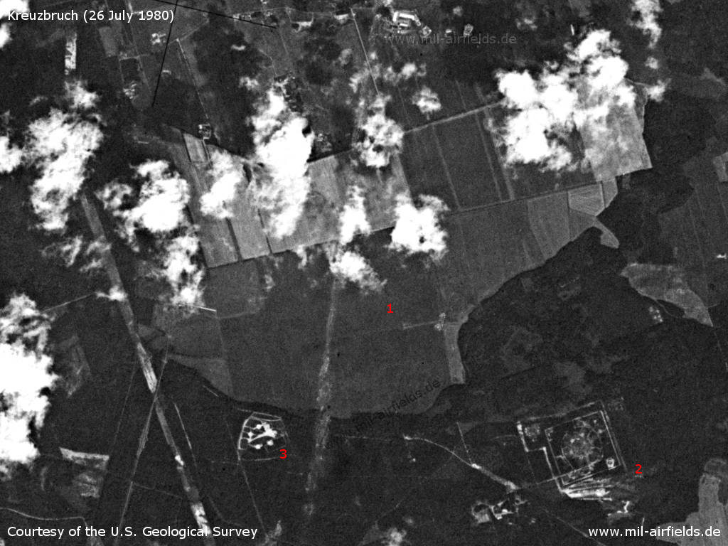
Kreuzbruch Airfield on a US satellite image from 26 July 1980 - 1: airfield; 2: launcher site of the Anit-aircraft Missile Unit 4123 Klosterfelde; 3: Unknown object which was apparently newly built. Possibly it is related to the SAM site, because a similar object was created at the same time near the FRA-4121 Markgrafpieske.
Source: U.S. Geological Survey
Runways, taxiways, aprons
For Helipad 3114 is stated:
- Dimensions: 500 m x 1000 m
- Main take-off and landing direction: 315°
- Surface: grass runway
- usable without crop damage
- Capacity: 10 helicopters
- Dimensions: 500 m x 1000 m
- Main take-off and landing direction: 315°
- Surface: grass runway
- usable without crop damage
- Capacity: 10 helicopters
For Helipad 6102:
- Dimensions: 800 m x 1000 m
- Main take-off and landing direction: 80°, 260°
- Surface: grass
- usable without crop damage
- Dimensions: 800 m x 1000 m
- Main take-off and landing direction: 80°, 260°
- Surface: grass
- usable without crop damage
The reason for the differences is unknown to me.
Communication
Stabsnetz S1 2734-759-58
Airspace and procedures
Usable at day and good weather conditions
Alert time: 60 minutes
Alert time: 60 minutes
Obstacles
Trees: distance 30 m, height 10 m
Today
Use
Closed.
Links
- /BYU/:
http://lib.byu.edu/collections/german-maps/ - German Maps (Topographische Karte 1:25,000)
Airfields in the vicinity
- 149°/14km Ladeburg: Object 5020
- 133°/17km Ladeburg: Helipad 3106 (HSLP 3106)
- 088°/18km Finow: Air Base (Eberswalde-Finow, Аэродром Финов)
- 235°/18km Oranienburg: Air Base (Z67, Germendorf, Аэродром Ораниенбург (ГДР))
- 081°/20km Eberswalde: Helipad 1036 (HSLP / HLP 1036, Eberswalde-Finow)
- 134°/21km Albertshof: Airfield
Categories
Military Airfields GermanyMilitary Airfields in former East GermanyGST AirfieldsHelipads of former National People's ArmyRecommended
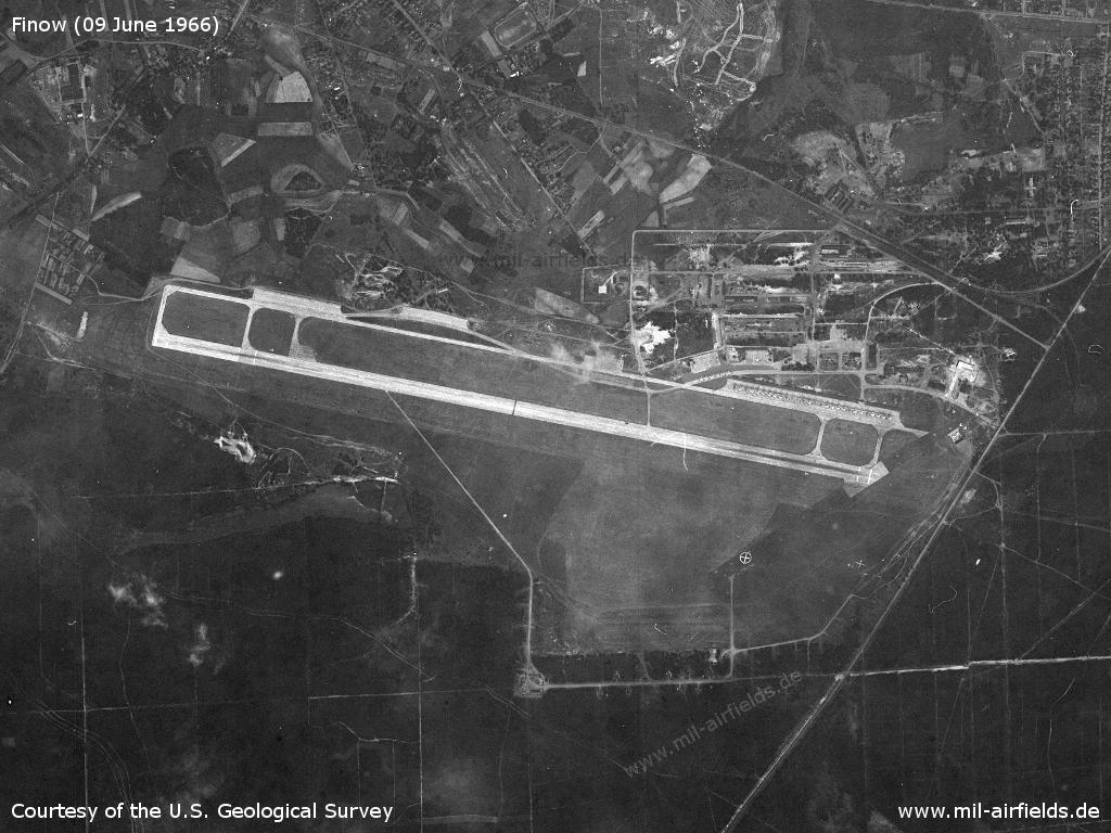
Image credits are shown on the respective target page, click on the preview to open it.
 Follow mil-airfields on Facebook